Sheenjek River
Site and River
Site & River
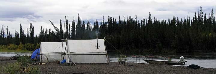
The Site
The sonar site is located at mile six of the Sheenjek River and consists of two sonar transducers located across the river from one another. Each transducer is submerged as close to shore as feasible and all surface electronics are housed in a small self-supporting tent on the left bank and a canvas wall tent on the right bank. The site's main camp and primary counting station are on the right bank. A wireless router transfers data between the left bank sonar and a laptop computer on the right bank.
The River
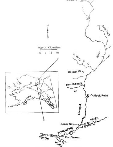
Located above the Arctic Circle, the Sheenjek River drains from glacial ice fields of the Romanzof Mountains, a northern extension of the Brooks Range. From the these glacial ice fields, the river flows southward approximately 250 miles to where it empties into the Porcupine River, which in turn empties into the Yukon River.
While created by glaciers, the Sheenjek River has numerous clear water tributaries. Water clarity in the lower river is somewhat unpredictable, but generally clearest during periods of low water. Historically, the water level begins to drop in late August or early September. Upwelling ground water composes a significant portion of the river flow volume, especially in winter. It is in these spring areas that fall chum salmon spawn, particularly within the lower 100 miles.
At the sonar site, a smooth river bottom profile provides favorable conditions for using sonar to detect fish. On average the river is about 200 feet wide at site, but width can fluctuate dramatically. The lower Sheenjek River is prone to severe flooding and when heavy rain occurs upstream the river can expand to 650 feet wide at the sonar site. When severe flooding occurs, as it did in 2006 and in 2010, sonar site operations are sometimes disrupted.