Areas With Restrictions
Search By Game Management
Unit (GMU)
Note: Use of these maps indicates that you have read and understand the liability statement.
Select a Game Management Unit.
Game Management Unit
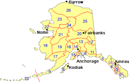
Results for Game Management Unit 12
The following restrictions are those specific to GMU 12. Be sure to check the hunting regulations for additional state-wide hunting and trapping restrictions.
Management Areas
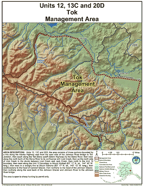
Tok Management Area
- Restriction: Open to sheep hunting by permit only
- View Map: GIF Map (144 K) PDF Map (459 K)
- Area Description: Tok Management Area: the area consists of those portions of Units 12, 13(C), and 20(D) bounded by a line along the Alaska Highway east from the west side of the Johnson River bridge to Tok Junction, then south along the Tok-Slana cutoff (Glenn Highway) to the Slana River; then west along the north bank of the Slana River to its confluence with Lost Creek, then up the north side of Lost Creek to the divide between Lost Creek and Jack Creek, then north to the Unit 12 boundary, then west along the Unit 12 boundary to Mount Kimball (63° 17' N. lat., 144° 40' W. long.), then west in a straight line to Mount Gakona (63° 17' N. lat., 145° 12' W. long.), then southwesterly to the head of Canwell Glacier, then northerly to the head of the Johnson Glacier, then northerly along the west bank of the Johnson Glacier and Johnson River to the Johnson River bridge
Note: Changes to area restrictions for hunting and trapping by Emergency Orders may not be shown on this page. Please be sure to check the Emergency Orders page for the most current list of changes.