Areas Closed to Trapping
Note: Use of these maps indicates that you have read and understand the liability statement.
Click on an area name for additional details, or use the dropdown box below.
| Name | GMU | Restrictions | View Map |
|---|---|---|---|
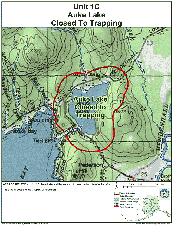
| Unit 1(C) Auke Lake | 01C | Closed to the trapping of furbearers |
GIF Map
(129 K)
PDF Map (232 K) |
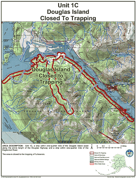
| Unit 1(C) Douglas Island | 01C | Closed to the trapping of furbearers |
GIF Map
(148 K)
PDF Map (520 K) |
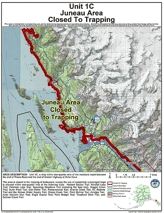
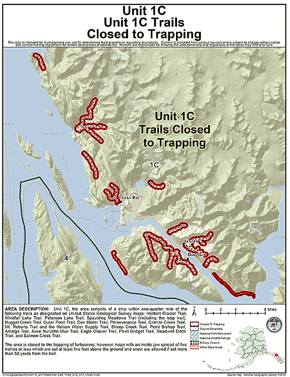
| Unit 1(C) Juneau Area | 01C | The area is closed to the trapping of furbearers; except the use of completely submerged traps is allowed within one-quarter mile of the following trails: Herbert Glacier Trail, Windfall Lake Trail, Peterson Lake Trail, Spaulding Meadows Trail (including the loop trail), Nugget Creek Trail, Outer Point Trail, Dan Moller Trail, |
GIF Map
(133 K)
PDF Map (329 K) |
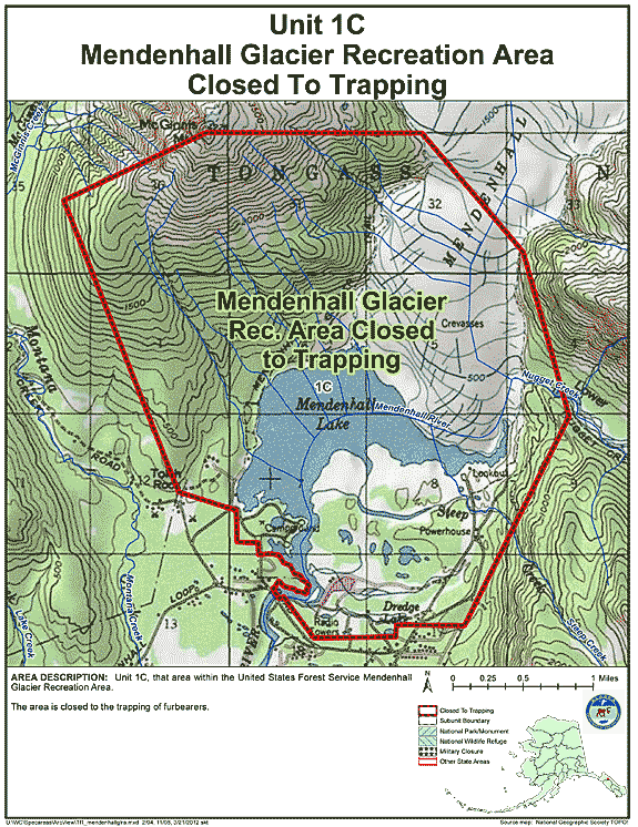
| Unit 1(C) Mendenhall Glacier Recreation Area | 01C | Closed to the trapping of furbearers |
GIF Map
(140 K)
PDF Map (311 K) |
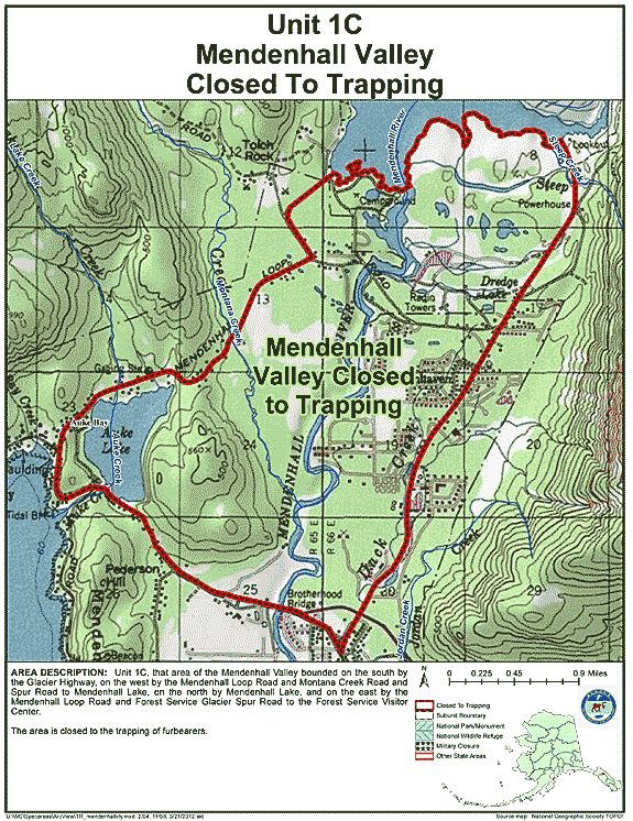
| Unit 1(C) Mendenhall Valley | 01C | Closed to the trapping of furbearers |
GIF Map
(140 K)
PDF Map (299 K) |
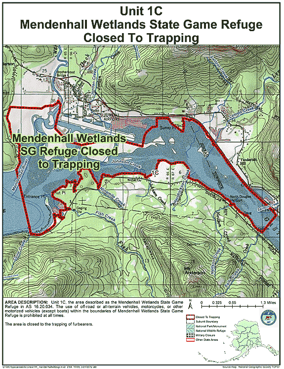
| Unit 1(C) Mendenhall Wetlands State Game Refuge | 01C | Closed to the trapping of furbearers |
GIF Map
(143 K)
PDF Map (361 K) |
| Unit 1(C) Trails | 01C | Closed to the trapping of furbearers; however, traps with an inside jaw spread of five inches or less which are set at least five feet above the ground and snow are allowed if set more than 50 yards from the trail |
GIF Map
(109 K)
PDF Map (268 K) |
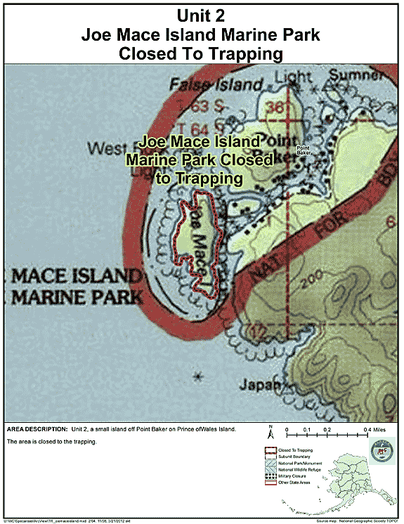
| Joe Mace Island Marine Park | 02 | Closed to trapping |
GIF Map
(110 K)
PDF Map (199 K) |
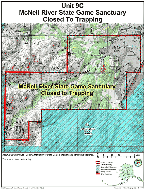
| McNeil River State Game Sanctuary Closed Area | 09 | Closed to trapping |
GIF Map
(130 K)
PDF Map (373 K) |
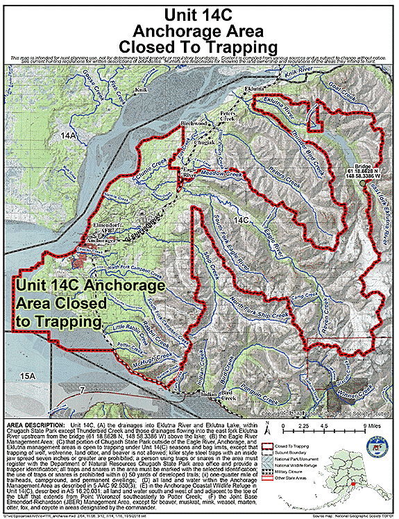
| Unit 14(C) Anchorage Area | 14C | Closed to the trapping of furbearers; additional restriction within area (C) listed above; killer style steel traps with an inside jaw spread seven inches or greater are prohibited: a person using traps or snares in the area must register with the Department of Natural Resources, Chugach State Park area office and provide a trapper identification; all traps and snares in the area must be marked with selected identification; the use of traps or snare is prohibited within (i) 50 yards of developed trails; (ii) one-quarter mile of trailheads, campground, and permanent dwellings |
GIF Map
(160 K)
PDF Map (546 K) |
| Unit 15A, Kenai Moose Research Center Closed Area | 15A | Closed to trapping |
GIF Map
(115 K)
PDF Map (204 K) |
| Unit 17 Walrus Island State Game Sanctuary | 17 | Closed to trapping |
GIF Map
(108 K)
PDF Map (194 K) |