Management Areas
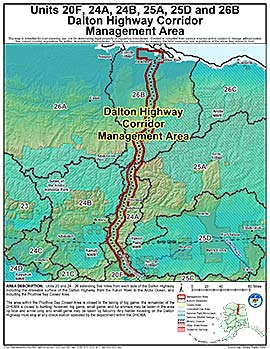
Dalton Highway Corridor Management Area
Note: Use of these maps indicates that you have read and understand the liability statement.
Units: 20, 24, 25, 26
Area Description: Dalton Highway Corridor Management Area (DHCMA): the portions of Units 20 and 24-26 extending five miles from each side of the Dalton Highway, including the driveable surface of the Dalton Highway, from the Yukon River to the Arctic Ocean, and including the Prudhoe Bay Closed Area
Restrictions: The area within the Prudhoe Bay Closed Area is closed to the taking of big game; the remainder of the DHCMA is closed to hunting; however, big game, small game, and fur animals may be taken in the area by bow and arrow only, and small game may be taken by falconry.
Any hunter traveling on the Dalton Highway must stop at any check station operated by the department within the DHCMA