Walrus Tracking Maps Archive
10/296/2015 – 11/306/2015
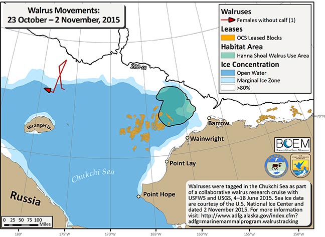
During the last 10 days we received locations for 1 female walrus. This walrus is near the edge of the sea ice, roughly 80 miles north of Wrangel Island in the northern Chukchi Sea. In addition to the movement tracks of these walruses we mapped the OCS leased blocks (orange cubes), the Hanna Shoal Walrus Use Area (green), and the 200 m isobath (black line). Sea ice data are courtesy of the U.S. National Ice Center, dated 2 November (http://www.natice.noaa.gov).