Walrus Tracking Maps Archive
08/228/2014 – 08/238/2014
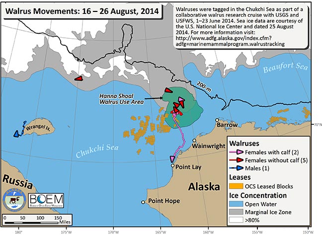
Over the last ten days we received transmissions from 8 walruses (1 male and 7 female). Six walruses spent more than one day within the Hanna Shoal Walrus Use Area. One adult female has moved south from the Hanna Shoal Walrus Use Area and is now north of Point Lay, Alaska. The one male is in Russian waters, west of Wrangel Island.
In addition to the movement tracks of these walruses we mapped the OCS leased blocks (orange cubes), the Hanna Shoal Walrus Use Area (green), and the 200 m isobath (black line). Sea ice data are courtesy of the U.S. National Ice Center, dated 25 August 2014 (http://www.natice.noaa.gov/index.html). Funding for this project is provided by the Bureau of Ocean Energy Management (BOEM). Walruses were tagged in the Chukchi Sea from 1–23 June, 2014.
In addition to the movement tracks of these walruses we mapped the OCS leased blocks (orange cubes), the Hanna Shoal Walrus Use Area (green), and the 200 m isobath (black line). Sea ice data are courtesy of the U.S. National Ice Center, dated 25 August 2014 (http://www.natice.noaa.gov/index.html). Funding for this project is provided by the Bureau of Ocean Energy Management (BOEM). Walruses were tagged in the Chukchi Sea from 1–23 June, 2014.