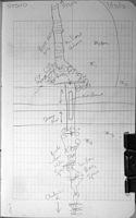
Fish Passage Site 40501759
Coordinates (dec. deg.): 65.21872°, -147.01031°
Legal Description: F005N004E31
Region: Interior
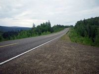
Road Name: Steese Highway
Datum: WGS84
Quad Name / ITM: Livengood A-1
AWC Stream #:
Stream Name:
Elevation:
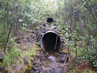
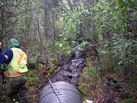
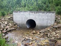
Site Comments: This culvert is about 110' downstream from STS09.
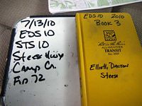
Survey EDS10-STS10
Observers: Mark Eisenman, Justin Leon
Overall Fish Passage Rating:
Tidal: No
Backwatered: No
Step Pools: No
Construction Year:
Site Observations:
- Culvert gradient red
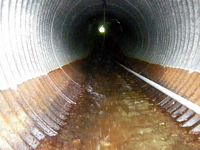
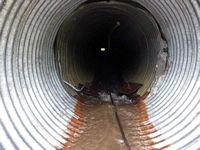
- Compound gradient in pipe
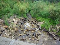
- Road bank erosion
Comments: This culvert appears to have a large amount of animal trapping occuring downstream, lot of old buckets and garbage D/S.This culvert is about 110' downstream from STS09. There is an obvious compound gradient in this pipe, but it was also not possible to get inside the pipe to measure it. No minnow traps were set out because the water was too shallow.
Culvert Measurements
| ID: 1 | Structure Type: Circular pipe (Corrugated steel) | Fish Passage Rating: | |||||||||||||||||||||||||||||||||||||||||
|
|
|
|||||||||||||||||||||||||||||||||||||||||
Culvert Observations:
|
|||||||||||||||||||||||||||||||||||||||||||
Stream Measurements
|
|
| Stream Width Type | Distance From Crossing (ft) |
Stream Width (ft) |
|---|---|---|
| Upstream ordinary high water | 50.0 | 5.20 |
| Upstream ordinary high water | 75.0 | 3.80 |
| Upstream ordinary high water | 96.0 | 5.70 |
Elevations
| Locator ID | Culvert Number |
River Distance (ft)1 |
Distance From Crossing (ft)2 |
Relative Elevation (ft) |
|---|---|---|---|---|
| U/S Grade Ctrl (Thalweg) (Thalweg) | 0.00 | 81.61 | ||
| U/S Water Surface Elev (Water Surface) | 0.00 | 81.89 | ||
| Inlet Culvert Invert (Bottom of Pipe - Headwater @ invert in) | 22.00 | 79.32 | ||
| U/S Water Surface Elev (Water Surface) | 22.00 | 79.65 | ||
| Outlet Invert (Bottom of Pipe) | 208.10 | 62.31 | ||
| D/S Water Surface Elev (Water Surface) | 208.10 | 62.72 | ||
| Max Pool Depth (Substrate) | 211.10 | 61.80 | ||
| Outlet Pool Water Elev (Water Surface) | 211.10 | 62.52 | ||
| D/S Tailcrest or 1st Thalweg (Substrate) | 214.10 | 62.34 | ||
| D/S Water Surface Elev (Water Surface) | 214.10 | 62.44 | ||
| D/S Grade Ctrl (Thalweg) (Thalweg) | 240.10 | 58.90 | ||
| D/S Water Surface Elev (Water Surface) | 240.10 | 59.10 |
Notes:
- River distance is measured continuously throughout the survey reach along the thalweg of the stream.
- Measured from each end of the crossing along the thalweg of the stream.
Fish Sampling Efforts
| Gear Type: None (A) | ||
| Comments: No traps set, water too shallow. No fish observed. | ||
Fish Observations
No fish observations occurred during this survey.
Questions or comments about this report can be directed to dfg.dsf.webmaster@alaska.gov
