Fish Passage Site 40501719
Coordinates (dec. deg.): 64.95959°, -147.62299°
Legal Description: F002N001E31
Region: Interior
Road Name: Private Drive
Datum: WGS84
Quad Name / ITM: Fairbanks D-2
AWC Stream #:
Stream Name: Fox Creek
Elevation:
Site Comments: None
Survey EDS10-FOX01
Observers: Mark Eisenman, Justin Leon
Overall Fish Passage Rating:
Tidal: No
Backwatered: No
Step Pools: No
Construction Year:
Site Observations:
- Outfall height red
- Road bank erosion
- Inlet perch
- Damage associated with ice problems
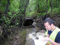
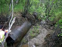
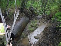
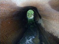
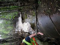
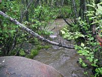
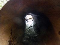
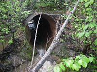
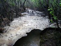
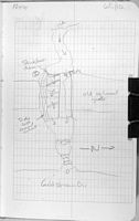
Comments: Abandoned culvert. We talked to the landowner of the property that this culvert is on. This pipe is a piece of the old Davidson Ditch pipeline. It looks to be over 100 years old. No constriction ratio was calculated because the upstream of the culvert is still ice. Some flow bypassing culvert.
Culvert Measurements
| ID: 1 | Structure Type: Circular pipe (Non-corrugated metal) | Fish Passage Rating: | |||||||||||||||||||||||||||||||||||||||||
|
|
|
|||||||||||||||||||||||||||||||||||||||||
Stream Measurements
|
|
No stream width data available.
Elevations
| Locator ID | Culvert Number |
River Distance (ft)1 |
Distance From Crossing (ft)2 |
Relative Elevation (ft) |
|---|---|---|---|---|
| Road Elev (Old Road Grade) | 102.59 | |||
| Misc. (Outlet into Goldstream Creek Substrate) | 0.00 | 93.40 | ||
| D/S Water Surface Elev (Mouth of Stream Water Surface) | 0.00 | 94.02 | ||
| D/S Tailcrest or 1st Thalweg (Substrate) | 9.00 | 94.57 | ||
| D/S Water Surface Elev (Water Surface) | 9.00 | 94.94 | ||
| Outlet Pool Water Elev | 17.00 | 94.06 | ||
| Outlet Invert (Bottom of Pipe) | 18.00 | 95.50 | ||
| D/S Water Surface Elev (Water Surface) | 18.00 | 95.76 | ||
| Outlet Culvert Top (Top of Pipe) | 18.00 | 100.00 | ||
| U/S Water Surface Elev (Water Surface) | 44.00 | 97.08 | ||
| Inlet Culvert Top (Top of Pipe) | 44.00 | 99.93 | ||
| Inlet Culvert Invert (Substrate) | 44.00 | 96.44 | ||
| U/S Water Surface Elev (Water Surface) | 45.00 | 97.04 | ||
| U/S Headwater (Thalweg) | 45.00 | 96.38 |
Notes:
- River distance is measured continuously throughout the survey reach along the thalweg of the stream.
- Measured from each end of the crossing along the thalweg of the stream.
Fish Sampling Efforts
No fish sampling occurred during this survey.
Fish Observations
No fish observations occurred during this survey.
Questions or comments about this report can be directed to dfg.dsf.webmaster@alaska.gov
