Fish Passage Site 40501709
Coordinates (dec. deg.): 65.39685°, -148.91628°
Legal Description: F007N007W35
Region: Interior
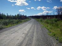
Road Name: Elliott Highway
Datum: WGS84
Quad Name / ITM: Livengood B-4
AWC Stream #:
Stream Name:
Elevation:
Site Comments: MP 84
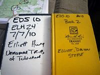
Survey EDS10-ELH24
Observers: Mark Eisenman, Justin Leon
Overall Fish Passage Rating:
Tidal: No
Backwatered: No
Step Pools: No
Construction Year:
Site Observations:
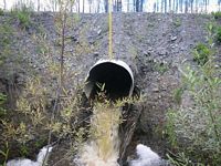
- Constriction ratio red
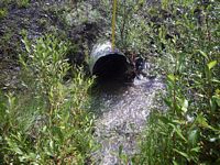
- Road bank erosion
- Outfall height red
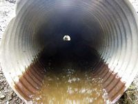
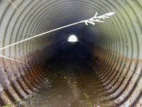
- Culvert gradient red
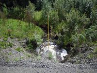
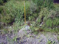
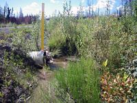
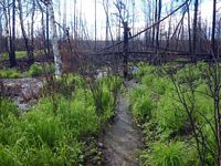
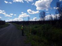
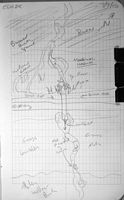
Comments: This culvert had multiple channels upstream so no approach angle was taken. Downstream widths were used for this same reason. There are pieces of culvert downstream, as well as a lot of erosion. The stream looks like it could have been disturbed from a recent fire. No minnow traps were set here because the water was too shallow.
Culvert Measurements
| ID: 1 | Structure Type: Circular pipe (Structural steel plate) | Fish Passage Rating: | |||||||||||||||||||||||||||||||||||||||||
|
|
|
|||||||||||||||||||||||||||||||||||||||||
Culvert Observations:
|
|||||||||||||||||||||||||||||||||||||||||||
Stream Measurements
|
|
| Stream Width Type | Distance From Crossing (ft) |
Stream Width (ft) |
|---|---|---|
| Downstream ordinary high water | 89.0 | 8.40 |
| Downstream ordinary high water | 125.0 | 6.90 |
| Downstream ordinary high water | 146.0 | 3.50 |
Elevations
| Locator ID | Culvert Number |
River Distance (ft)1 |
Distance From Crossing (ft)2 |
Relative Elevation (ft) |
|---|---|---|---|---|
| Road Elev (Road Surface) | 101.91 | |||
| D/S Thalweg (Thalweg) | 0.00 | 90.99 | ||
| D/S Water Surface Elev (Water Surface) | 0.00 | 91.47 | ||
| D/S Tailcrest or 1st Thalweg (Thalweg) | 56.00 | 93.31 | ||
| D/S Water Surface Elev (Water Surface) | 56.00 | 93.67 | ||
| Outlet Pool Water Elev (Water Surface) | 67.00 | 93.74 | ||
| Max Pool Depth (Substrate) | 67.00 | 92.00 | ||
| Outlet Invert (Bottom of Pipe) | 70.00 | 95.34 | ||
| D/S Water Surface Elev (Water Surface) | 70.00 | 95.57 | ||
| Inlet Culvert Invert (Bottom of Pipe) | 111.10 | 97.50 | ||
| U/S Water Surface Elev (Water Surface) | 111.10 | 98.02 | ||
| U/S Headwater (Water Surface) | 113.10 | 98.10 | ||
| U/S Thalweg (Substrate) | 113.10 | 97.77 |
Notes:
- River distance is measured continuously throughout the survey reach along the thalweg of the stream.
- Measured from each end of the crossing along the thalweg of the stream.
Fish Sampling Efforts
| Gear Type: None (A) | ||
| Comments: No traps set water too shallow, no fish observed. | ||
Fish Observations
No fish observations occurred during this survey.
Questions or comments about this report can be directed to dfg.dsf.webmaster@alaska.gov
