Fish Passage Site 40500252
Coordinates (dec. deg.): 64.83464°, -147.48768°
Legal Description: F001S001E11
Region: Interior
Road Name: Persinger
Datum: WGS84
Quad Name / ITM: Fairbanks D-1
AWC Stream #:
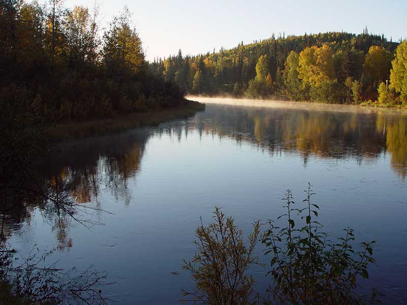
Stream Name: Badger Slough
Elevation:
Site Comments: None
Survey CRB02-BAD01
Observers: Dave Ryland, Christopher Brockman, Beth Evers
Overall Fish Passage Rating:
Tidal: No
Backwatered: No
Step Pools:
Construction Year:
Comments: None
Culvert Measurements
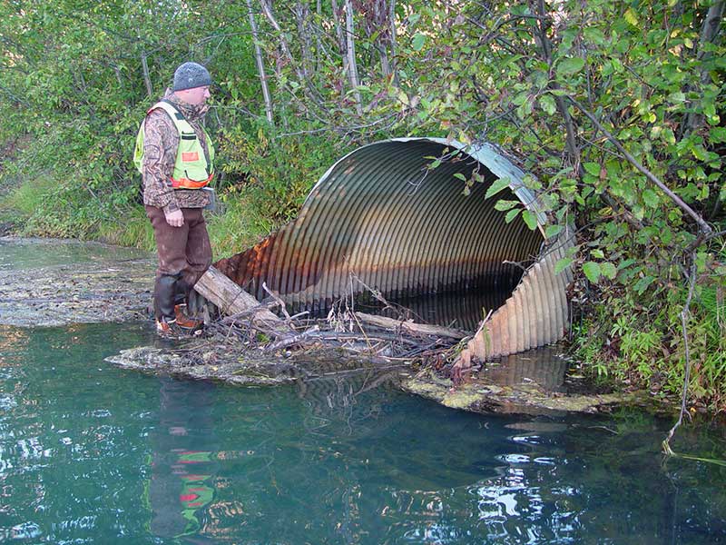
| ID: 1 | Structure Type: Circular pipe (Corrugated steel) | Fish Passage Rating: | |||||||||||||||||||||||||||||||||||||||||
|
|
|
|||||||||||||||||||||||||||||||||||||||||
Comments: Debris jam at inlet 3.8-4' deep/ fish obs adult and juv. Grayling, pacific lamprey |
|||||||||||||||||||||||||||||||||||||||||||
| ID: 2 | Structure Type: Circular pipe (Corrugated steel) | Fish Passage Rating: | |||||||||||||||||||||||||||||||||||||||||
|
|
|
|||||||||||||||||||||||||||||||||||||||||
Stream Measurements
|
|
| Stream Width Type | Distance From Crossing (ft) |
Stream Width (ft) |
|---|---|---|
| Upstream ordinary high water | ||
| Upstream ordinary high water | ||
| Upstream ordinary high water | ||
| Upstream ordinary high water |
Elevations
| Locator ID | Culvert Number |
River Distance (ft)1 |
Distance From Crossing (ft)2 |
Relative Elevation (ft) |
|---|---|---|---|---|
| Outlet Invert | 2 | 0.00 | 0.0 | 91.66 |
| Outlet Invert | 1 | 0.00 | 0.0 | 94.03 |
| Outlet Pool Water Elev | 0.00 | 0.0 | 96.84 | |
| Road Elev | 43.50 | 104.73 | ||
| Inlet Culvert Invert | 2 | 87.00 | 0.0 | 91.39 |
| U/S Headwater | 87.00 | 0.0 | 97.21 | |
| Inlet Culvert Invert | 1 | 87.00 | 0.0 | 93.12 |
Notes:
- River distance is measured continuously throughout the survey reach along the thalweg of the stream.
- Measured from each end of the crossing along the thalweg of the stream.
Fish Sampling Efforts
No fish sampling occurred during this survey.
Fish Observations
No fish observations occurred during this survey.
Photos


Questions or comments about this report can be directed to dfg.dsf.webmaster@alaska.gov