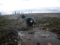
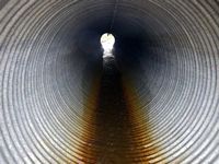
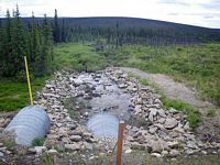
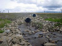
Fish Passage Site 40401727
Coordinates (dec. deg.): 65.33879°, -146.82451°
Legal Description: F006N004E24
Region: Interior
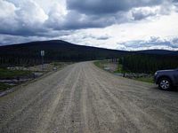
Road Name: Nome Creek Road
Datum: WGS84
Quad Name / ITM: Circle B-6
AWC Stream #:
Stream Name: Nome Creek tributary
Elevation:
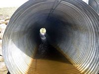
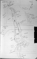
Site Comments: This site is up stream aobut 1/4 mile from NCR01 inNome Creek Rd White Mountain Rec Area.
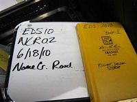
Survey EDS10-NCR02
Observers: Mark Eisenman, Justin Leon
Overall Fish Passage Rating:
Tidal: No
Backwatered: No
Step Pools: No
Construction Year:
Site Observations:
- Culvert gradient red
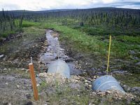
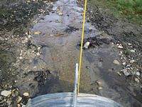
Comments: Nome Creek Rd White Mountain Rec Area. No Minnow Traps used no deep pools. Natural steam bed a long way u/s from culvert. Stream narrows above influence and below. Habitat marginal above culvert.
Culvert Measurements
| ID: 1 | Structure Type: Circular pipe (Corrugated steel) | Fish Passage Rating: | |||||||||||||||||||||||||||||||||||||||||
|
|
|
|||||||||||||||||||||||||||||||||||||||||
Culvert Observations:
|
|||||||||||||||||||||||||||||||||||||||||||
Stream Measurements
|
|
| Stream Width Type | Distance From Crossing (ft) |
Stream Width (ft) |
|---|---|---|
| Upstream ordinary high water | 203.0 | 3.80 |
| Upstream ordinary high water | 222.0 | 2.10 |
| Upstream ordinary high water | 234.0 | 3.70 |
Elevations
| Locator ID | Culvert Number |
River Distance (ft)1 |
Distance From Crossing (ft)2 |
Relative Elevation (ft) |
|---|---|---|---|---|
| Road Elev (Road Surface) | 98.73 | |||
| D/S Grade Ctrl (Thalweg) (D/S grad control point) | 0.00 | 80.62 | ||
| D/S Water Surface Elev | 0.00 | 81.27 | ||
| D/S Grade Ctrl (Thalweg) (d/s grade control point Thalweg) | 38.00 | 82.63 | ||
| D/S Water Surface Elev | 38.00 | 83.28 | ||
| D/S Tailcrest or 1st Thalweg (Tailwater control Thalweg) | 81.00 | 83.51 | ||
| D/S Water Surface Elev (Tailwater surface elev.) | 81.00 | 84.24 | ||
| Misc. (Water Surface at Invert out) | 86.00 | 84.32 | ||
| Outlet Invert (Bottom of Pipe) | 86.00 | 83.54 | ||
| Inlet Culvert Invert (Bottom of Pipe) | 166.00 | 86.69 | ||
| Misc. (Water Surface at invert in.) | 166.00 | 87.04 | ||
| U/S Headwater | 170.00 | 87.05 | ||
| U/S Thalweg | 170.00 | 86.60 | ||
| U/S Grade Ctrl (Thalweg) (0' starts d/s) | 345.00 | 90.82 | ||
| U/S Water Surface Elev | 345.00 | 91.18 |
Notes:
- River distance is measured continuously throughout the survey reach along the thalweg of the stream.
- Measured from each end of the crossing along the thalweg of the stream.
Fish Sampling Efforts
| Gear Type: None (A) | ||
| Comments: No traps set water too shallow, no fish observed. | ||
Fish Observations
No fish observations occurred during this survey.
Questions or comments about this report can be directed to dfg.dsf.webmaster@alaska.gov
