Fish Passage Site 30103674
Coordinates (dec. deg.): 51.89409°, -176.66709°
Legal Description: S096S195W03
Region: Southwest
Road Name: Old Military Road
Datum: NAD83
Quad Name / ITM: Adak C-2
AWC Stream #:
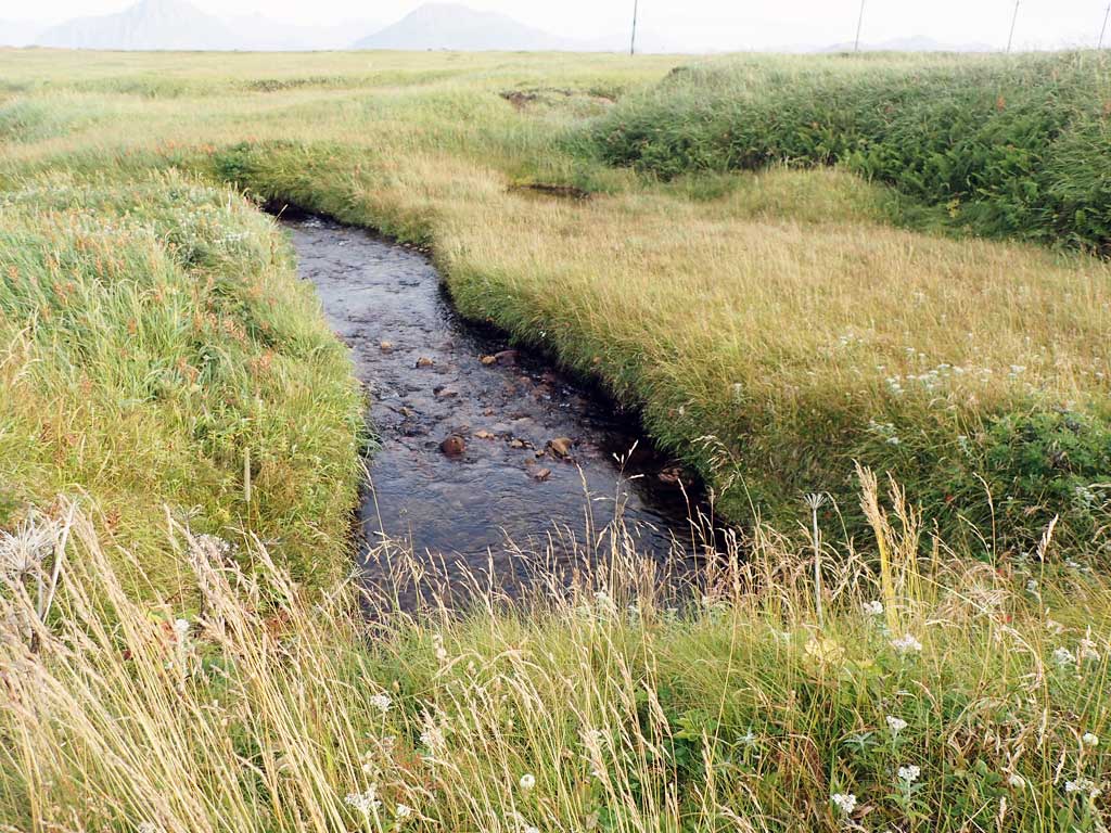
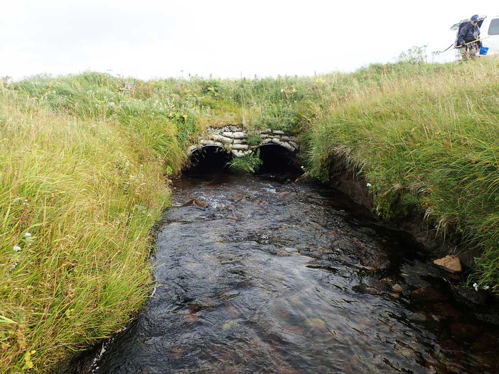
Stream Name: Airport Creek
Elevation:
Site Comments: Crossing is above documented anadromy.
Survey ADAK17-C75
Observers: Mark Eisenman, Jeanette Alas
Overall Fish Passage Rating:
Tidal: No
Backwatered: No
Step Pools: No
Construction Year:
Site Observations:
- Structural Problem
Comments: This information was gathered as part of the joint reconnaissance level project between the ADF&G Habitat Division and the Fish Passage Assessment Project on Adak Island. Due to time constraints full site assessments were not conducted, but base line information was collected.
Culvert Measurements
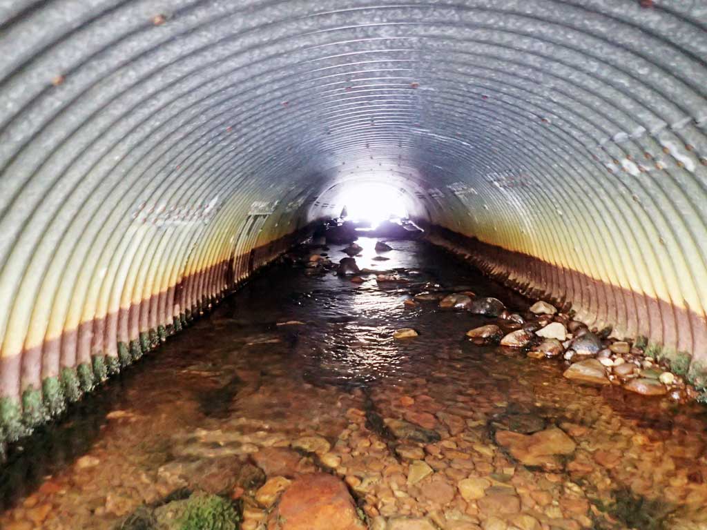
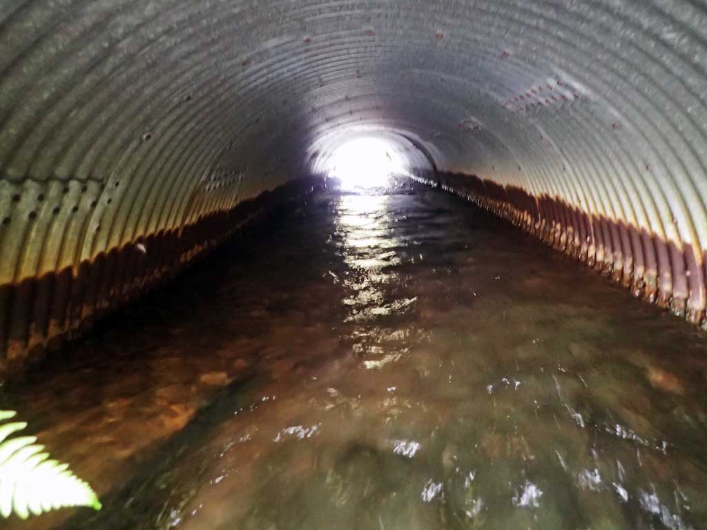
| ID: 1 | Structure Type: Pipe-arch (Corrugated steel) | Fish Passage Rating: | |||||||||||||||||||||||||||||||||||||||||
|
|
|
|||||||||||||||||||||||||||||||||||||||||
Comments: Culvert length estimated from aerial imagery. Culvert looks to have substrate throughout culvert, maybe embedded. Substrate in barrel of culvert likely naturally deposited. Constriction may be an issue with this site. Culvert shows significant rustline and pitting. Concrete pillow headwalls. |
|||||||||||||||||||||||||||||||||||||||||||
Culvert Observations:
|
|||||||||||||||||||||||||||||||||||||||||||
| ID: 2 | Structure Type: Pipe-arch (Corrugated steel) | Fish Passage Rating: | |||||||||||||||||||||||||||||||||||||||||
|
|
|
|||||||||||||||||||||||||||||||||||||||||
Comments: Culvert length estimated from aerial imagery. Culvert looks to have substrate throughout culvert, maybe embedded. Substrate in barrel of culvert likely naturally deposited. Constriction may be an issue with this site. Culvert shows significant rustline and pitting. Concrete pillow headwalls. |
|||||||||||||||||||||||||||||||||||||||||||
Culvert Observations:
|
|||||||||||||||||||||||||||||||||||||||||||
Stream Measurements
|
|
No stream width data available.
Elevations
No elevation data available.
Fish Sampling Efforts
| Gear Type: Smith-Root LR-24 (A) | ||
| Gear Type: Visual Observation, Ground (B) | ||
Fish Observations
| Species: juvenile/adult Dolly Varden | Life History: Unknown | ||
| Total Fish Observed: 8 | Fish Measured: 3 | Fork Lengths (mm) Min: 40 Max: 77 Mean: 59 | |
| Collected/Observed by Gear Type: Upstream Visual Observation, Ground (5) Upstream Smith-Root LR-24 (3) | |||
| Comments: 5 additional Dolly Varden observed but not captured upstream. | |||
Photos


Questions or comments about this report can be directed to dfg.dsf.webmaster@alaska.gov