Fish Passage Site 20300924
Coordinates (dec. deg.): 59.29671°, -151.71590°
Legal Description: S010S014W19
Region: South Central
Road Name: Port Graham
Datum: NAD83
Quad Name / ITM: Seldovia B-5
AWC Stream #:
Stream Name:
Elevation:
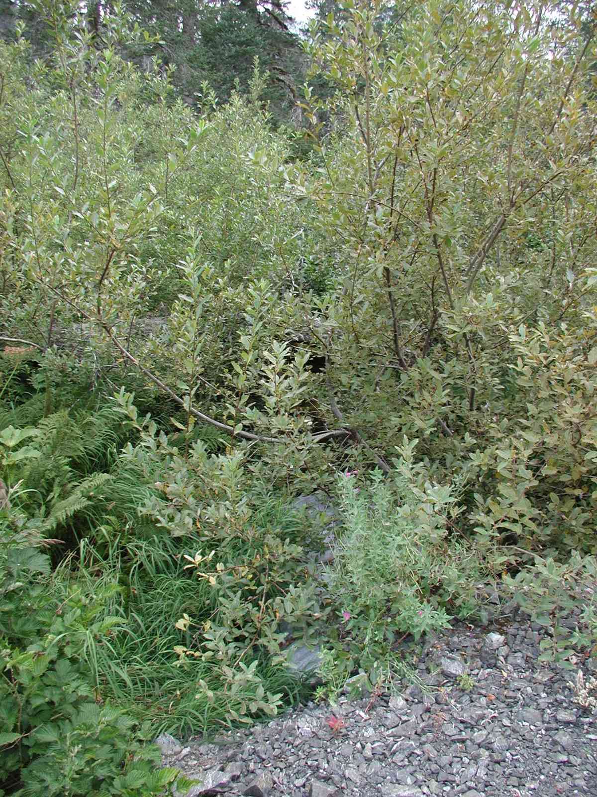
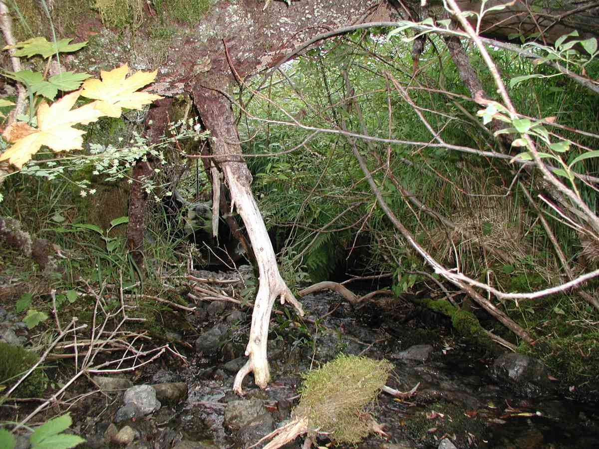
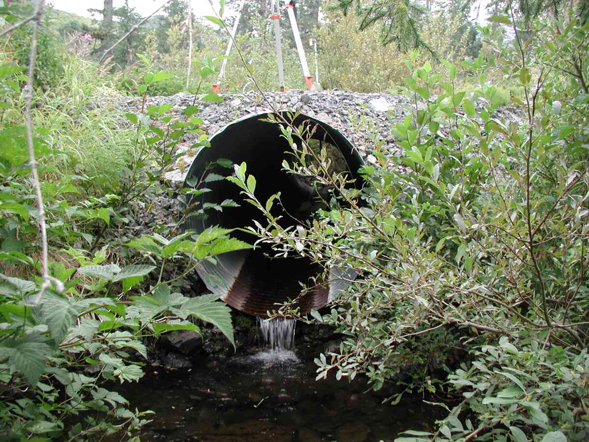
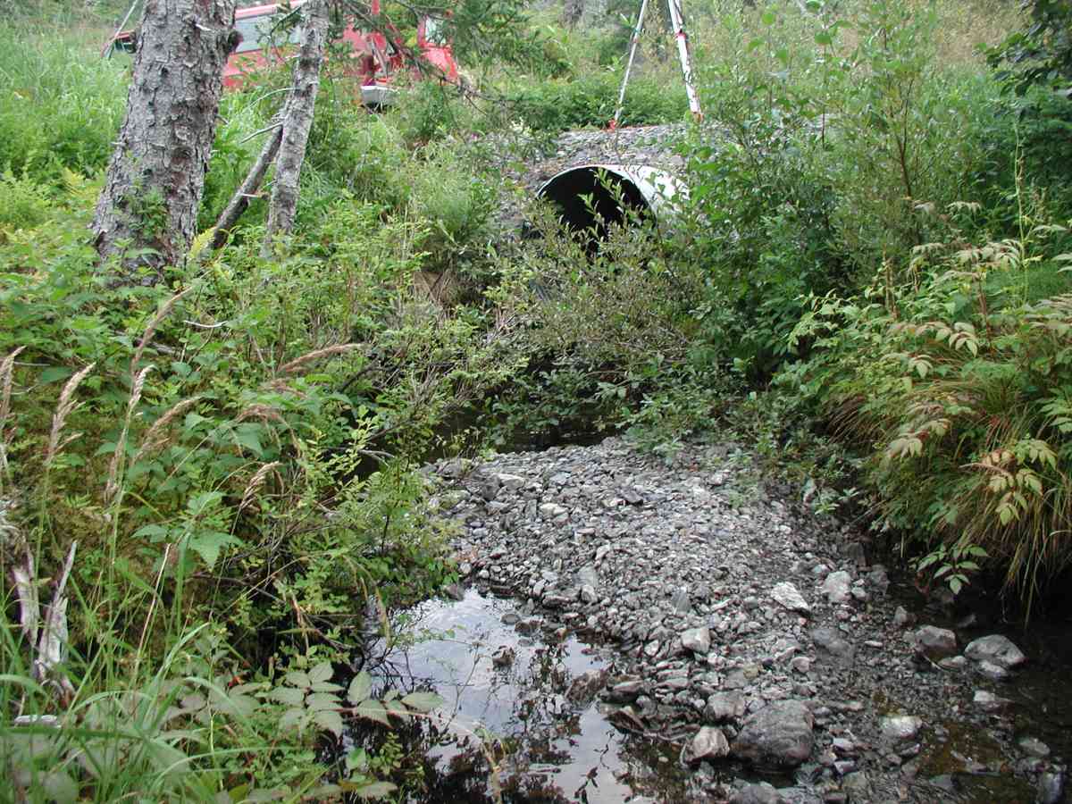
Site Comments: Location: Port Graham Stream: Steep gradient with pools and some falls (~12"). Substrate is very rocky upstream and gravel/cobble downstream. Downstream has gravel bars and is more meandering. Streambank is densely vegetated.
Survey KPC04-1A104
Observers: Mary King, Pam Russell
Overall Fish Passage Rating:
Tidal: No
Backwatered: No
Step Pools:
Construction Year:
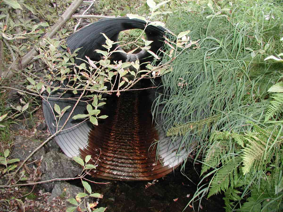
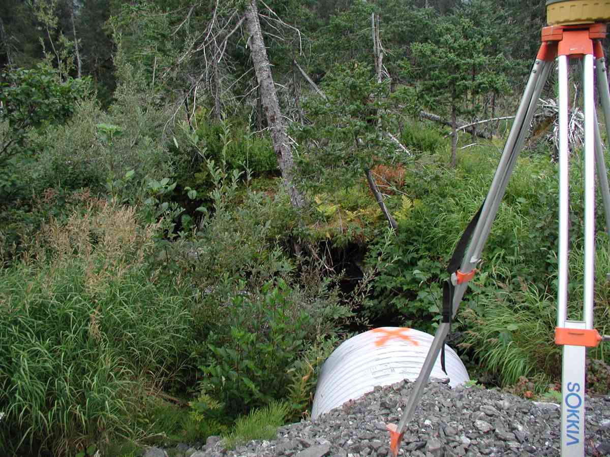
Comments: Location: Port Graham Stream: Steep gradient with pools and some falls (~12"). Substrate is very rocky upstream and gravel/cobble downstream. Downstream has gravel bars and is more meandering. Streambank is densely vegetated. Minimal bank undercut. Flow measurements were done 30' upstream of inlet; rocks and water level were problematic. Culvert: Pipe condition=5. Outlet is perched. Not embedded. Note: Waypoint led to a road location with no culvert, but consistent 400' error in the Port Graham waypoint database indicated that the culvert was likely located on a side road down the mountainside--measurements done there.
Culvert Measurements
| ID: 1 | Structure Type: Circular pipe (Corrugated Metal) | Fish Passage Rating: | |||||||||||||||||||||||||||||||||||||||||
|
|
|
|||||||||||||||||||||||||||||||||||||||||
Stream Measurements
|
|
| Stream Width Type | Distance From Crossing (ft) |
Stream Width (ft) |
|---|---|---|
| Upstream bank full | 75.0 | 9.25 |
| Upstream bank full | 100.0 | 7.50 |
| Upstream bank full | 125.0 | 9.83 |
| Upstream bank full | 150.0 | 7.42 |
| Upstream bed width | 75.0 | 1.83 |
| Upstream bed width | 100.0 | 2.83 |
| Upstream bed width | 125.0 | 6.67 |
| Upstream bed width | 150.0 | 4.75 |
| Upstream ordinary high water | 75.0 | 7.42 |
| Upstream ordinary high water | 100.0 | 5.33 |
| Upstream ordinary high water | 125.0 | 8.75 |
| Upstream ordinary high water | 150.0 | 6.08 |
Elevations
| Locator ID | Culvert Number |
River Distance (ft)1 |
Distance From Crossing (ft)2 |
Relative Elevation (ft) |
|---|---|---|---|---|
| D/S Tailcrest or 1st Thalweg | 95.03 | |||
| OHW Left Bank (Pipe perched.) | 95.38 | |||
| OHW Left Bank | 95.77 | |||
| D/S Thalweg | 93.98 | |||
| U/S Thalweg | 1 | 97.46 | ||
| Outlet Culvert Top (Orange Painted "X" on top of outlet; measurement on 2nd corrugation.) | 1 | 100.00 | ||
| Max Pool Depth | 0.00 | 5.0 | 94.21 | |
| Outlet Invert (Pipe perched.) | 1 | 5.00 | 0.0 | 95.84 |
| Road Elev (Road surface) | 20.00 | 101.06 | ||
| Inlet Culvert Invert | 1 | 35.00 | 0.0 | 96.72 |
Notes:
- River distance is measured continuously throughout the survey reach along the thalweg of the stream.
- Measured from each end of the crossing along the thalweg of the stream.
Fish Sampling Efforts
No fish sampling occurred during this survey.
Fish Observations
No fish observations occurred during this survey.
Photos

Questions or comments about this report can be directed to dfg.dsf.webmaster@alaska.gov