Fish Passage Site 20300920
Coordinates (dec. deg.): 59.30175°, -151.71189°
Legal Description: S010S014W19
Region: South Central
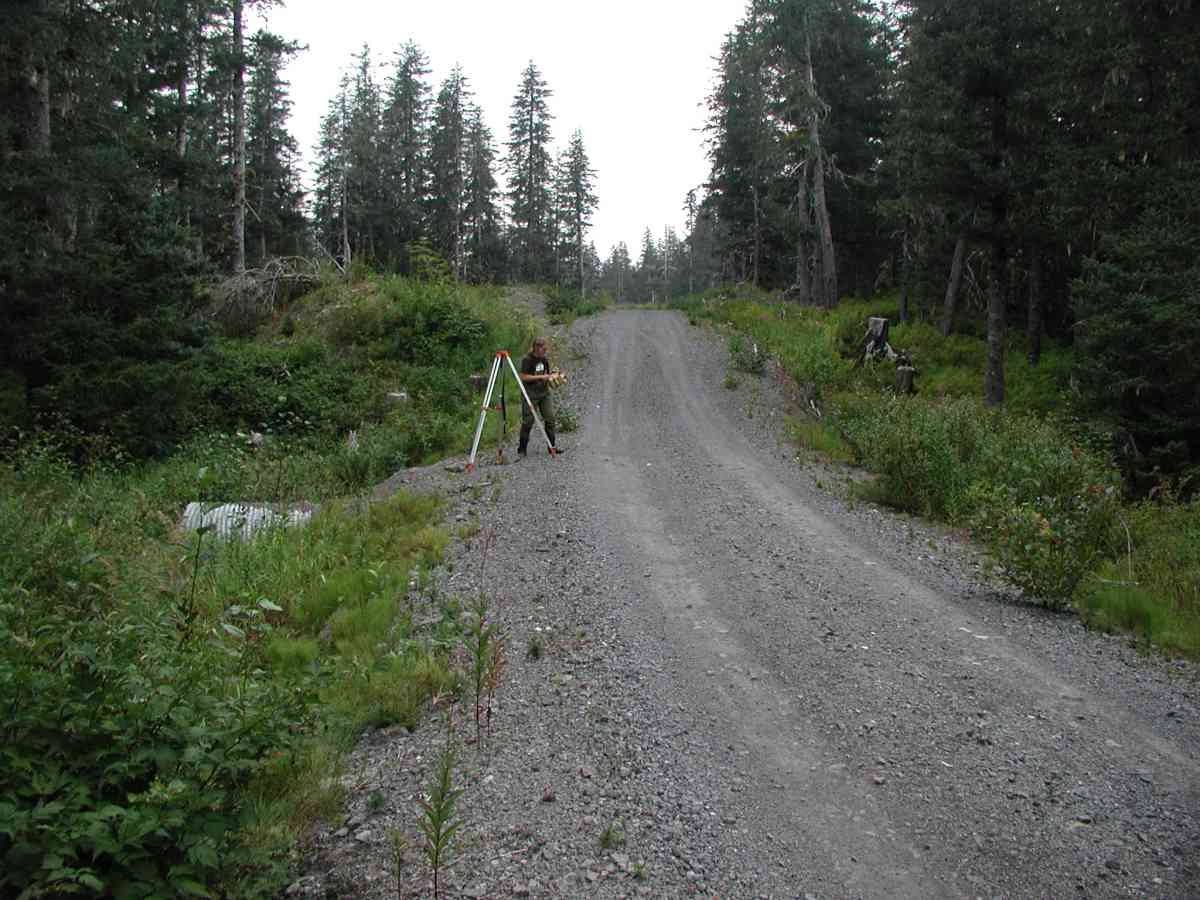
Road Name: Port Graham
Datum: NAD83
Quad Name / ITM: Seldovia B-5
AWC Stream #: 241-20-10550-2019
Stream Name:
Elevation:
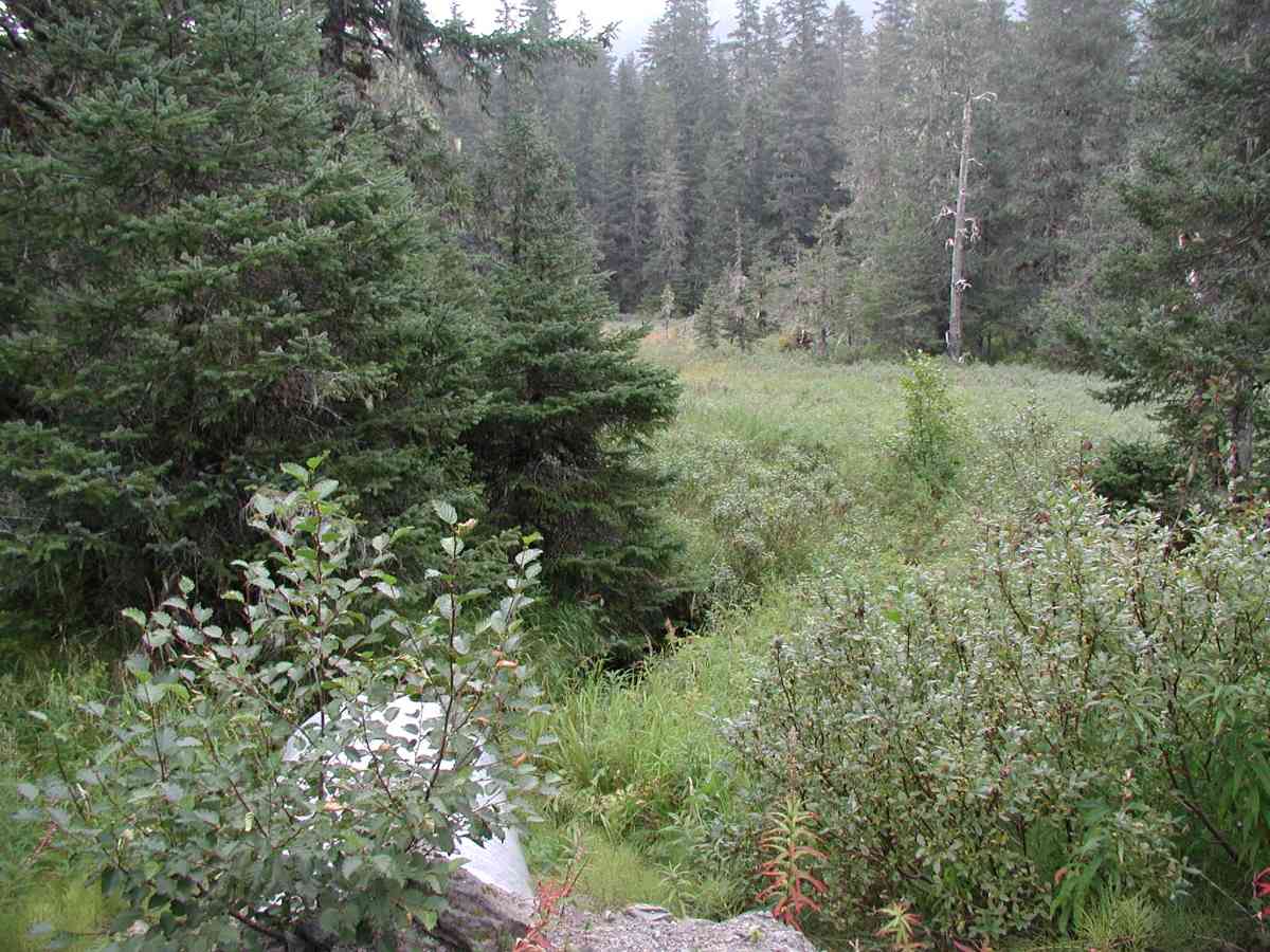
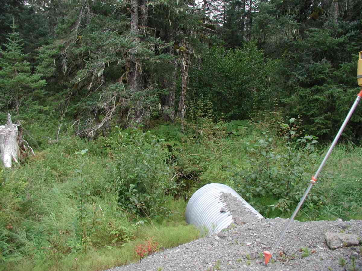
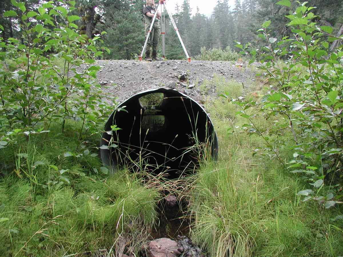
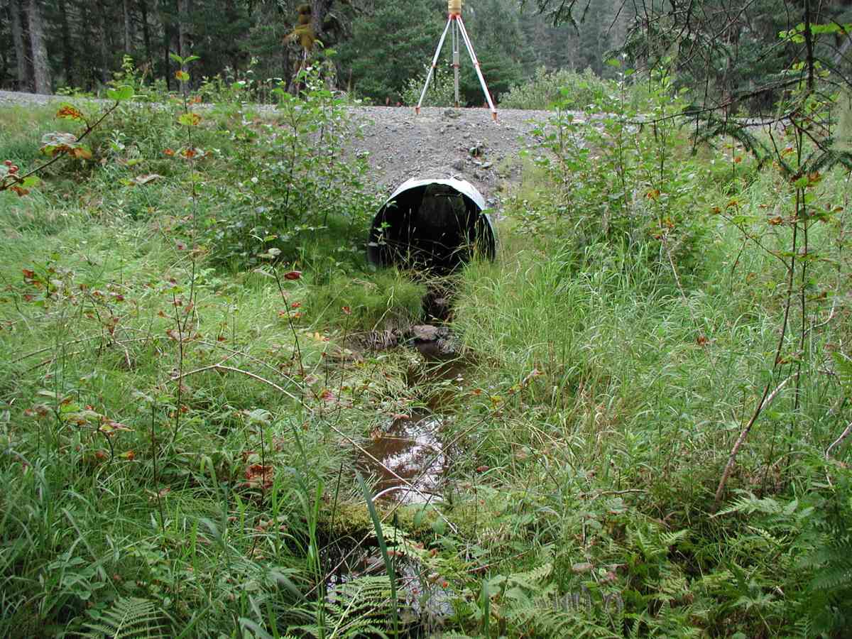
Site Comments: Location: Port Graham Stream: Stream drains an open marsh. Banks are densely vegetated. Channel is narrow, deeply incised. Substrate is sand/ muck (very soft) upstream and gravel downstream.
Survey KPC04-1A098
Observers: Mary King, Pam Russell
Overall Fish Passage Rating:
Tidal: No
Backwatered: No
Step Pools:
Construction Year:
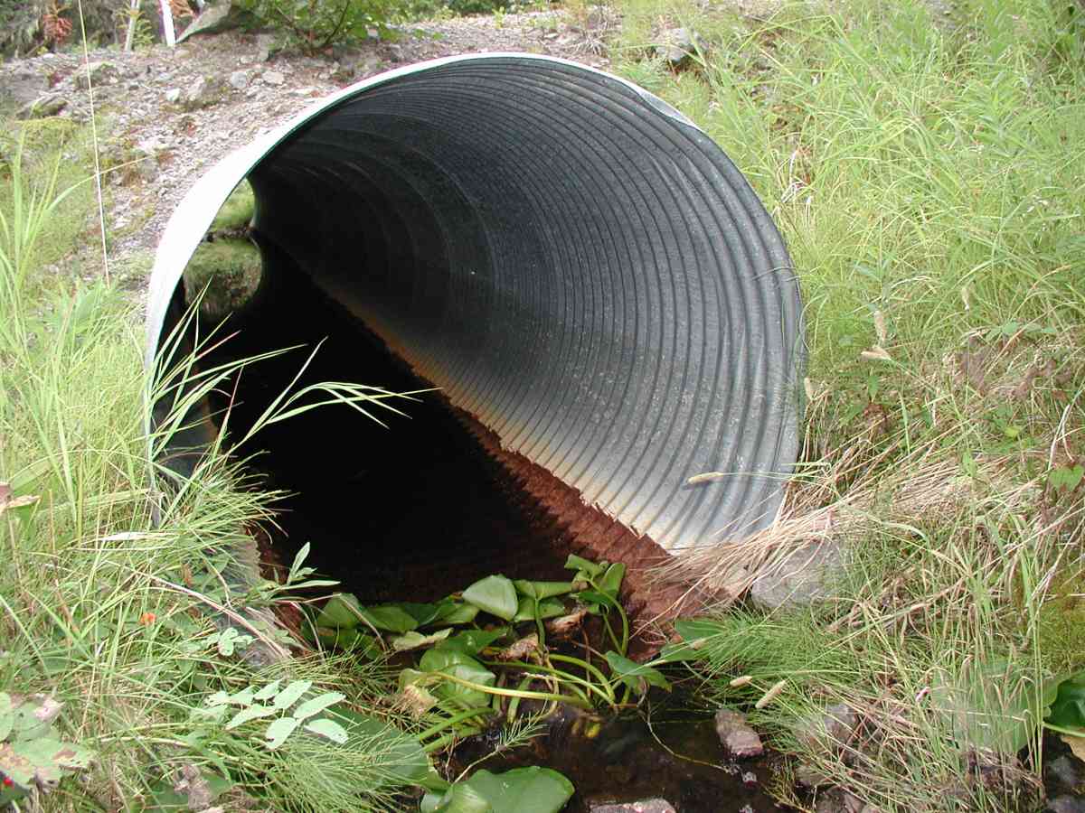
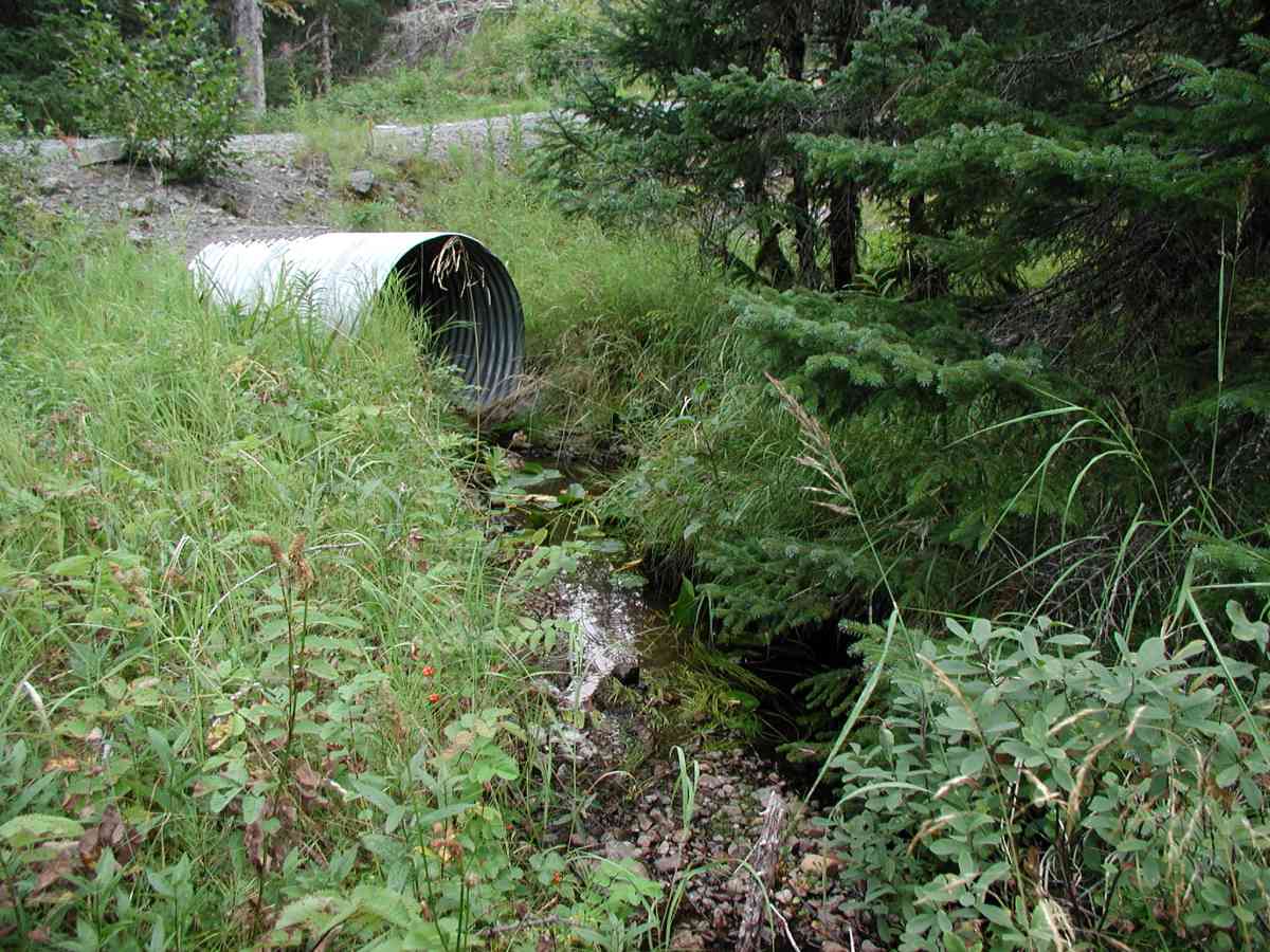
Comments: Location: Port Graham Stream: Stream drains an open marsh. Banks are densely vegetated. Channel is narrow, deeply incised. Substrate is sand/ muck (very soft) upstream and gravel downstream. No detectable flow (no measurements taken). Bank undercut 3"-5'. Culvert: Pipe condition=5. Not embedded. Appears to function well. Note: Waypoint error for relocating sites in Port Graham area was ~400'. Two pipes were located in this road section. Measurements were taken on the pipe with the 400' error.
Culvert Measurements
| ID: 1 | Structure Type: Circular pipe (Corrugated Metal) | Fish Passage Rating: | |||||||||||||||||||||||||||||||||||||||||
|
|
|
|||||||||||||||||||||||||||||||||||||||||
Stream Measurements
|
|
| Stream Width Type | Distance From Crossing (ft) |
Stream Width (ft) |
|---|---|---|
| Upstream bank full | 75.0 | 3.42 |
| Upstream bank full | 100.0 | 3.00 |
| Upstream bank full | 125.0 | 3.50 |
| Upstream bank full | 150.0 | 1.75 |
| Upstream bed width | 75.0 | 2.00 |
| Upstream bed width | 100.0 | 1.92 |
| Upstream bed width | 125.0 | 2.92 |
| Upstream bed width | 150.0 | 0.67 |
| Upstream ordinary high water | 75.0 | 2.50 |
| Upstream ordinary high water | 100.0 | 1.92 |
| Upstream ordinary high water | 125.0 | 2.83 |
| Upstream ordinary high water | 150.0 | 0.67 |
Elevations
| Locator ID | Culvert Number |
River Distance (ft)1 |
Distance From Crossing (ft)2 |
Relative Elevation (ft) |
|---|---|---|---|---|
| D/S Thalweg | 96.14 | |||
| D/S Tailcrest or 1st Thalweg | 96.20 | |||
| OHW Left Bank | 96.37 | |||
| OHW Left Bank | 96.46 | |||
| U/S Thalweg | 1 | 96.54 | ||
| Outlet Culvert Top (Orange paninted "X" on outlet, measurement taken on 3rd corrugation.) | 1 | 100.00 | ||
| Max Pool Depth | 0.00 | 5.0 | 95.58 | |
| Outlet Invert | 1 | 5.00 | 0.0 | 96.09 |
| Road Elev (Road surface.) | 25.00 | 101.34 | ||
| Inlet Culvert Invert | 1 | 45.00 | 0.0 | 96.41 |
Notes:
- River distance is measured continuously throughout the survey reach along the thalweg of the stream.
- Measured from each end of the crossing along the thalweg of the stream.
Fish Sampling Efforts
No fish sampling occurred during this survey.
Fish Observations
No fish observations occurred during this survey.
Photos
Questions or comments about this report can be directed to dfg.dsf.webmaster@alaska.gov