Fish Passage Site 20300912
Coordinates (dec. deg.): 59.31087°, -151.77171°
Legal Description: S010S015W14
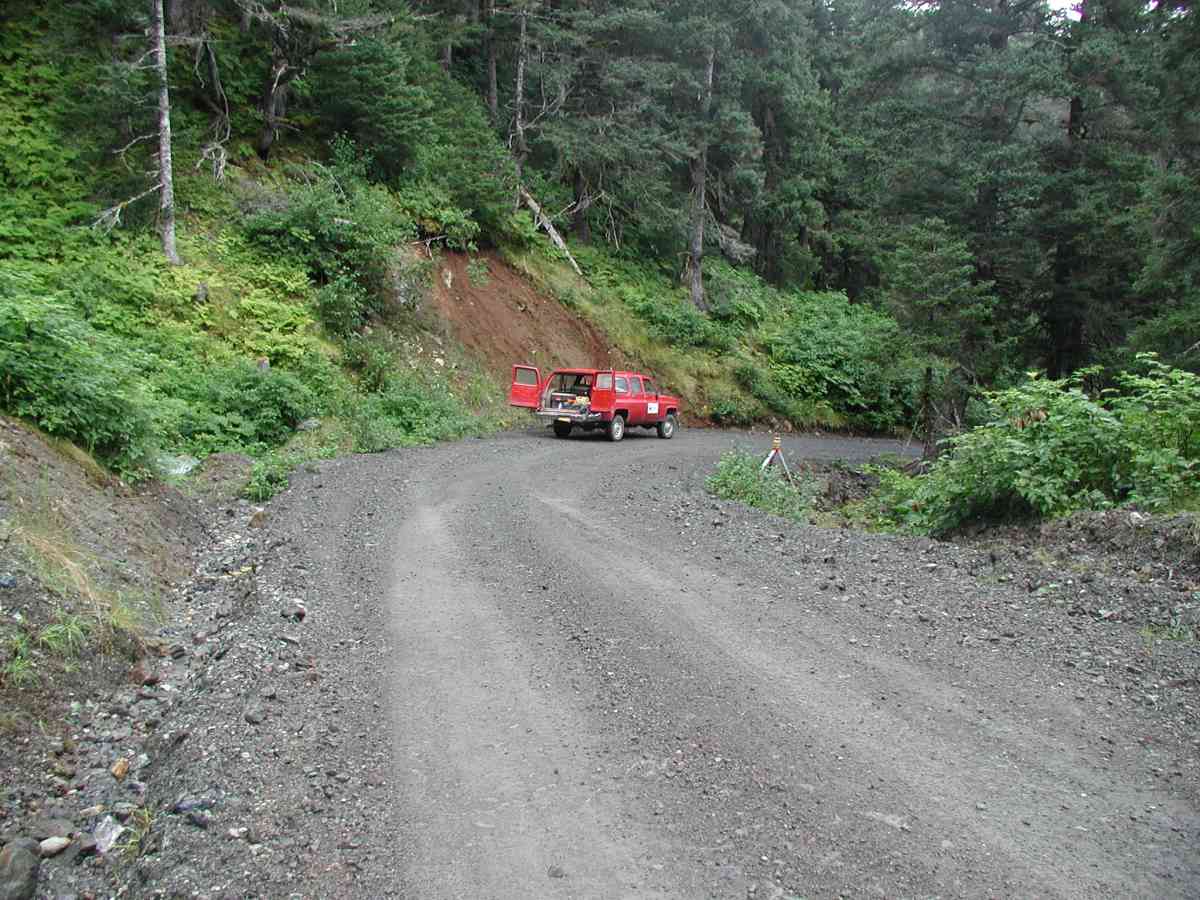
Region: South Central
Road Name: Port Graham
Datum: NAD83
Quad Name / ITM: Seldovia B-5
AWC Stream #:
Stream Name:
Elevation:
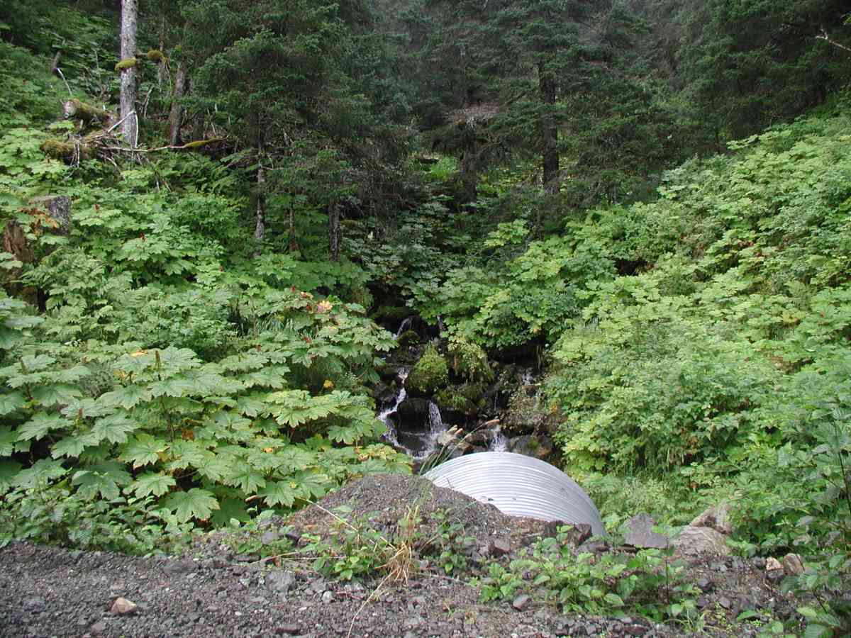
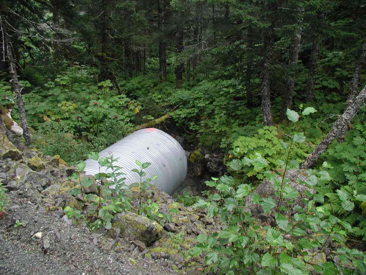
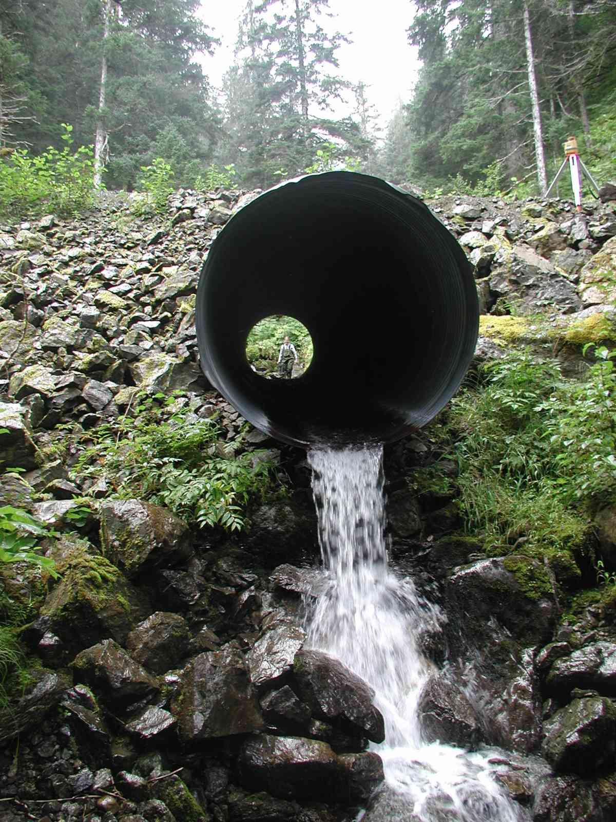
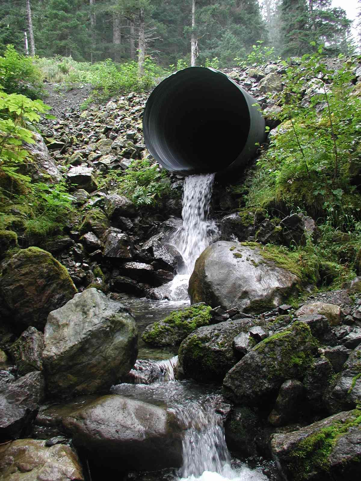
Site Comments: Location: Port Graham Stream: Stream has cascading falls (some exceeding 300'), plunge pools, large boulders and a gradient of ~40 degrees. Water is clear with very swift flow. The physical characteristics of the stream make it a natural barrier for fish migration.
Survey KPC04-1A088
Observers: Mary King, Pam Russell
Overall Fish Passage Rating:
Tidal: No
Backwatered: No
Step Pools:
Construction Year:
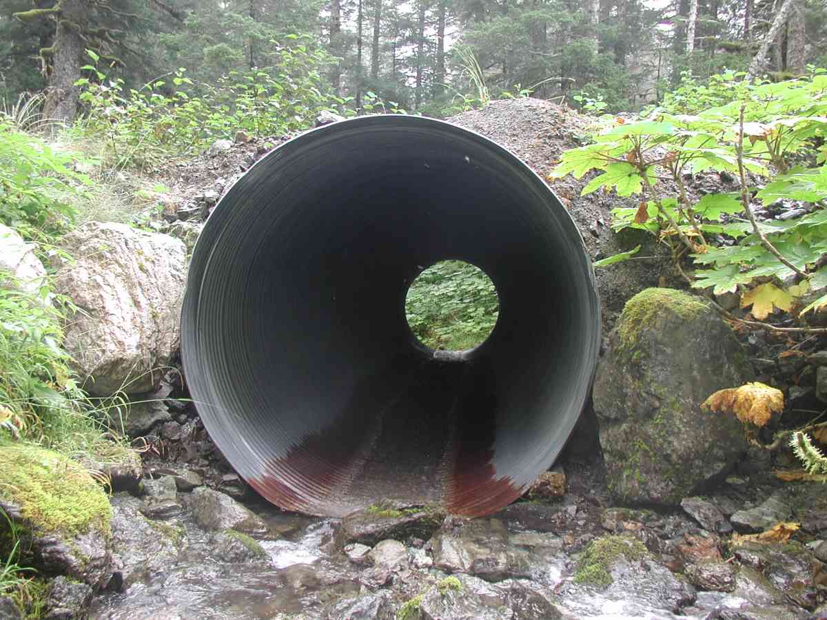
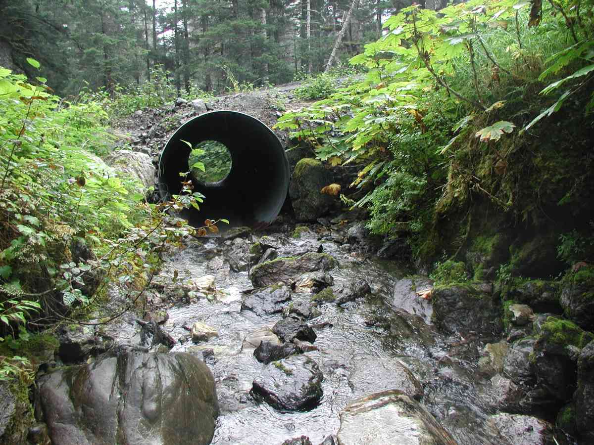
Comments: Location: Port Graham Stream: Stream has cascading falls (some exceeding 300'), plunge pools, large boulders and a gradient of ~40 degrees. Water is clear with very swift flow. The physical characteristics of the stream make it a natural barrier for fish migration. Due to ponding upstream of inlet, flow measurements were done downstream of outlet; rocks were problematic. Culvert: Pipe condition=5. Not embedded.
Culvert Measurements
| ID: 1 | Structure Type: Circular pipe (Corrugated Metal) | Fish Passage Rating: | |||||||||||||||||||||||||||||||||||||||||
|
|
|
|||||||||||||||||||||||||||||||||||||||||
Stream Measurements
|
|
| Stream Width Type | Distance From Crossing (ft) |
Stream Width (ft) |
|---|---|---|
| Upstream bank full | 75.0 | 10.00 |
| Upstream bank full | 100.0 | 15.75 |
| Upstream bank full | 125.0 | 19.50 |
| Upstream bank full | 150.0 | 20.33 |
| Upstream bed width | 75.0 | 4.42 |
| Upstream bed width | 100.0 | 5.17 |
| Upstream bed width | 125.0 | 7.75 |
| Upstream bed width | 150.0 | 11.00 |
| Upstream ordinary high water | 75.0 | 7.75 |
| Upstream ordinary high water | 100.0 | 14.08 |
| Upstream ordinary high water | 125.0 | 10.75 |
| Upstream ordinary high water | 150.0 | 16.33 |
Elevations
| Locator ID | Culvert Number |
River Distance (ft)1 |
Distance From Crossing (ft)2 |
Relative Elevation (ft) |
|---|---|---|---|---|
| D/S Tailcrest or 1st Thalweg | 85.91 | |||
| OHW Left Bank | 87.23 | |||
| D/S Thalweg | 87.43 | |||
| OHW Left Bank | 88.30 | |||
| Outlet Culvert Top (Orange painted "X" painted on top of outlet, measurement taken on 3rd corrugation.) | 1 | 100.00 | ||
| U/S Thalweg | 1 | 104.83 | ||
| Max Pool Depth | 0.00 | 5.0 | 87.43 | |
| Outlet Invert | 1 | 5.00 | 0.0 | 92.26 |
| Road Elev (Road surface) | 26.50 | 106.38 | ||
| Inlet Culvert Invert | 1 | 48.00 | 0.0 | 102.56 |
Notes:
- River distance is measured continuously throughout the survey reach along the thalweg of the stream.
- Measured from each end of the crossing along the thalweg of the stream.
Fish Sampling Efforts
No fish sampling occurred during this survey.
Fish Observations
No fish observations occurred during this survey.
Photos
Questions or comments about this report can be directed to dfg.dsf.webmaster@alaska.gov