Fish Passage Site 20300908
Coordinates (dec. deg.): 59.33480°, -151.81748°
Legal Description: S010S015W04
Region: South Central
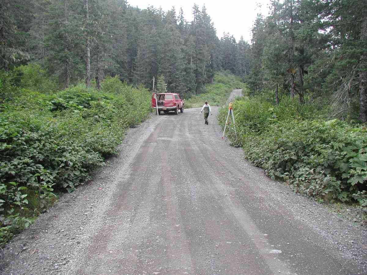
Road Name: Port Graham
Datum: NAD83
Quad Name / ITM: Seldovia B-5
AWC Stream #:
Stream Name:
Elevation:
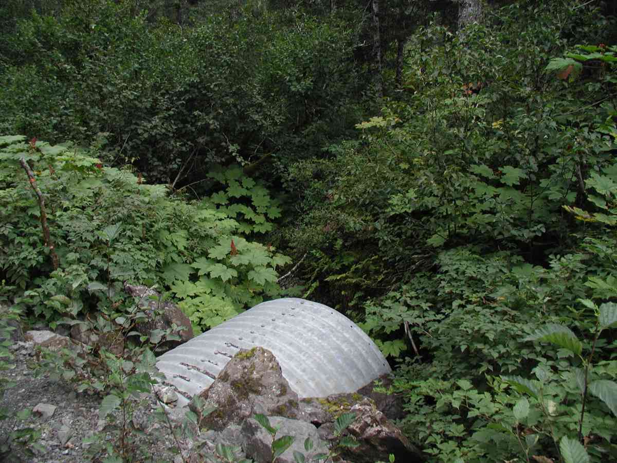
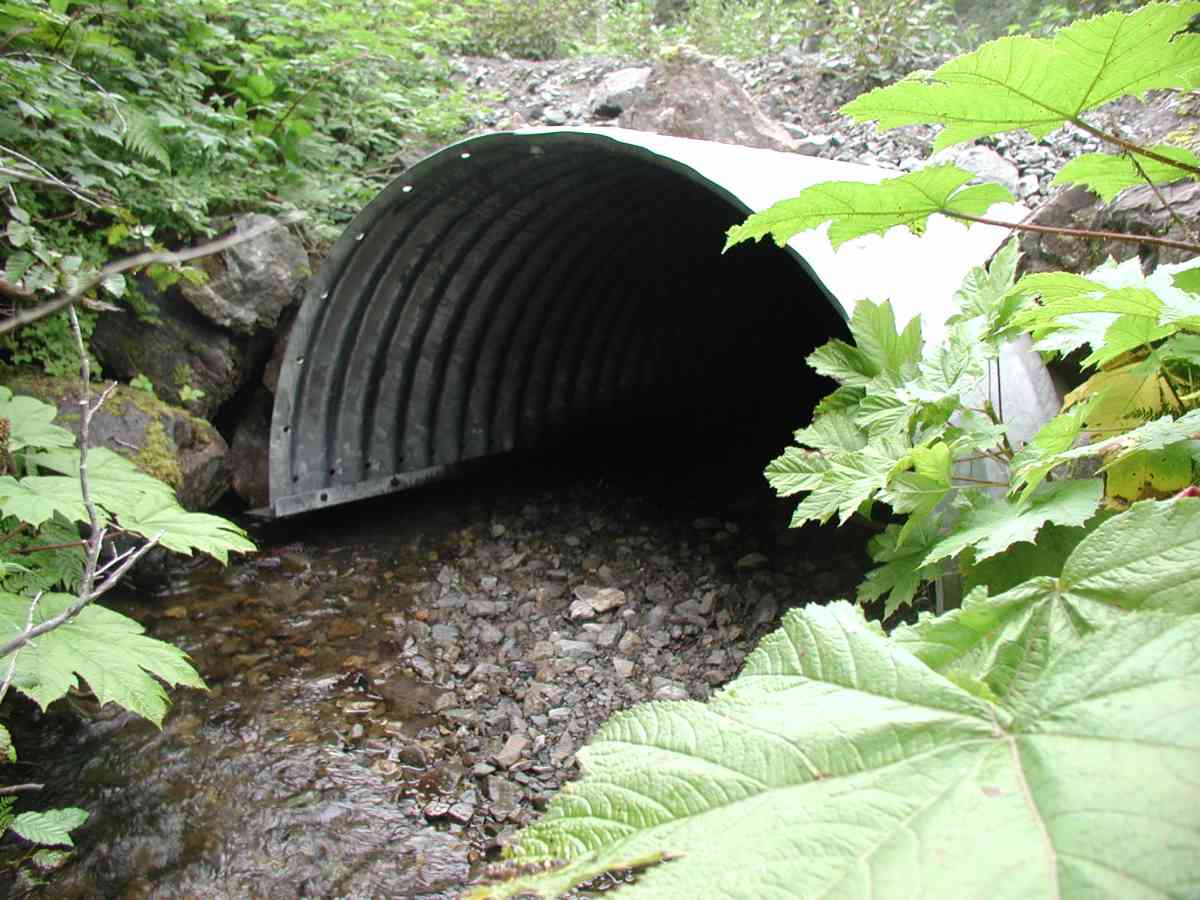
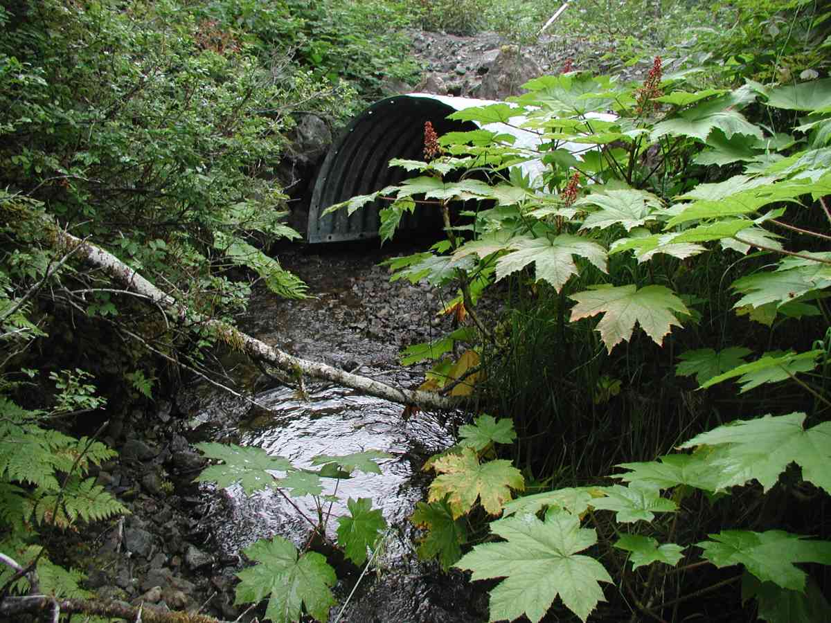
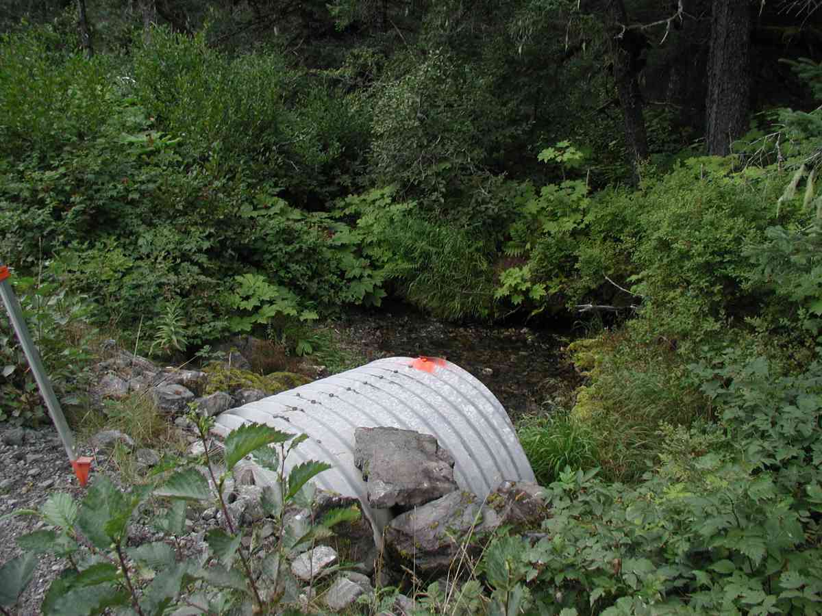
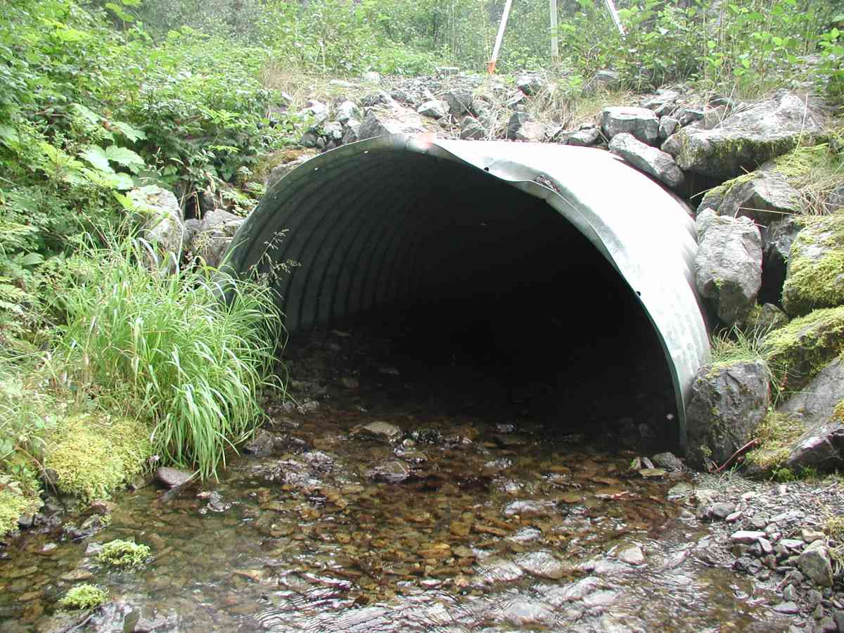
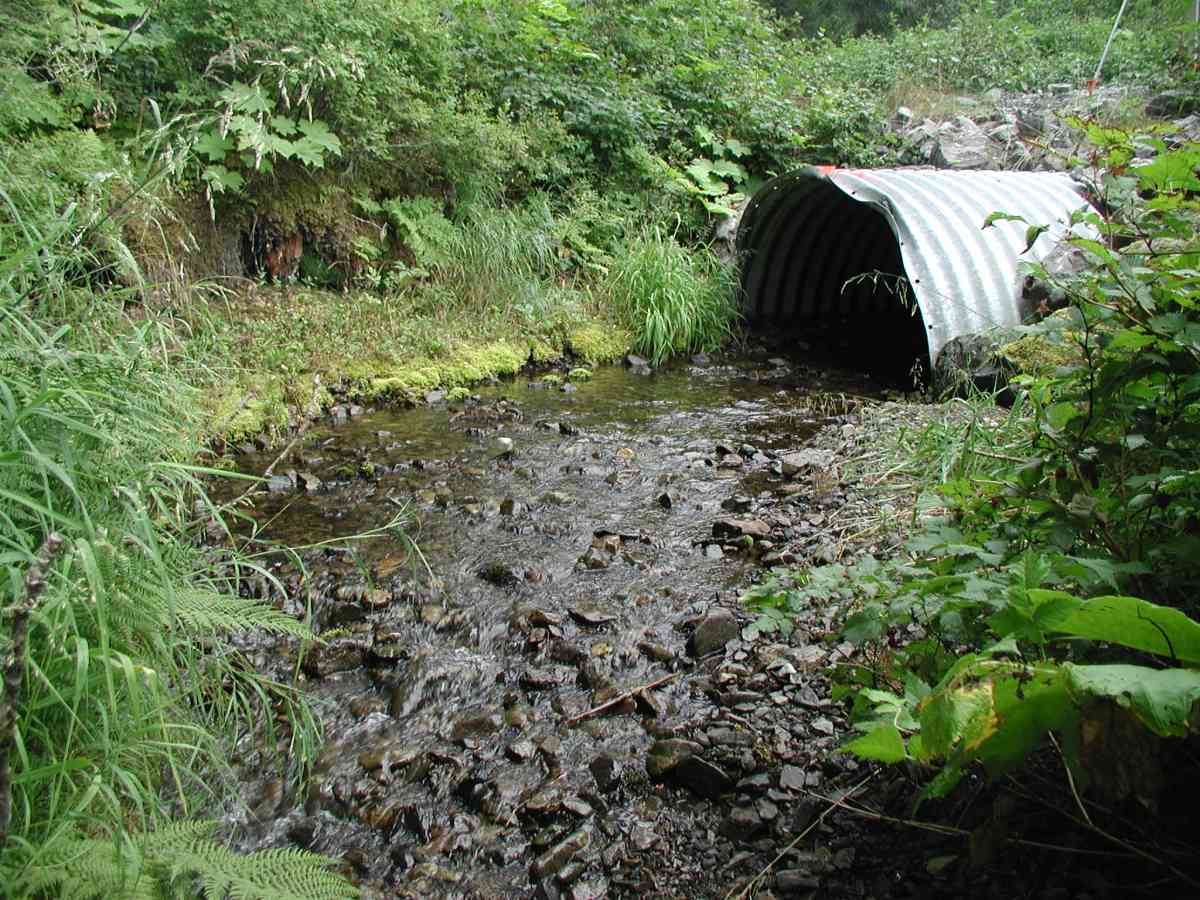
Site Comments: Location: Port Graham Stream: Channel width up and downstream of pipe is 2-3'.
Survey KPC04-1A079
Observers: Mary King, Pam Russell
Overall Fish Passage Rating:
Tidal: No
Backwatered: No
Step Pools:
Construction Year:
Comments: Location: Port Graham Stream: Channel width up and downstream of pipe is 2-3'. The stream enters the arch on a meander, causing erosion of the foundation on the left bank. Gravel substrate (small with some larger rocks) is unaltered and uniform inside the arch. Streamside is densely vegetated. No pool or tailcrest at the outlet. Bank undercut 3-7". Flow measurements taken 30' upstream; rocks problematic. Culvert: Pipe condition=5. No embedded--natural substrate.
Culvert Measurements
| ID: 1 | Structure Type: Open-bottom arch (Corrugated Metal) | Fish Passage Rating: | |||||||||||||||||||||||||||||||||||||||||
|
|
|
|||||||||||||||||||||||||||||||||||||||||
Stream Measurements
|
|
| Stream Width Type | Distance From Crossing (ft) |
Stream Width (ft) |
|---|---|---|
| Upstream bank full | 75.0 | 5.92 |
| Upstream bank full | 100.0 | 10.33 |
| Upstream bank full | 125.0 | 7.00 |
| Upstream bank full | 150.0 | 5.75 |
| Upstream bed width | 75.0 | 1.67 |
| Upstream bed width | 100.0 | 5.92 |
| Upstream bed width | 125.0 | 4.83 |
| Upstream bed width | 150.0 | 1.17 |
| Upstream ordinary high water | 75.0 | 4.67 |
| Upstream ordinary high water | 100.0 | 8.83 |
| Upstream ordinary high water | 125.0 | 5.50 |
| Upstream ordinary high water | 150.0 | 4.25 |
Elevations
| Locator ID | Culvert Number |
River Distance (ft)1 |
Distance From Crossing (ft)2 |
Relative Elevation (ft) |
|---|---|---|---|---|
| OHW Left Bank | 96.74 | |||
| U/S Thalweg | 1 | 97.38 | ||
| Outlet Culvert Top (Flourescent painted "X" on top of outlet. Measurement taken from 1st full corrugation) | 1 | 100.00 | ||
| Max Pool Depth | 0.00 | 5.0 | 96.19 | |
| Outlet Invert | 1 | 5.00 | 0.0 | 96.30 |
| Road Elev (Road surface) | 25.00 | 101.58 | ||
| Inlet Culvert Invert (From center of invert measurement falls on gravel bar. Stream flows down Left Bank.) | 1 | 45.00 | 0.0 | 97.46 |
Notes:
- River distance is measured continuously throughout the survey reach along the thalweg of the stream.
- Measured from each end of the crossing along the thalweg of the stream.
Fish Sampling Efforts
No fish sampling occurred during this survey.
Fish Observations
No fish observations occurred during this survey.
Photos
Questions or comments about this report can be directed to dfg.dsf.webmaster@alaska.gov