Fish Passage Site 20300906
Coordinates (dec. deg.): 59.87099°, -151.60558°
Legal Description: S003S014W36
Region: South Central
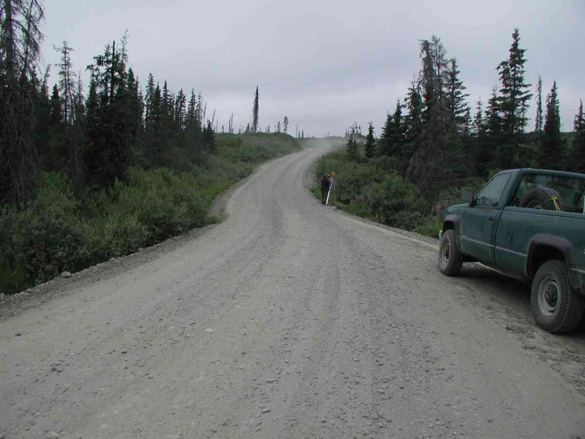
Road Name: Tall Tree Road
Datum: NAD83
Quad Name / ITM: Seldovia D-5
AWC Stream #: 244-10-10010-2011-3031-4038-5029
Stream Name:
Elevation:
Site Comments: Location: Tall Tree Rd. Stream: Small pool at inlet; braids forming 125ft upstream.
arrow to the right of the survey date below to choose a different report for this site.
Survey KPC04-1A062
Observers: Mary King, Pam Russell
Overall Fish Passage Rating:
Tidal: No
Backwatered: No
Step Pools:
Construction Year:
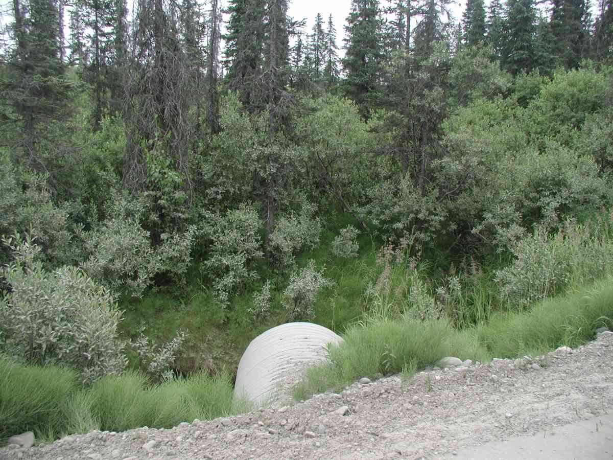
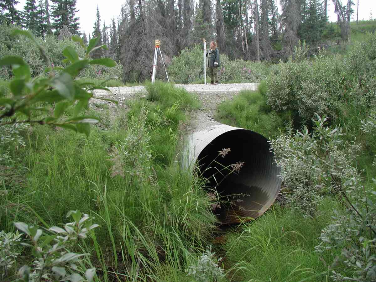
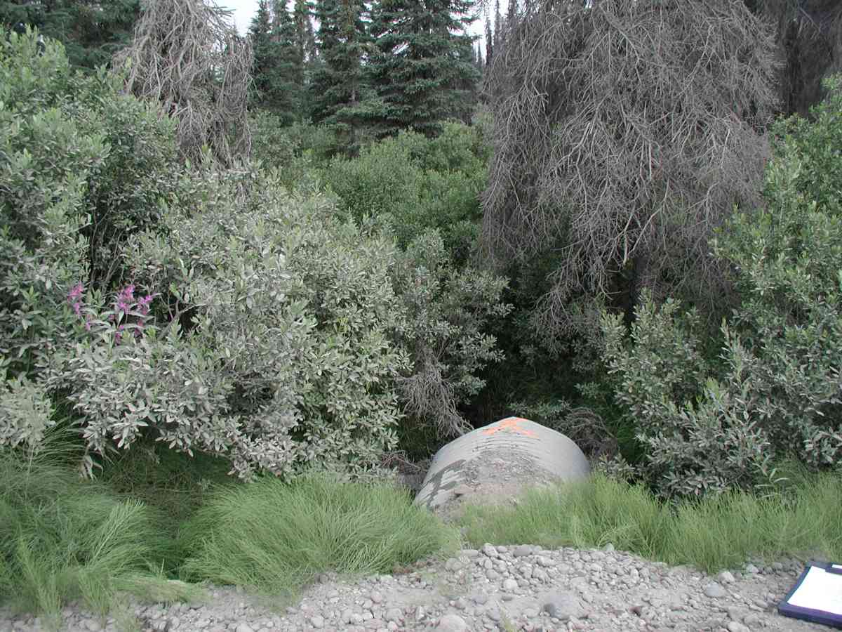
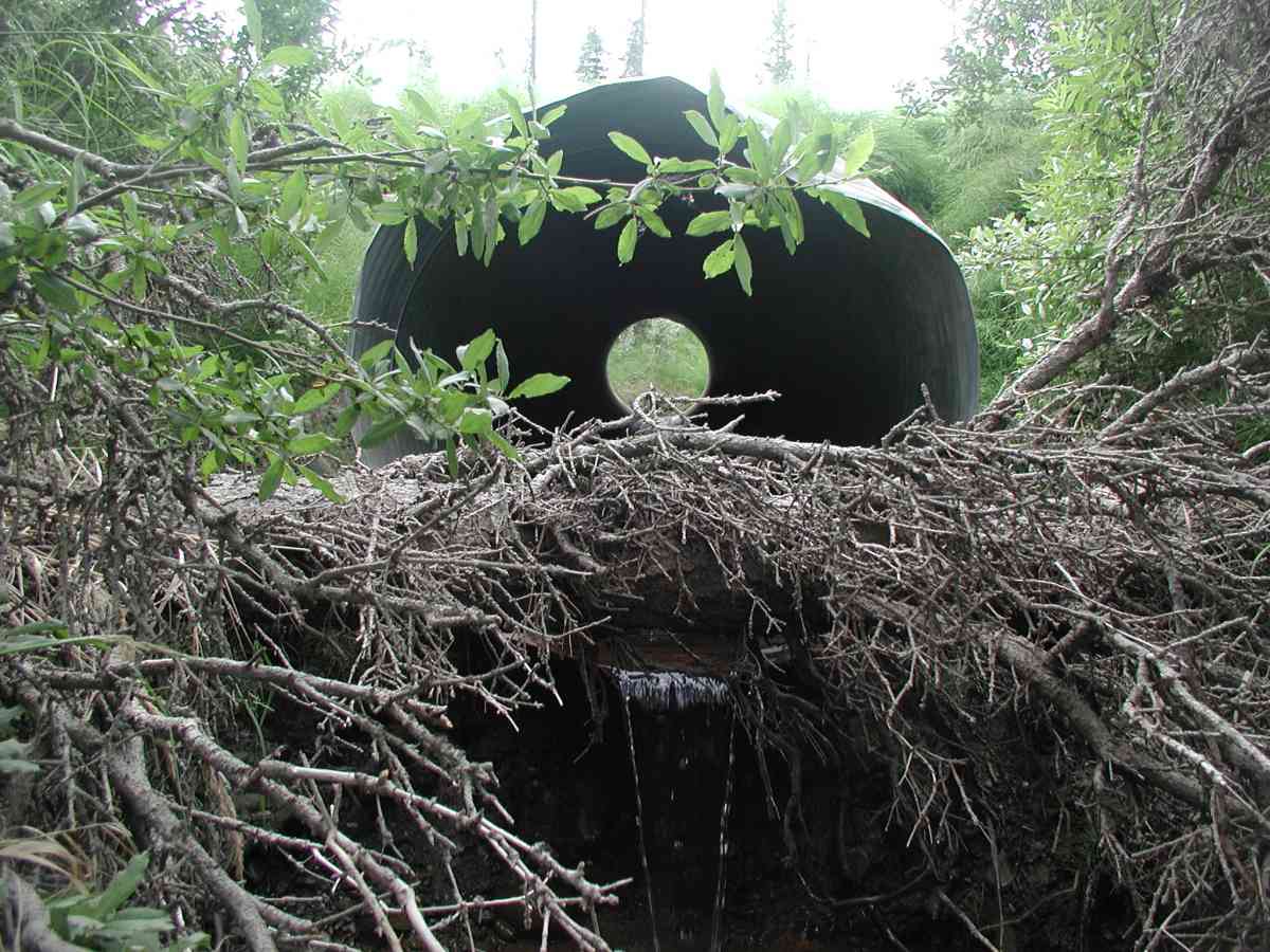
Comments: Location: Tall Tree Rd. Stream: Small pool at inlet; braids forming 125ft upstream. The tailcrest is formed by rocks with overgrown vegetation. No stream flow measurements due to narrow, braided channel reducing flow. Culvert: 1 overflow pipe. Outlet perched ~3'. Inlet pipe is a few inches above the substrate causing a pool and limited flow--potentially a barrier. Pipe condition=5. Not embedded.
Culvert Measurements
| ID: 1 | Structure Type: Circular pipe (Corrugated Metal) | Fish Passage Rating: | |||||||||||||||||||||||||||||||||||||||||
|
|
|
|||||||||||||||||||||||||||||||||||||||||
Stream Measurements
|
|
| Stream Width Type | Distance From Crossing (ft) |
Stream Width (ft) |
|---|---|---|
| Upstream bank full | 75.0 | 3.75 |
| Upstream bank full | 100.0 | 4.25 |
| Upstream bank full | 125.0 | 3.17 |
| Upstream bed width | 75.0 | 1.25 |
| Upstream bed width | 100.0 | 1.00 |
| Upstream bed width | 125.0 | 1.67 |
| Upstream ordinary high water | 75.0 | 1.25 |
| Upstream ordinary high water | 100.0 | 1.00 |
| Upstream ordinary high water | 125.0 | 1.67 |
Elevations
| Locator ID | Culvert Number |
River Distance (ft)1 |
Distance From Crossing (ft)2 |
Relative Elevation (ft) |
|---|---|---|---|---|
| OHW Left Bank | 93.83 | |||
| D/S Tailcrest or 1st Thalweg | 93.89 | |||
| OHW Left Bank | 94.24 | |||
| D/S Thalweg | 92.57 | |||
| U/S Thalweg | 1 | 96.79 | ||
| Outlet Culvert Top (Orange painted "X" on top of outlet, near end.) | 1 | 100.00 | ||
| Max Pool Depth | 0.00 | 5.0 | 92.98 | |
| Outlet Invert | 1 | 5.00 | 0.0 | 96.14 |
| Road Elev (Road surface.) | 25.00 | 102.41 | ||
| Inlet Culvert Invert (Pipe is actually perched about 0.7') | 1 | 45.00 | 0.0 | 96.98 |
Notes:
- River distance is measured continuously throughout the survey reach along the thalweg of the stream.
- Measured from each end of the crossing along the thalweg of the stream.
Fish Sampling Efforts
No fish sampling occurred during this survey.
Fish Observations
No fish observations occurred during this survey.
Photos


Questions or comments about this report can be directed to dfg.dsf.webmaster@alaska.gov