Fish Passage Site 20300905
Coordinates (dec. deg.): 59.88105°, -151.56042°
Legal Description: S003S013W29
Region: South Central
Road Name: Tall Tree Road
Datum: NAD83
Quad Name / ITM: Seldovia D-5
AWC Stream #: 244-10-10010-2011-3031-4038-5033-6008
Stream Name:
Elevation:
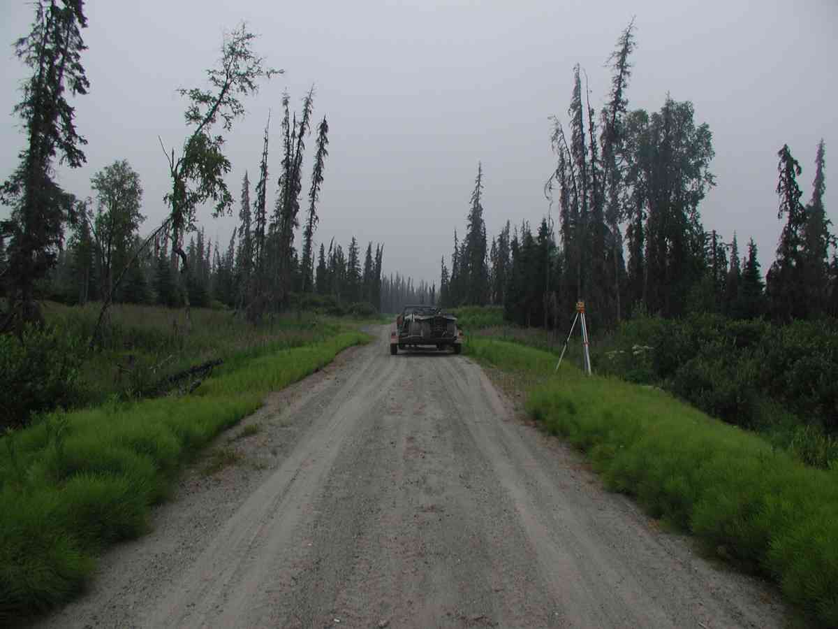
Site Comments: Location: Tall Tree Rd.
arrow to the right of the survey date below to choose a different report for this site.
Survey KPC04-1A061
Observers: Mary King, Pam Russell
Overall Fish Passage Rating:
Tidal: No
Backwatered: No
Step Pools:
Construction Year:
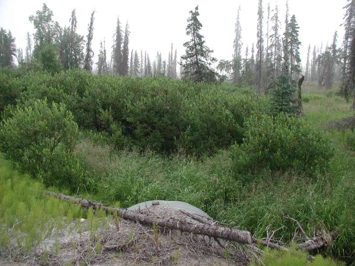
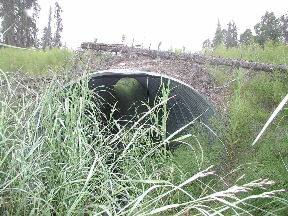
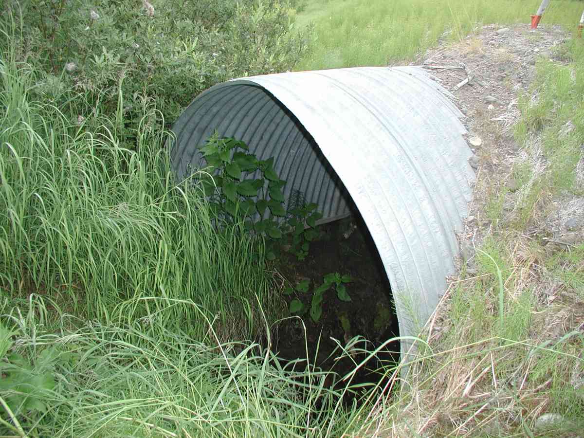
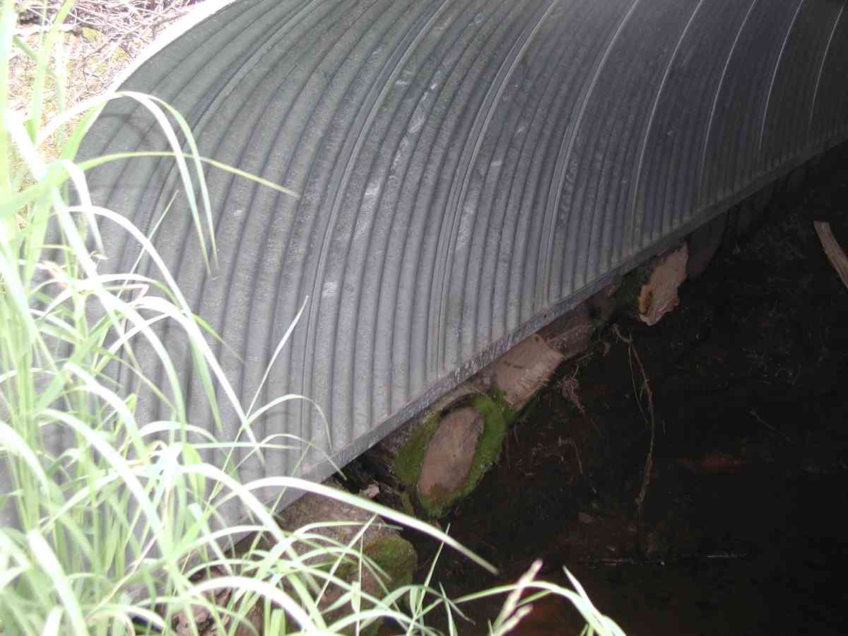
Comments: Location: Tall Tree Rd. Stream: Channel is narrow and deeply incised with dense vegetation both up and downstream of the pipe. Bank undercut ranged from 10-30". The stream was too shallow to do stream flow. Within arch, stream has gravel substrate with pools. Culvert: The arch is supported on logs laid perpendular to the pipe; 3' of erosion in some locations along the pipe. Pipe condition=5, functional but may be problematic in long term if further erosion causing foundation to fail. Not embedded (normal substrate).
Culvert Measurements
| ID: 1 | Structure Type: Open-bottom arch (Corrugated Metal) | Fish Passage Rating: | |||||||||||||||||||||||||||||||||||||||||
|
|
|
|||||||||||||||||||||||||||||||||||||||||
Comments: Culvert: The arch is supported on logs laid perpendular to the pipe; 3' of erosion in some locations along the pipe. Pipe condition=5, functional but may be problematic in long term if further erosion causing foundation to fail. Not embedded (normal substrate). |
|||||||||||||||||||||||||||||||||||||||||||
Stream Measurements
|
|
| Stream Width Type | Distance From Crossing (ft) |
Stream Width (ft) |
|---|---|---|
| Upstream bank full | 75.0 | 1.83 |
| Upstream bank full | 100.0 | 3.00 |
| Upstream bank full | 125.0 | 3.33 |
| Upstream bank full | 150.0 | 3.08 |
| Upstream bed width | 1.17 | |
| Upstream bed width | 1.67 | |
| Upstream bed width | 2.75 | |
| Upstream bed width | 150.0 | 2.08 |
| Upstream ordinary high water | 75.0 | 1.17 |
| Upstream ordinary high water | 100.0 | 1.67 |
| Upstream ordinary high water | 125.0 | 2.75 |
| Upstream ordinary high water | 150.0 | 2.17 |
Elevations
| Locator ID | Culvert Number |
River Distance (ft)1 |
Distance From Crossing (ft)2 |
Relative Elevation (ft) |
|---|---|---|---|---|
| OHW Left Bank | 92.59 | |||
| U/S Thalweg | 1 | 94.05 | ||
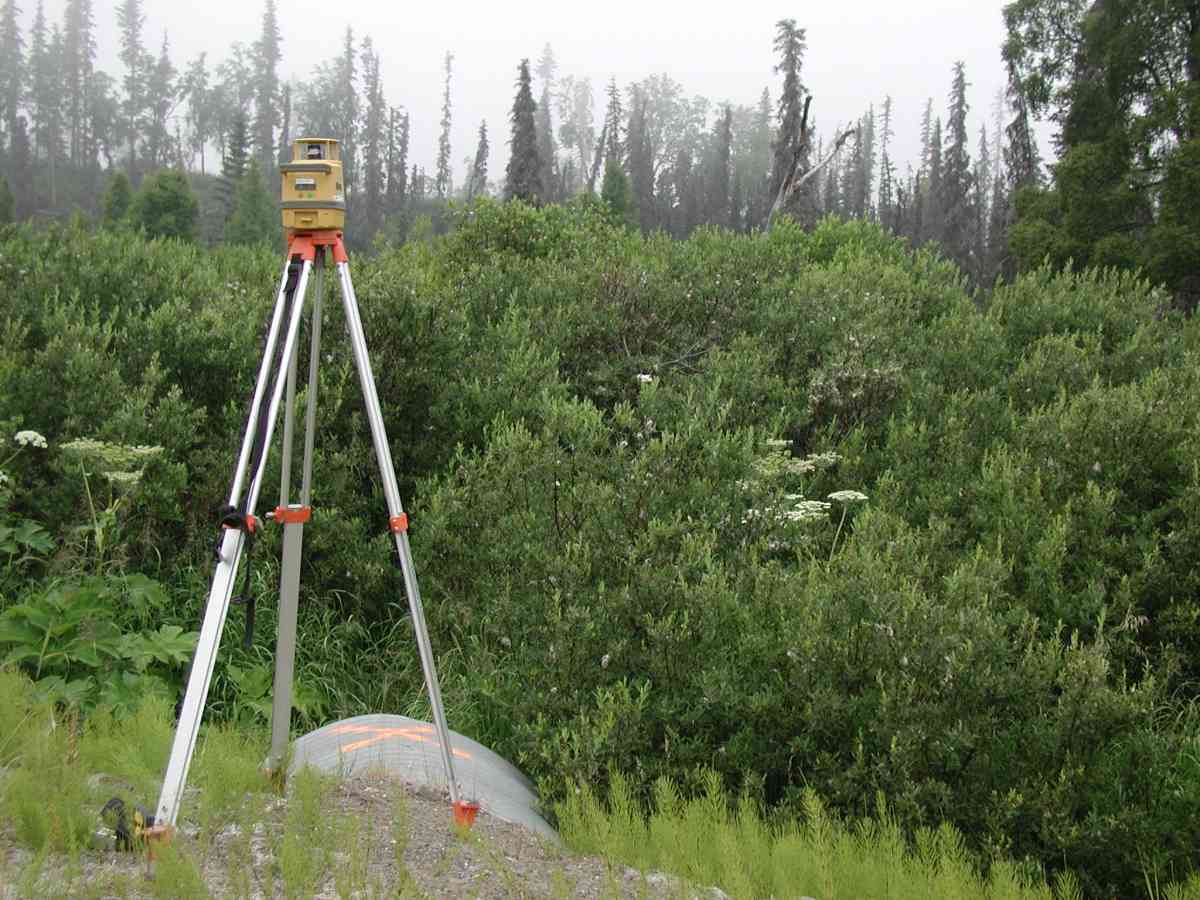
| Outlet Culvert Top (Orange "X" painted on top of culvert, placed rod on center of X.) | 1 | 100.00 | ||
| Max Pool Depth | 0.00 | 5.0 | 92.01 | |
| Outlet Invert (11.06 from pipe bottom-14.26 from substrate.) | 1 | 5.00 | 0.0 | 95.72 |
| Road Elev (Road surface.) | 28.00 | 101.11 | ||
| Inlet Culvert Invert (10.41 from pipe bottom-13.34 from substrate.) | 1 | 51.00 | 0.0 | 96.37 |
Notes:
- River distance is measured continuously throughout the survey reach along the thalweg of the stream.
- Measured from each end of the crossing along the thalweg of the stream.
Fish Sampling Efforts
No fish sampling occurred during this survey.
Fish Observations
No fish observations occurred during this survey.
Photos
Questions or comments about this report can be directed to dfg.dsf.webmaster@alaska.gov