Fish Passage Site 20300903
Coordinates (dec. deg.): 60.02751°, -151.57334°
Legal Description: S002S013W06
Region: South Central
Road Name: Oil Well Road
Datum: NAD83
Quad Name / ITM: Kenai A-5
AWC Stream #:
Stream Name:
Elevation:
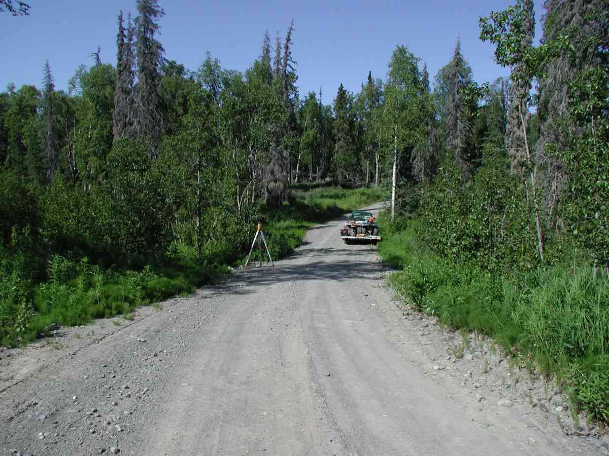
Site Comments: Location: Oilwell Rd to Tribal Council Rd. Stream:
Survey KPC04-1A058
Observers: Mary King, Pam Russell
Overall Fish Passage Rating:
Tidal: No
Backwatered: No
Step Pools:
Construction Year:
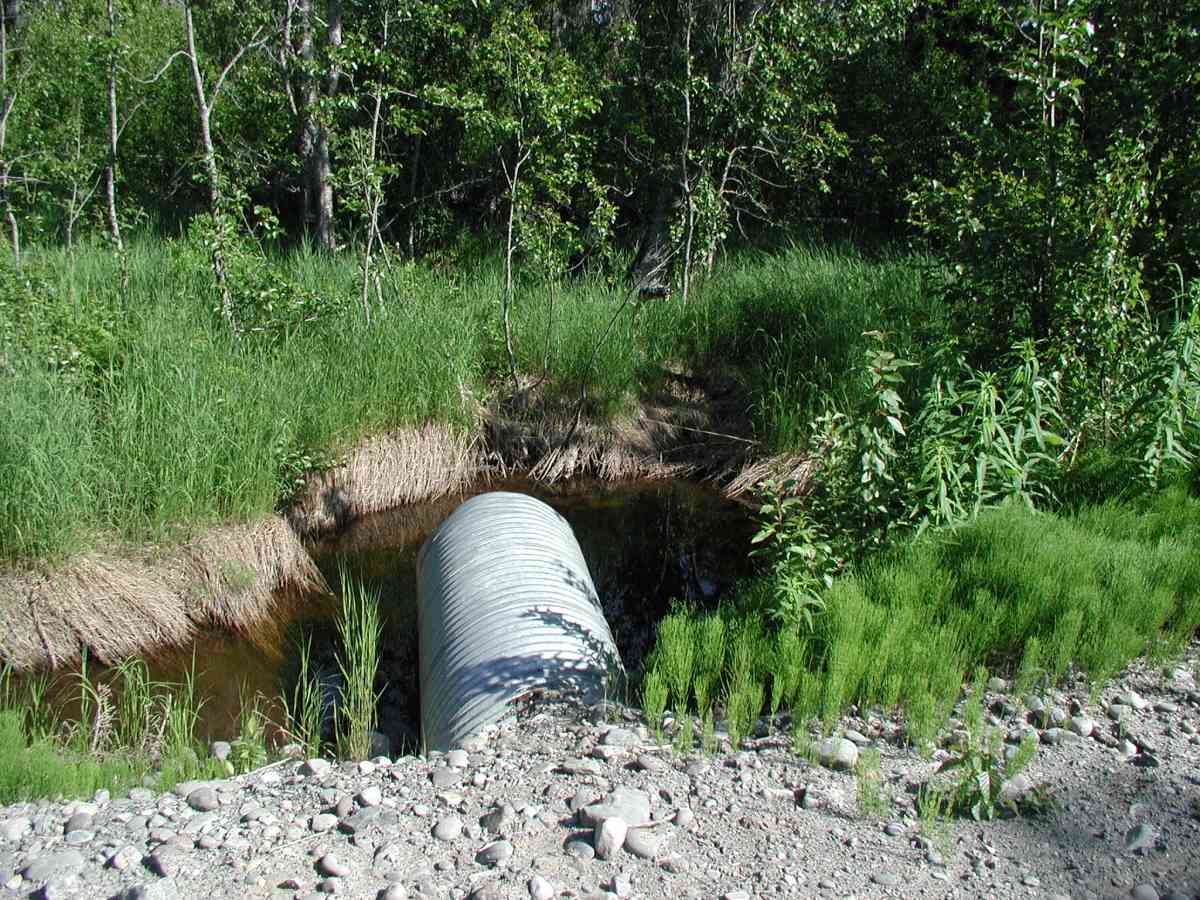
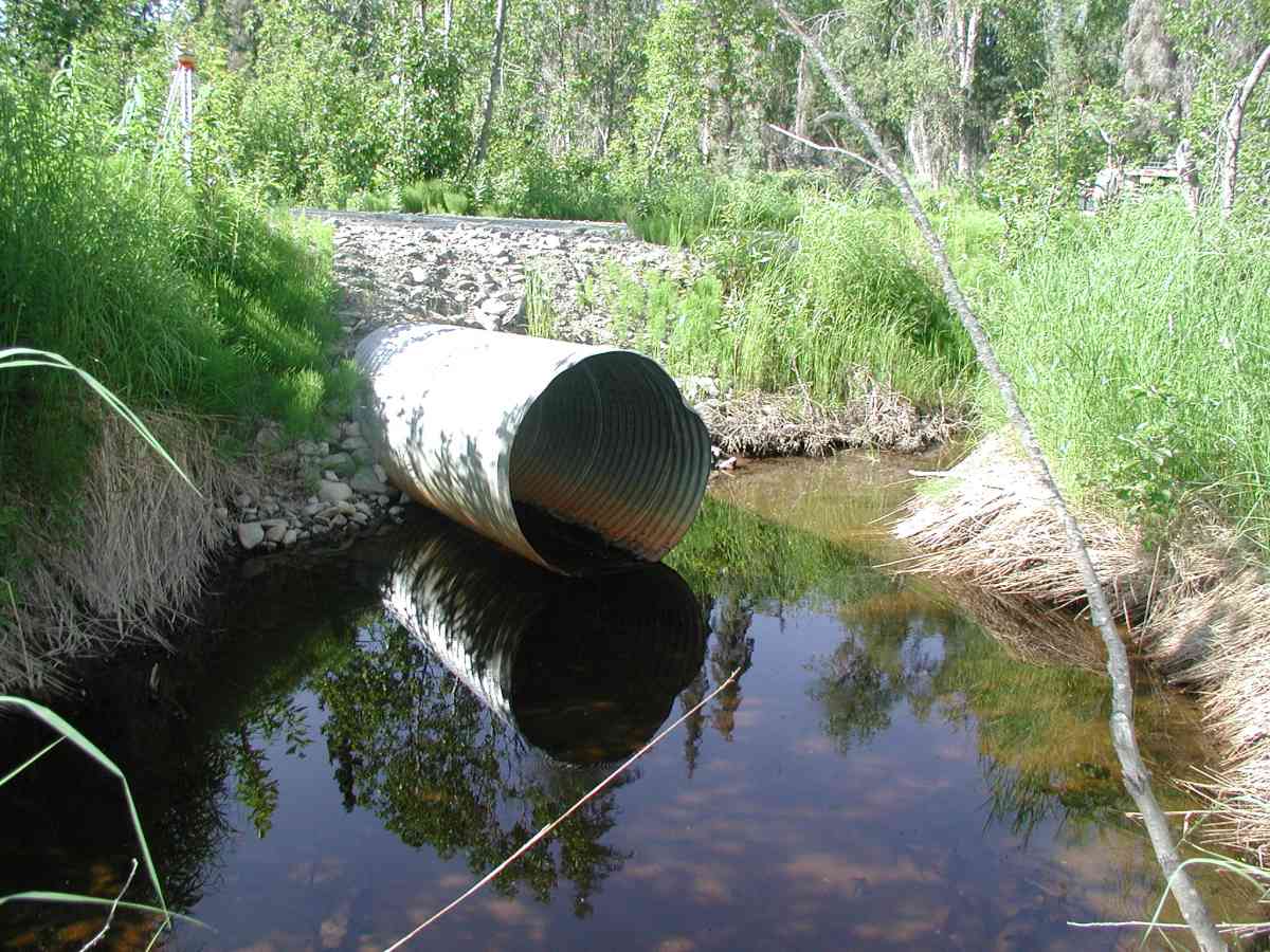
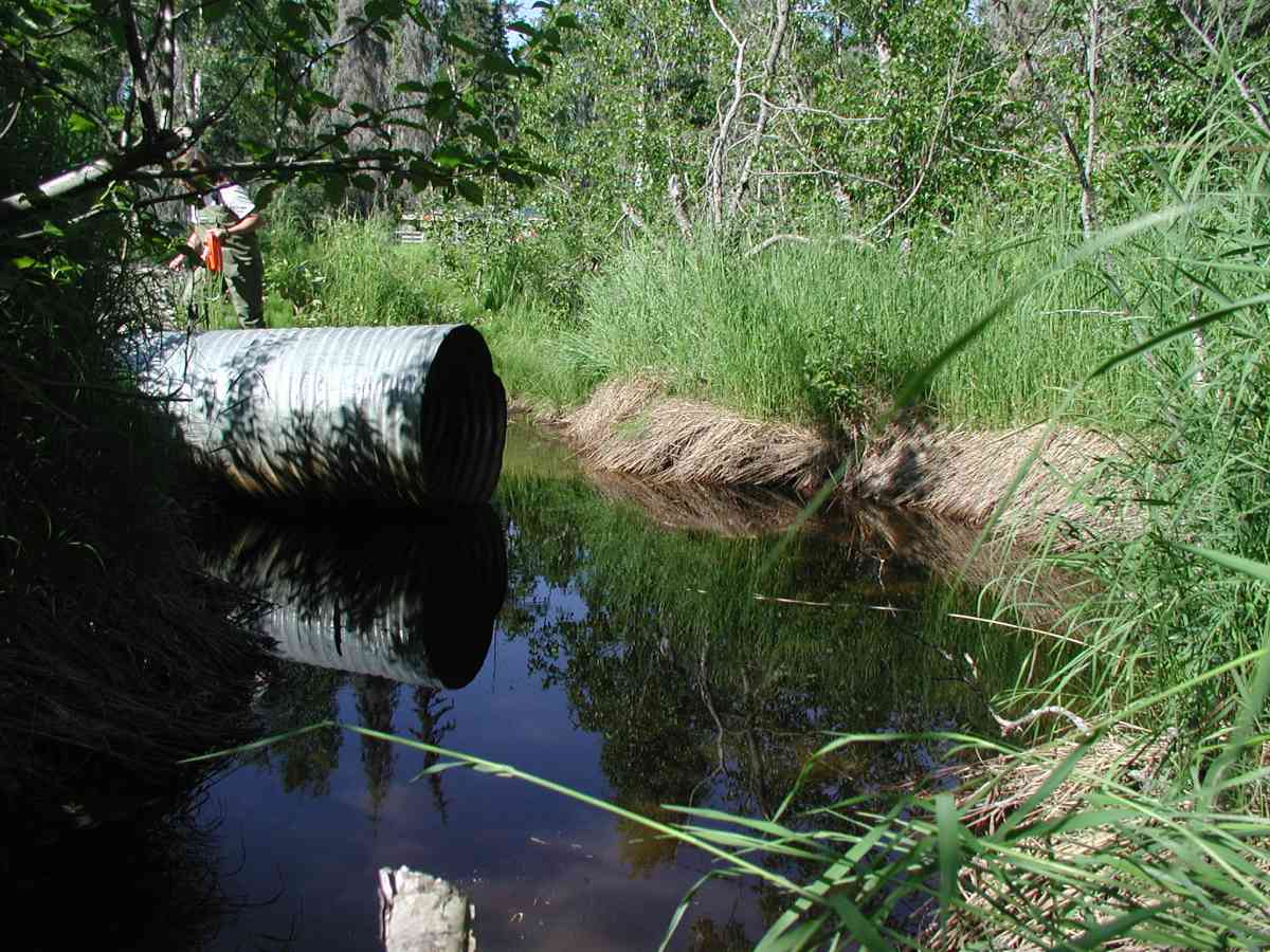
Comments: Location: Oilwell Rd to Tribal Council Rd. Stream: Channel is narrow and overgrown with vegetation. No stream flow (no measurements taken). Culvert: Outlet is perched 6-8". Inlet pipe extends 10' from the roadside barely touching the water surface with marginal flow. Pipe condition=1-2 (functional but needs repair). Not embedded.
Culvert Measurements
| ID: 1 | Structure Type: Circular pipe (Corrugated Metal) | Fish Passage Rating: | |||||||||||||||||||||||||||||||||||||||||
|
|
|
|||||||||||||||||||||||||||||||||||||||||
Comments: Culvert: Outlet is perched 6-8". Inlet pipe extends 10' from the roadside barely touching the water surface with marginal flow. Pipe condition=1-2 (functional but needs repair). Not embedded. |
|||||||||||||||||||||||||||||||||||||||||||
Stream Measurements
|
|
| Stream Width Type | Distance From Crossing (ft) |
Stream Width (ft) |
|---|---|---|
| Upstream bank full | 75.0 | 7.03 |
| Upstream bank full | 100.0 | 13.50 |
| Upstream bank full | 125.0 | 6.58 |
| Upstream bank full | 150.0 | 7.67 |
| Upstream bed width | 75.0 | 3.42 |
| Upstream bed width | 100.0 | 6.17 |
| Upstream bed width | 125.0 | 4.83 |
| Upstream bed width | 150.0 | 3.58 |
| Upstream ordinary high water | 75.0 | 4.67 |
| Upstream ordinary high water | 100.0 | 10.42 |
| Upstream ordinary high water | 125.0 | 6.03 |
| Upstream ordinary high water | 150.0 | 5.17 |
Elevations
| Locator ID | Culvert Number |
River Distance (ft)1 |
Distance From Crossing (ft)2 |
Relative Elevation (ft) |
|---|---|---|---|---|
| D/S Thalweg | 96.89 | |||
| D/S Tailcrest or 1st Thalweg | 97.17 | |||
| OHW Left Bank | 97.29 | |||
| U/S Thalweg | 1 | 97.62 | ||
| OHW Left Bank | 97.80 | |||
| Outlet Culvert Top (Outlet has a number "20" painted in red on the side. The TBM was at the top of the "2".) | 1 | 100.00 | ||
| Max Pool Depth | 0.00 | 5.0 | 96.67 | |
| Outlet Invert | 1 | 5.00 | 0.0 | 97.58 |
| Road Elev (Road surface.) | 27.50 | 102.44 | ||
| Inlet Culvert Invert | 1 | 50.00 | 0.0 | 98.27 |
Notes:
- River distance is measured continuously throughout the survey reach along the thalweg of the stream.
- Measured from each end of the crossing along the thalweg of the stream.
Fish Sampling Efforts
No fish sampling occurred during this survey.
Fish Observations
No fish observations occurred during this survey.
Photos


Questions or comments about this report can be directed to dfg.dsf.webmaster@alaska.gov