Fish Passage Site 20300901
Coordinates (dec. deg.): 60.05031°, -151.58200°
Legal Description: S001S013W31
Region: South Central
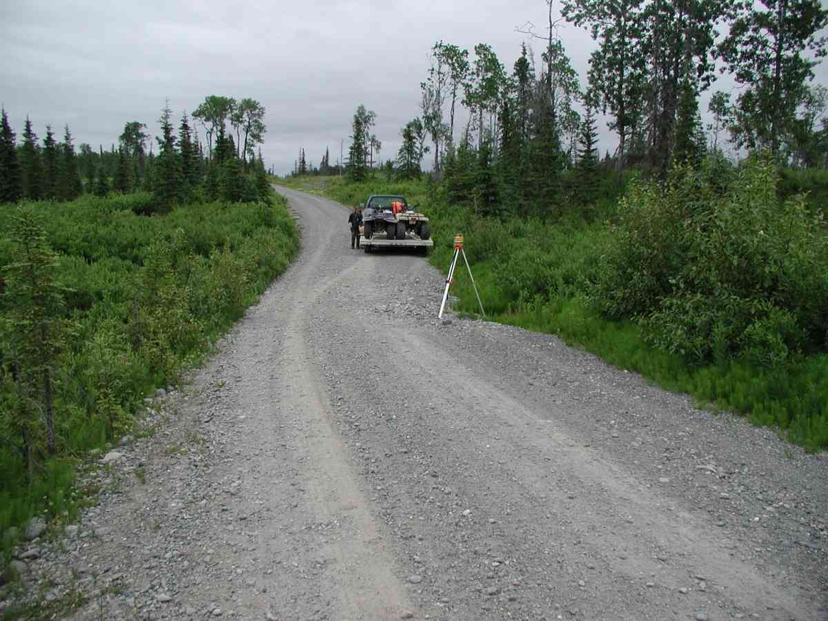
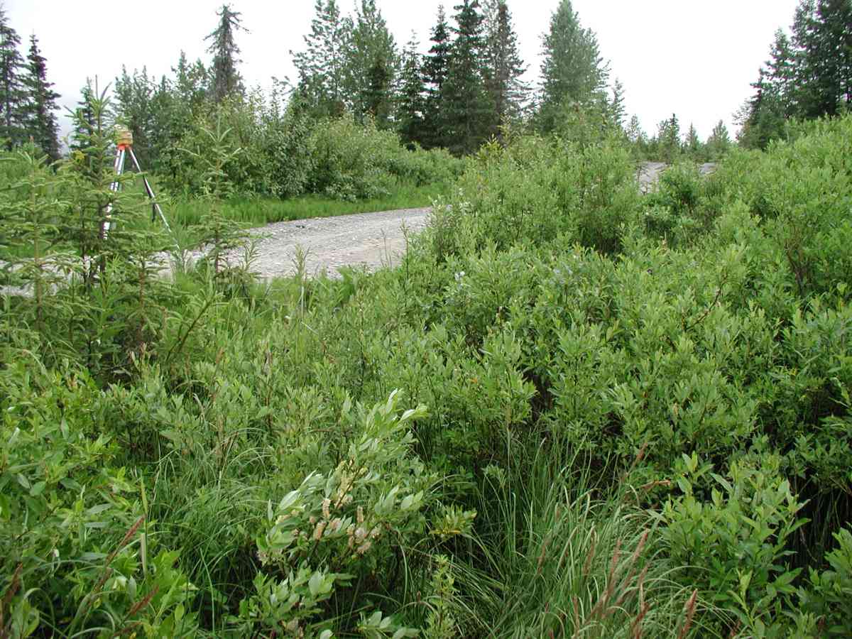
Road Name: Oil Well Road
Datum: NAD83
Quad Name / ITM: Kenai A-5
AWC Stream #:
Stream Name:
Elevation:
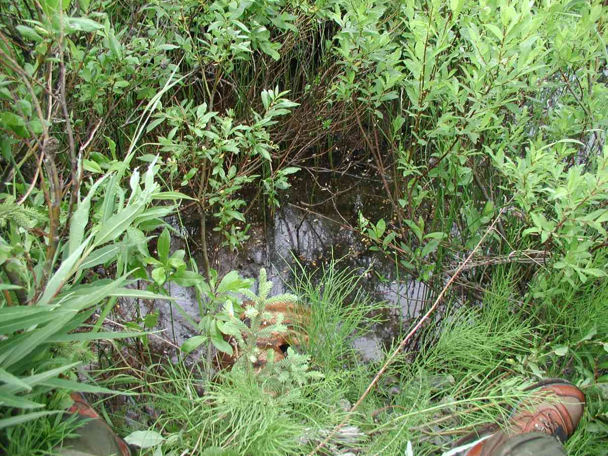
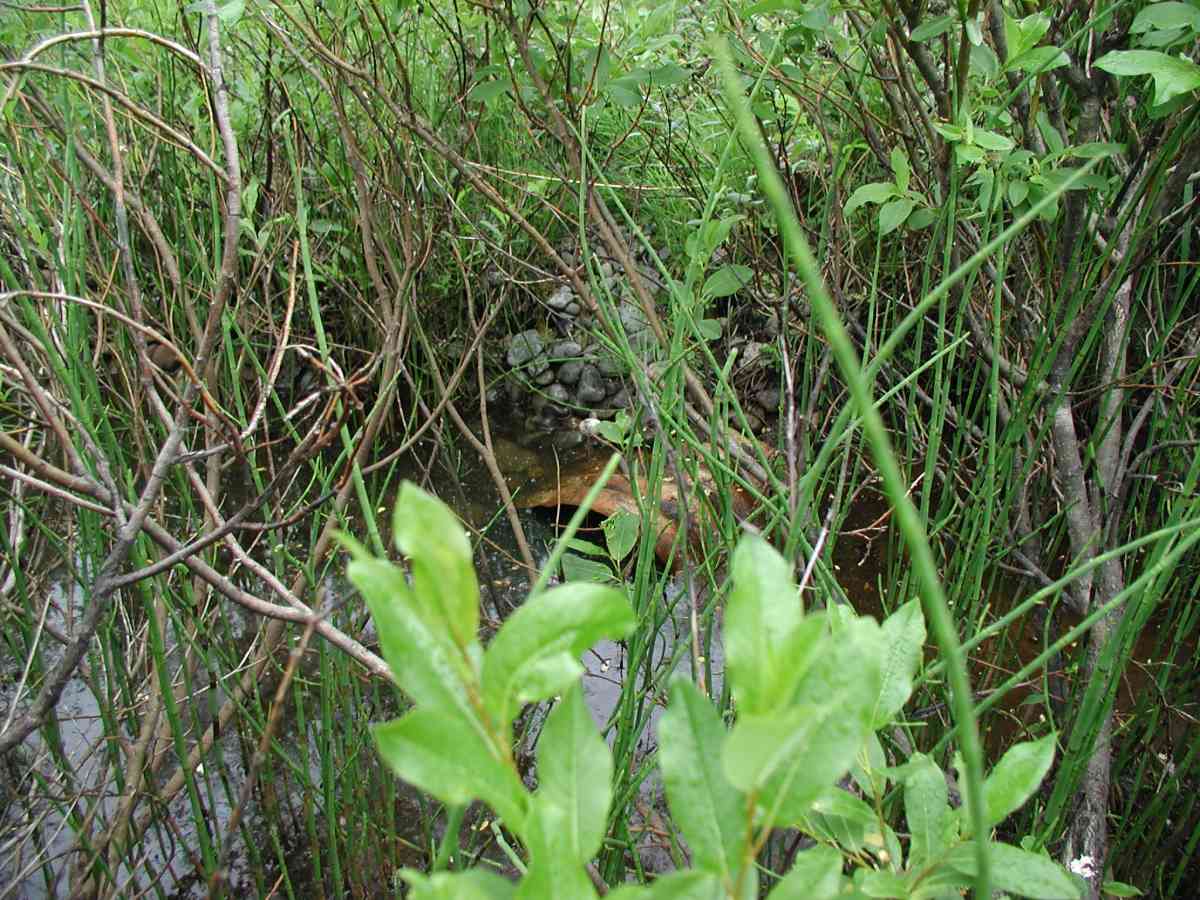
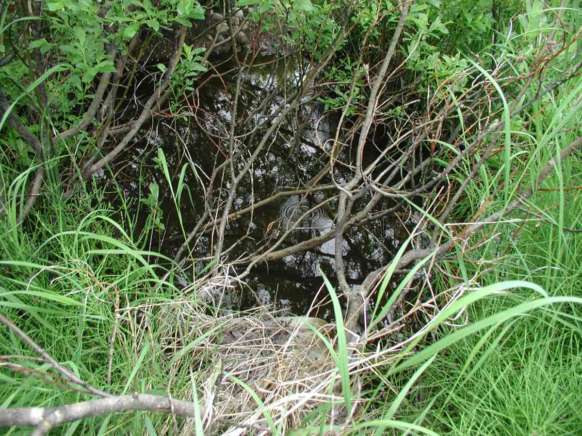
Site Comments: Location: Oilwell to Brody Rd. Ponding present a short distance upstream; then stream forms narrow channel and is overgrown with willows.
Survey KPC04-1A045
Observers: Mary King, Pam Russell
Overall Fish Passage Rating:
Tidal: No
Backwatered: No
Step Pools:
Construction Year:
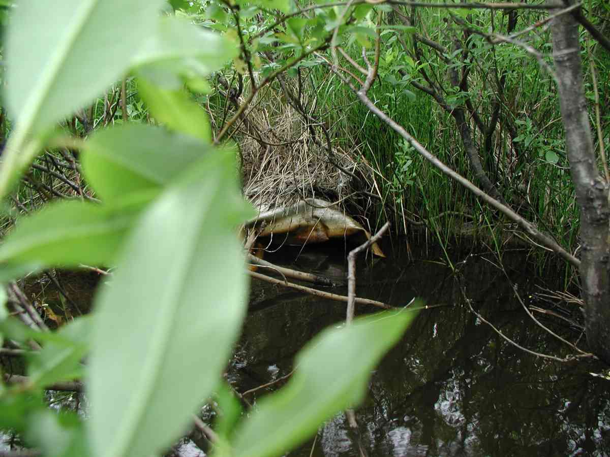
Comments: Location: Oilwell to Brody Rd. Stream: Ponding present a short distance upstream; then stream forms narrow channel and is overgrown with willows. Bank undercut was 6-24". Substrate is gravel downstream and soft silt upstream until channel forms and is then gravel. Culvert: Outlet is squashed and rolled over below water surface; has a small hole on top. The inlet has rust all the way around with a 3" hole 10" from the end. Pipe condition=3. Not embedded.
Culvert Measurements
| ID: 1 | Structure Type: Circular pipe (Corrugated Metal) | Fish Passage Rating: | |||||||||||||||||||||||||||||||||||||||||
|
|
|
|||||||||||||||||||||||||||||||||||||||||
Comments: Culvert: Outlet is squashed and rolled over below water surface; has a small hole on top. The inlet has rust all the way around with a 3" hole 10" from the end. Pipe condition=3. Not embedded. |
|||||||||||||||||||||||||||||||||||||||||||
Stream Measurements
|
|
| Stream Width Type | Distance From Crossing (ft) |
Stream Width (ft) |
|---|---|---|
| Upstream bank full | 75.0 | 3.75 |
| Upstream bank full | 100.0 | 4.00 |
| Upstream bank full | 125.0 | 2.83 |
| Upstream bank full | 150.0 | 4.17 |
| Upstream bed width | 75.0 | 2.00 |
| Upstream bed width | 100.0 | 1.17 |
| Upstream bed width | 125.0 | 1.67 |
| Upstream bed width | 150.0 | 1.92 |
| Upstream ordinary high water | 75.0 | 2.33 |
| Upstream ordinary high water | 100.0 | 3.17 |
| Upstream ordinary high water | 125.0 | 1.67 |
| Upstream ordinary high water | 150.0 | 1.92 |
Elevations
| Locator ID | Culvert Number |
River Distance (ft)1 |
Distance From Crossing (ft)2 |
Relative Elevation (ft) |
|---|---|---|---|---|
| D/S Thalweg | 98.23 | |||
| U/S Thalweg | 1 | 98.52 | ||
| D/S Tailcrest or 1st Thalweg | 99.14 | |||
| OHW Left Bank | 99.40 | |||
| OHW Left Bank | 99.63 | |||
| Outlet Culvert Top (Flourescent orange "X" on top of oulet, taken from top of corregation.) | 1 | 100.00 | ||
| Max Pool Depth | 0.00 | 5.0 | 99.01 | |
| Outlet Invert | 1 | 5.00 | 0.0 | 98.46 |
| Road Elev (Road surface) | 20.00 | 102.02 | ||
| Inlet Culvert Invert | 1 | 35.00 | 0.0 | 98.24 |
Notes:
- River distance is measured continuously throughout the survey reach along the thalweg of the stream.
- Measured from each end of the crossing along the thalweg of the stream.
Fish Sampling Efforts
No fish sampling occurred during this survey.
Fish Observations
No fish observations occurred during this survey.
Photos
Questions or comments about this report can be directed to dfg.dsf.webmaster@alaska.gov