Fish Passage Site 20300900
Coordinates (dec. deg.): 60.04575°, -151.30012°
Legal Description: S001S012W35
Region: South Central
Road Name: Oil Well Road
Datum: NAD83
Quad Name / ITM: Kenai A-4
AWC Stream #:
Stream Name:
Elevation:
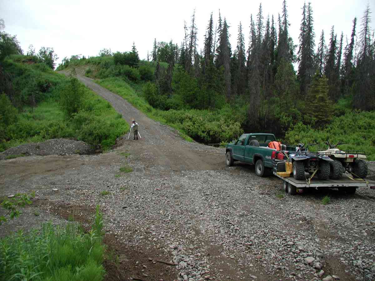
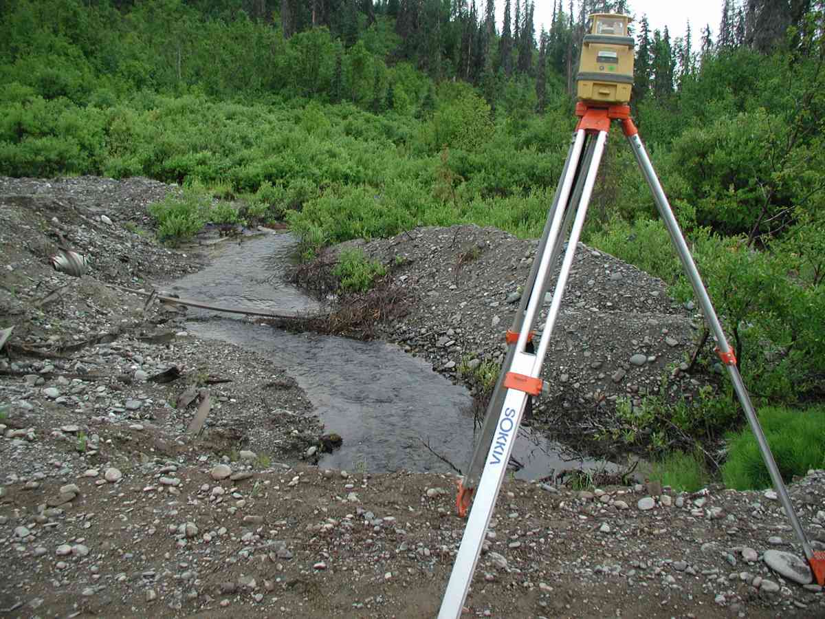
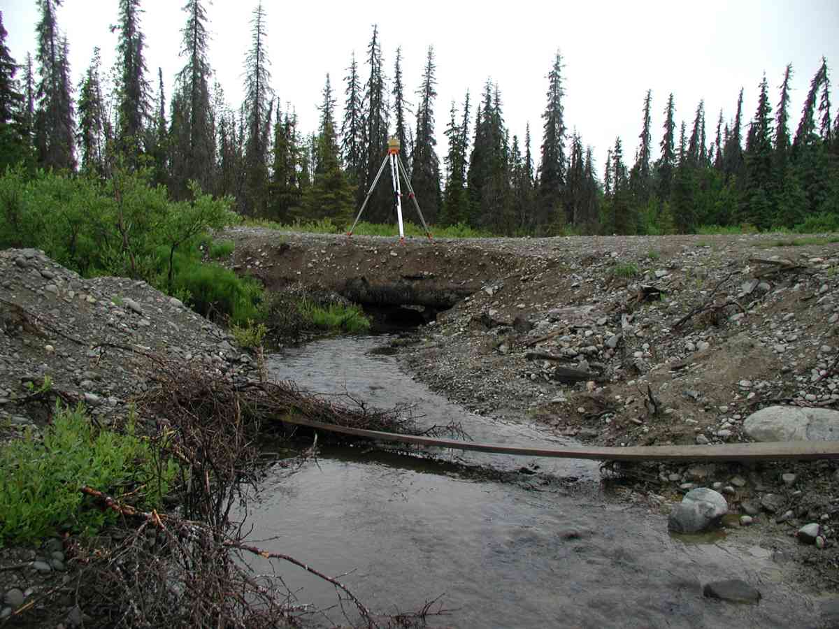
Site Comments: Location: Oilwell Rd. Stream lies at the base of a steep hill.
Survey KPC04-1A032
Observers: Mary King, Pam Russell
Overall Fish Passage Rating:
Tidal: No
Backwatered: No
Step Pools:
Construction Year:
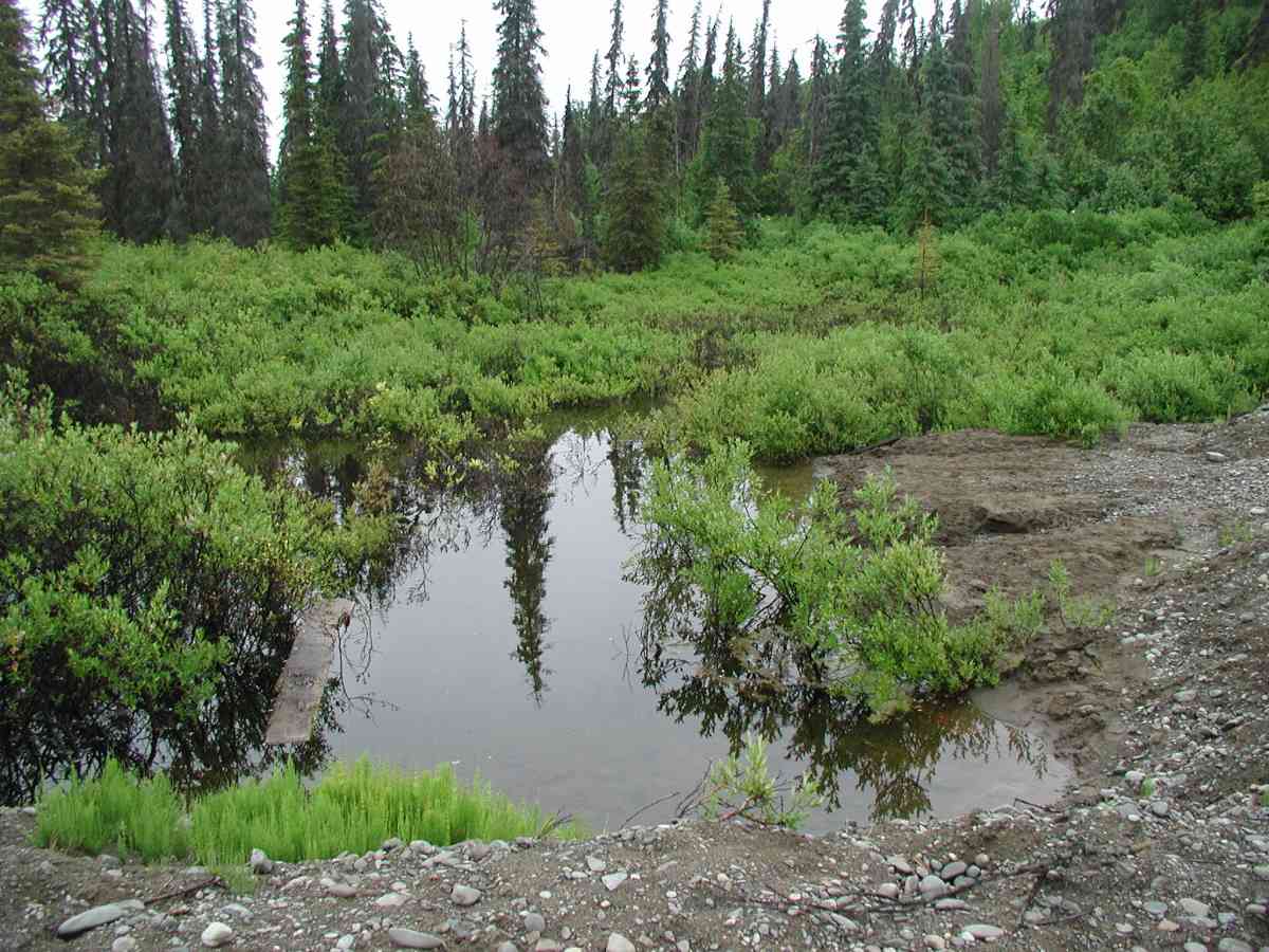
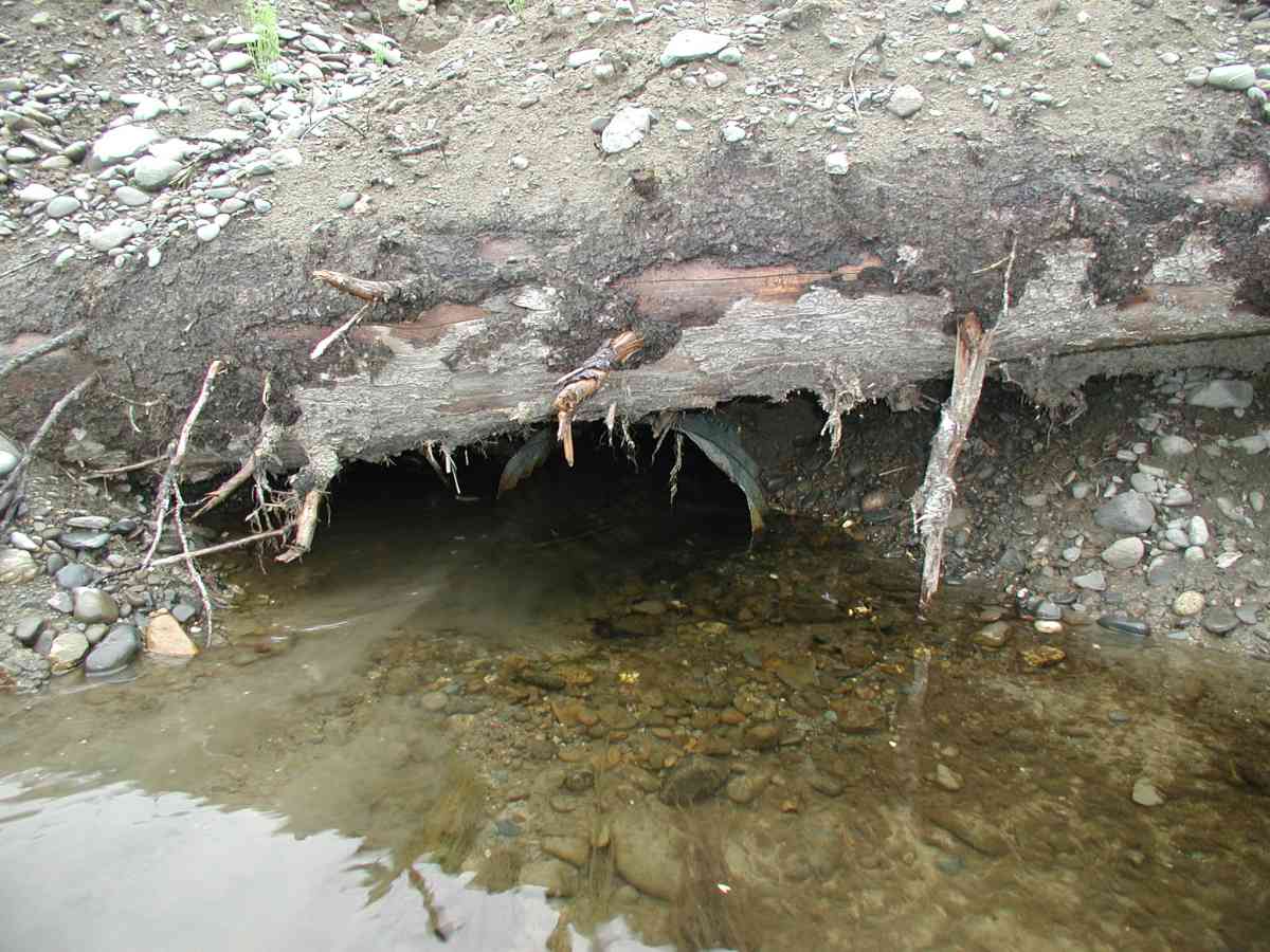
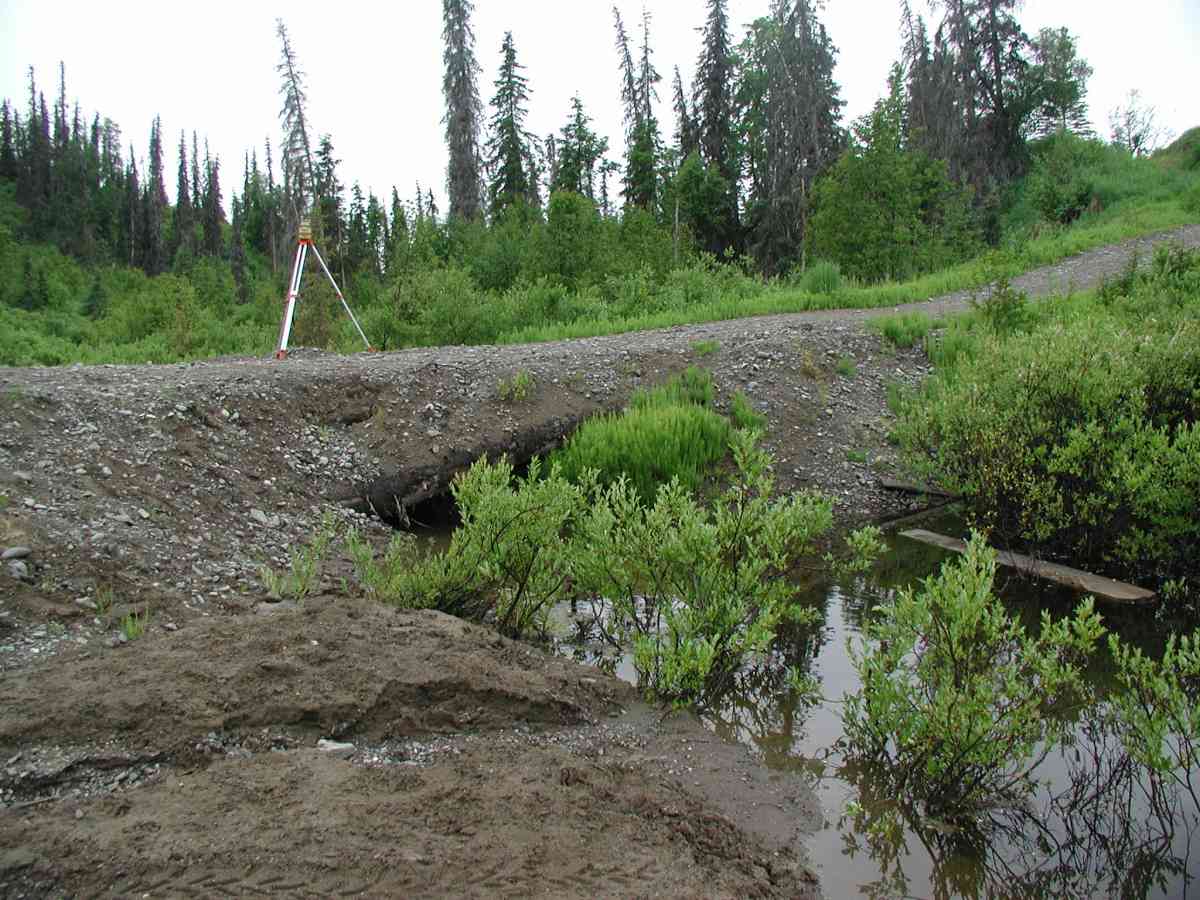
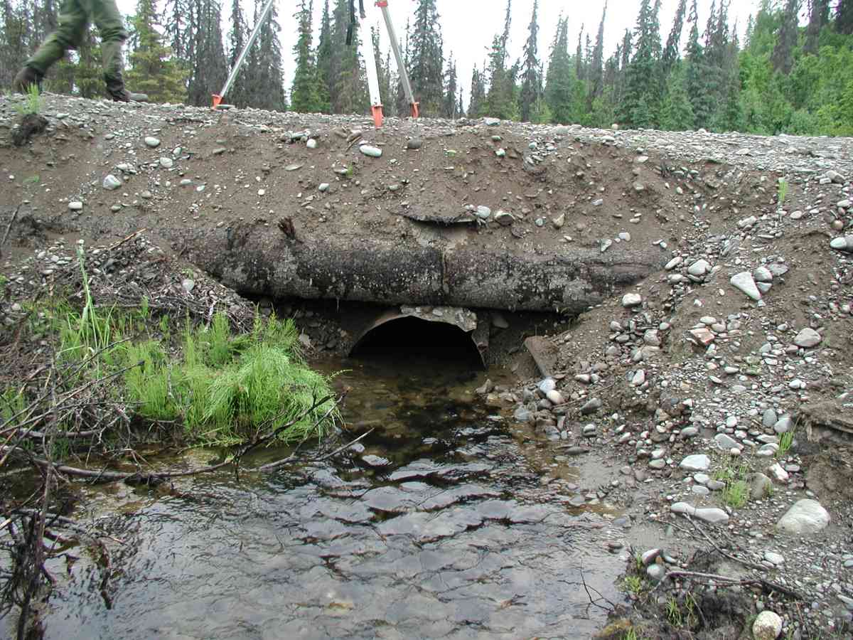
Comments: Location: Oilwell Rd. Stream: Stream lies at the base of a steep hill. Extensive ponding: 3' deep, 50' wide, and extends beyond 75' from the inlet. Measurements from the inlet and outlet were problematic due to logs. Gravel from washout is in large pile downstream of outlet. Dense alder and willow growth along stream. Culvert: It appears as if the road had washed out partially and was rebuilt by laying logs over the culvert and then adding gravel. The pipe is heavily embedded. Benchmark is located on tree stump located on the right bank near the outlet (see data form for more info.). Pipe condition=3 (should be replaced).
Culvert Measurements
| ID: 1 | Structure Type: Circular pipe (Corrugated Metal) | Fish Passage Rating: | |||||||||||||||||||||||||||||||||||||||||
|
|
|
|||||||||||||||||||||||||||||||||||||||||
Comments: Culvert: It appears as if the road had washed out partially and was rebuilt by laying logs over the culvert and then adding gravel. The pipe is heavily embedded. Benchmark is located on tree stump located on the right bank near the outlet (see data form for more info.). Pipe condition=3 (should be replaced). |
|||||||||||||||||||||||||||||||||||||||||||
Stream Measurements
|
|
No stream width data available.
Elevations
| Locator ID | Culvert Number |
River Distance (ft)1 |
Distance From Crossing (ft)2 |
Relative Elevation (ft) |
|---|---|---|---|---|
| D/S Thalweg | 98.84 | |||
| D/S Tailcrest or 1st Thalweg | 99.01 | |||
| OHW Left Bank | 99.20 | |||
| OHW Left Bank | 99.33 | |||
| Outlet Culvert Top (Four tree stumps (cut at base) "X" painted on stump near right bank near outlet.) | 1 | 100.00 | ||
| U/S Thalweg | 1 | 98.58 | ||
| Max Pool Depth | 0.00 | 5.0 | 98.69 | |
| Outlet Invert | 1 | 5.00 | 0.0 | 98.53 |
| Road Elev (Road surface.) | 15.00 | 103.14 | ||
| Inlet Culvert Invert | 1 | 25.00 | 0.0 | 98.72 |
Notes:
- River distance is measured continuously throughout the survey reach along the thalweg of the stream.
- Measured from each end of the crossing along the thalweg of the stream.
Fish Sampling Efforts
No fish sampling occurred during this survey.
Fish Observations
No fish observations occurred during this survey.
Photos

Questions or comments about this report can be directed to dfg.dsf.webmaster@alaska.gov