Fish Passage Site 20300895
Coordinates (dec. deg.): 60.00980°, -151.33167°
Legal Description: S002S012W15
Region: South Central
Road Name: Oil Well Road
Datum: NAD83
Quad Name / ITM: Kenai A-4
AWC Stream #: 244-20-10100-2019
Stream Name:
Elevation:
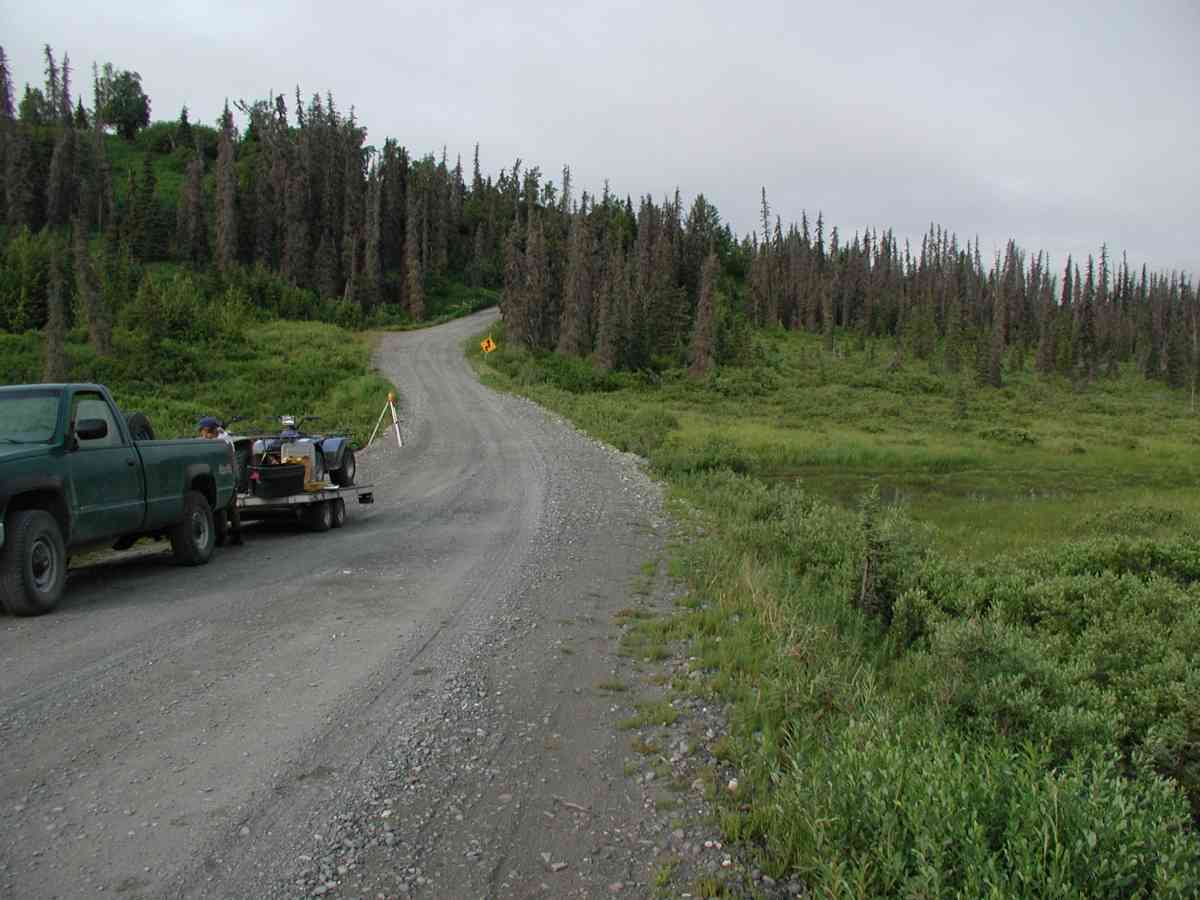
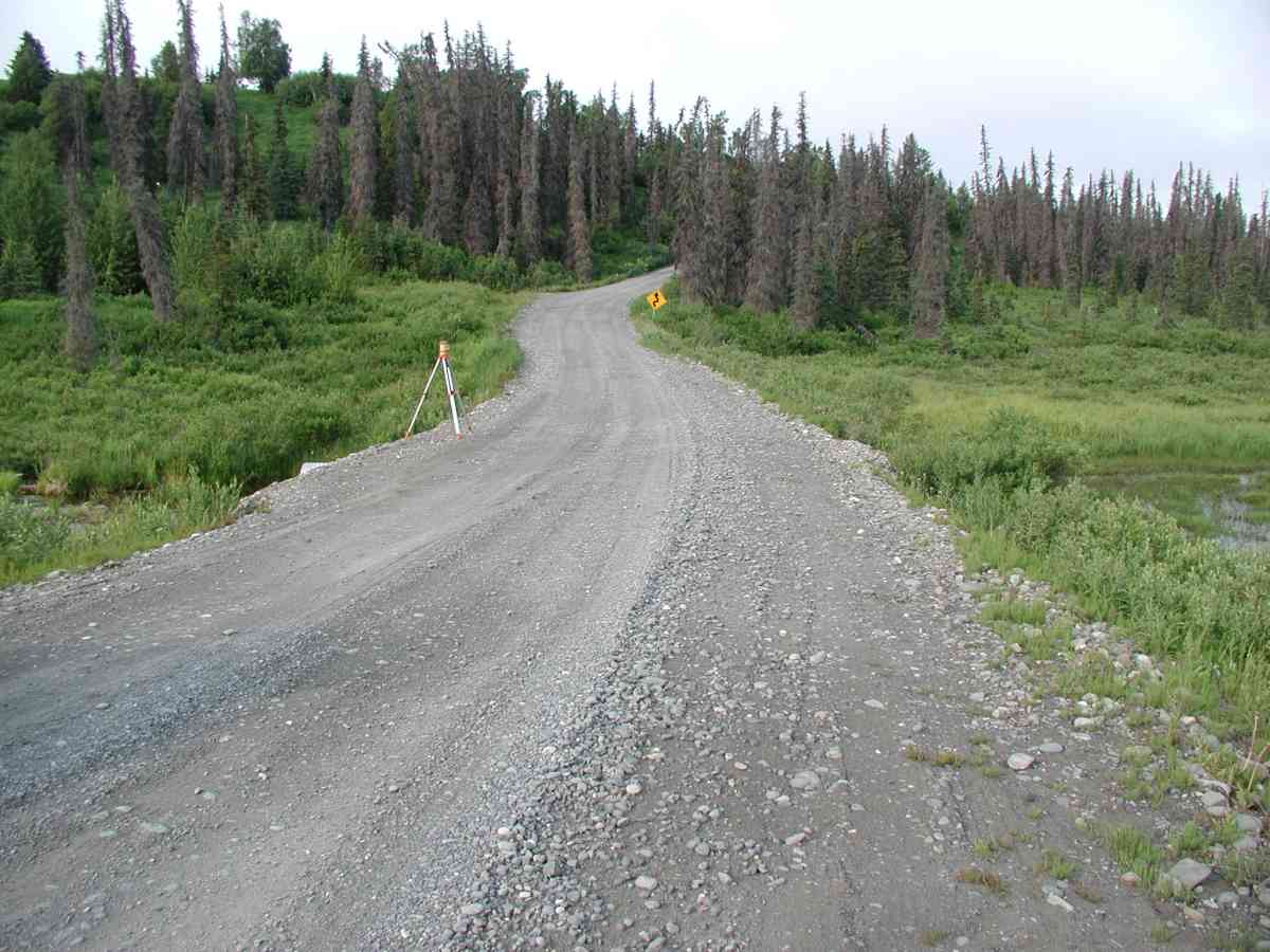
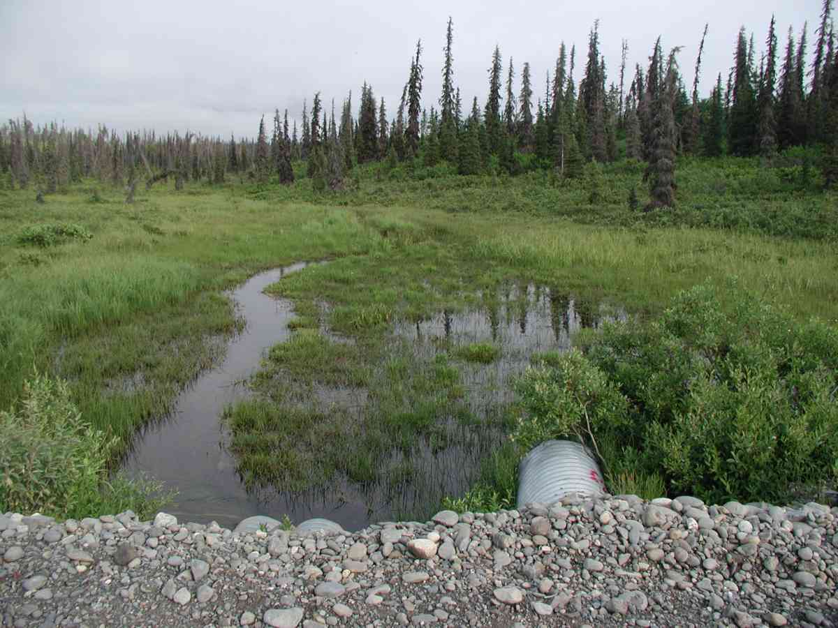
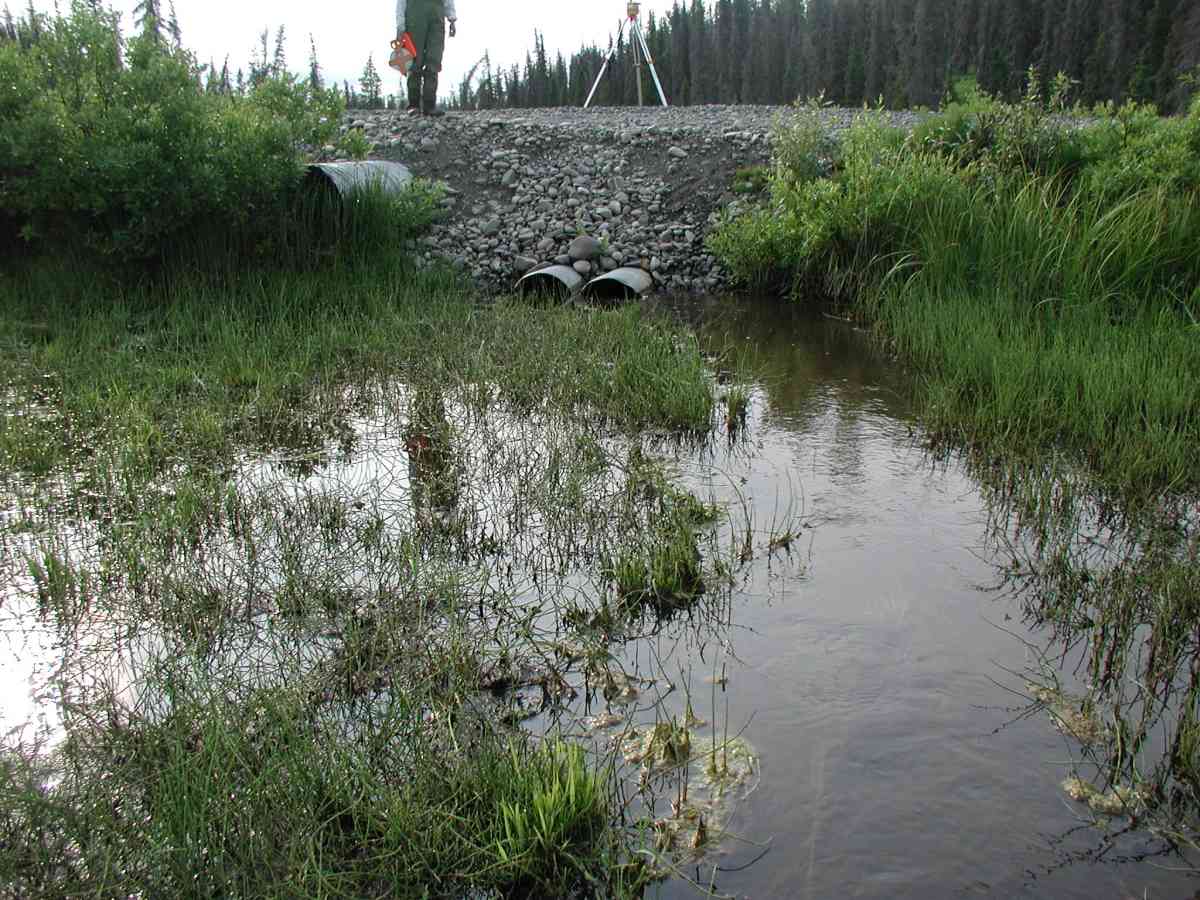
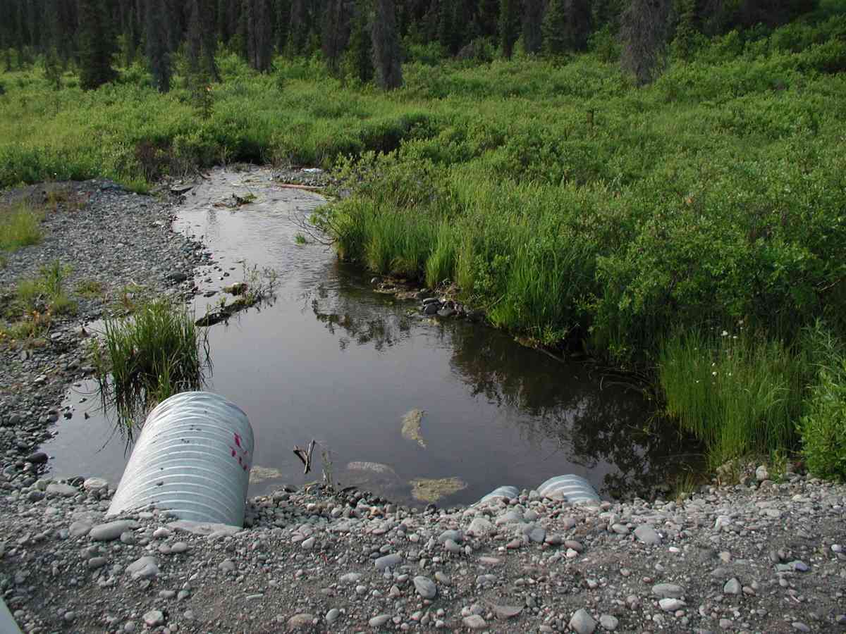
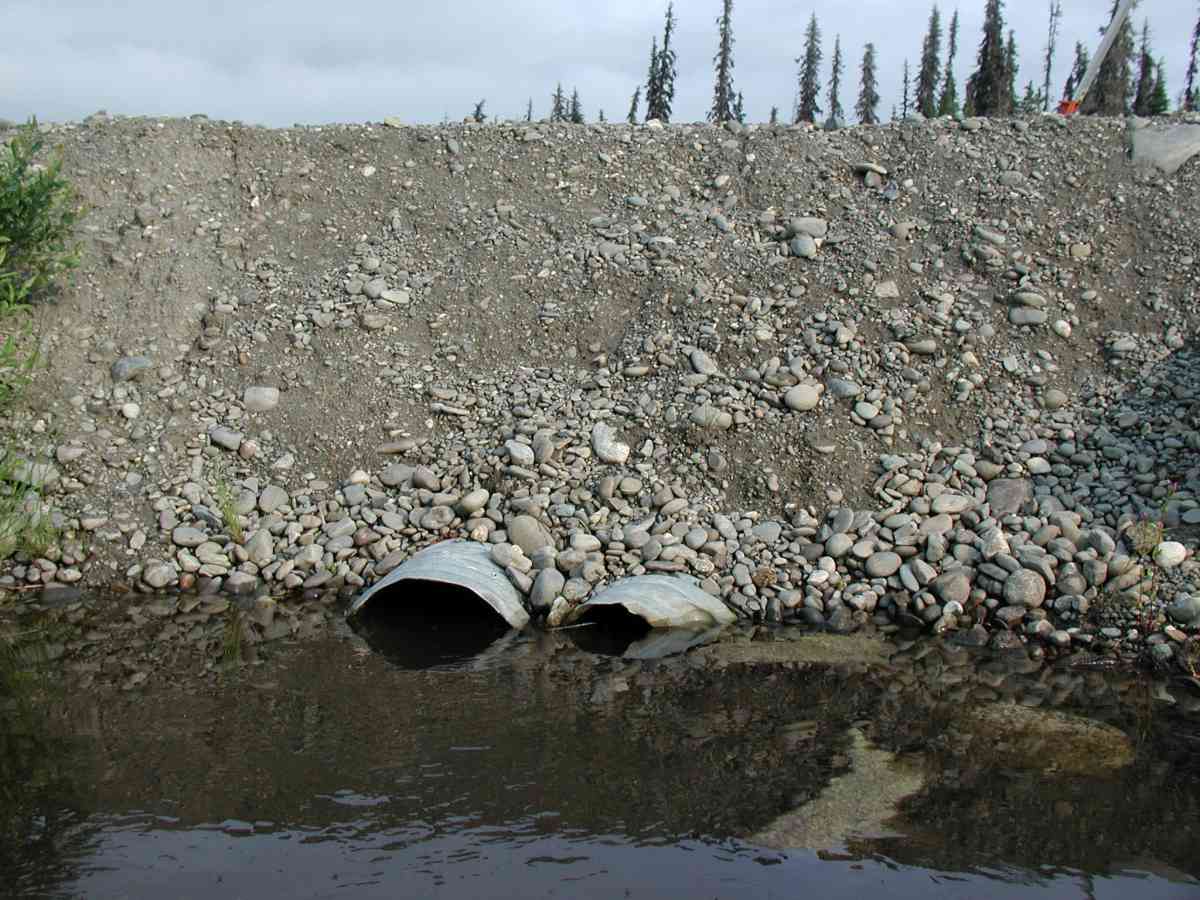
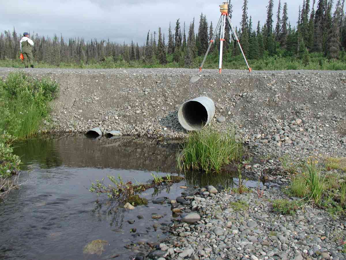
Site Comments: Location: Oilwell Road. Slow stream flow with moderate ponding upstream and significant gradient changes downstream.
Survey KPC04-1A024
Observers: Mary King, Pam Russell
Overall Fish Passage Rating:
Tidal: No
Backwatered: No
Step Pools:
Construction Year:
Comments: Location: Oilwell Road. Stream: Slow stream flow with moderate ponding upstream and significant gradient changes downstream. Substrate was very soft/silty at inlet and gravel at the outlet. Flow measurements done at 175' with very slow surface flow. Culvert: Three pipes were side by side at this site with only one as an overflow pipe. The center pipe was slightly squashed but functional. Pipe condition= 4-5. Not embedded.
Culvert Measurements
| ID: 1 | Structure Type: Circular pipe (Corrugated Metal) | Fish Passage Rating: | |||||||||||||||||||||||||||||||||||||||||
|
|
|
|||||||||||||||||||||||||||||||||||||||||
Comments: Culvert: Three pipes were side by side at this site with only one as an overflow pipe. The center pipe was slightly squashed but functional. Pipe condition= 4-5. Not embedded. |
|||||||||||||||||||||||||||||||||||||||||||
| ID: 2 | Structure Type: Circular pipe (Corrugated Metal) | Fish Passage Rating: | |||||||||||||||||||||||||||||||||||||||||
|
|
|
|||||||||||||||||||||||||||||||||||||||||
Stream Measurements
|
|
| Stream Width Type | Distance From Crossing (ft) |
Stream Width (ft) |
|---|---|---|
| Upstream bank full | 75.0 | 3.00 |
| Upstream bank full | 100.0 | 2.83 |
| Upstream bank full | 125.0 | 3.33 |
| Upstream bank full | 150.0 | 5.83 |
| Upstream bed width | 75.0 | 1.83 |
| Upstream bed width | 100.0 | 4.00 |
| Upstream bed width | 125.0 | 2.50 |
| Upstream bed width | 150.0 | 3.50 |
| Upstream ordinary high water | 75.0 | 2.92 |
| Upstream ordinary high water | 100.0 | 3.67 |
| Upstream ordinary high water | 125.0 | 3.00 |
| Upstream ordinary high water | 150.0 | 5.50 |
Elevations
| Locator ID | Culvert Number |
River Distance (ft)1 |
Distance From Crossing (ft)2 |
Relative Elevation (ft) |
|---|---|---|---|---|
| D/S Thalweg | 95.73 | |||
| U/S Thalweg | 1 | 96.23 | ||
| D/S Tailcrest or 1st Thalweg | 96.95 | |||
| OHW Left Bank | 97.41 | |||
| OHW Left Bank | 97.47 | |||
| Outlet Culvert Top | 1 | 100.00 | ||
| Outlet Culvert Top | 2 | 100.00 | ||
| U/S Thalweg | 2 | 96.33 | ||
| Max Pool Depth | 0.00 | 5.0 | 95.94 | |
| Outlet Invert | 1 | 5.00 | 0.0 | 96.16 |
| Outlet Invert | 2 | 5.00 | 0.0 | 96.30 |
| Road Elev | 25.00 | 100.89 | ||
| Inlet Culvert Invert | 1 | 45.00 | 0.0 | 96.44 |
| Inlet Culvert Invert | 2 | 45.00 | 0.0 | 96.49 |
Notes:
- River distance is measured continuously throughout the survey reach along the thalweg of the stream.
- Measured from each end of the crossing along the thalweg of the stream.
Fish Sampling Efforts
No fish sampling occurred during this survey.
Fish Observations
No fish observations occurred during this survey.
Photos

Questions or comments about this report can be directed to dfg.dsf.webmaster@alaska.gov