Fish Passage Site 20300894
Coordinates (dec. deg.): 59.99458°, -151.49387°
Legal Description: S002S013W22
Region: South Central
Road Name: Oil Well Road
Datum: NAD83
Quad Name / ITM: Seldovia D-4
AWC Stream #: 244-20-10100-2019-3018-4009
Stream Name:
Elevation:
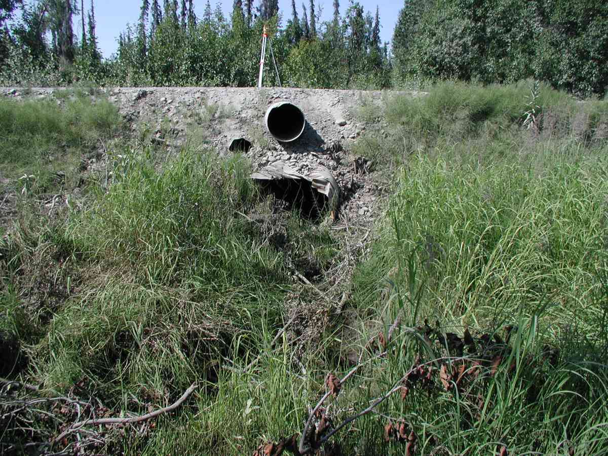
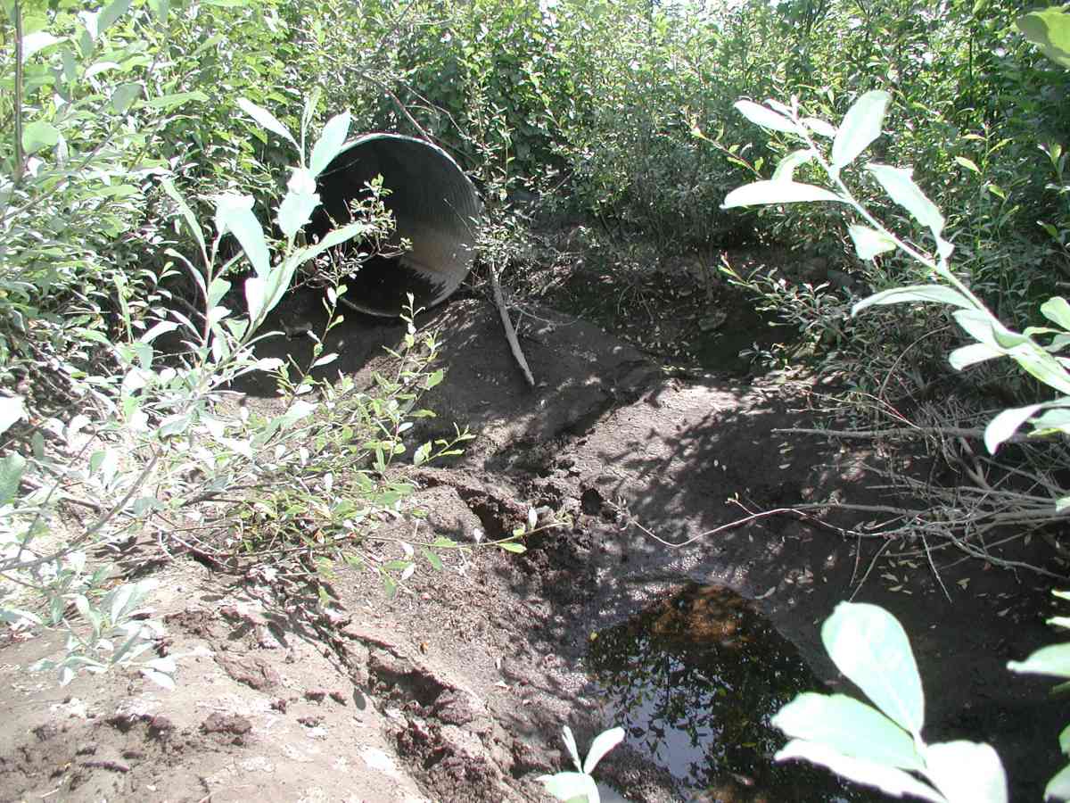
Site Comments: Location: Oilwell Road. Stream bed is dry upstream of the pipe with some ponds at 125' .
Survey KPC04-1A023
Observers: Mary King, Pam Russell
Overall Fish Passage Rating:
Tidal: No
Backwatered: No
Step Pools:
Construction Year:
Comments: Location: Oilwell Road. Stream: Stream bed is dry upstream of the pipe with some ponds at 125' . A pond is present 5' downstream of the outlet, contains 2 land locked Dolly Varden juveniles (6"). No stream flow (no measurements taken). Culvert: No water in pipe. The inlet is ripped, smashed and perched. Pipe condition=4. Not embedded.
Culvert Measurements
| ID: 1 | Structure Type: Circular pipe (Corrugated Metal) | Fish Passage Rating: | |||||||||||||||||||||||||||||||||||||||||
|
|
|
|||||||||||||||||||||||||||||||||||||||||
Comments: No water in pipe. The inlet is ripped, smashed and perched. Pipe condition=4. Not embedded. |
|||||||||||||||||||||||||||||||||||||||||||
Stream Measurements
|
|
| Stream Width Type | Distance From Crossing (ft) |
Stream Width (ft) |
|---|---|---|
| Upstream bank full | 75.0 | 4.33 |
| Upstream bank full | 100.0 | 4.00 |
| Upstream bed width | 75.0 | 2.50 |
| Upstream bed width | 100.0 | 3.58 |
| Upstream ordinary high water | 75.0 | 2.50 |
| Upstream ordinary high water | 100.0 | 3.58 |
Elevations
| Locator ID | Culvert Number |
River Distance (ft)1 |
Distance From Crossing (ft)2 |
Relative Elevation (ft) |
|---|---|---|---|---|
| Outlet Culvert Top (Orange spray painted "X" on top of outlet pipe.) | 1 | 100.00 | ||
| Outlet Invert | 1 | 0.00 | 0.0 | 95.49 |
| Inlet Culvert Invert | 1 | 40.00 | 0.0 | 95.99 |
Notes:
- River distance is measured continuously throughout the survey reach along the thalweg of the stream.
- Measured from each end of the crossing along the thalweg of the stream.
Fish Sampling Efforts
No fish sampling occurred during this survey.
Fish Observations
No fish observations occurred during this survey.
Photos


Questions or comments about this report can be directed to dfg.dsf.webmaster@alaska.gov