Fish Passage Site 20300892
Coordinates (dec. deg.): 59.95374°, -151.70371°
Legal Description: S002S014W33
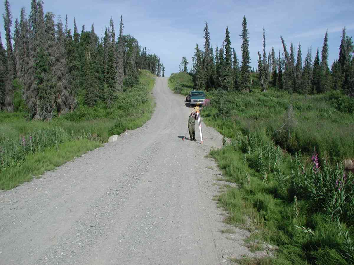
Region: South Central
Road Name: East Road
Datum: NAD83
Quad Name / ITM: Seldovia D-5
AWC Stream #:
Stream Name:
Elevation:
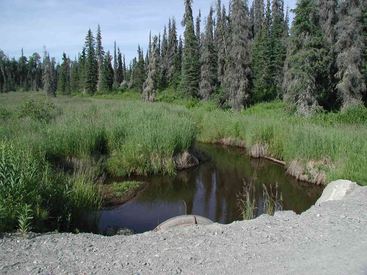
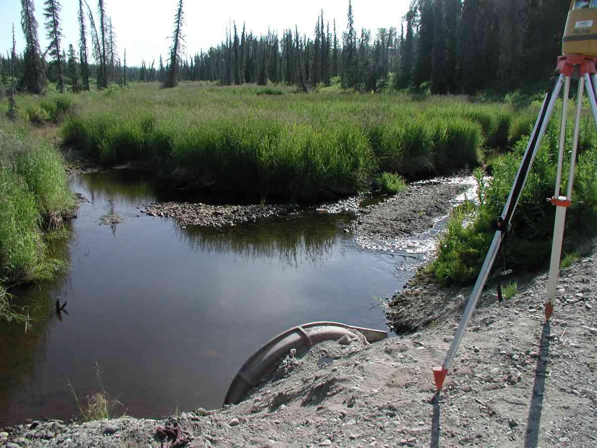
Site Comments: Location: East Rd. Deep ponding occurred upstream, extended beyond 150'.
Survey KPC04-1A021
Observers: Mary King, Pam Russell
Overall Fish Passage Rating:
Tidal: No
Backwatered: No
Step Pools:
Construction Year:
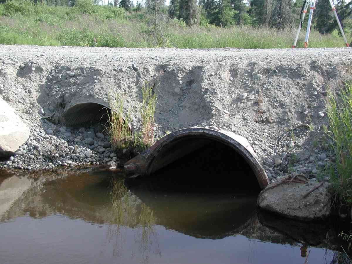
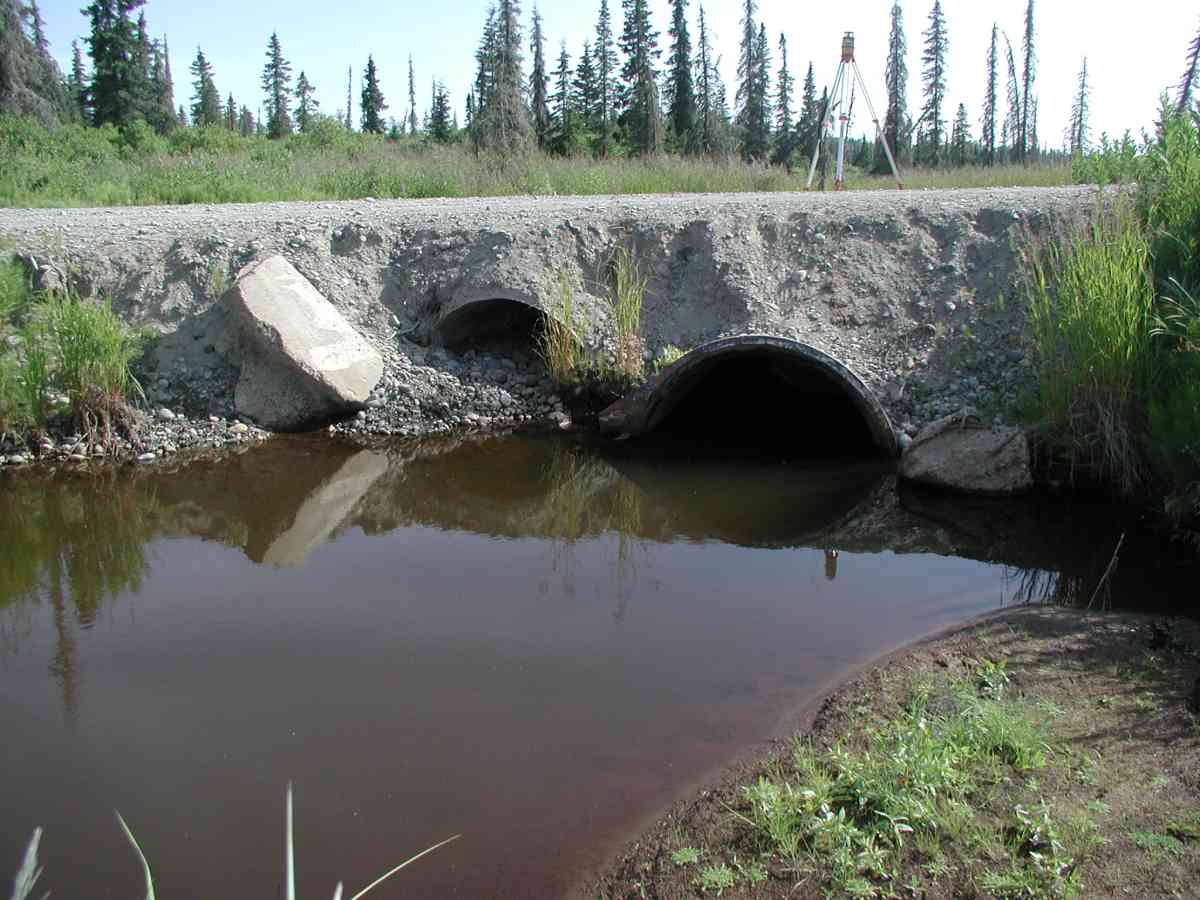
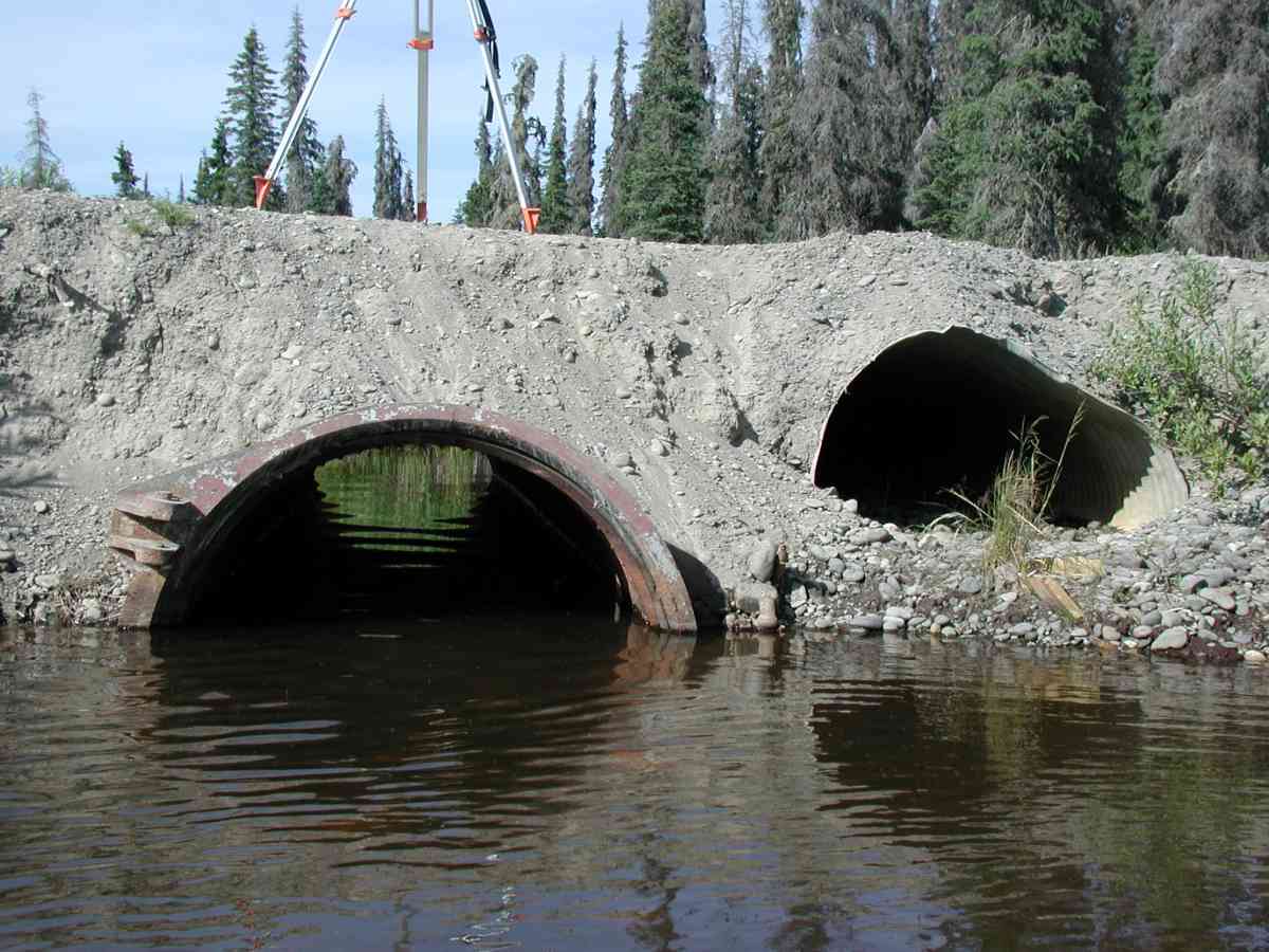
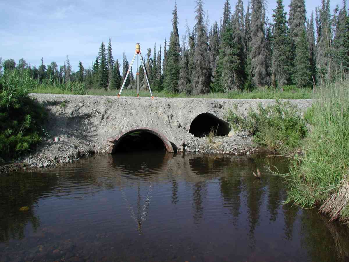
Comments: Location: East Rd. Stream: Deep ponding occurred upstream, extended beyond 150'. Stream braids into 2 channels at the tailcrest. Excavation failed at the inlet and outlet, measurements taken at the substrate level. Culvert: The overflow pipe was embedded half the height throughout its length. The functional pipe was embedded with gravel 1-2' deep the entire length. Pipe condition=4-5 (Pipe has minor deficiencies but is still functional). Steel pipe with valve type ends.
Culvert Measurements
| ID: 1 | Structure Type: Circular pipe (Corrugated Metal) | Fish Passage Rating: | |||||||||||||||||||||||||||||||||||||||||
|
|
|
|||||||||||||||||||||||||||||||||||||||||
Comments: The overflow pipe was embedded half the height throughout its length. The functional pipe was embedded with gravel 1-2' deep the entire length. Pipe condition=4-5 (Pipe has minor deficiencies but is still functional). Steel pipe with valve type ends. |
|||||||||||||||||||||||||||||||||||||||||||
Stream Measurements
|
|
| Stream Width Type | Distance From Crossing (ft) |
Stream Width (ft) |
|---|---|---|
| Upstream bank full | 75.0 | 8.83 |
| Upstream bank full | 100.0 | 8.67 |
| Upstream bank full | 125.0 | 11.42 |
| Upstream bank full | 150.0 | 11.58 |
| Upstream bed width | 75.0 | 8.00 |
| Upstream bed width | 100.0 | 6.75 |
| Upstream bed width | 125.0 | 8.25 |
| Upstream bed width | 150.0 | 8.67 |
| Upstream ordinary high water | 75.0 | 8.33 |
| Upstream ordinary high water | 100.0 | 7.67 |
| Upstream ordinary high water | 125.0 | 9.08 |
| Upstream ordinary high water | 150.0 | 10.08 |
Elevations
| Locator ID | Culvert Number |
River Distance (ft)1 |
Distance From Crossing (ft)2 |
Relative Elevation (ft) |
|---|---|---|---|---|
| U/S Thalweg | 1 | 94.74 | ||
| D/S Thalweg | 96.09 | |||
| D/S Tailcrest or 1st Thalweg (Stream divides/ right channel.) | 97.22 | |||
| OHW Left Bank | 97.77 | |||
| OHW Left Bank | 97.88 | |||
| Outlet Culvert Top (Orange spot on rib of outlet top on the valve end.) | 1 | 100.00 | ||
| Max Pool Depth | 0.00 | 5.0 | 96.08 | |
| Outlet Invert (Measurement taken from substrate.) | 1 | 5.00 | 0.0 | 95.98 |
| Road Elev (Road surface.) | 19.50 | 102.00 | ||
| Inlet Culvert Invert (Measurement taken from substrate.) | 1 | 34.00 | 0.0 | 95.19 |
Notes:
- River distance is measured continuously throughout the survey reach along the thalweg of the stream.
- Measured from each end of the crossing along the thalweg of the stream.
Fish Sampling Efforts
No fish sampling occurred during this survey.
Fish Observations
No fish observations occurred during this survey.
Photos
Questions or comments about this report can be directed to dfg.dsf.webmaster@alaska.gov