Fish Passage Site 20300888
Coordinates (dec. deg.): 60.04927°, -151.34229°
Legal Description: S001S012W33
Region: South Central
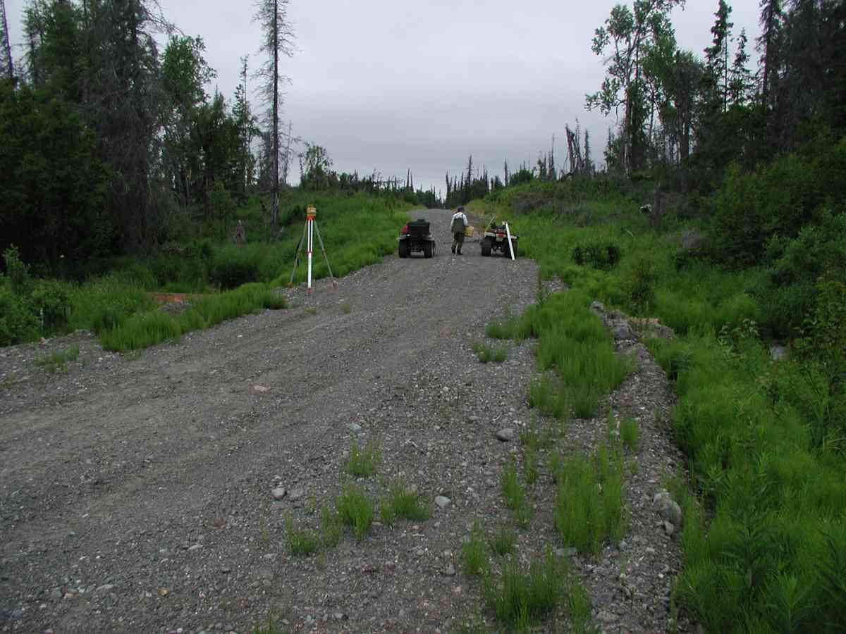
Road Name: Oil Well Road
Datum: NAD83
Quad Name / ITM: Kenai A-4
AWC Stream #:
Stream Name:
Elevation:
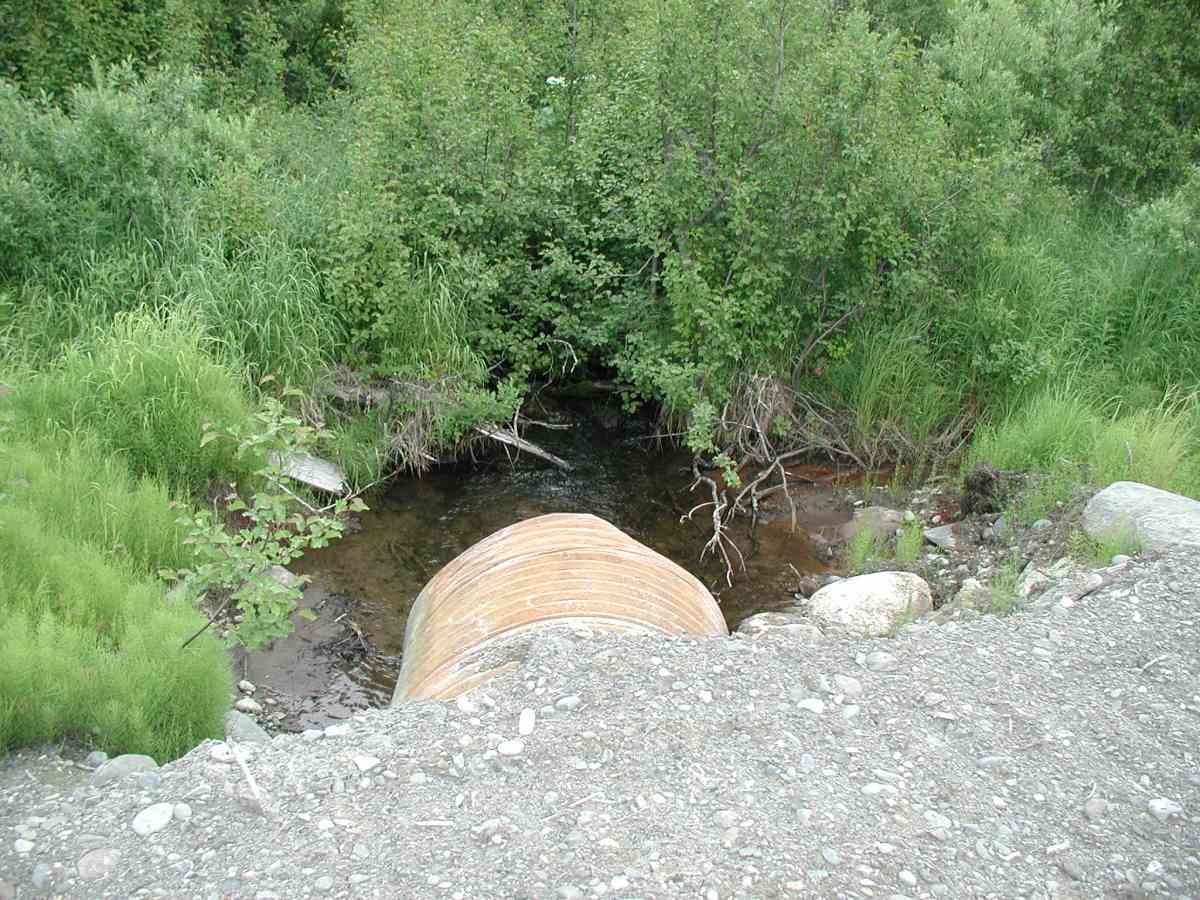
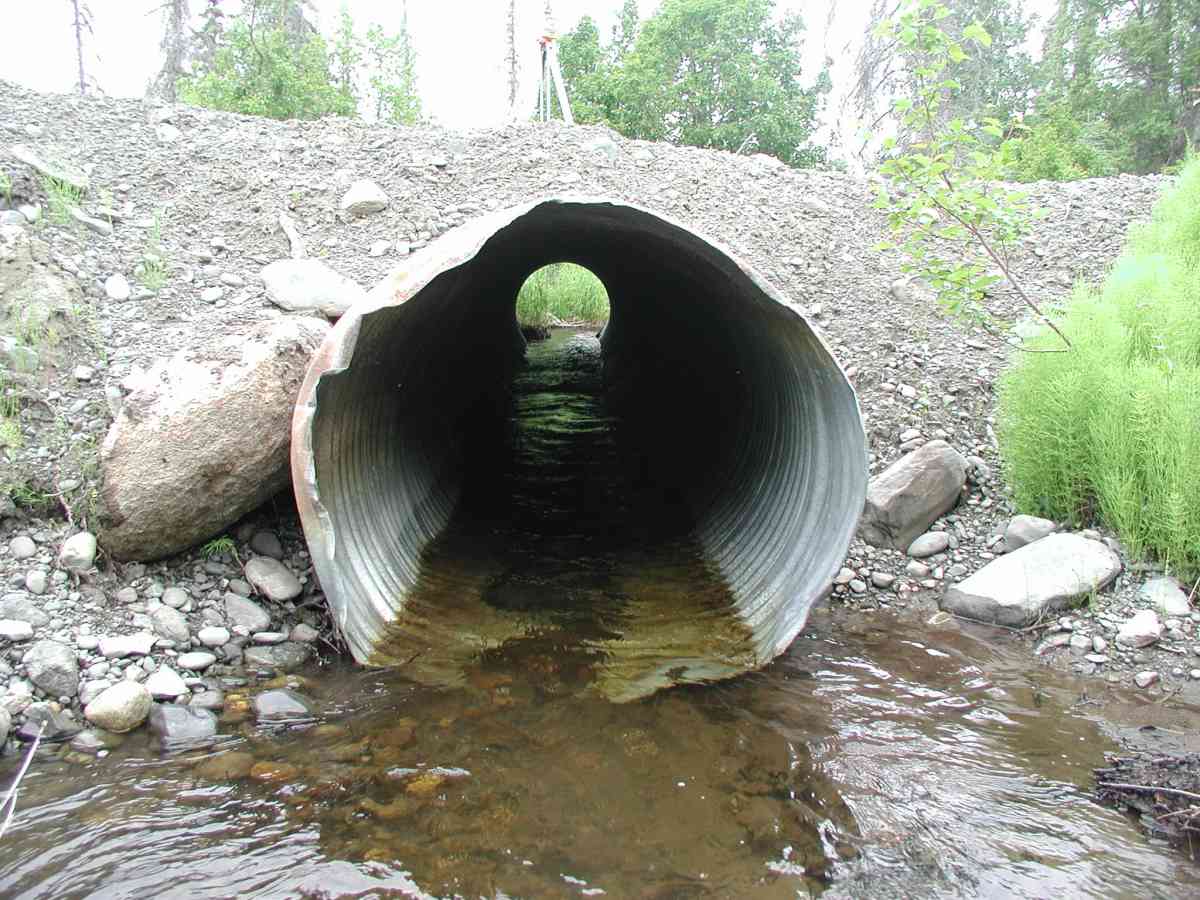
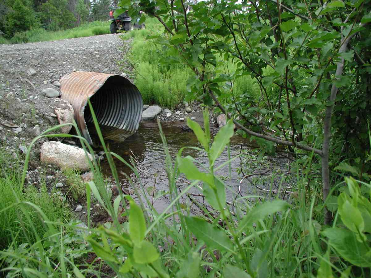
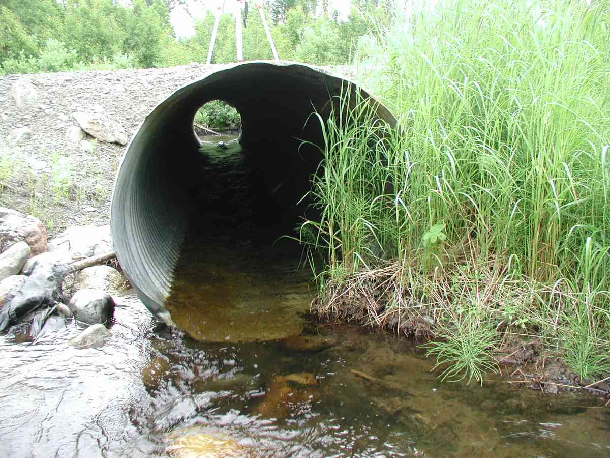
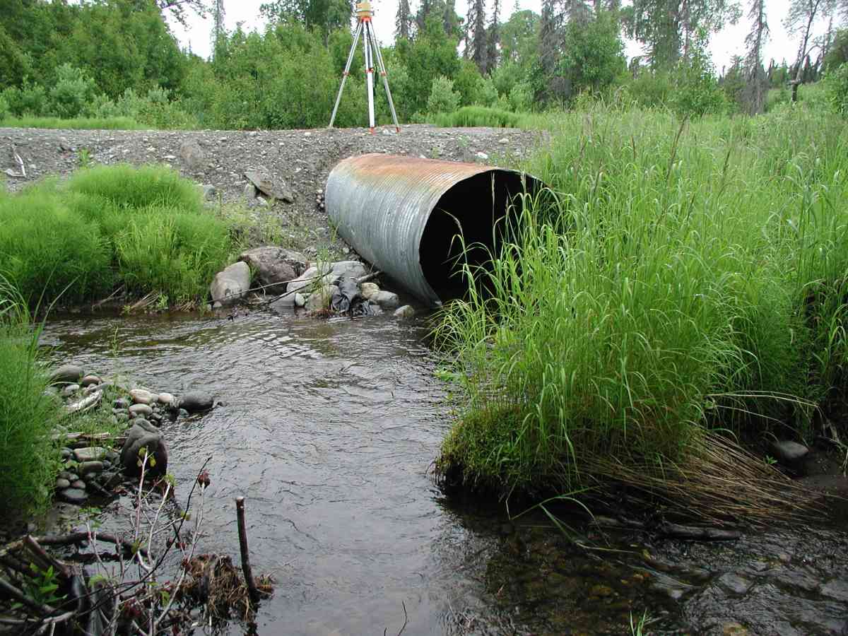
Site Comments: Location: Oil Well Road to 1200 Rd. Channel is braided upstream of pipe and narrows to one channel at 125'. The streambanks are very vegetated. The substrate is mixed rock sizes.
arrow to the right of the survey date below to choose a different report for this site.
Survey KPC04-1A015
Observers: Mary King, Pam Russell
Overall Fish Passage Rating:
Tidal: No
Backwatered: No
Step Pools:
Construction Year:
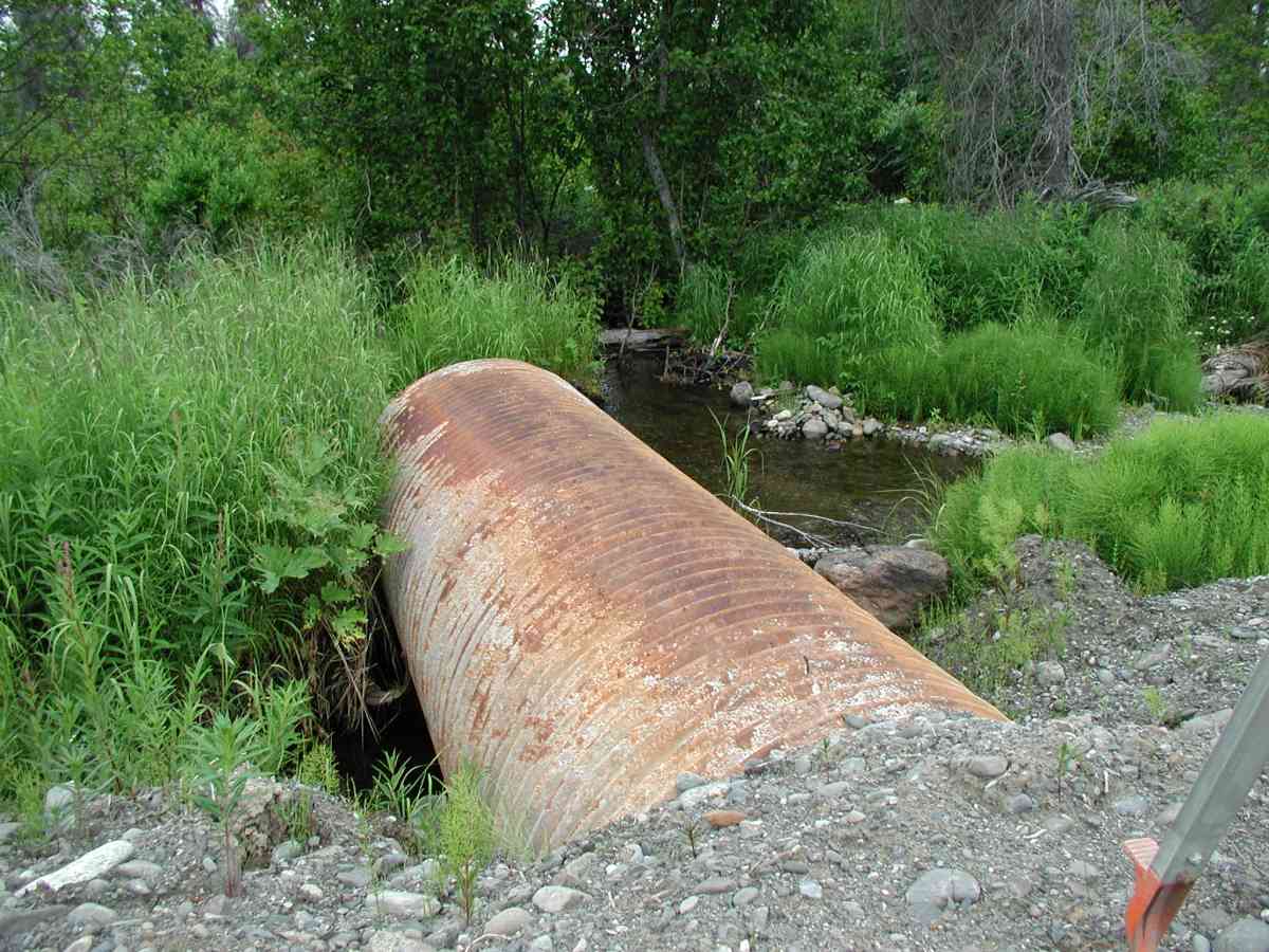
Comments: Location: Oil Well Road to 1200 Rd. Stream: Channel is braided upstream of pipe and narrows to one channel at 125'. The streambanks are very vegetated. The substrate is mixed rock sizes. Some vegetation growing in the pipe. Bank undercut ranged from 4"-10". Rocks in the channel interfered with stream flow measurements; taken at 125ft upstream. Culvert: Pipe condition=5 (good) The pipe had minor dents on the edges and rust all across the exterior. Not embedded.
Culvert Measurements
| ID: 1 | Structure Type: Circular pipe (Corrugated Metal) | Fish Passage Rating: | |||||||||||||||||||||||||||||||||||||||||
|
|
|
|||||||||||||||||||||||||||||||||||||||||
Stream Measurements
|
|
| Stream Width Type | Distance From Crossing (ft) |
Stream Width (ft) |
|---|---|---|
| Upstream bank full | 125.0 | 4.50 |
| Upstream bank full | 150.0 | 11.17 |
| Upstream bed width | 125.0 | 3.08 |
| Upstream bed width | 150.0 | 6.58 |
| Upstream ordinary high water | 125.0 | 3.08 |
| Upstream ordinary high water | 150.0 | 8.42 |
Elevations
| Locator ID | Culvert Number |
River Distance (ft)1 |
Distance From Crossing (ft)2 |
Relative Elevation (ft) |
|---|---|---|---|---|
| D/S Thalweg | 95.33 | |||
| D/S Tailcrest or 1st Thalweg | 96.03 | |||
| U/S Thalweg | 1 | 96.43 | ||
| OHW Left Bank | 96.59 | |||
| OHW Left Bank | 96.62 | |||
| Outlet Culvert Top (Top of outlet culvert on cross of painted "X", located on 2nd seam from end of pipe.) | 1 | 100.00 | ||
| Max Pool Depth | 0.00 | 5.0 | 96.02 | |
| Outlet Invert | 1 | 5.00 | 0.0 | 95.63 |
| Road Elev (Road surface) | 25.50 | 100.86 | ||
| Inlet Culvert Invert | 1 | 46.00 | 0.0 | 96.36 |
Notes:
- River distance is measured continuously throughout the survey reach along the thalweg of the stream.
- Measured from each end of the crossing along the thalweg of the stream.
Fish Sampling Efforts
No fish sampling occurred during this survey.
Fish Observations
No fish observations occurred during this survey.
Photos
Questions or comments about this report can be directed to dfg.dsf.webmaster@alaska.gov