Fish Passage Site 20300886
Coordinates (dec. deg.): 60.04943°, -151.38203°
Legal Description: S001S012W32
Region: South Central
Road Name: Oil Well Road
Datum: NAD83
Quad Name / ITM: Kenai A-4
AWC Stream #:
Stream Name:
Elevation:
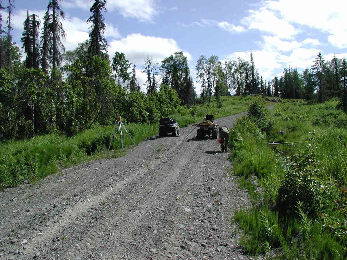
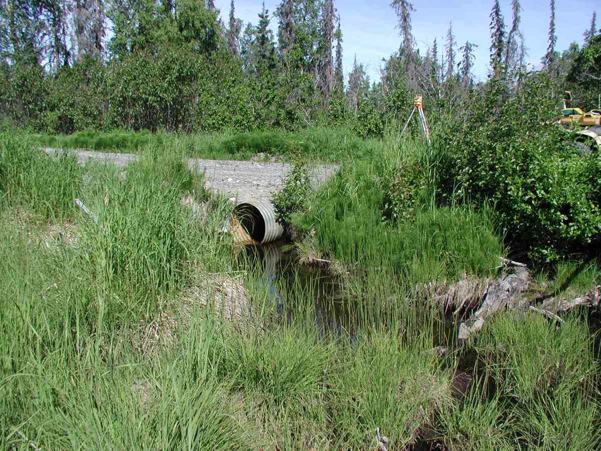
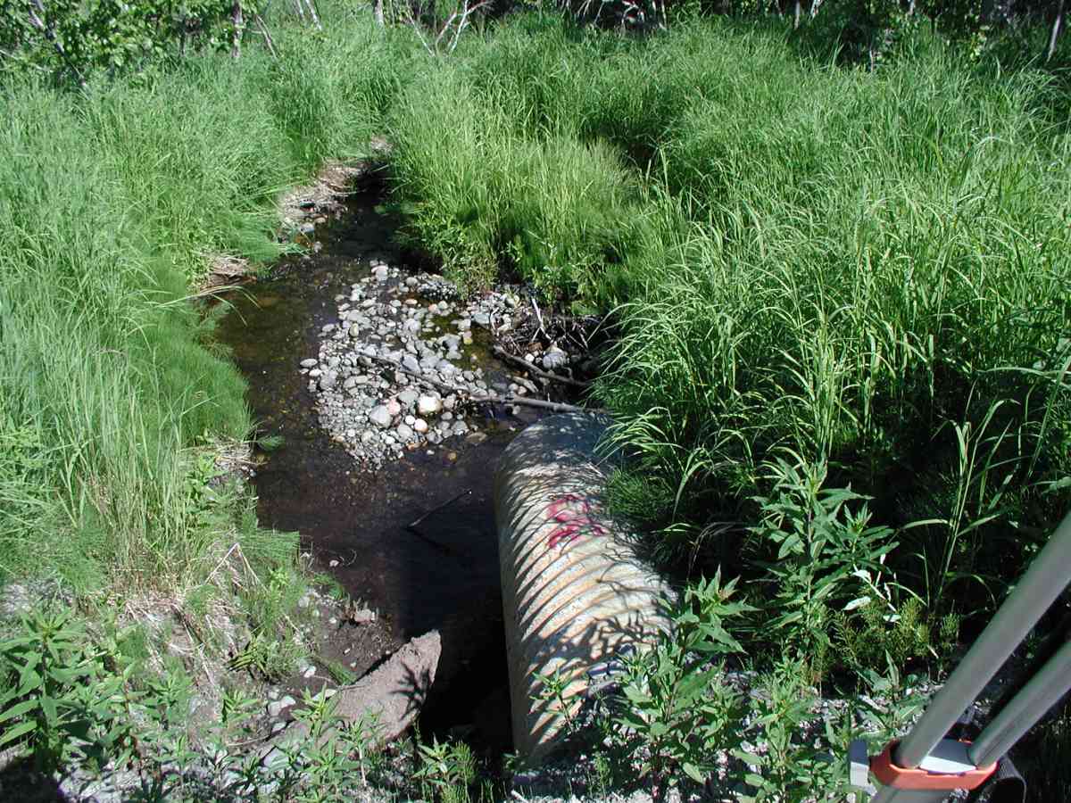
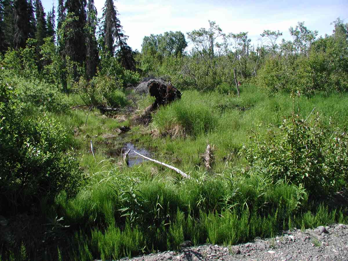
Site Comments: Location: Oil Well Road to Tribal Council Road. Stream lies in an open marsh that it drains. Substrate is mixed rocks.
Survey KPC04-1A013
Observers: Mary King, Pam Russell
Overall Fish Passage Rating:
Tidal: No
Backwatered: No
Step Pools:
Construction Year:
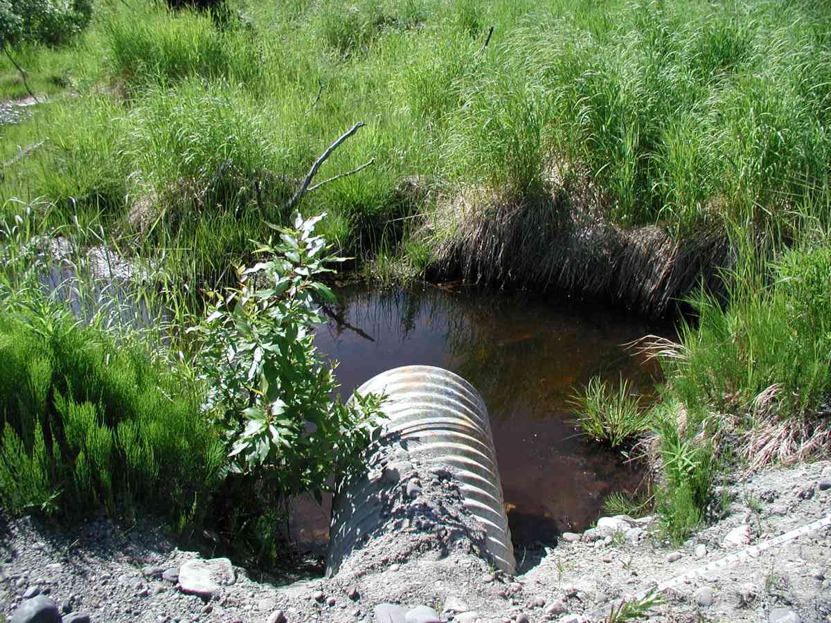
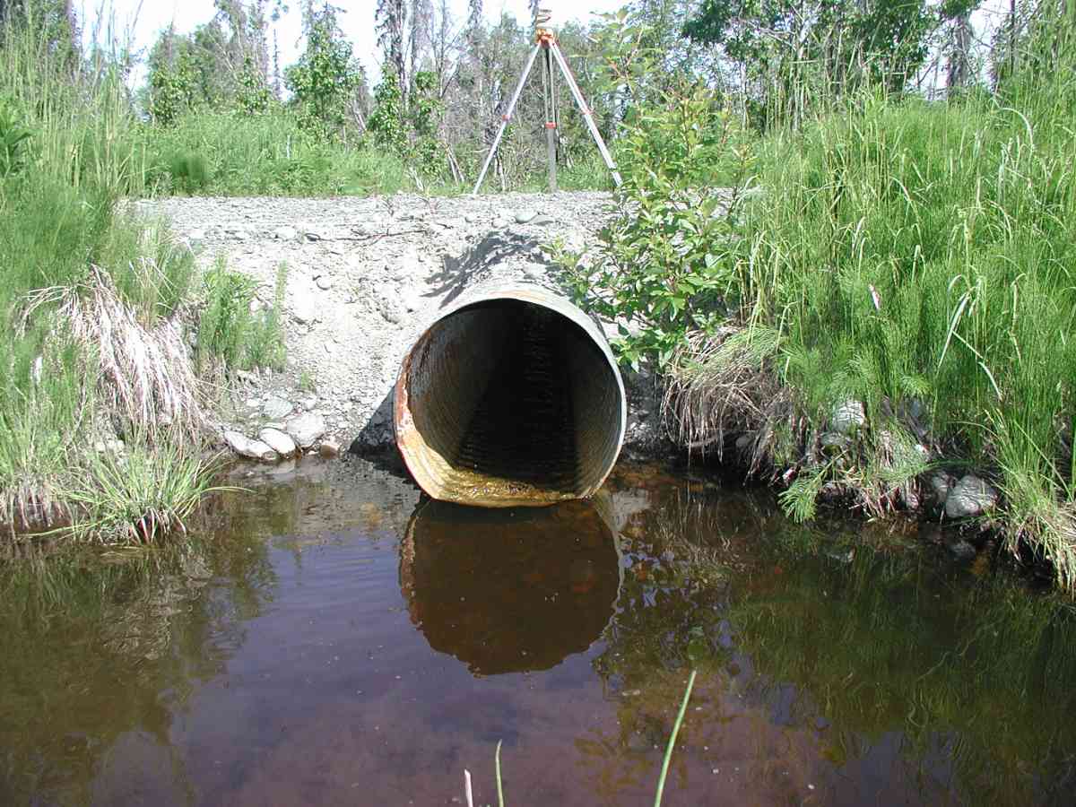
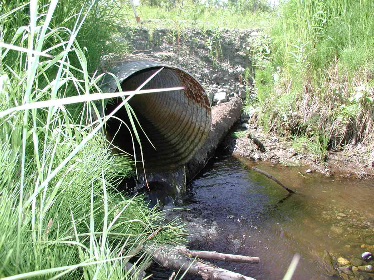
Comments: Location: Oil Well Road to Tribal Council Road. Stream: Stream lies in an open marsh that it drains. Substrate is mixed rocks. Due to ponding upstream of inlet, flow measurements were done downstream of outlet; rocks were problematic. Washout gravel formed a gravel bar 6ft in diameter downstream from the pipe. Bank undercut ranged from 0.5-2.5'. Culvert: Upstream ponding and erosion resulted in 1" stream depth in pipe. Outlet is supported by logs (1' diam.), extends 6' from roadside and is perched. Pipe condition=4-5. Not embedded.
Culvert Measurements
| ID: 1 | Structure Type: Circular pipe (Corrugated Metal) | Fish Passage Rating: | |||||||||||||||||||||||||||||||||||||||||
|
|
|
|||||||||||||||||||||||||||||||||||||||||
Stream Measurements
|
|
| Stream Width Type | Distance From Crossing (ft) |
Stream Width (ft) |
|---|---|---|
| Upstream bank full | 75.0 | 4.58 |
| Upstream bank full | 100.0 | 5.00 |
| Upstream bank full | 125.0 | 5.50 |
| Upstream bank full | 150.0 | 3.83 |
| Upstream bed width | 75.0 | 1.83 |
| Upstream bed width | 100.0 | 3.92 |
| Upstream bed width | 125.0 | 1.75 |
| Upstream bed width | 150.0 | 2.08 |
| Upstream ordinary high water | 75.0 | 3.75 |
| Upstream ordinary high water | 100.0 | 4.33 |
| Upstream ordinary high water | 125.0 | 2.58 |
| Upstream ordinary high water | 150.0 | 2.33 |
Elevations
| Locator ID | Culvert Number |
River Distance (ft)1 |
Distance From Crossing (ft)2 |
Relative Elevation (ft) |
|---|---|---|---|---|
| OHW Left Bank | 97.59 | |||
| OHW Left Bank | 97.64 | |||
| U/S Thalweg | 1 | 97.84 | ||
| D/S Thalweg | 96.84 | |||
| D/S Tailcrest or 1st Thalweg | 97.16 | |||
| Outlet Culvert Top (Outlet pipe has a red #"30". TBM was taken from bottom o f"3" centered on the paint.) | 1 | 100.00 | ||
| Max Pool Depth | 0.00 | 5.0 | 97.29 | |
| Outlet Invert | 1 | 5.00 | 0.0 | 97.98 |
| Road Elev (Road surface.) | 20.00 | 100.86 | ||
| Inlet Culvert Invert | 1 | 35.00 | 0.0 | 98.62 |
Notes:
- River distance is measured continuously throughout the survey reach along the thalweg of the stream.
- Measured from each end of the crossing along the thalweg of the stream.
Fish Sampling Efforts
No fish sampling occurred during this survey.
Fish Observations
No fish observations occurred during this survey.
Photos

Questions or comments about this report can be directed to dfg.dsf.webmaster@alaska.gov