Fish Passage Site 20300881
Coordinates (dec. deg.): 60.15142°, -151.35272°
Legal Description: S001N012W27
Region: South Central
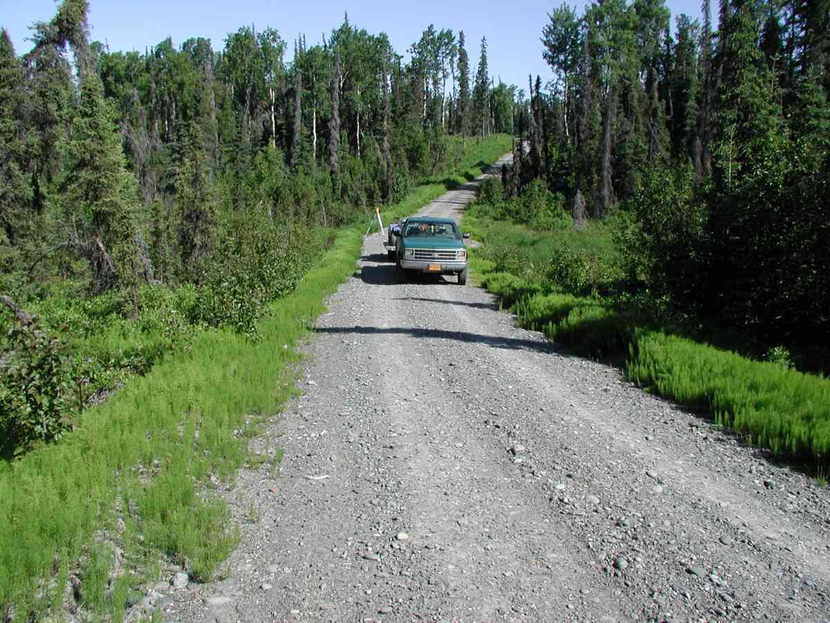
Road Name: Falls Creek Road
Datum: NAD83
Quad Name / ITM: Kenai A-4
AWC Stream #:
Stream Name:
Elevation:
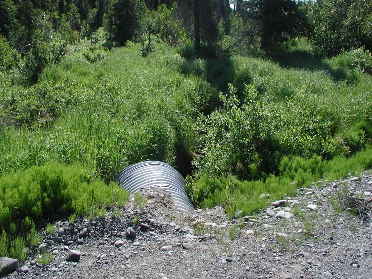
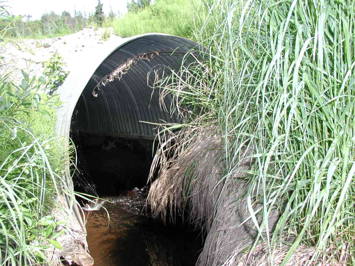
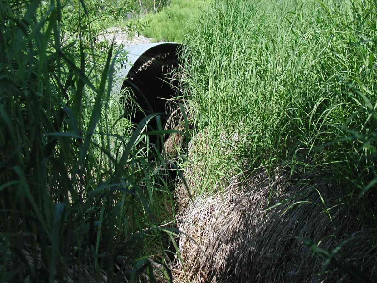
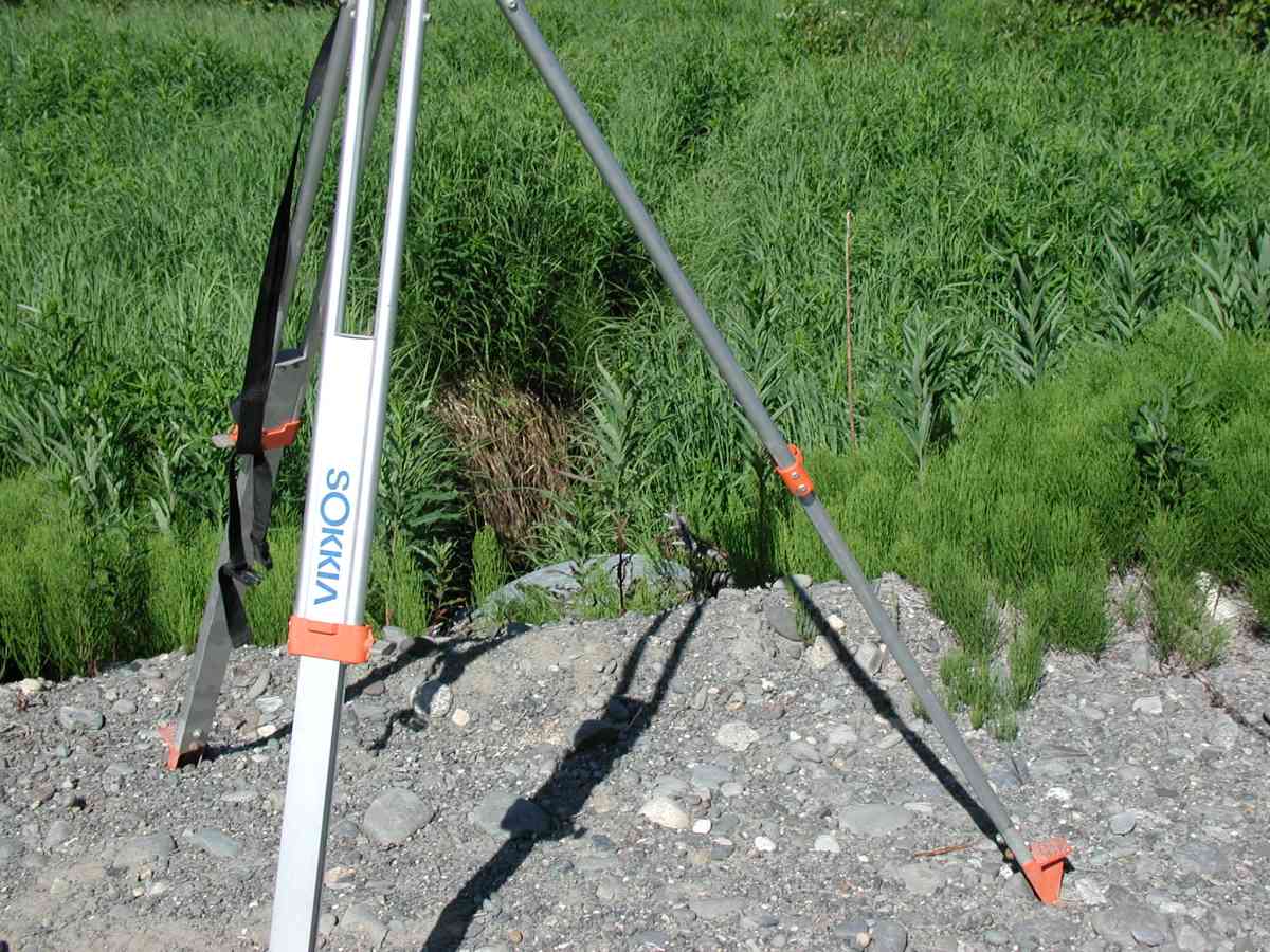
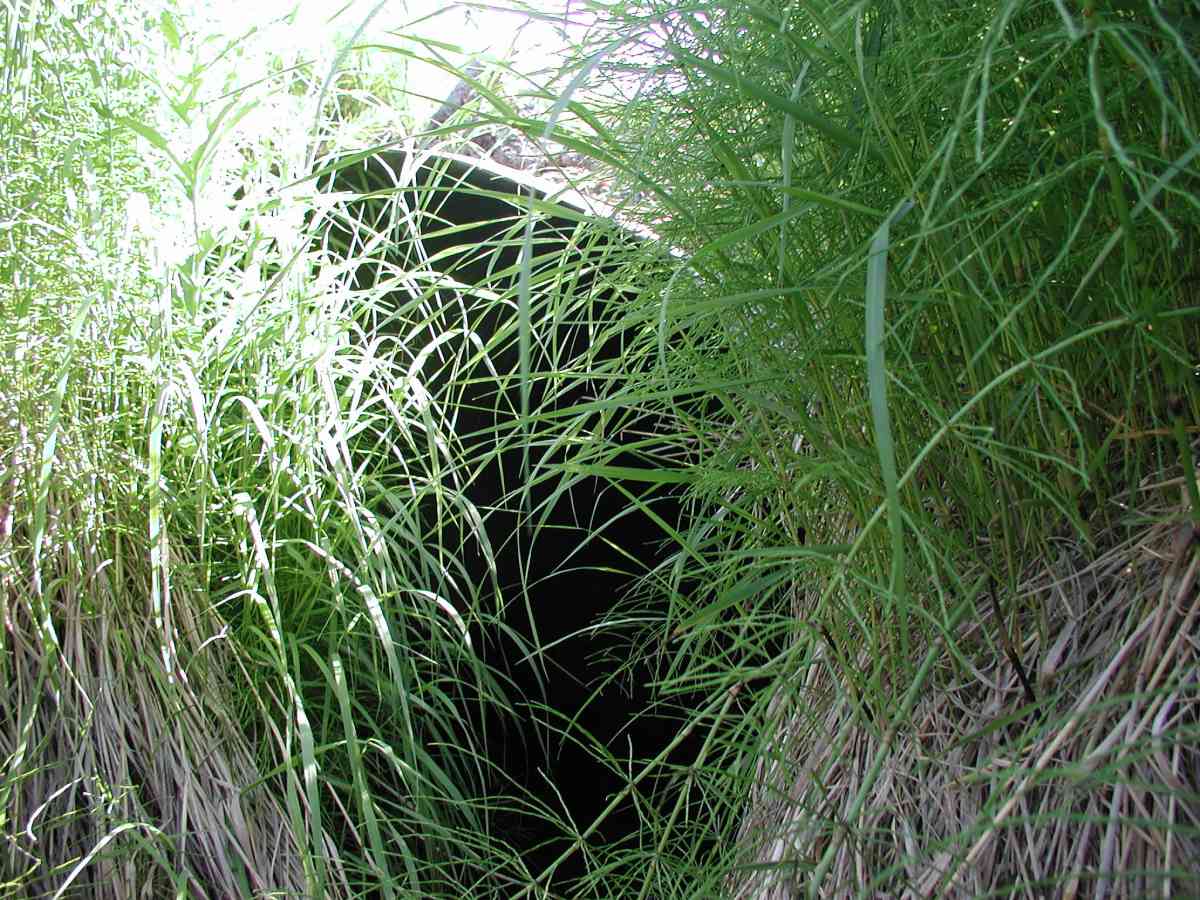
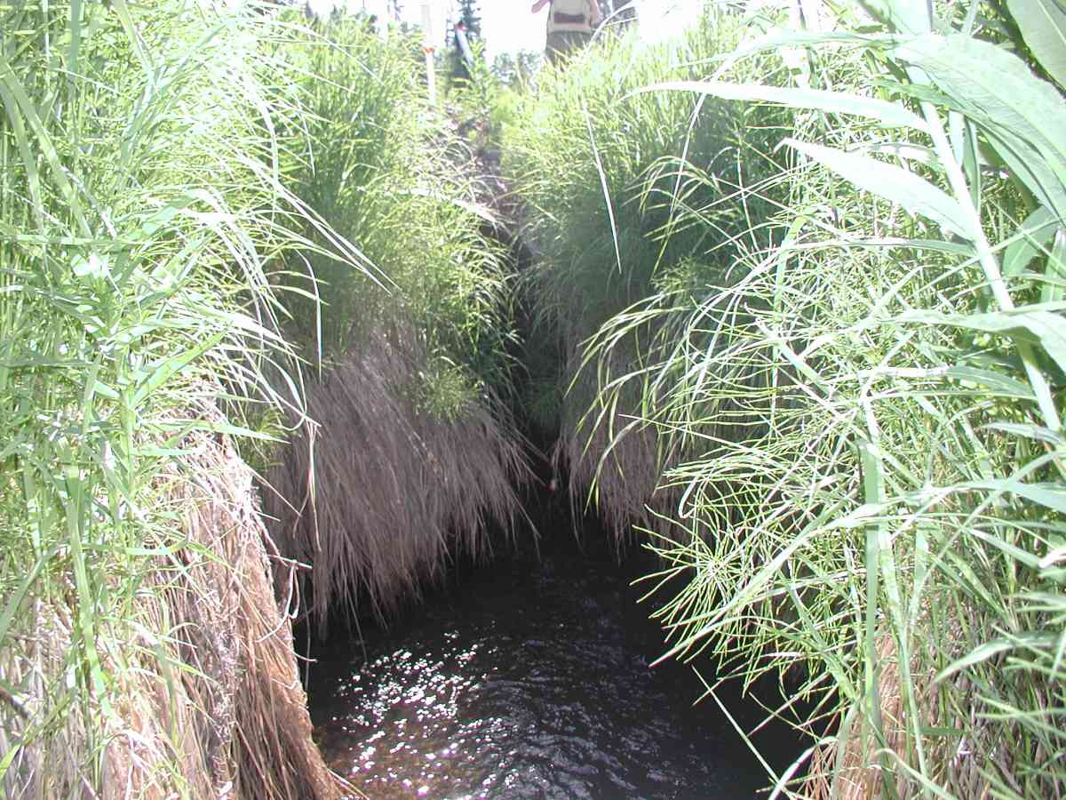
Site Comments: Location: Falls Creek Rd. Channel is narrow and overgrown with vegetation. Bank undercut ranged from 6-18”.
Survey KPC04-1A003
Observers: Mary King, Pam Russell
Overall Fish Passage Rating:
Tidal: No
Backwatered: No
Step Pools:
Construction Year:
Comments: Location: Falls Creek Rd. See data form for details. Stream: Channel is narrow and overgrown with vegetation. Bank undercut ranged from 6-18”. Flow through culvert appears natural, unaltered. Substrate appears unaltered and uniform, related to inside vs. outside pipe. Culvert: Benchmark is located on top of a survey monument mounted on rebar at outlet. Half arch has a log foundation (logs parallel to pipe with interior cross ties). Pipe condition = 4-5; minor deficiencies (rust and abrasion). Embedded-no.
Culvert Measurements
| ID: 1 | Structure Type: Open-bottom arch (Corrugated Metal) | Fish Passage Rating: | |||||||||||||||||||||||||||||||||||||||||
|
|
|
|||||||||||||||||||||||||||||||||||||||||
Comments: Culvert: Benchmark is located on top of a survey monument mounted on rebar at outlet. Half arch has a log foundation (logs parallel to pipe with interior cross ties). Pipe condition = 4-5; minor deficiencies (rust and abrasion). Embedded-no. |
|||||||||||||||||||||||||||||||||||||||||||
Stream Measurements
|
|
| Stream Width Type | Distance From Crossing (ft) |
Stream Width (ft) |
|---|---|---|
| Upstream bank full | 75.0 | 3.58 |
| Upstream bank full | 100.0 | 3.17 |
| Upstream bank full | 125.0 | 3.50 |
| Upstream bank full | 150.0 | 3.08 |
| Upstream bed width | 75.0 | 3.58 |
| Upstream bed width | 100.0 | 2.67 |
| Upstream bed width | 125.0 | 1.03 |
| Upstream bed width | 150.0 | 2.75 |
| Upstream ordinary high water | 75.0 | 3.58 |
| Upstream ordinary high water | 100.0 | 2.67 |
| Upstream ordinary high water | 125.0 | 1.03 |
| Upstream ordinary high water | 150.0 | 2.75 |
Elevations
| Locator ID | Culvert Number |
River Distance (ft)1 |
Distance From Crossing (ft)2 |
Relative Elevation (ft) |
|---|---|---|---|---|
| D/S Thalweg | 94.50 | |||
| D/S Tailcrest or 1st Thalweg | 94.79 | |||
| OHW Left Bank | 95.51 | |||
| U/S Thalweg | 1 | 96.00 | ||
| OHW Left Bank | 96.70 | |||
| Outlet Culvert Top (Scratched a line on the top of the outlet pipe.) | 1 | 100.00 | ||
| Max Pool Depth | 0.00 | 5.0 | 94.50 | |
| Outlet Invert | 1 | 5.00 | 0.0 | 95.43 |
| Road Elev (Road surface.) | 19.00 | 101.33 | ||
| Inlet Culvert Invert | 1 | 33.00 | 0.0 | 96.38 |
Notes:
- River distance is measured continuously throughout the survey reach along the thalweg of the stream.
- Measured from each end of the crossing along the thalweg of the stream.
Fish Sampling Efforts
No fish sampling occurred during this survey.
Fish Observations
No fish observations occurred during this survey.
Photos
Questions or comments about this report can be directed to dfg.dsf.webmaster@alaska.gov