Fish Passage Site 20300466
Coordinates (dec. deg.): 60.96211°, -149.13762°
Legal Description: S010N002E17
Region: South Central
Road Name: Alyeska Highway
Datum: NAD83
Quad Name / ITM: Seward D-6
AWC Stream #: 247-60-10250-2007
Stream Name: California Creek
Elevation:
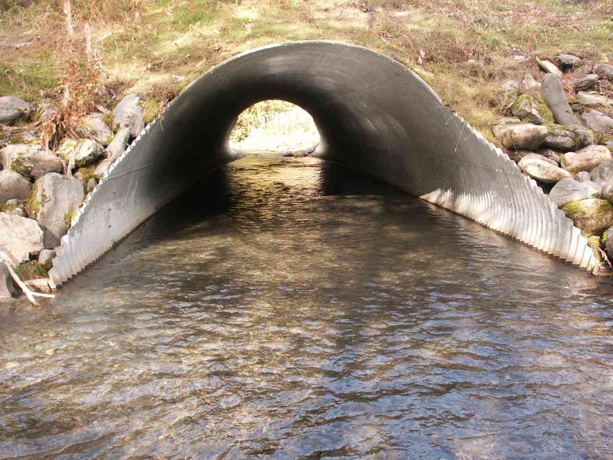
Site Comments: In 1992 DOT replaced the existing undersized culvert with a larger culvert that provided fish passage and could also handle flood flows. Boulders were placed in the stream upstream of the culvert to provide pool habitat for fish. The ste was hydroseeded after construction and willow budles were planted on the up and downstream banks in May 1993.
arrow to the right of the survey date below to choose a different report for this site.
Survey CRB02-Al328
Observers: Dean Beers, James Laurence, James Laurence
Overall Fish Passage Rating:
Tidal: No
Backwatered: No
Step Pools:
Construction Year:
Comments: None
Culvert Measurements
| ID: 1 | Structure Type: Pipe-arch (Corrugated Metal) | Fish Passage Rating: | |||||||||||||||||||||||||||||||||||||||||
|
|
|
|||||||||||||||||||||||||||||||||||||||||
Stream Measurements
|
|
| Stream Width Type | Distance From Crossing (ft) |
Stream Width (ft) |
|---|---|---|
| Upstream ordinary high water | 50.0 | 18.00 |
| Upstream ordinary high water | 75.0 | 19.00 |
| Upstream ordinary high water | 100.0 | 24.00 |
Elevations
| Locator ID | Culvert Number |
River Distance (ft)1 |
Distance From Crossing (ft)2 |
Relative Elevation (ft) |
|---|---|---|---|---|
| Outlet Thalweg | 1 | 0.00 | 0.0 | 79.12 |
| Outlet Invert | 1 | 0.00 | 0.0 | 89.19 |
| Inlet Culvert Invert | 1 | 101.00 | 0.0 | 90.89 |
| Inlet Thalweg | 1 | 101.00 | 0.0 | 79.09 |
Notes:
- River distance is measured continuously throughout the survey reach along the thalweg of the stream.
- Measured from each end of the crossing along the thalweg of the stream.
Fish Sampling Efforts
No fish sampling occurred during this survey.
Fish Observations
No fish observations occurred during this survey.
Photos


Questions or comments about this report can be directed to dfg.dsf.webmaster@alaska.gov