Fish Passage Site 20200929
Coordinates (dec. deg.): 59.24985°, -151.62725°
Legal Description: S011S014W03
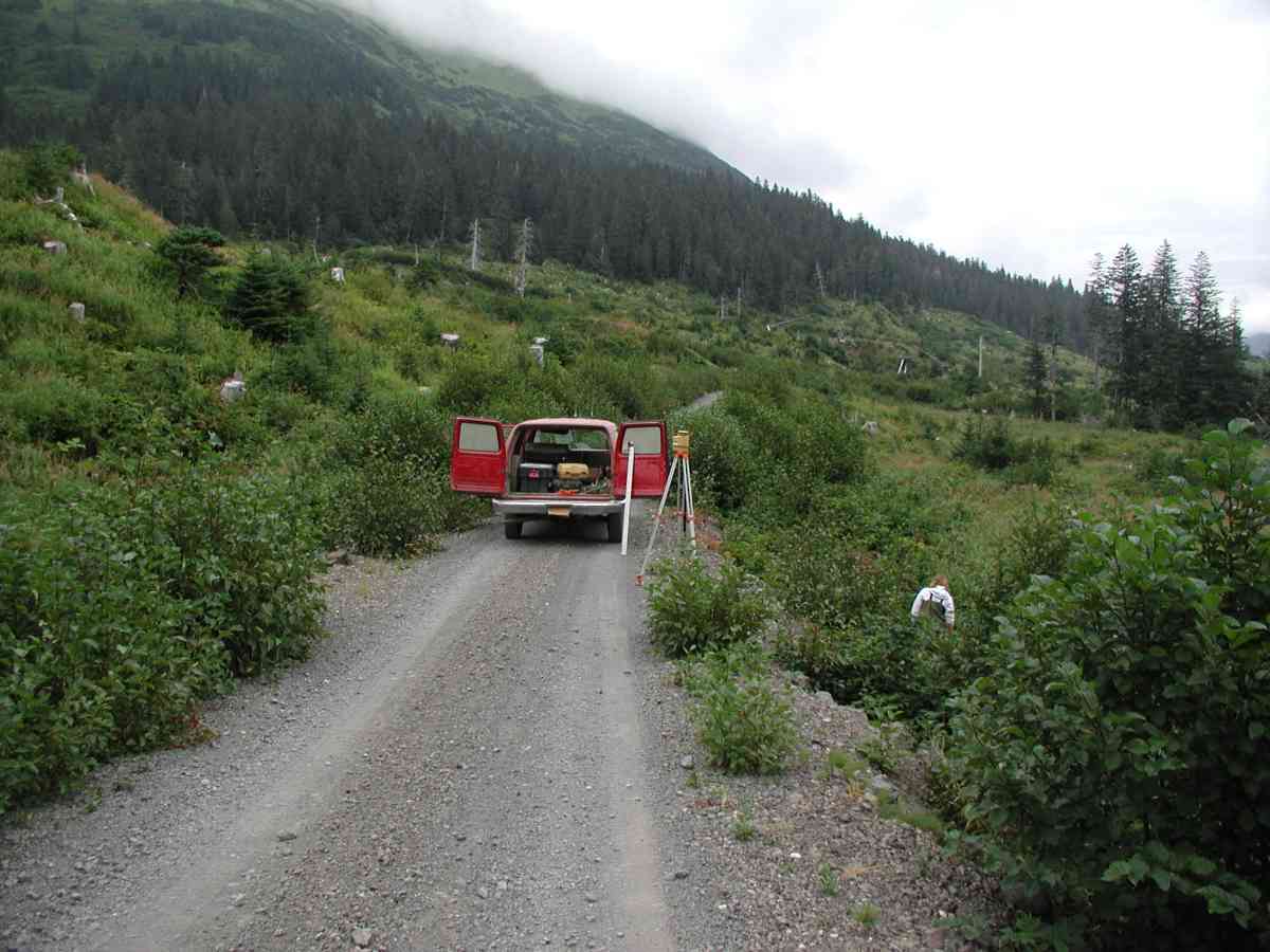
Region: South Central
Road Name: Port Graham
Datum: NAD83
Quad Name / ITM: Seldovia B-5
AWC Stream #:
Stream Name:
Elevation:
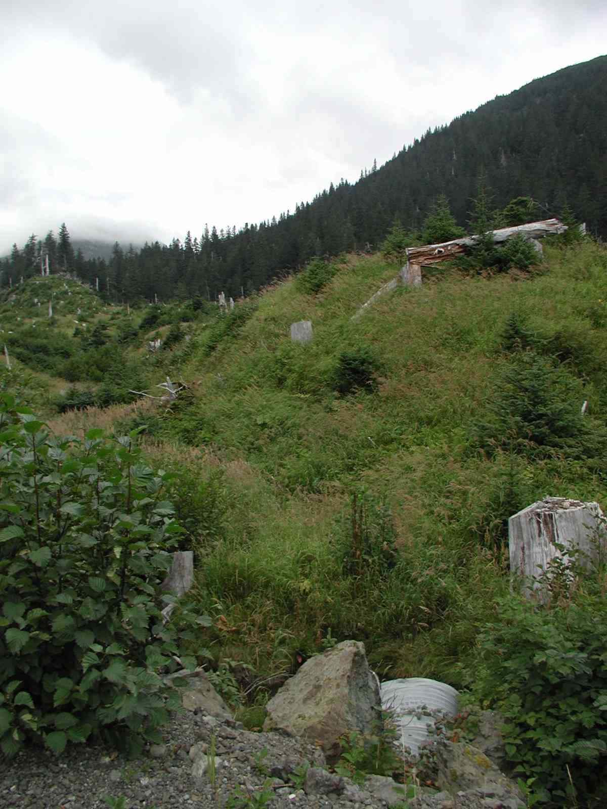
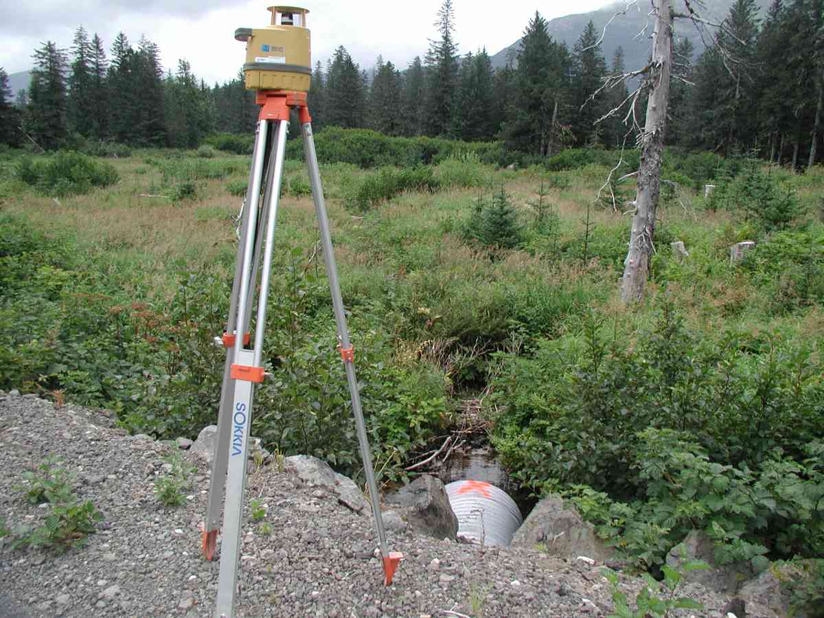
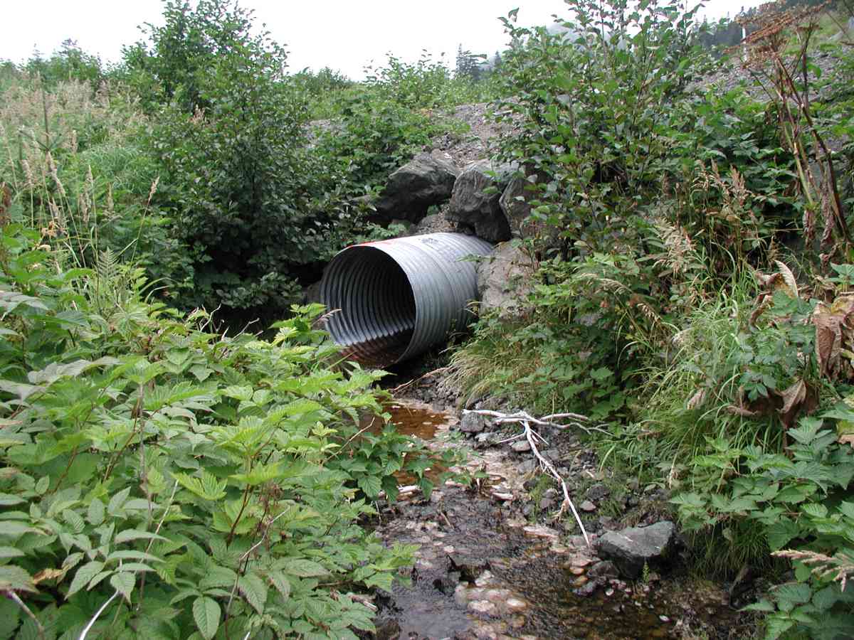
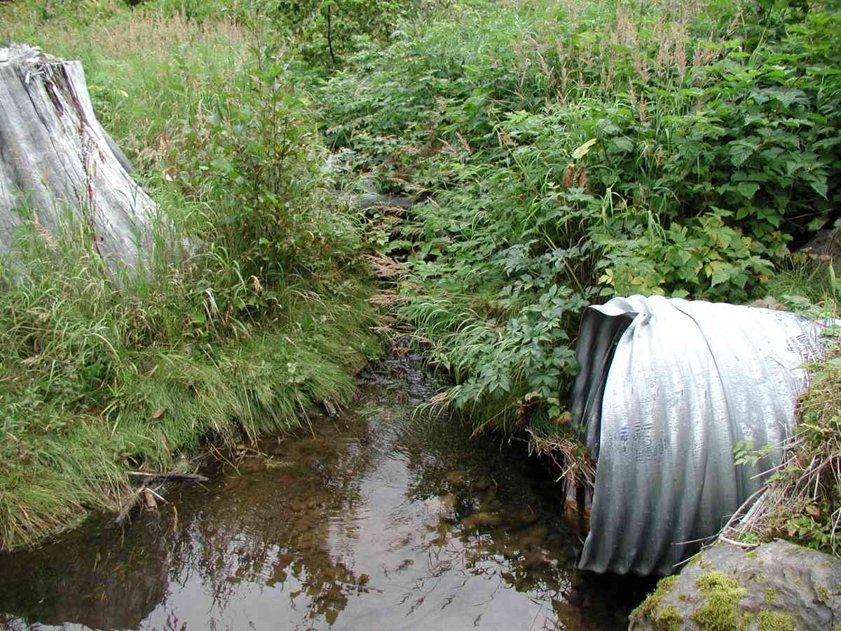
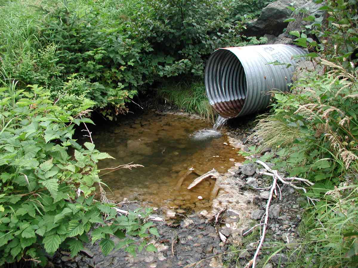
Site Comments: Location: Port Graham Stream: The inlet has 2 channels: left (facing upstream) is the primary. Substrate is gravel/pebble downstream and soft sediment with some gravel upstream. Streambank up and downstream is densely vegetated.
Survey KPC04-1A119
Observers: Mary King, Pam Russell
Overall Fish Passage Rating:
Tidal: No
Backwatered: No
Step Pools:
Construction Year:
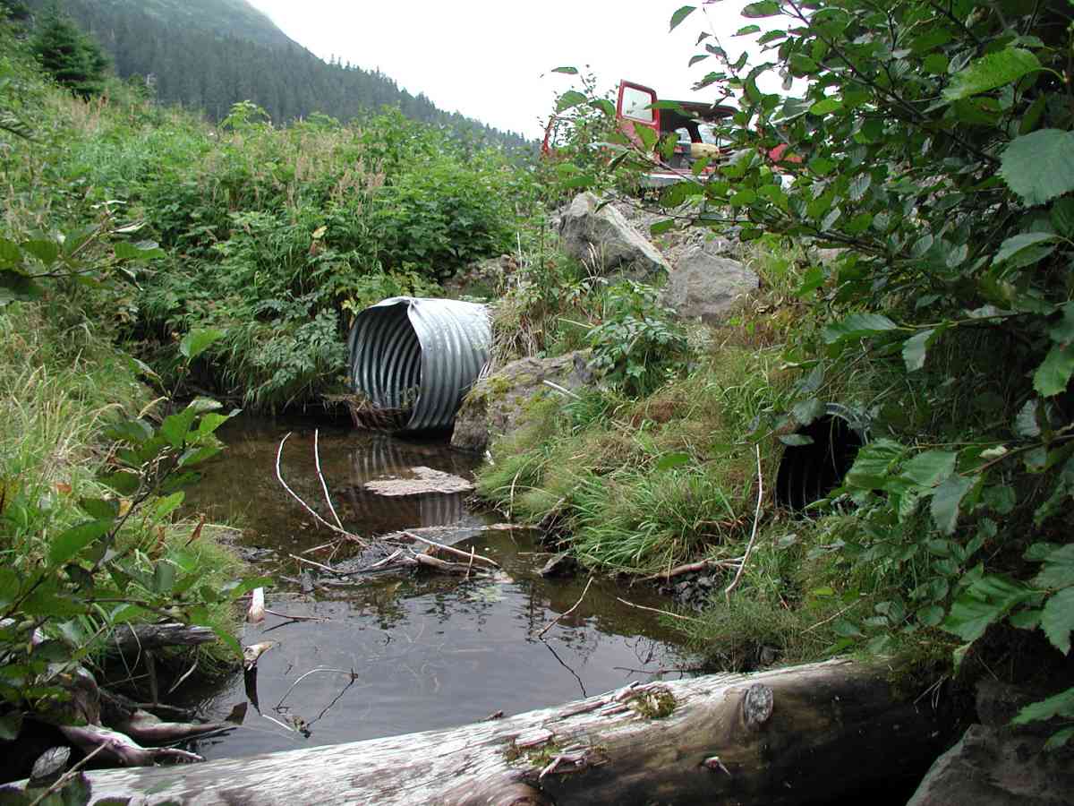
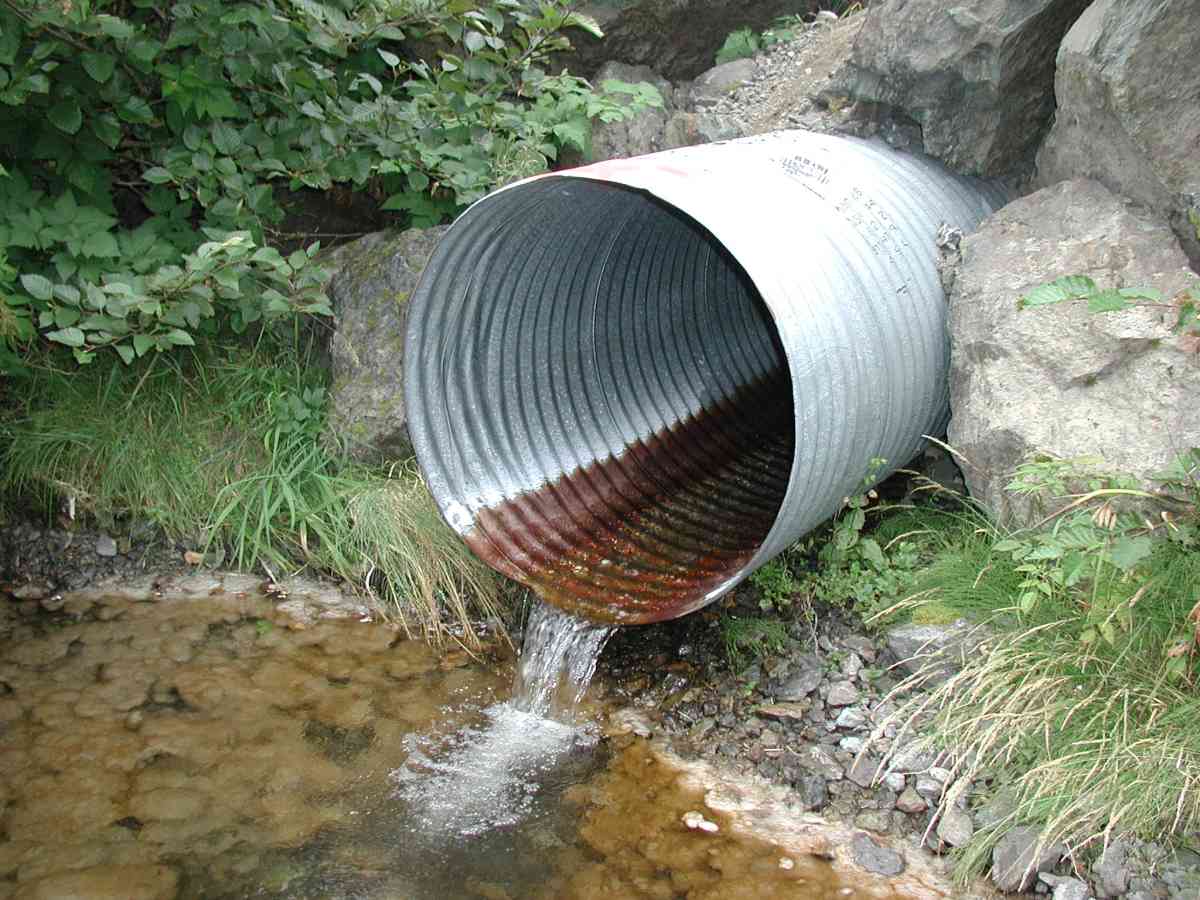
Comments: Location: Port Graham Stream: The inlet has 2 channels: left (facing upstream) is the primary. Substrate is gravel/pebble downstream and soft sediment with some gravel upstream. Streambank up and downstream is densely vegetated. Outlet has a large pool with much algal/fungal growth on the substrate. Flow measurements were done at 40' upstream (minimal flow).
Culvert Measurements
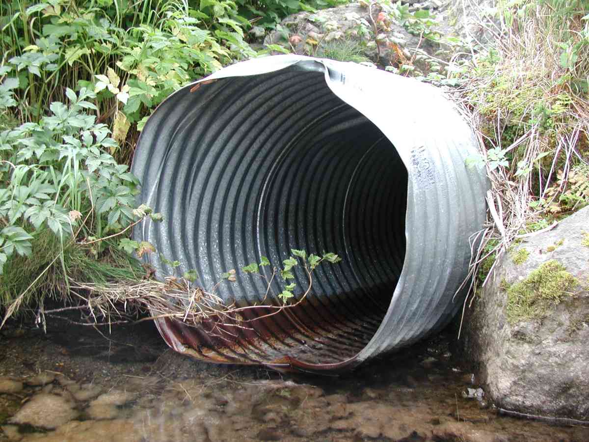
| ID: 1 | Structure Type: Circular pipe (Corrugated Metal) | Fish Passage Rating: | |||||||||||||||||||||||||||||||||||||||||
|
|
|
|||||||||||||||||||||||||||||||||||||||||
Comments: Culvert: Pipe is perched at outlet and nearly so at inlet. Pipe condition=4. Not embedded. |
|||||||||||||||||||||||||||||||||||||||||||
Stream Measurements
|
|
| Stream Width Type | Distance From Crossing (ft) |
Stream Width (ft) |
|---|---|---|
| Upstream bank full | 75.0 | 6.58 |
| Upstream bank full | 100.0 | 5.75 |
| Upstream bank full | 125.0 | 4.33 |
| Upstream bank full | 150.0 | 5.25 |
| Upstream bed width | 75.0 | 2.08 |
| Upstream bed width | 100.0 | 2.17 |
| Upstream bed width | 125.0 | 1.92 |
| Upstream bed width | 150.0 | 3.42 |
| Upstream ordinary high water | 75.0 | 5.67 |
| Upstream ordinary high water | 100.0 | 3.67 |
| Upstream ordinary high water | 125.0 | 3.33 |
| Upstream ordinary high water | 150.0 | 4.50 |
Elevations
| Locator ID | Culvert Number |
River Distance (ft)1 |
Distance From Crossing (ft)2 |
Relative Elevation (ft) |
|---|---|---|---|---|
| D/S Thalweg | 95.08 | |||
| D/S Tailcrest or 1st Thalweg | 96.25 | |||
| OHW Left Bank | 96.37 | |||
| OHW Left Bank | 96.84 | |||
| U/S Thalweg | 1 | 99.65 | ||
| Outlet Culvert Top (Orange painted "X" on top of outlet; measured on 1st corrugation.) | 1 | 100.00 | ||
| Max Pool Depth | 0.00 | 5.0 | 95.08 | |
| Outlet Invert | 1 | 5.00 | 0.0 | 96.88 |
| Road Elev (Road surface.) | 25.00 | 104.82 | ||
| Inlet Culvert Invert | 1 | 45.00 | 0.0 | 99.80 |
Notes:
- River distance is measured continuously throughout the survey reach along the thalweg of the stream.
- Measured from each end of the crossing along the thalweg of the stream.
Fish Sampling Efforts
No fish sampling occurred during this survey.
Fish Observations
No fish observations occurred during this survey.
Photos
Questions or comments about this report can be directed to dfg.dsf.webmaster@alaska.gov