Fish Inventory Site FSNPR1604C06
Coordinates (dec. deg.): 69.32316°, -150.39296°
Legal Description: U001S007E26
Region: Arctic
Datum: WGS84
Quad Name / ITM: Umiat B-1
AWC Stream #:
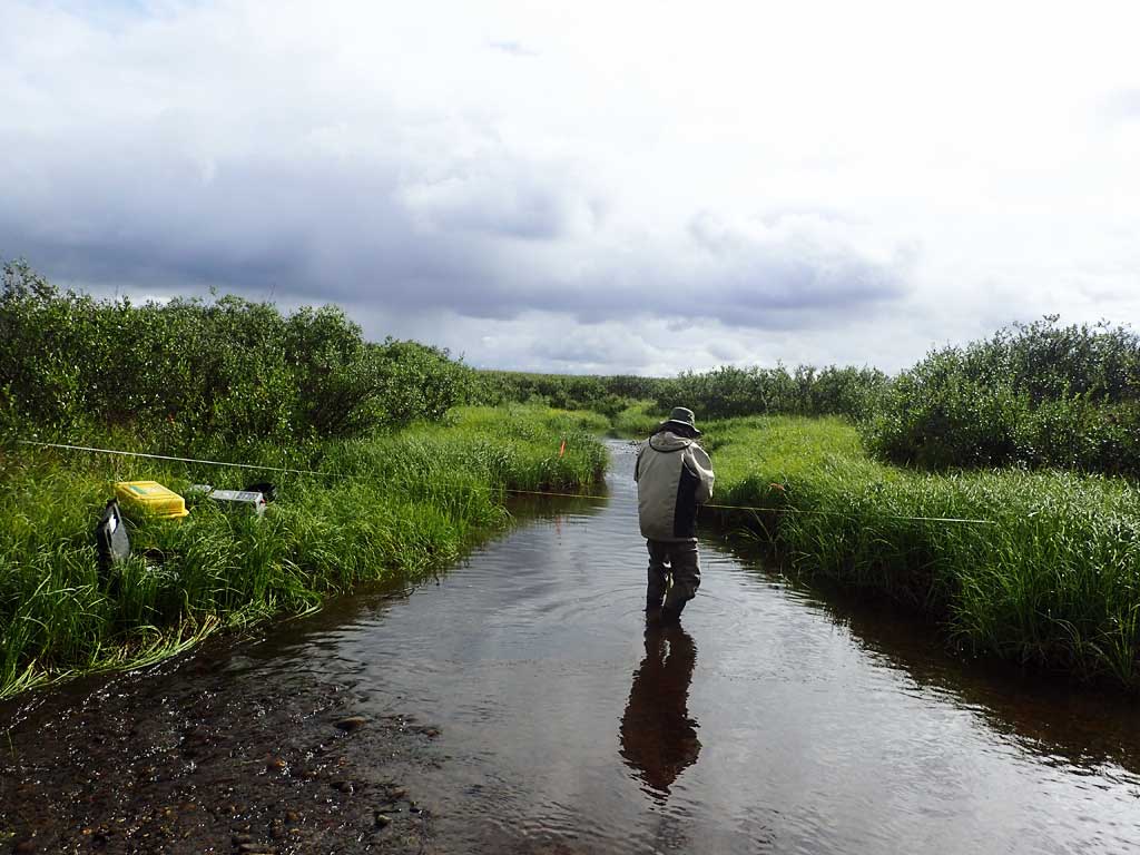
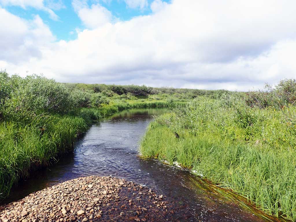
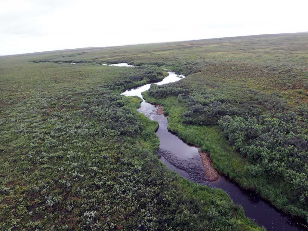
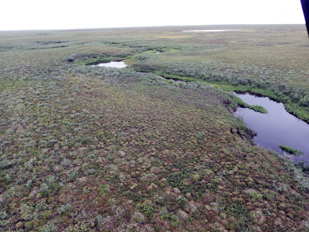
Stream Name: Unnamed stream
Elevation:
Site Comments: H59 Kupuruk River downstream
Survey FSNPR16-04C06
Observers: Raye Ann Neustel, J Johnson
Station Characteristics
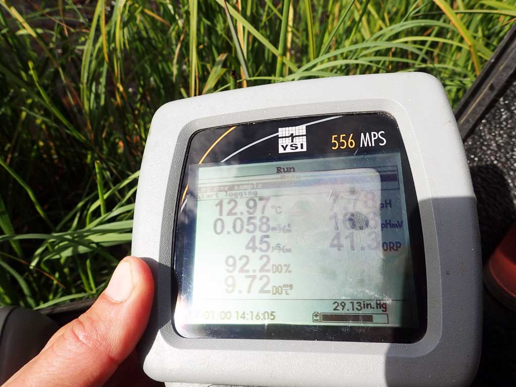
| Water Temperature: 12.97° C DO: 9.72 ppm | Conductivity: 45.0 μS/cm | Stream Stage: Low | |||||||||
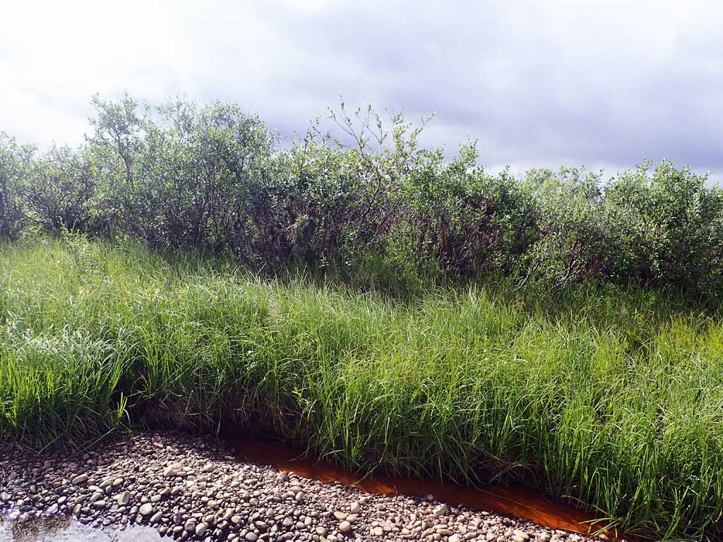
| Water Color: Humic | Turbidity: 4.36 NTU / pH: 7.78 | Stream Gradient: 1.5% | |||||||||
| Qualitative Velocity: | 48 hr. Precipitation/Runoff: Moderate | ||||||||||
| Substrates: Gravel, Cobble, Organic | |||||||||||
Channel Dimensions:
|
Rosgen Channel Classification: (C4) Low gradient, meandering, point-bar, riffle/pool, alluvial channels with broad, well-defined floodplains. | ||||||||||
| Visit Comments: None | |||||||||||
Vegetation Classification
| Left Bank | Right Bank | ||
|---|---|---|---|
| Distance From OHW(m) |
0-5 | Fresh Sedge Marsh | Fresh Sedge Marsh |
| 5-10 | Closed Tall Willow Shrub | Closed Tall Willow Shrub | |
| 10-20 | Tussock Tundra | Tussock Tundra | |
| 20-30 | Tussock Tundra | Tussock Tundra | |
Fish Sampling Effort
| Gear Type: Smith-Root LR-24 (A) | ||
| Channel Type: Main Channel (>50% of water flow) | ||
| Gear Type: Minnow Trap (B) | ||
| Channel Type: Main Channel (>50% of water flow) | ||
| Gear Type: Visual Observation, Ground (C) | ||
| Channel Type: Main Channel (>50% of water flow) | ||
Fish Observations
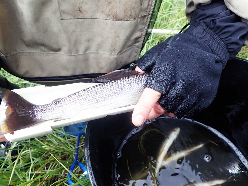
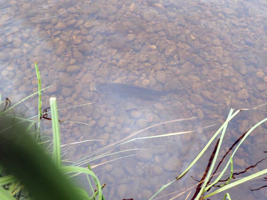
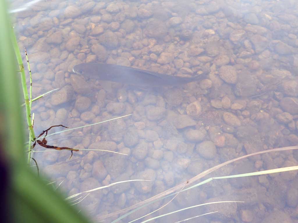
| Species: juvenile/adult Arctic grayling | Life History: Resident | ||
| Total Fish Observed: 3 | Fish Measured: 3 | Passage Barrier: | |
| Fork Lengths (mm) Min: 44 Max: 49 Mean: 46 | |||
| Collected/Observed by Gear Type: Minnow Trap (3) | |||
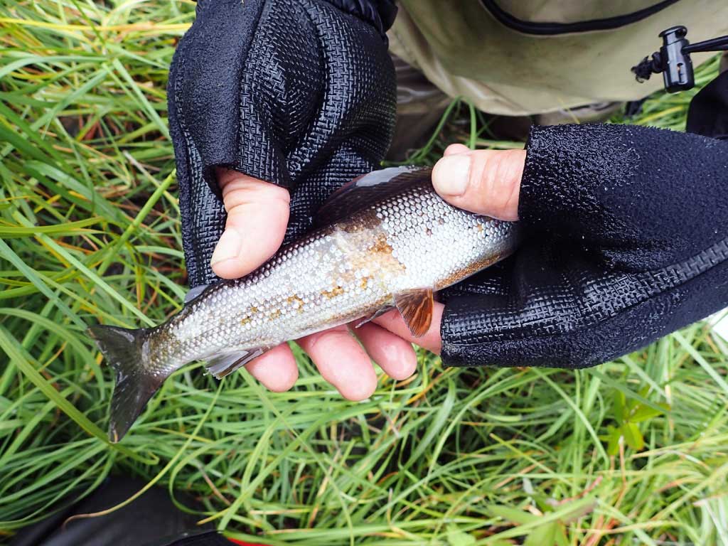
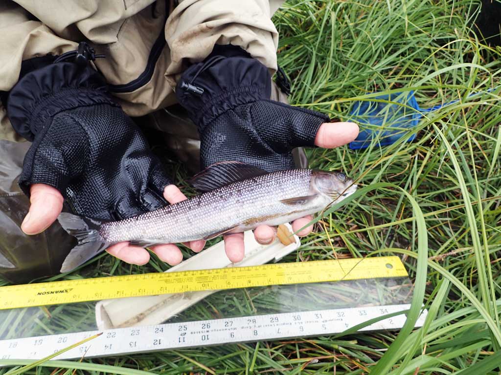
| Species: juvenile/adult Arctic grayling | Life History: Resident | ||
| Total Fish Observed: 10 | Fish Measured: 8 | Passage Barrier: | |
| Fork Lengths (mm) Min: 118 Max: 265 Mean: 198 | |||
| Collected/Observed by Gear Type: Minnow Trap (8) Visual Observation, Ground (2) | |||
Photos

Questions or comments about this report can be directed to dfg.dsf.webmaster@alaska.gov