Fish Passage Site 30303083
Coordinates (dec. deg.): 59.03064°, -158.53572°
Legal Description: S013S056W24
Region: Southwest
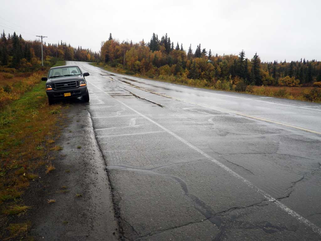
Road Name: Kanakanak Road
Datum: NAD83
Quad Name / ITM: Dillingham A-7
AWC Stream #: 325-30-10100-2019
Stream Name: Unnamed
Elevation:
Site Comments: None
arrow to the right of the survey date below to choose a different report for this site.
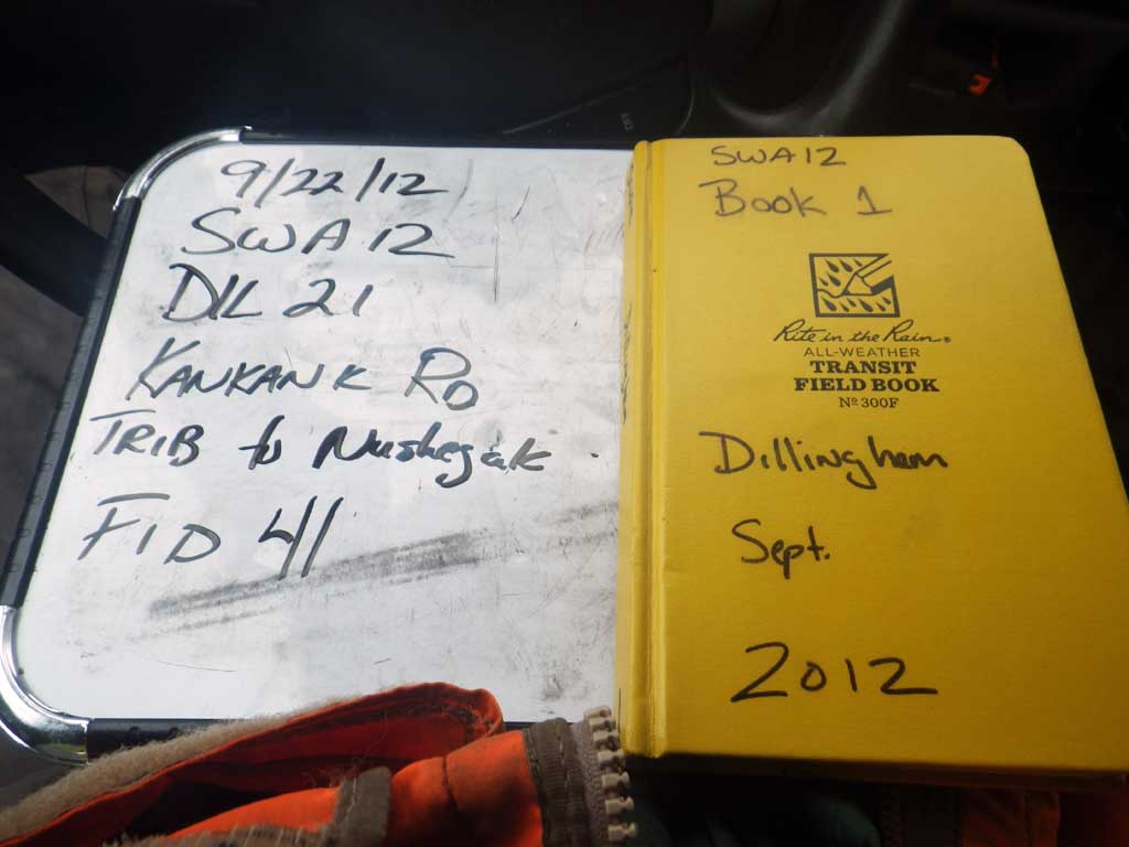
Survey SWA12-DIL21
Project Supervisor: Gillian O'Doherty, Alaska Department of Fish and Game
— Anchorage, AK
Observers: Gillian O'Doherty, Mark Eisenman
Overall Fish Passage Rating:
Tidal: No
Backwatered: Yes
Step Pools: No
Construction Year:
Site Observations:
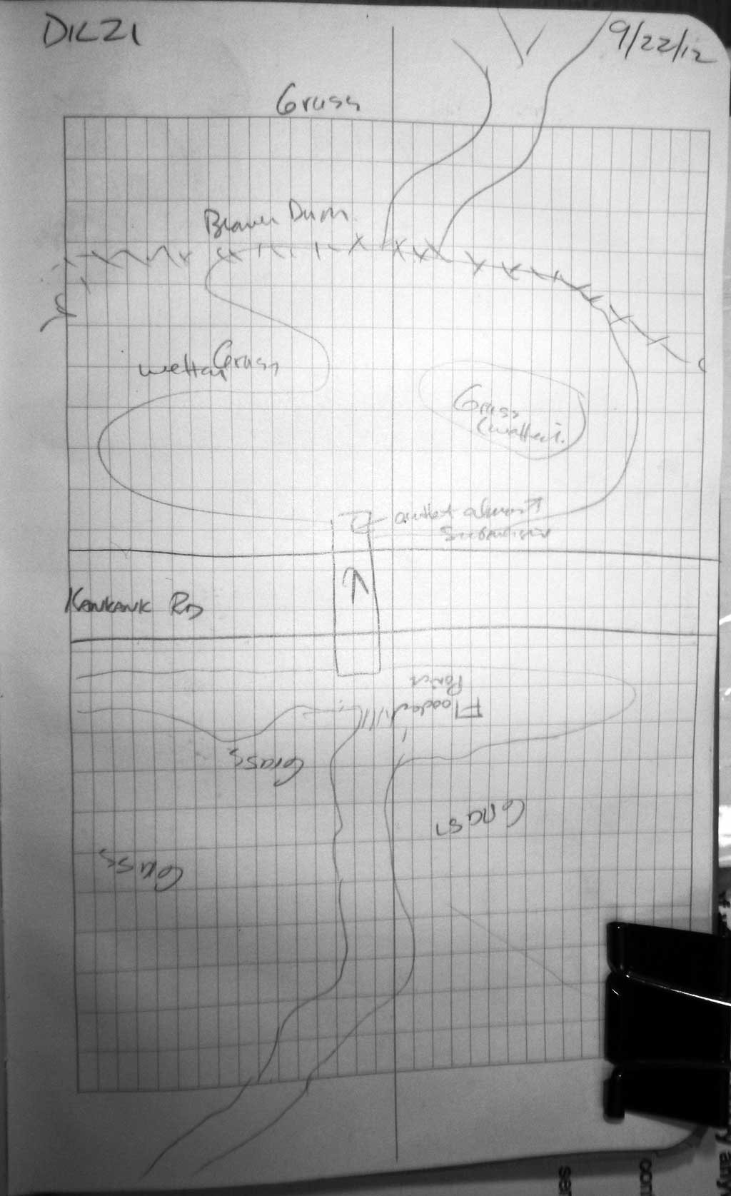
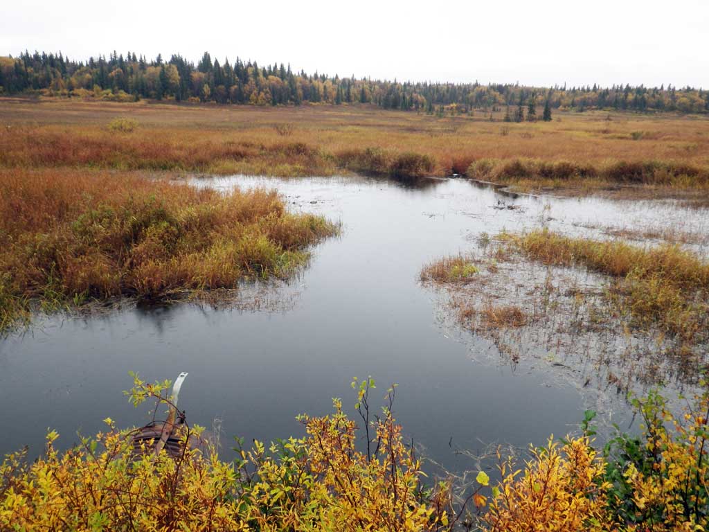
- Beaver Activity
- Hydraulic flows exceeded capacity
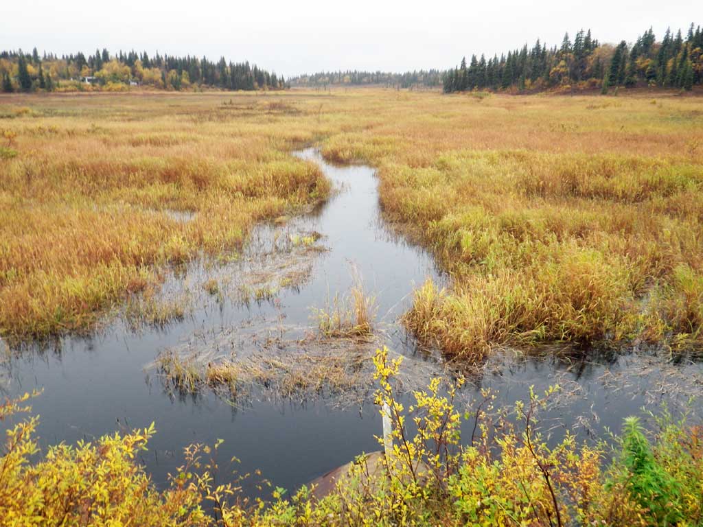
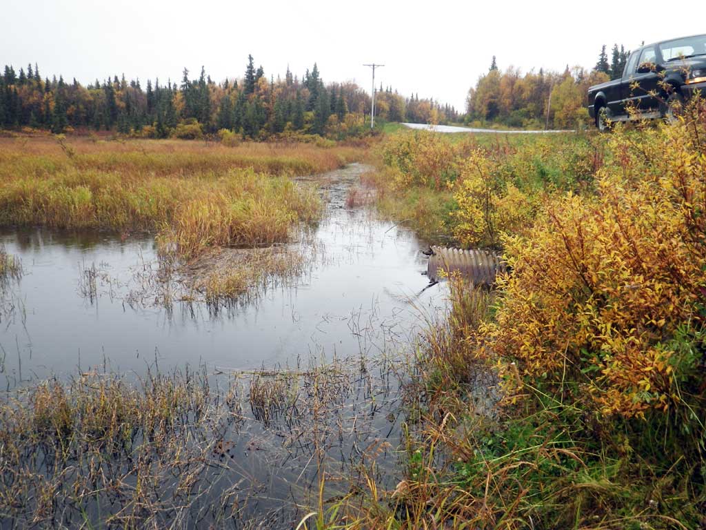
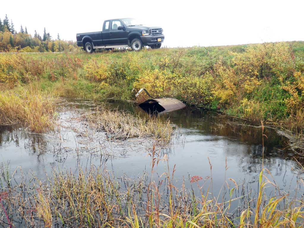
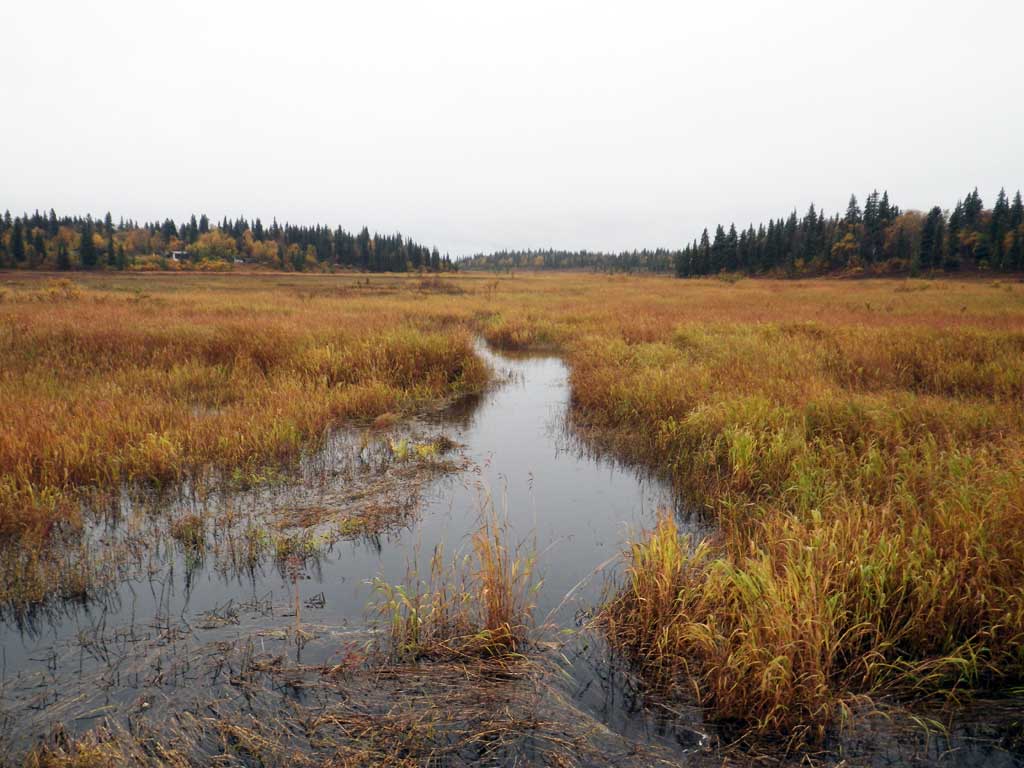
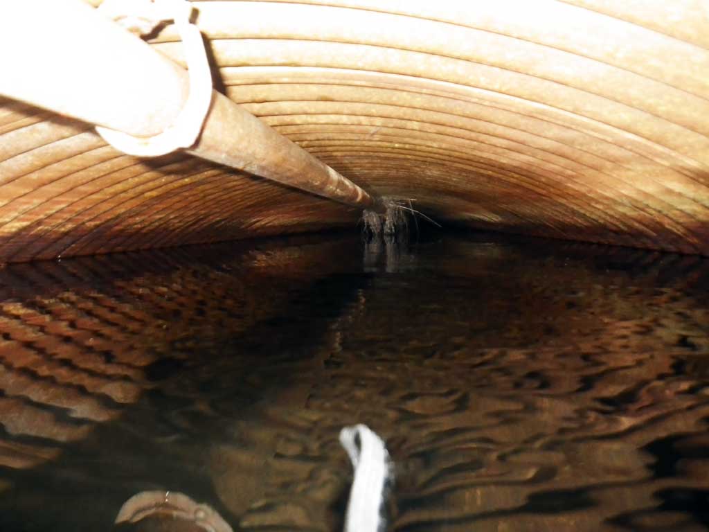
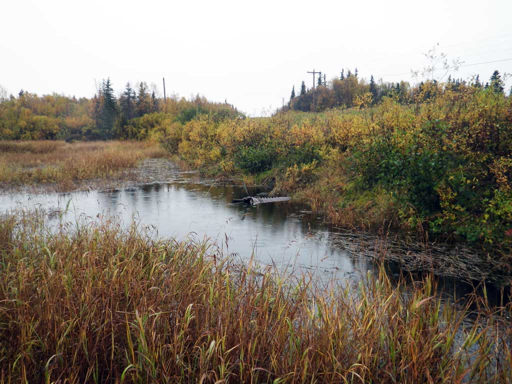
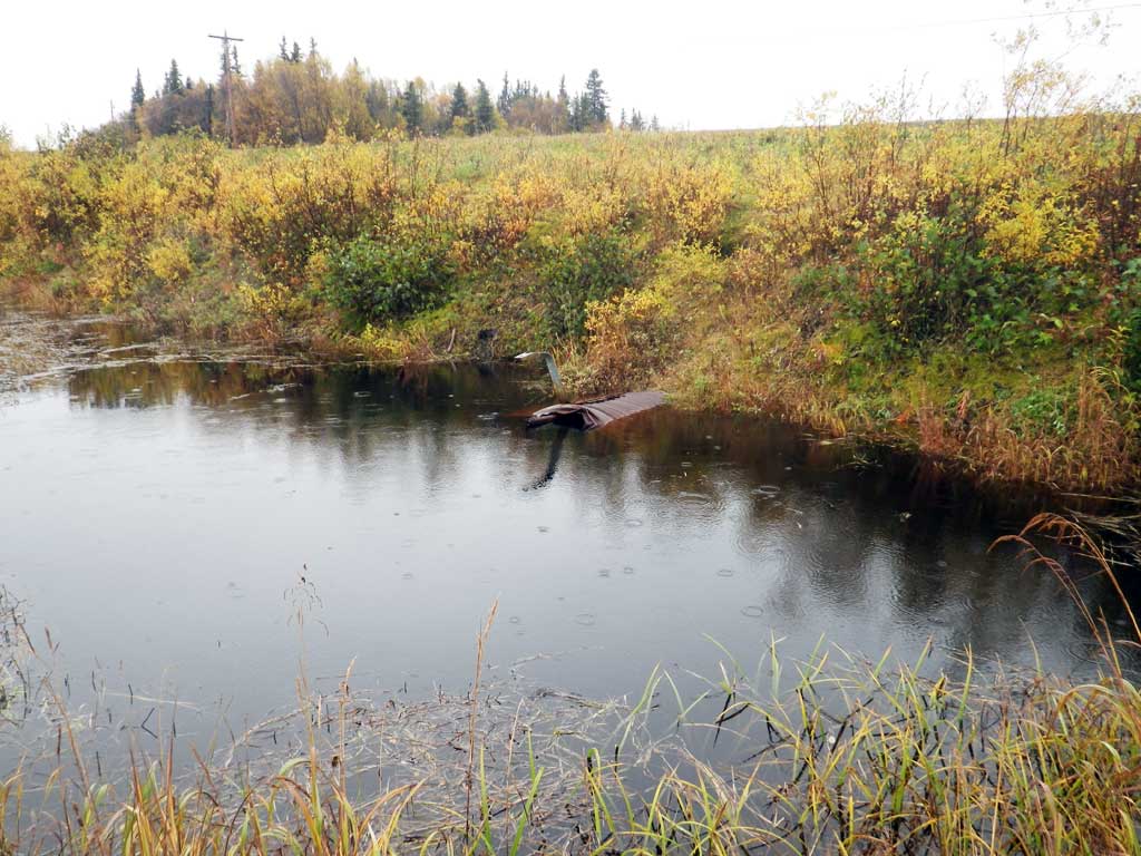
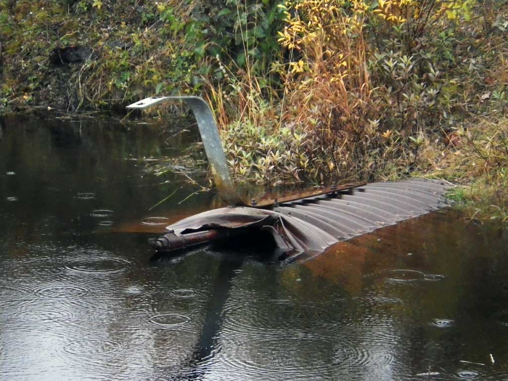
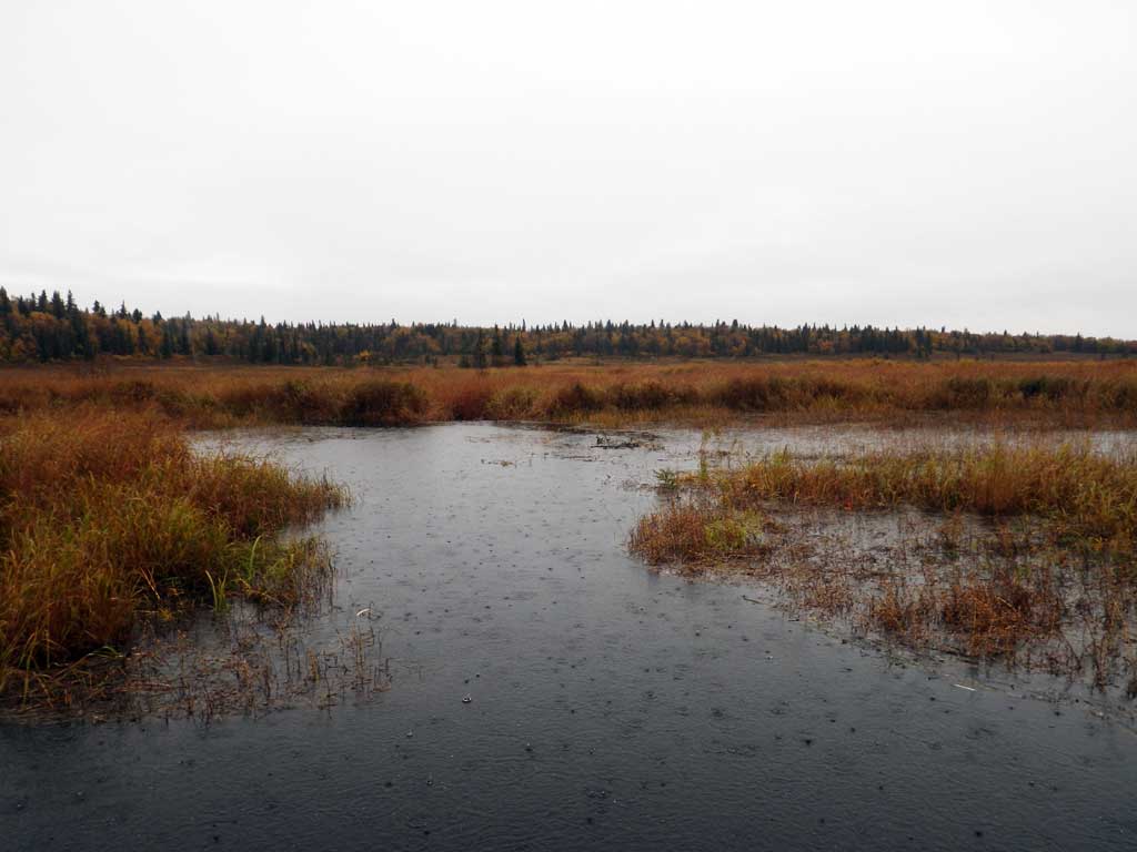
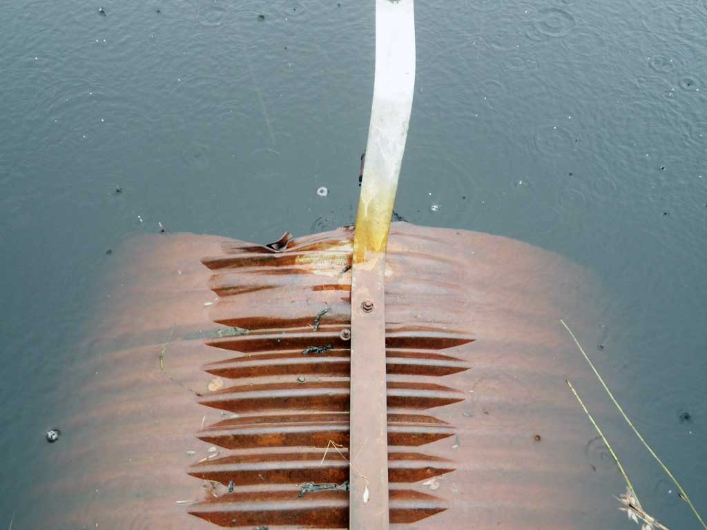
Comments: Backwatered so green. Pipe is submerged. Pipe is 5 or 6 feet in diameter and approximately 6 inches underwater, so all measurements are approximate. Beaver dam downstream is backwatering the pipe and several upstream channels. Outlet full to top. Downstream channel approximately 7 feet wide and 5 feet deep, but water is high.
Culvert Measurements
| ID: 1 | Structure Type: Circular pipe (Corrugated steel) | Fish Passage Rating: | |||||||||||||||||||||||||||||||||||||||||
|
|
|
|||||||||||||||||||||||||||||||||||||||||
Comments: Measurements approximate as pipe submerged at outlet and nearly submerged at inlet. |
|||||||||||||||||||||||||||||||||||||||||||
Culvert Observations:
|
|||||||||||||||||||||||||||||||||||||||||||
Stream Measurements
|
|
No stream width data available.
Elevations
| Locator ID | Culvert Number |
River Distance (ft)1 |
Distance From Crossing (ft)2 |
Relative Elevation (ft) |
|---|---|---|---|---|
| D/S Water Surface Elev (at outlet) | 92.98 | |||
| U/S Water Surface Elev (at inlet) | 92.99 |
Notes:
- River distance is measured continuously throughout the survey reach along the thalweg of the stream.
- Measured from each end of the crossing along the thalweg of the stream.
Fish Sampling Efforts
| Gear Type: Visual Observation, Ground (A) | ||
| Comments: No traps set, no fish observed. | ||
Fish Observations
No fish observations occurred during this survey.
Photos
Questions or comments about this report can be directed to dfg.dsf.webmaster@alaska.gov