Fish Passage Site 30303080
Coordinates (dec. deg.): 59.04218°, -158.48170°
Legal Description: S013S055W20
Region: Southwest
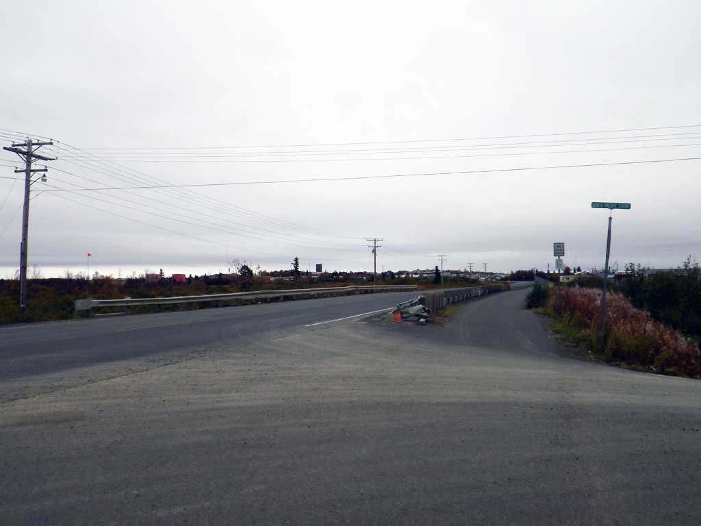
Road Name: Kanakanak Road
Datum: NAD83
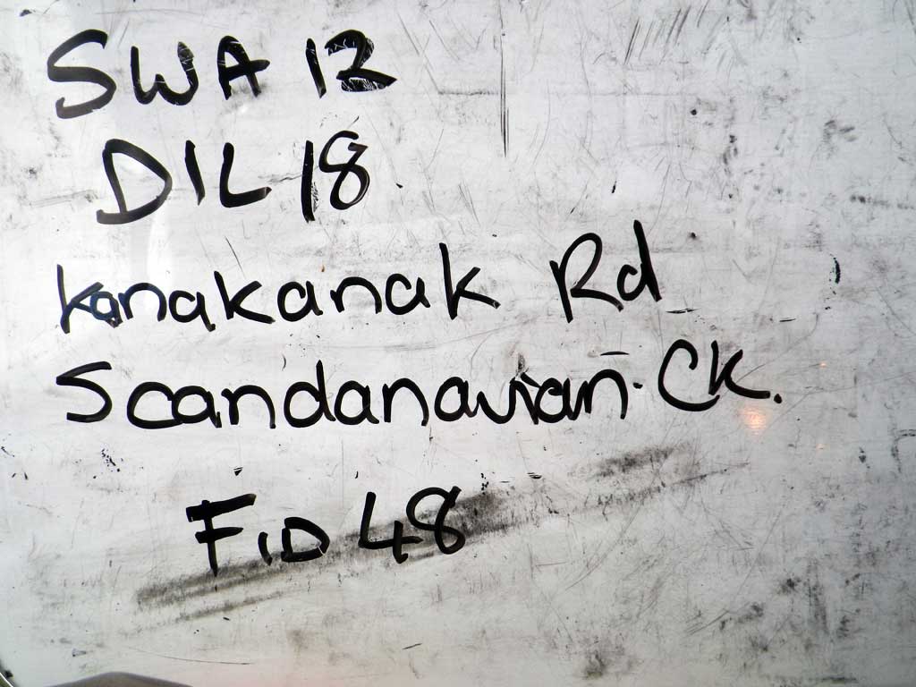
Quad Name / ITM: Dillingham A-7
AWC Stream #: 325-30-10100-2025
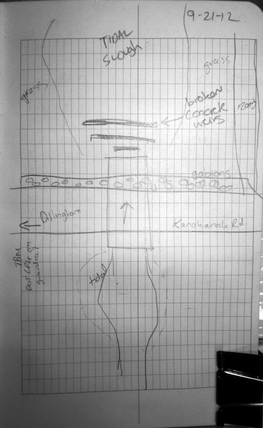
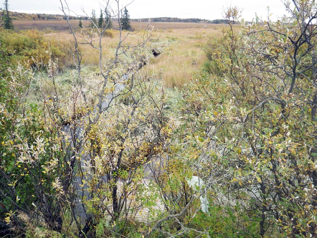
Stream Name: Scandinavian Creek
Elevation:
Site Comments: None
arrow to the right of the survey date below to choose a different report for this site.
Survey SWA12-DIL18
Project Supervisor: Gillian O'Doherty, Alaska Department of Fish and Game
— Anchorage, AK
Observers: Gillian O'Doherty, Mark Eisenman
Overall Fish Passage Rating:
Tidal: Yes
Backwatered: No
Step Pools: No
Construction Year:
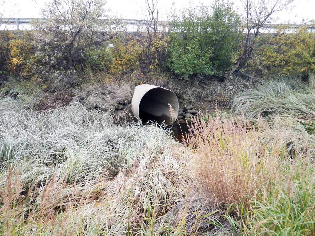
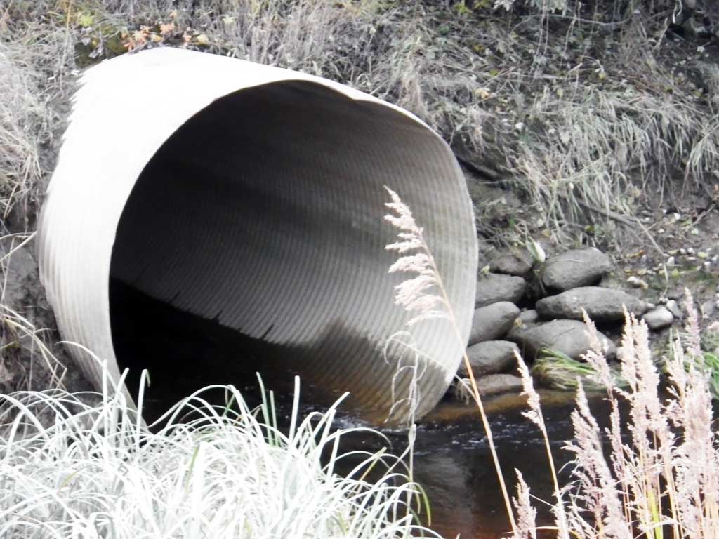
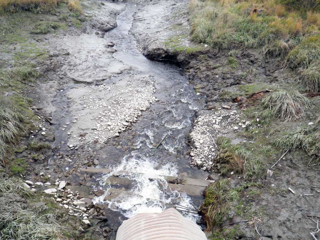
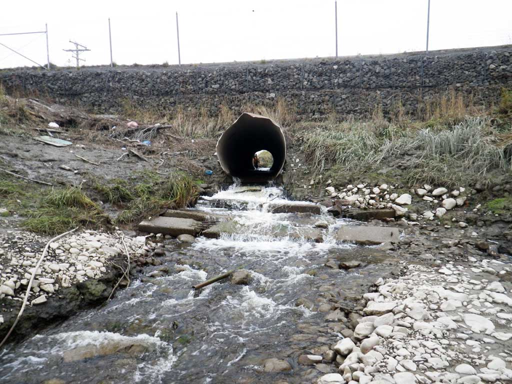
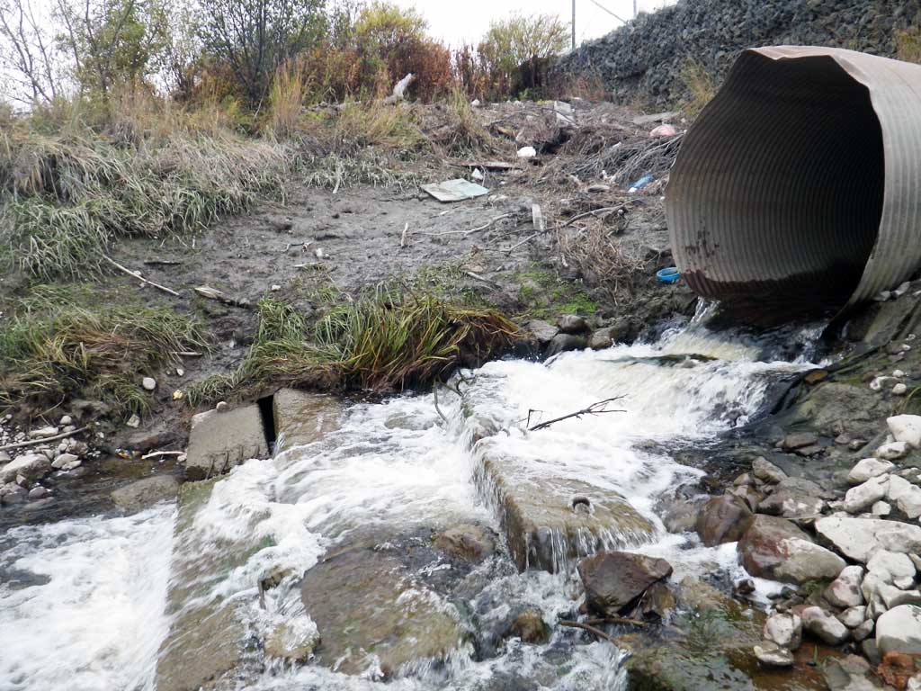
Comments: Tidal. At low tide culver outlet free falls onto concret slab steps. Pipe is completely rusted and becomes almost completely inundated at high tide. Inlet bottom mostly rusted away.
Culvert Measurements
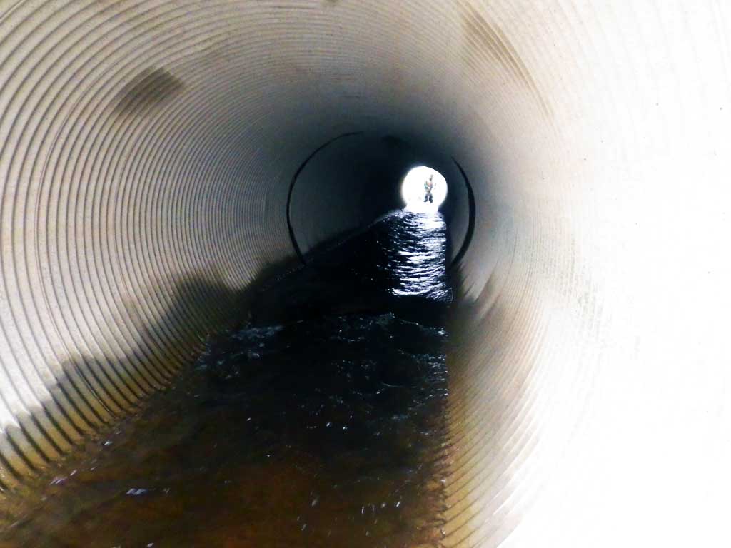
| ID: 1 | Structure Type: Circular pipe (Corrugated steel) | Fish Passage Rating: | |||||||||||||||||||||||||||||||||||||||||
|
|
|
|||||||||||||||||||||||||||||||||||||||||
Comments: Outfall is freefall onto concrete slab. Entered free fall onto rip rap as this is closest. No outfall height because pipe is tidal. |
|||||||||||||||||||||||||||||||||||||||||||
Stream Measurements
|
|
| Stream Width Type | Distance From Crossing (ft) |
Stream Width (ft) |
|---|---|---|
| Upstream ordinary high water | 124.0 | 6.00 |
| Upstream ordinary high water | 167.0 | 3.00 |
| Upstream ordinary high water | 190.0 | 5.00 |
Elevations
| Locator ID | Culvert Number |
River Distance (ft)1 |
Distance From Crossing (ft)2 |
Relative Elevation (ft) |
|---|---|---|---|---|
| Road Elev (on bike path) | 26.73 | |||
| D/S Grade Ctrl (Thalweg) (channel below concrete weir) | 0.00 | 7.12 | ||
| D/S Water Surface Elev | 0.00 | 8.06 | ||
| Outlet Invert (on metal pipe) | 16.00 | 10.89 | ||
| D/S Water Surface Elev | 16.00 | 11.54 | ||
| Outlet Culvert Top (just behind bent part) | 16.50 | 17.37 | ||
| Inlet Culvert Top (high tide line = about top of pipe) | 110.20 | 18.42 | ||
| Inlet Culvert Invert (on concrete footer, pipe rusted) | 110.20 | 11.76 | ||
| U/S Water Surface Elev | 110.20 | 12.90 | ||
| U/S Water Surface Elev | 120.20 | 12.87 | ||
| U/S Grade Ctrl (Thalweg) | 120.20 | 11.65 |
Notes:
- River distance is measured continuously throughout the survey reach along the thalweg of the stream.
- Measured from each end of the crossing along the thalweg of the stream.
Fish Sampling Efforts
| Gear Type: Visual Observation, Ground (A) | ||
| Comments: No traps set, no fish observed. | ||
Fish Observations
No fish observations occurred during this survey.
Photos
Questions or comments about this report can be directed to dfg.dsf.webmaster@alaska.gov