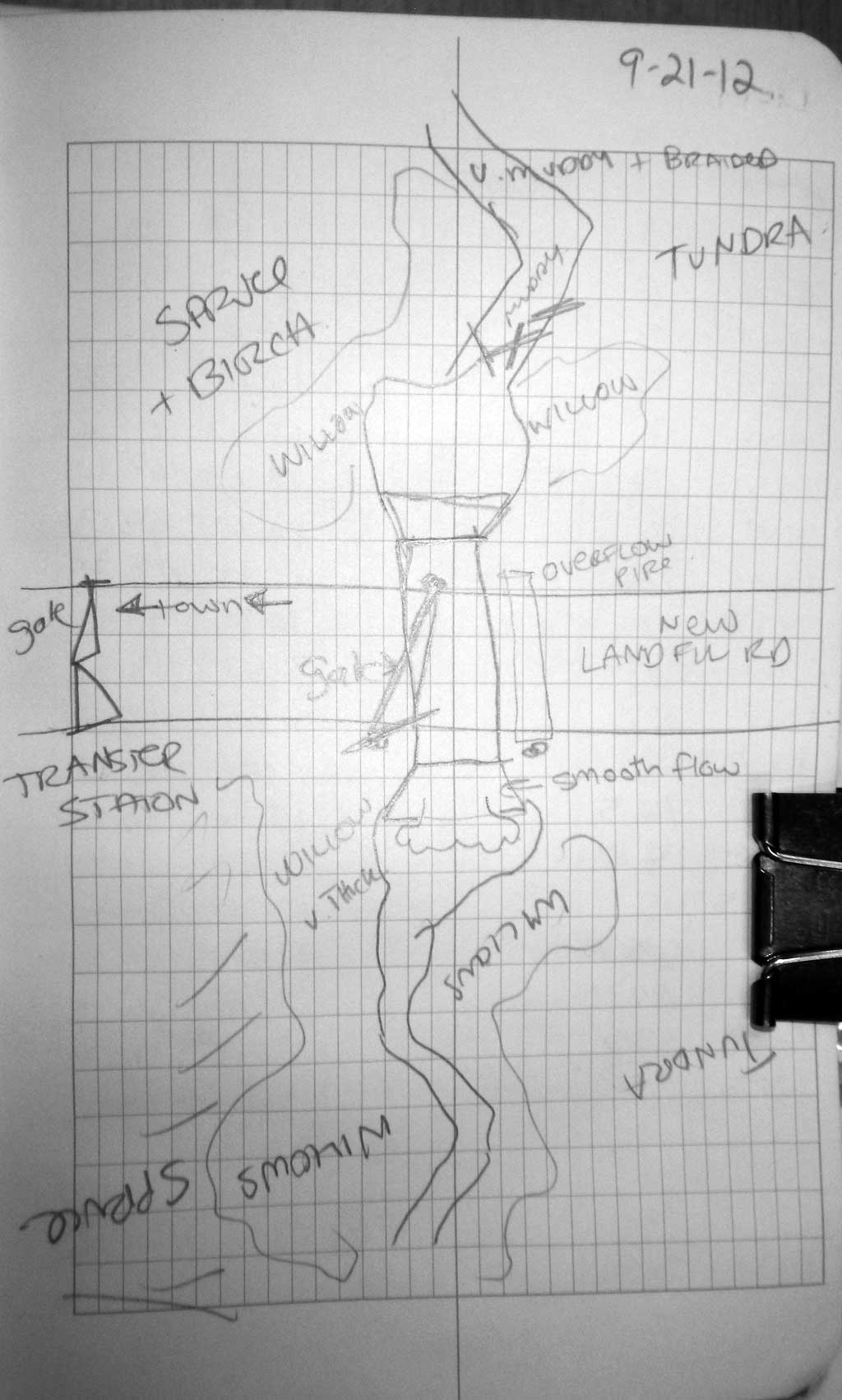
Fish Passage Site 30303079
Coordinates (dec. deg.): 59.09062°, -158.56815°
Legal Description: S012S055W32
Region: Southwest
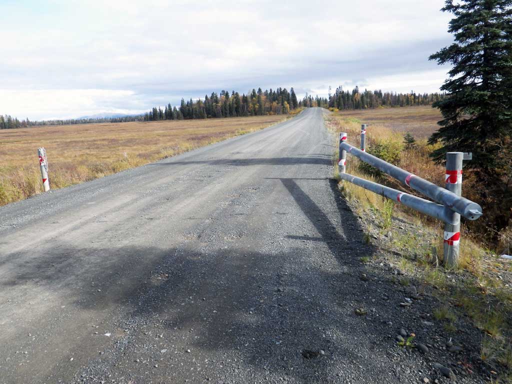
Road Name: New Landfill Road
Datum: NAD83
Quad Name / ITM: Dillingham A-7
AWC Stream #:
Stream Name: Wood River tributary
Elevation:
Site Comments: None
Survey SWA12-DIL17
Project Supervisor: Gillian O'Doherty, Alaska Department of Fish and Game
— Anchorage, AK
Observers: Gillian O'Doherty, Mark Eisenman
Overall Fish Passage Rating:
Tidal: No
Backwatered: No
Step Pools: No
Construction Year:
Site Observations:
- Outfall height red
- Culvert gradient red
- Culvert is poorly aligned
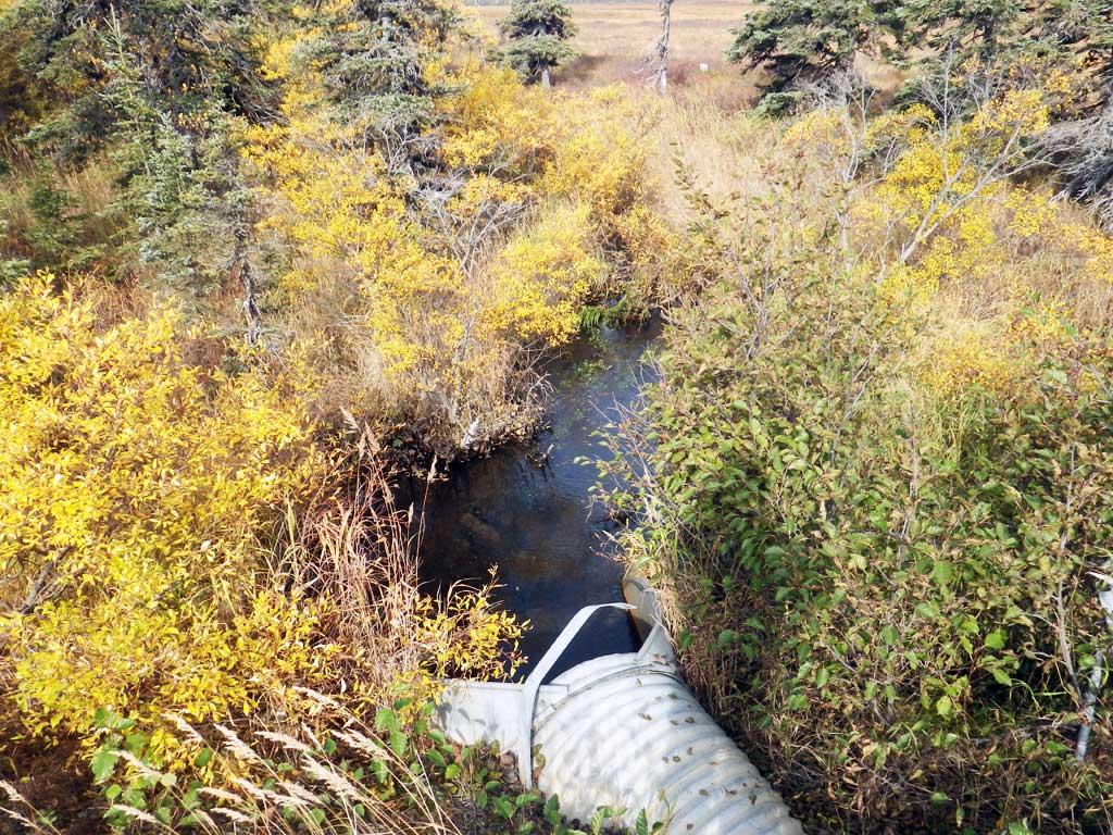
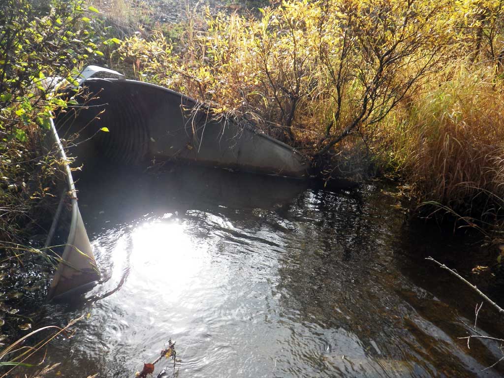
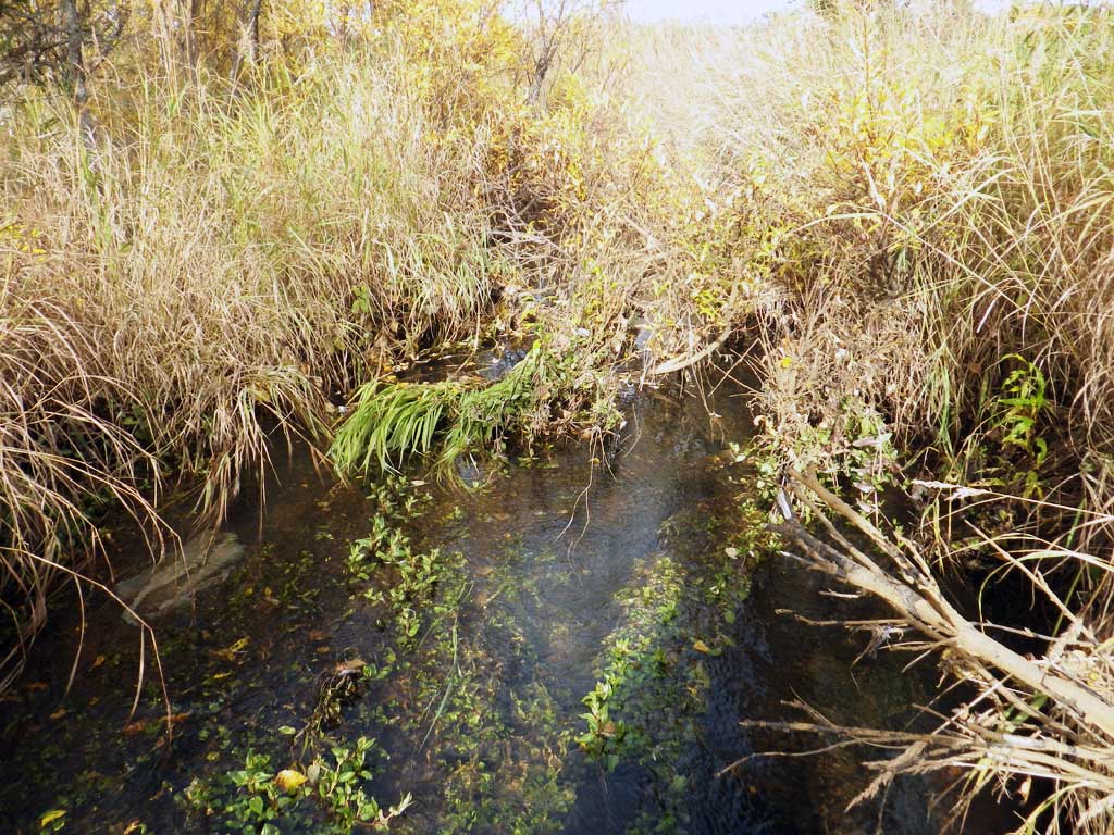
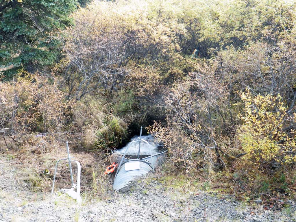
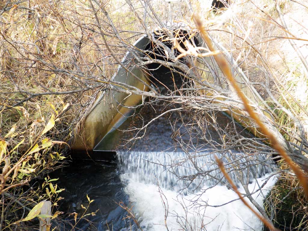
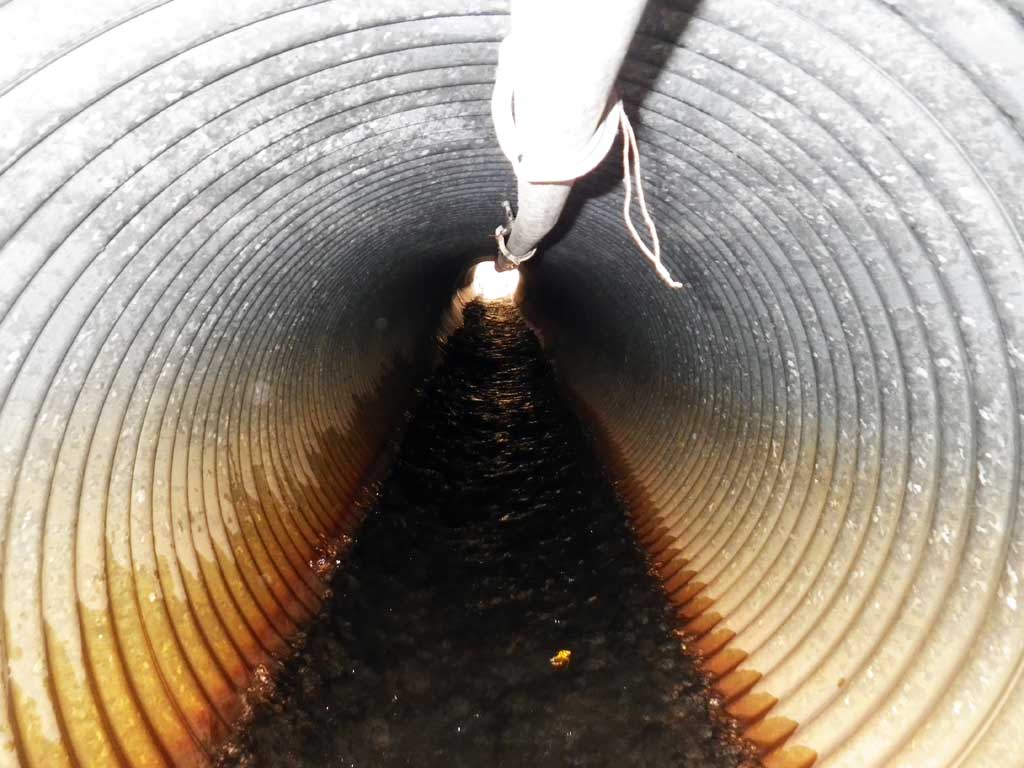
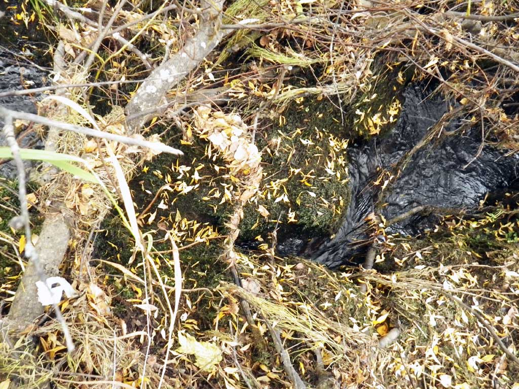
Comments: Stream flows over 5-foot apron at outlet and then free falls into outlet pool. Upstream and downstream differ quite a bit, culvert has backed up creek creating a wider, deeper channel with more sediment. Downstream stream is a small, constricted riffle with cobble substrate.
Culvert Measurements
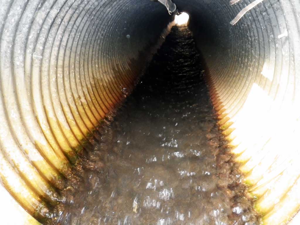
| ID: 1 | Structure Type: Circular pipe (Corrugated steel) | Fish Passage Rating: | |||||||||||||||||||||||||||||||||||||||||
|
|
|
|||||||||||||||||||||||||||||||||||||||||
Comments: Outfall type coded in field as SF/F: smooth flow over apron/free fall. |
|||||||||||||||||||||||||||||||||||||||||||
Culvert Observations:
|
|||||||||||||||||||||||||||||||||||||||||||
Stream Measurements
|
|
| Stream Width Type | Distance From Crossing (ft) |
Stream Width (ft) |
|---|---|---|
| Downstream ordinary high water | 1.20 | |
| Downstream ordinary high water | 1.90 | |
| Downstream ordinary high water | 2.00 |
Elevations
| Locator ID | Culvert Number |
River Distance (ft)1 |
Distance From Crossing (ft)2 |
Relative Elevation (ft) |
|---|---|---|---|---|
| Road Elev | 98.32 | |||
| D/S Grade Ctrl (Thalweg) (cannot go further because of brush and log jams) | 0.00 | 86.81 | ||
| D/S Water Surface Elev | 0.00 | 87.92 | ||
| D/S Water Surface Elev (tailwater surface) | 3.00 | 87.88 | ||
| Max Pool Depth | 3.00 | 86.50 | ||
| D/S Water Surface Elev | 7.00 | 88.45 | ||
| D/S Thalweg (end apron) | 7.00 | 88.27 | ||
| Outlet Invert (on pipe) | 12.00 | 88.32 | ||
| D/S Water Surface Elev | 12.00 | 88.75 | ||
| Outlet Culvert Top | 12.00 | 91.38 | ||
| Inlet Culvert Top | 72.50 | 93.31 | ||
| Inlet Culvert Invert (on pipe) | 72.50 | 90.29 | ||
| U/S Water Surface Elev | 72.50 | 90.88 | ||
| U/S Grade Ctrl (Thalweg) (creek bed just upsream of apron on mud) | 77.50 | 89.92 | ||
| U/S Water Surface Elev | 77.50 | 90.98 | ||
| U/S Grade Ctrl (Thalweg) | 78.00 | 89.84 | ||
| U/S Grade Ctrl (Thalweg) | 83.50 | 89.19 | ||
| U/S Water Surface Elev | 83.50 | 90.95 |
Notes:
- River distance is measured continuously throughout the survey reach along the thalweg of the stream.
- Measured from each end of the crossing along the thalweg of the stream.
Fish Sampling Efforts
| Gear Type: Visual Observation, Ground (A) | ||
| Comments: No traps set, no fish observed. | ||
Fish Observations
No fish observations occurred during this survey.
Photos

Questions or comments about this report can be directed to dfg.dsf.webmaster@alaska.gov

