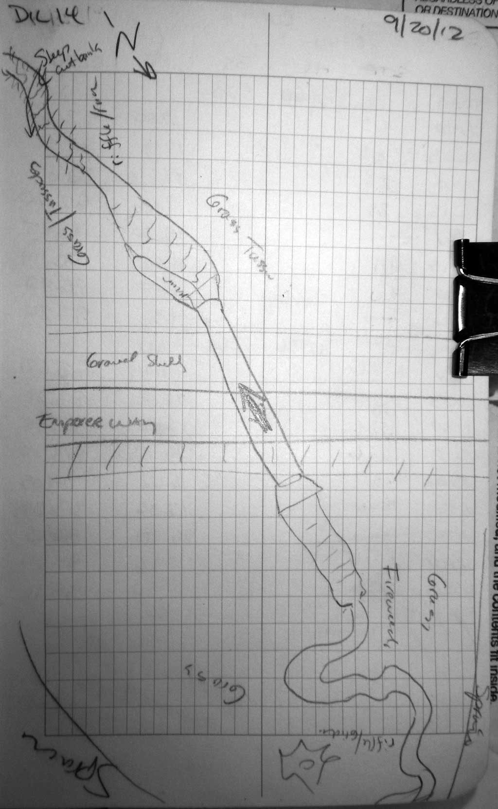
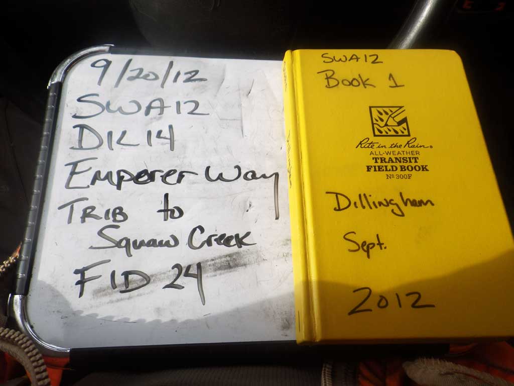
Fish Passage Site 30303076
Coordinates (dec. deg.): 59.05573°, -158.55849°
Legal Description: S013S056W14
Region: Southwest
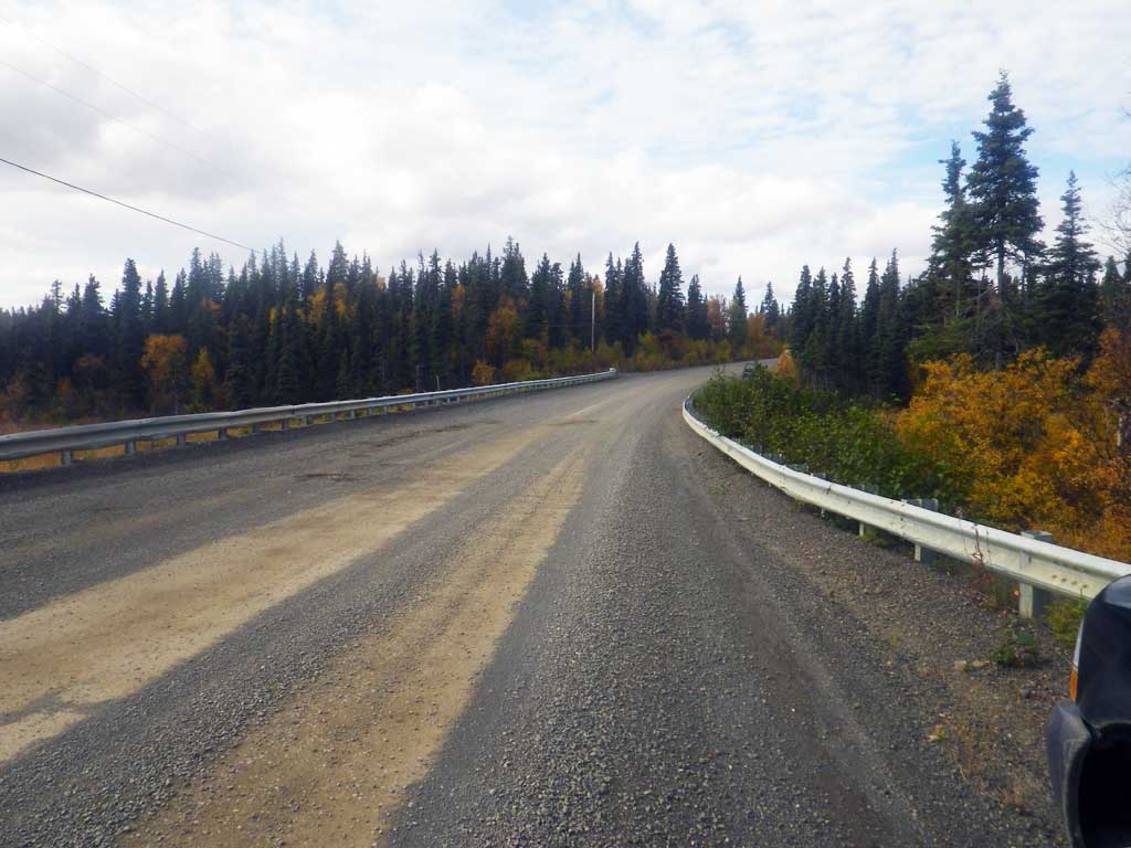
Road Name: Emperor Way
Datum: NAD83
Quad Name / ITM: Dillingham A-7
AWC Stream #:
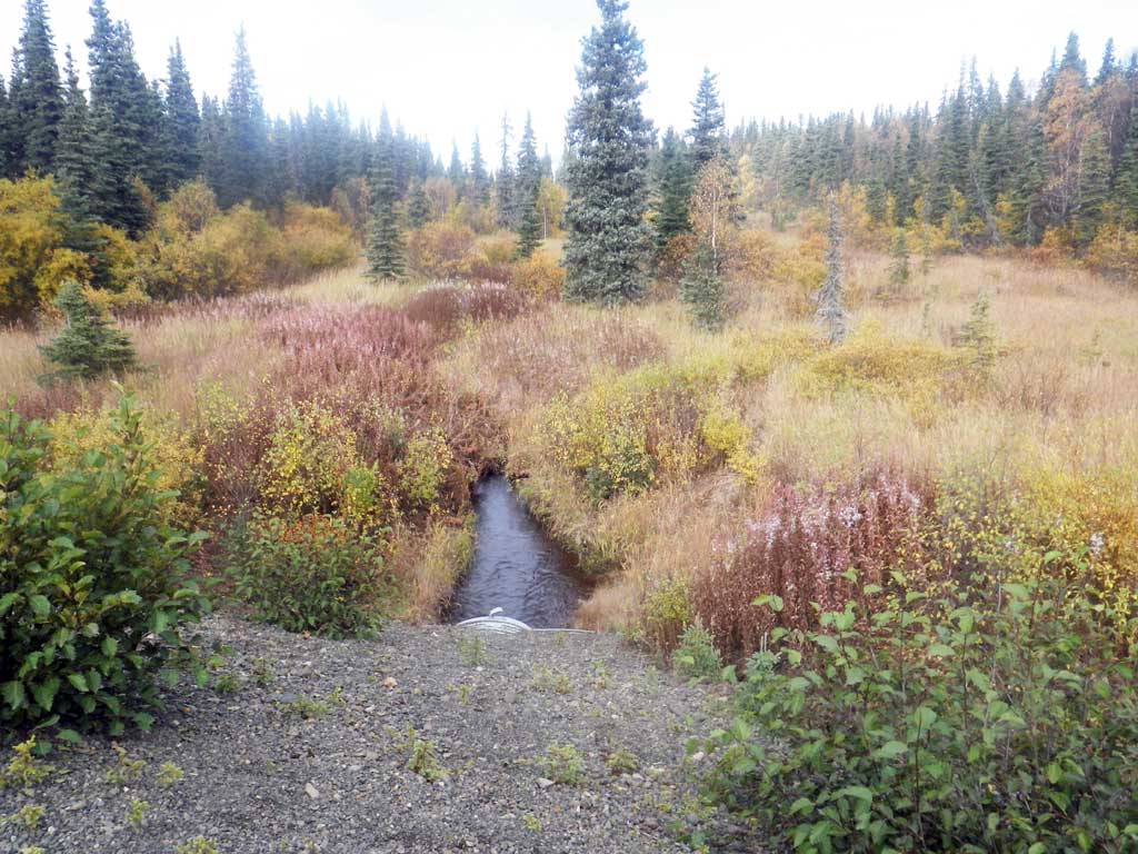
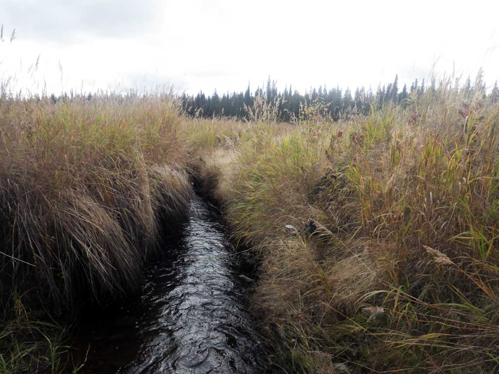
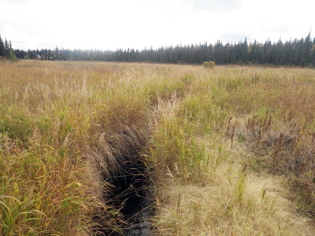
Stream Name: Seven Sisters Creek Middle Fork tributary
Elevation:
Site Comments: Stream and Watershed name changed to local name on 11.24.21
Survey SWA12-DIL14
Project Supervisor: Gillian O'Doherty, Alaska Department of Fish and Game
— Anchorage, AK
Observers: Gillian O'Doherty, Mark Eisenman
Overall Fish Passage Rating:
Tidal: No
Backwatered: No
Step Pools: No
Construction Year:
Site Observations:
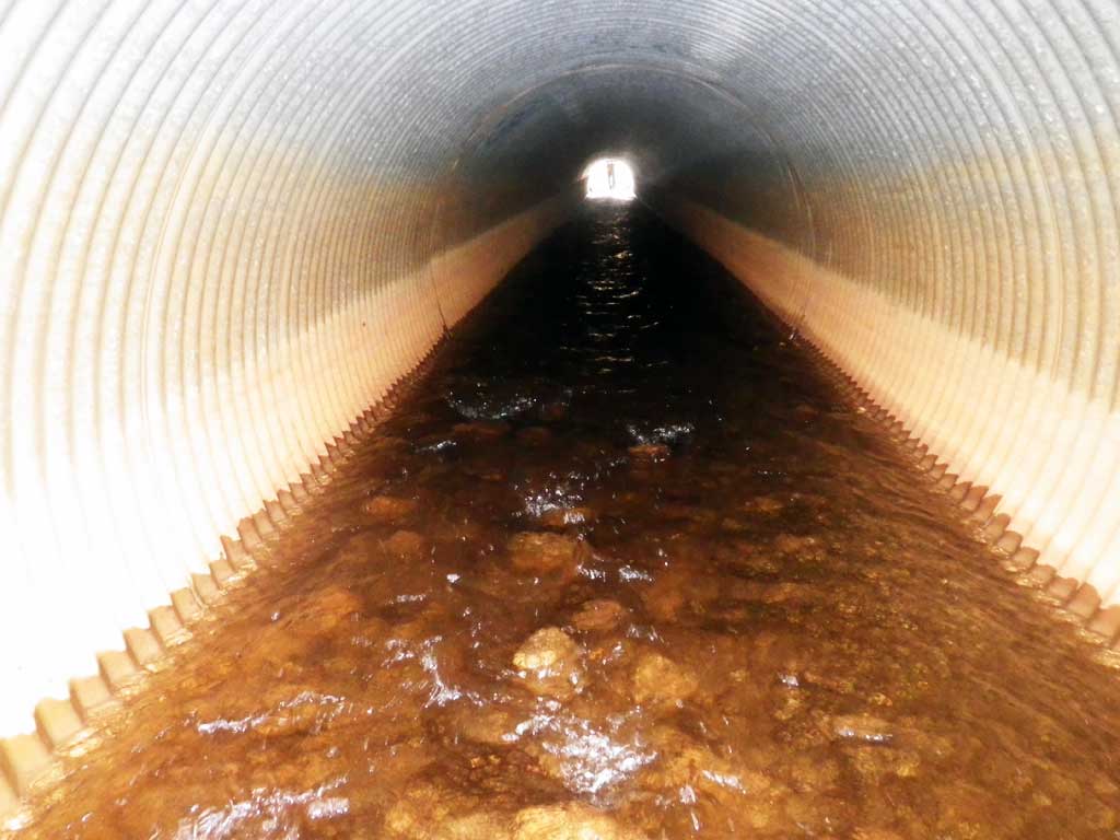
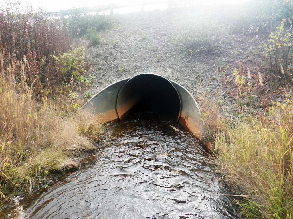
- Culvert gradient gray
- Mechanical damage or joints parting
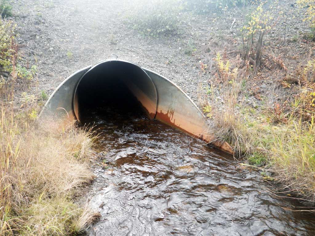
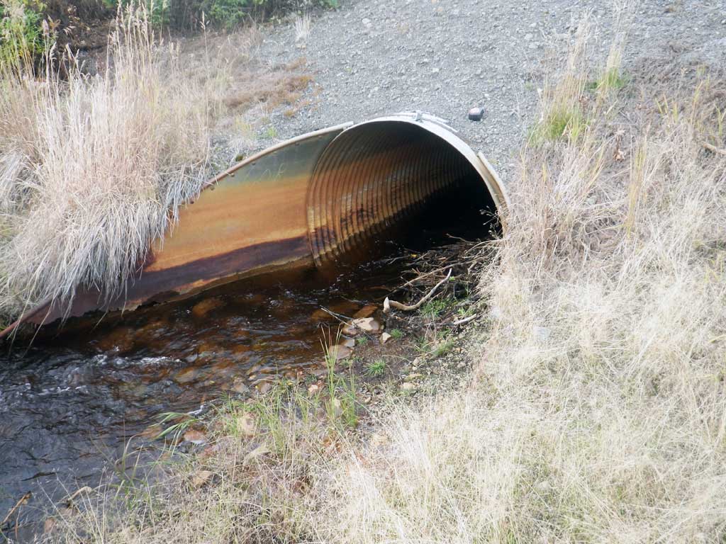
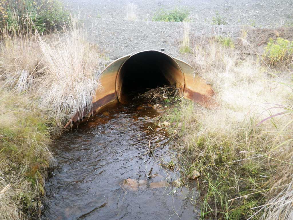
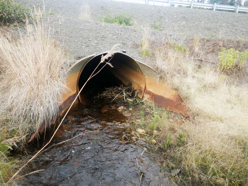
Comments: Outlet flare rusted through and detaching. Gradient slightly gray but pipe good otherwise so rated green.
Culvert Measurements
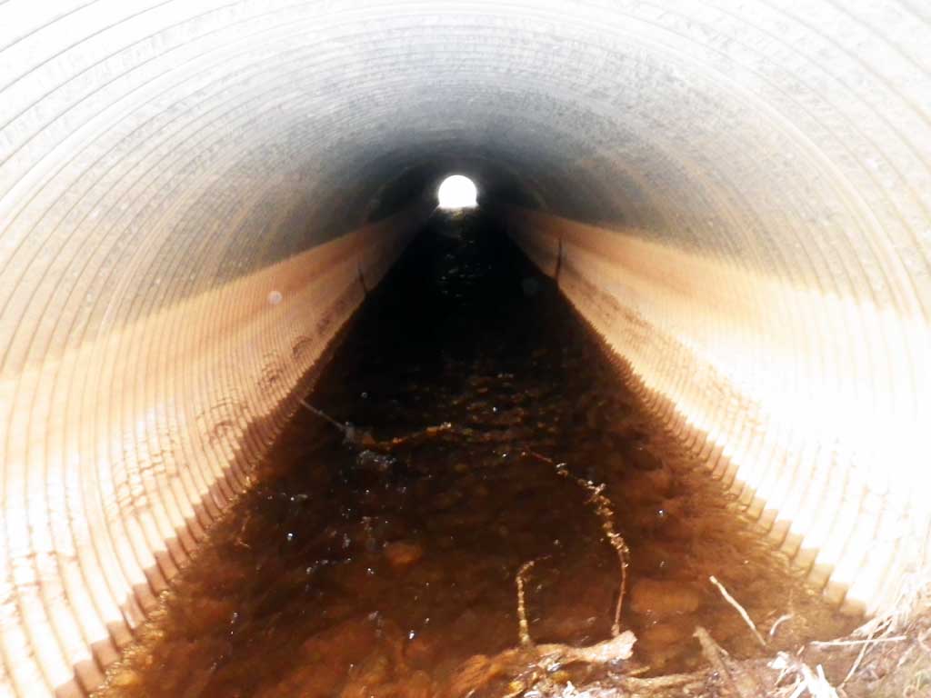
| ID: 1 | Structure Type: Circular pipe (Corrugated steel) | Fish Passage Rating: | |||||||||||||||||||||||||||||||||||||||||
|
|
|
|||||||||||||||||||||||||||||||||||||||||
Comments: Aprons not measured because covered in substrate/rocks. Outlet apron also rusted through. Rust line not measured because of staining. |
|||||||||||||||||||||||||||||||||||||||||||
Culvert Observations:
|
|||||||||||||||||||||||||||||||||||||||||||
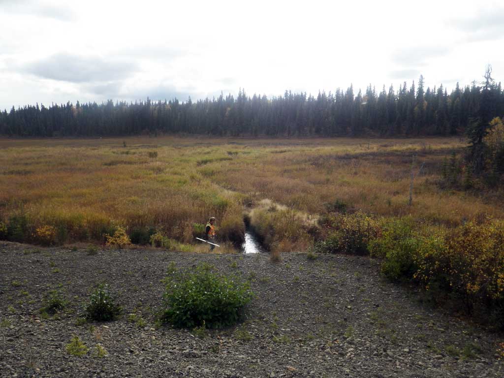
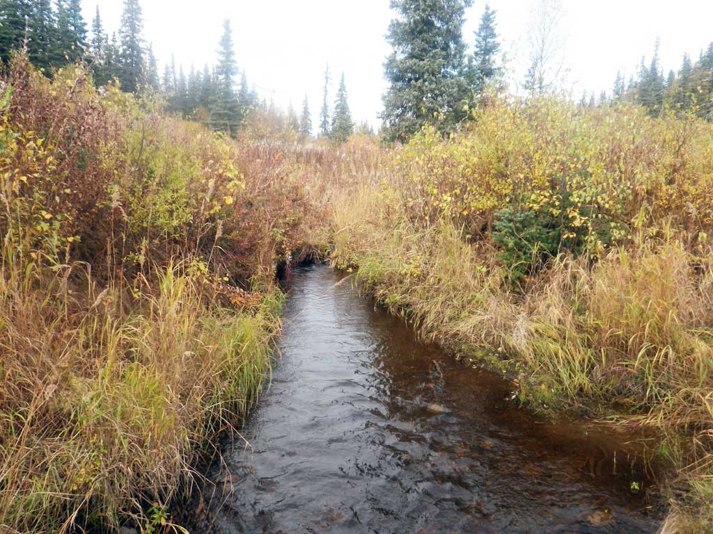
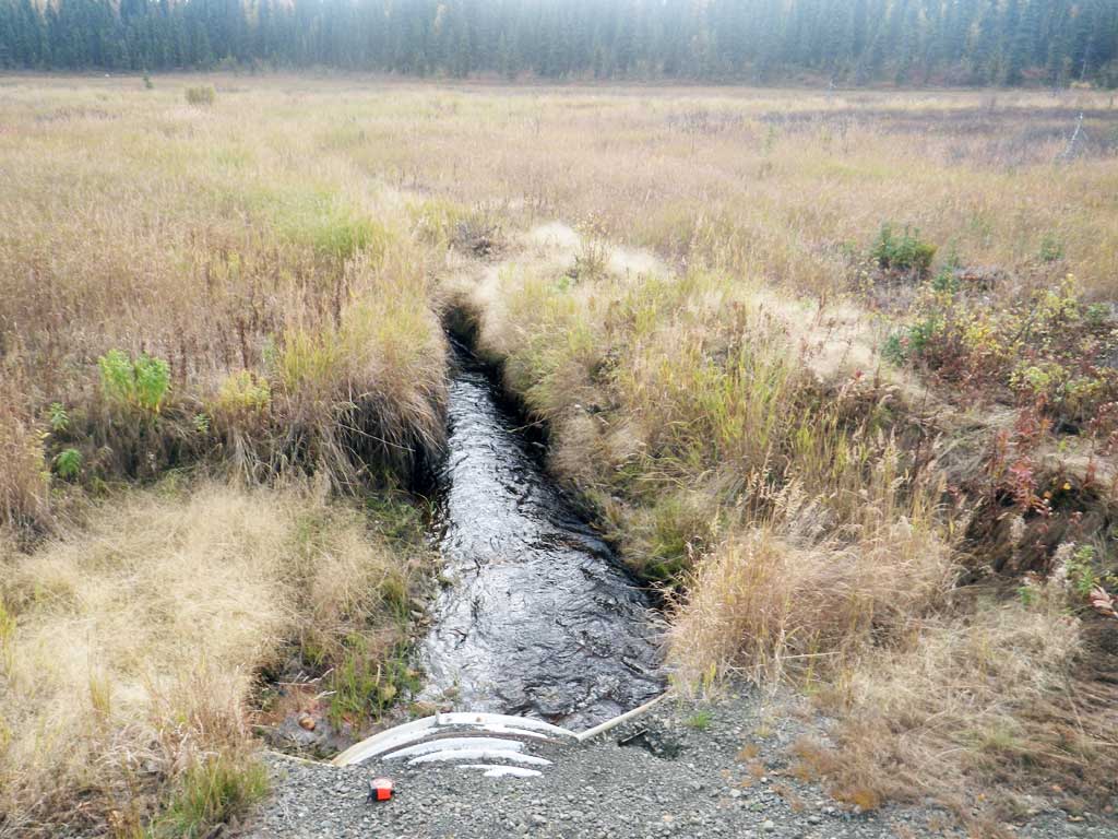
Stream Measurements
|
|
| Stream Width Type | Distance From Crossing (ft) |
Stream Width (ft) |
|---|---|---|
| Upstream ordinary high water | 61.0 | 3.20 |
| Upstream ordinary high water | 89.0 | 3.00 |
| Upstream ordinary high water | 120.0 | 6.00 |
Elevations
| Locator ID | Culvert Number |
River Distance (ft)1 |
Distance From Crossing (ft)2 |
Relative Elevation (ft) |
|---|---|---|---|---|
| Road Elev | 97.24 | |||
| D/S Thalweg | 0.00 | 82.10 | ||
| D/S Water Surface Elev | 0.00 | 82.50 | ||
| D/S Water Surface Elev | 23.00 | 82.50 | ||
| D/S Thalweg (where natural channel starts) | 23.00 | 82.07 | ||
| Outlet Invert (on pipe) | 40.00 | 81.85 | ||
| D/S Water Surface Elev | 40.00 | 82.74 | ||
| Outlet Culvert Top | 40.00 | 86.42 | ||
| Inlet Culvert Top | 152.60 | 87.58 | ||
| U/S Water Surface Elev | 152.60 | 83.91 | ||
| Inlet Culvert Invert (substrate) | 152.60 | 83.52 | ||
| U/S Thalweg (top of inlet riffle) | 163.60 | 83.77 | ||
| U/S Water Surface Elev | 163.60 | 84.05 | ||
| U/S Water Surface Elev (sg) | 188.60 | 84.16 | ||
| U/S Grade Ctrl (Thalweg) | 188.60 | 83.20 | ||
| U/S Grade Ctrl (Thalweg) | 267.60 | 84.64 | ||
| U/S Water Surface Elev (sg) | 267.60 | 85.16 |
Notes:
- River distance is measured continuously throughout the survey reach along the thalweg of the stream.
- Measured from each end of the crossing along the thalweg of the stream.
Fish Sampling Efforts
| Gear Type: Visual Observation, Ground (A) | ||
| Comments: No traps set, no fish observed. | ||
Fish Observations
No fish observations occurred during this survey.
Photos
Questions or comments about this report can be directed to dfg.dsf.webmaster@alaska.gov