Fish Passage Site 30303074
Coordinates (dec. deg.): 59.04526°, -158.55354°
Legal Description: S013S056W13
Region: Southwest
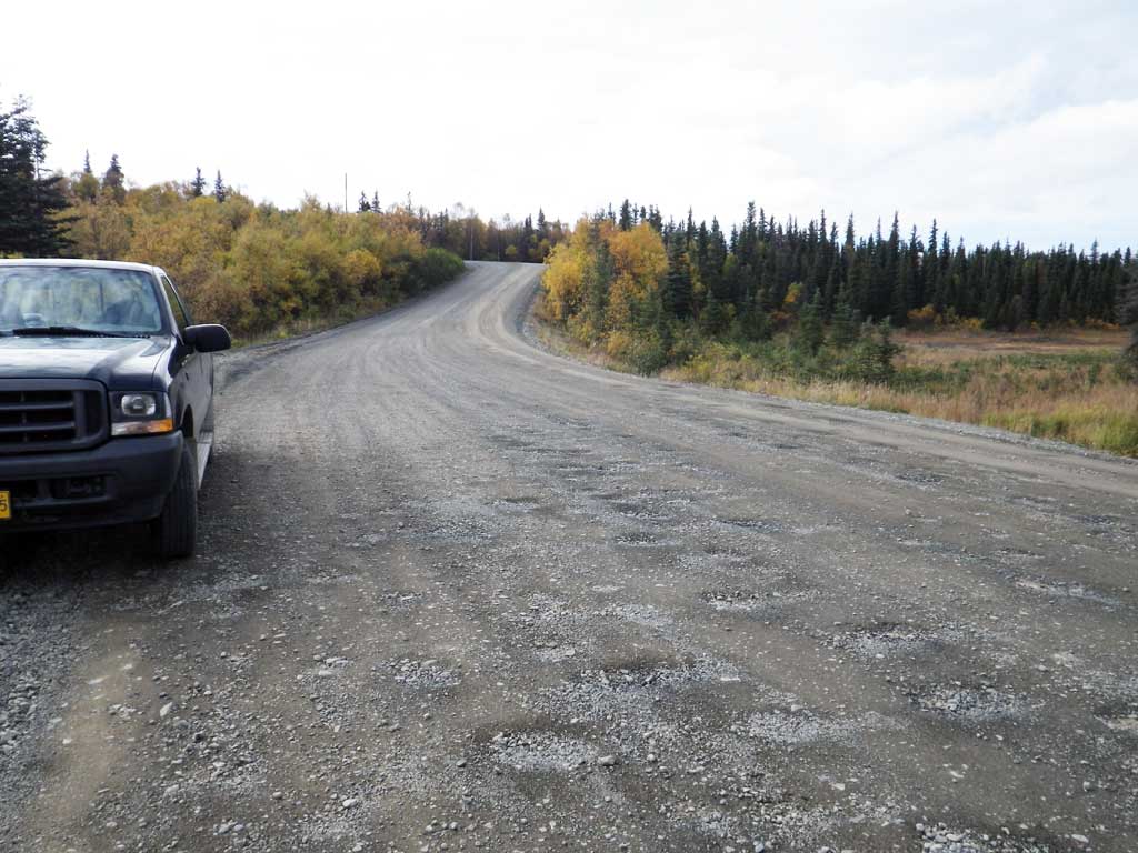
Road Name: Nerha Drive
Datum: NAD83
Quad Name / ITM: Dillingham A-7
AWC Stream #: 325-30-10100-2021
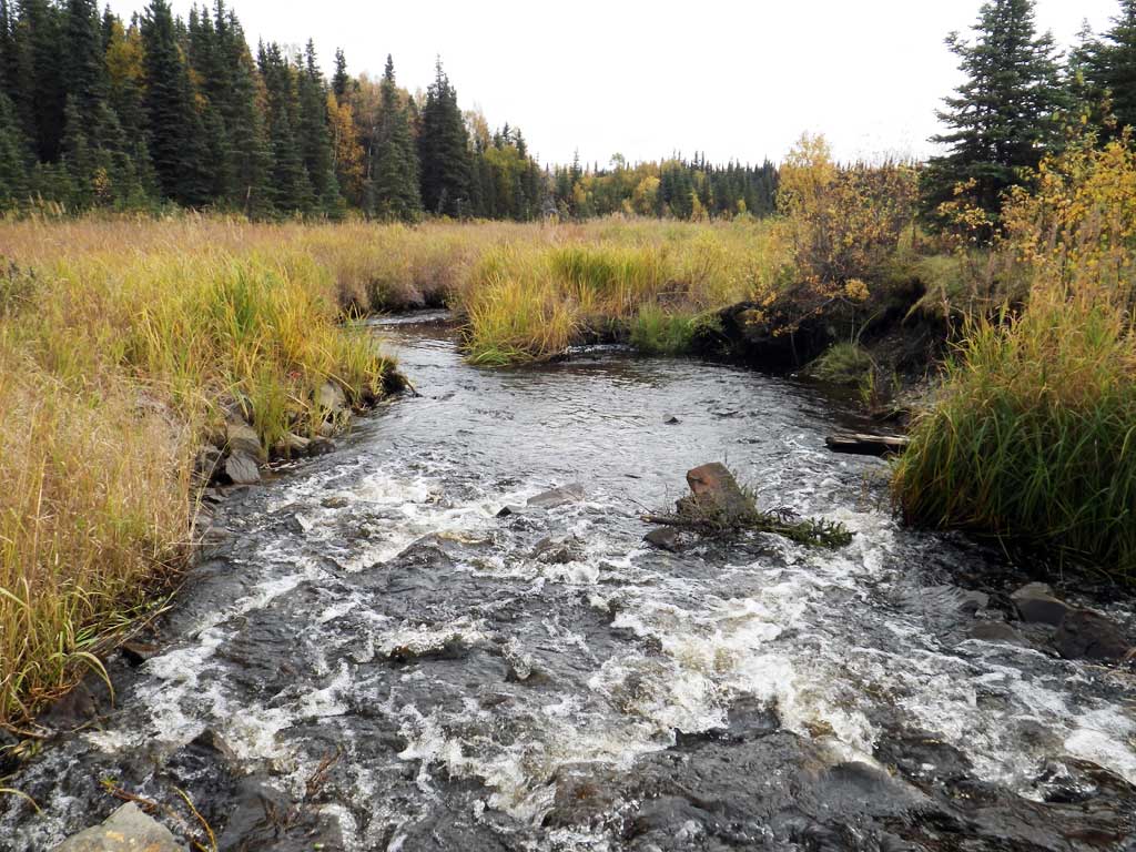
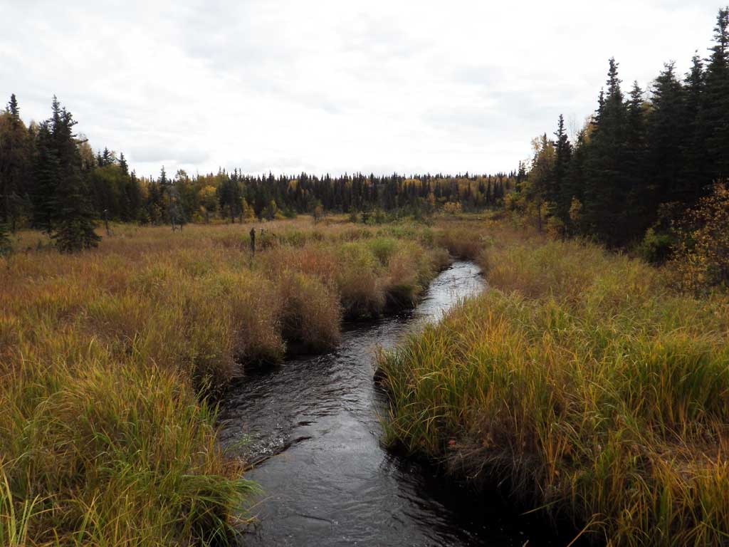
Stream Name: Seven Sisters Creek
Elevation:
Site Comments: Stream and Watershed name changed to local name on 11.24.21
Survey SWA12-DIL12
Project Supervisor: Gillian O'Doherty, Alaska Department of Fish and Game
— Anchorage, AK
Observers: Gillian O'Doherty, Mark Eisenman
Overall Fish Passage Rating:
Tidal: No
Backwatered: No
Step Pools: No
Construction Year: 1999
Site Observations:
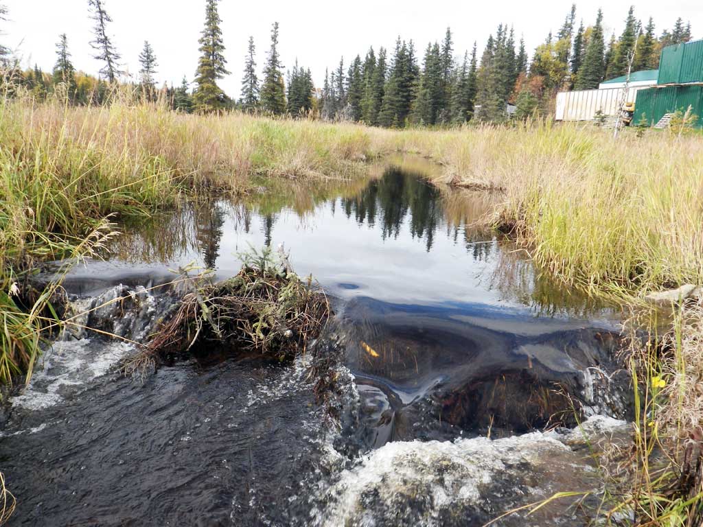
- Beaver Activity
- Hydraulic flows exceeded capacity
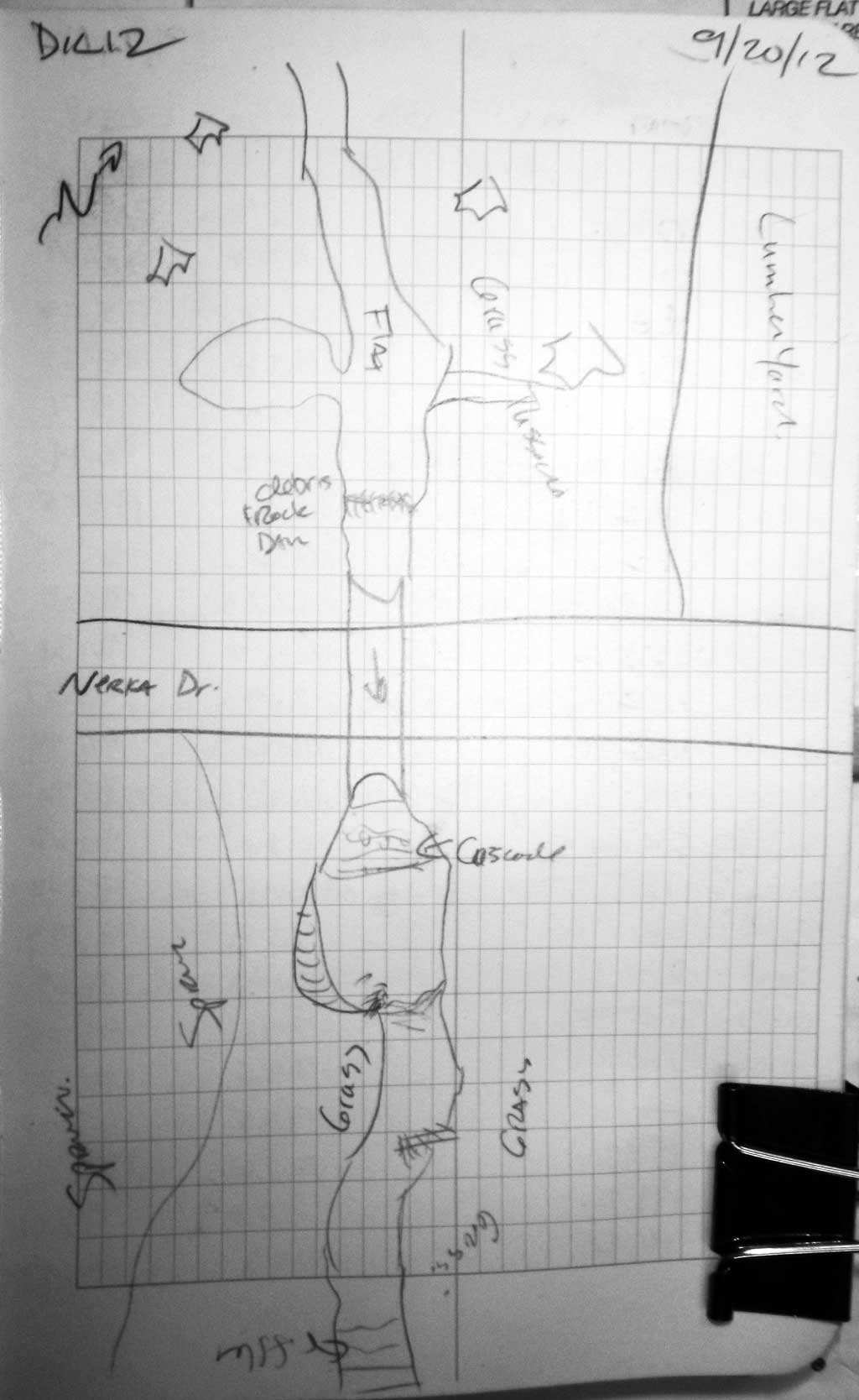
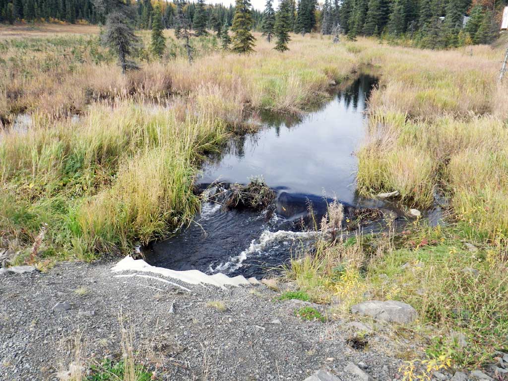
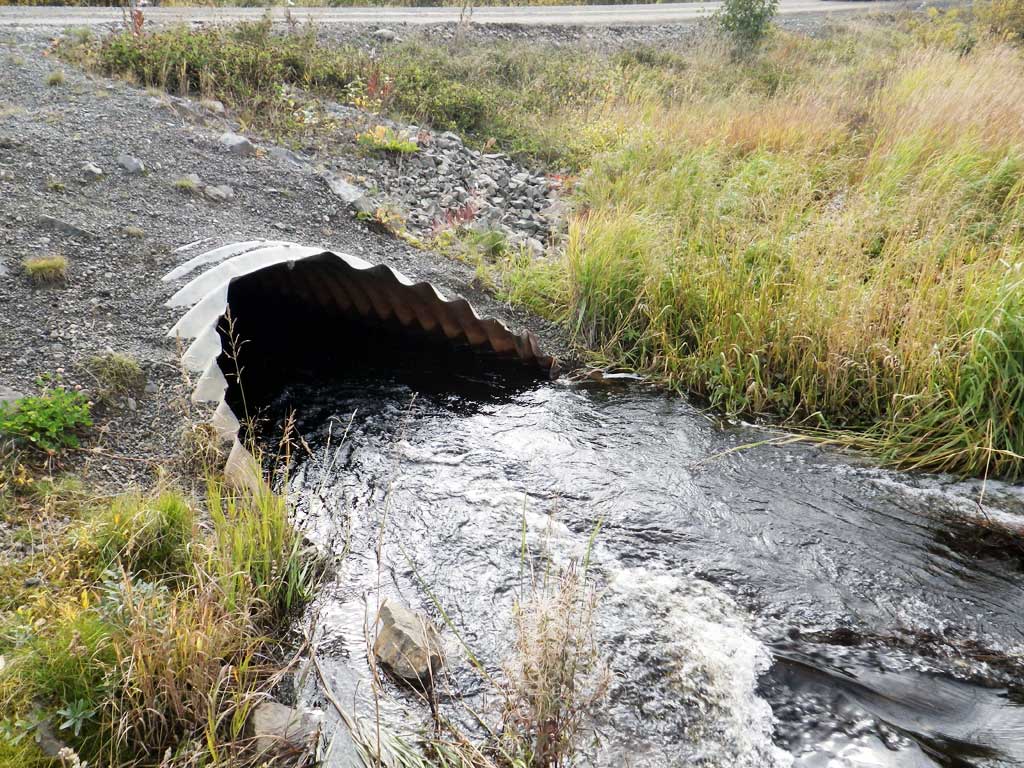
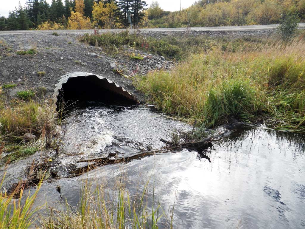
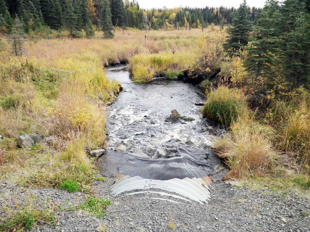
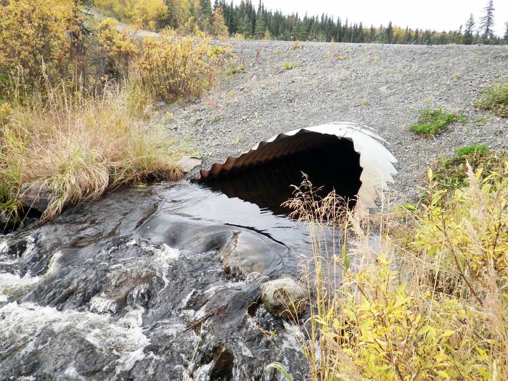
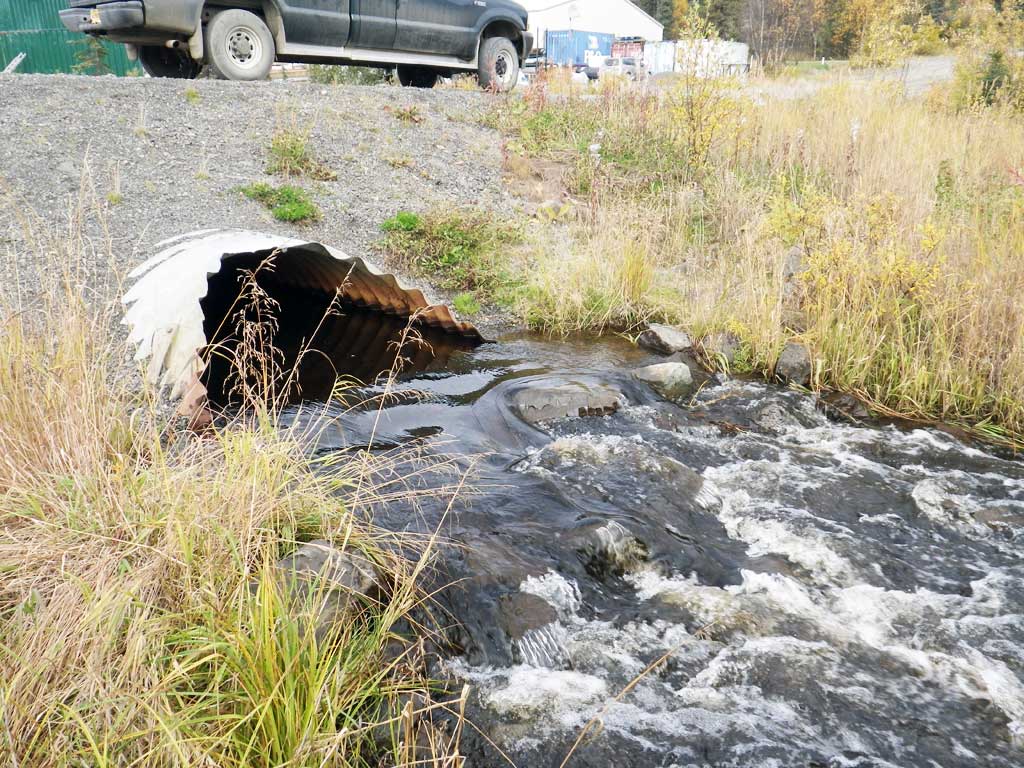
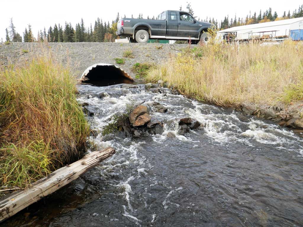
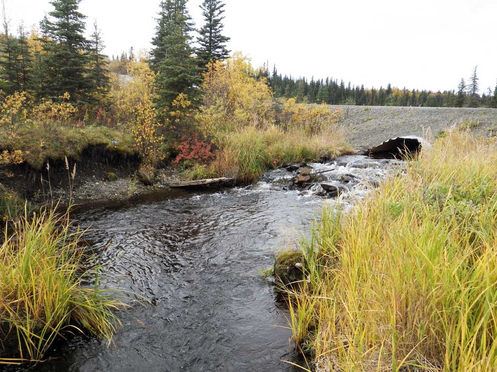
Comments: Outlet backwatered by riprap ramp in channel. Culvert set too high. Adult salmon spawning in creek. Debris or beaver dam immediately upstream. Riprap at inlet and outlet. Spawning adults downstream so had to cut long profile short and stream gradient is approx.
Culvert Measurements
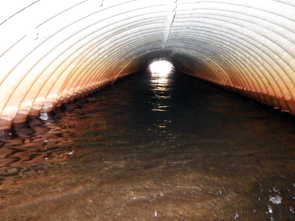
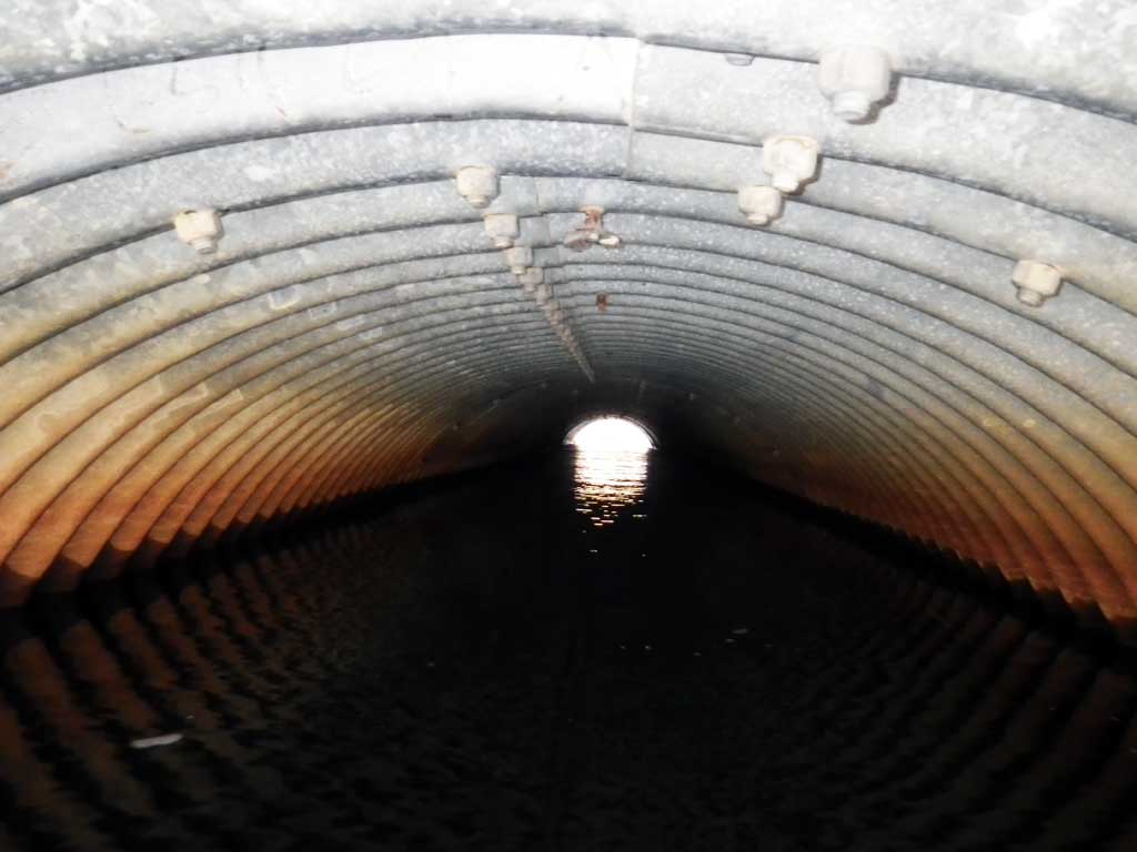
| ID: 1 | Structure Type: Pipe-arch (Structural steel plate) | Fish Passage Rating: | |||||||||||||||||||||||||||||||||||||||||
|
|
|
|||||||||||||||||||||||||||||||||||||||||
Comments: Rust line not measured: pipe stained. Approach angle not taken. Length is top of miter. Could not find ends of pipe. Substrate depth inlet unknown. Measurement at outlet is minimum. Outfall height is down cascade. |
|||||||||||||||||||||||||||||||||||||||||||
Culvert Observations:
|
|||||||||||||||||||||||||||||||||||||||||||
Stream Measurements
|
|
| Stream Width Type | Distance From Crossing (ft) |
Stream Width (ft) |
|---|---|---|
| Downstream ordinary high water | 7.80 | |
| Downstream ordinary high water | 6.00 | |
| Downstream ordinary high water | 6.50 |
Elevations
| Locator ID | Culvert Number |
River Distance (ft)1 |
Distance From Crossing (ft)2 |
Relative Elevation (ft) |
|---|---|---|---|---|
| Road Elev | 103.01 | |||
| D/S Grade Ctrl (Thalweg) (top of riffle) | 0.00 | 94.74 | ||
| D/S Water Surface Elev | 0.00 | 95.47 | ||
| D/S Grade Ctrl (Thalweg) | 31.00 | 95.28 | ||
| D/S Water Surface Elev | 31.00 | 95.88 | ||
| D/S Grade Ctrl (Thalweg) (log) | 68.00 | 95.71 | ||
| D/S Water Surface Elev | 68.00 | 96.24 | ||
| D/S Water Surface Elev | 82.00 | 96.30 | ||
| D/S Thalweg (pool) | 82.00 | 94.55 | ||
| D/S Grade Ctrl (Thalweg) (scour pool outlet) | 90.00 | 95.49 | ||
| D/S Water Surface Elev | 90.00 | 96.31 | ||
| D/S Water Surface Elev | 102.00 | 96.44 | ||
| D/S Thalweg (bottom of scour pool max depth) | 102.00 | 95.37 | ||
| D/S Thalweg (bottom of cascade) | 104.00 | 95.96 | ||
| D/S Water Surface Elev | 104.00 | 96.62 | ||
| D/S Tailcrest or 1st Thalweg (top of cascade/tail water control) | 115.00 | 97.08 | ||
| D/S Water Surface Elev | 118.00 | 97.93 | ||
| D/S Water Surface Elev | 125.00 | 98.05 | ||
| Outlet Invert (below miter/on substrate) | 125.00 | 96.69 | ||
| Outlet Culvert Top | 125.00 | 100.00 | ||
| Inlet Culvert Top | 199.20 | 100.23 | ||
| U/S Water Surface Elev | 199.20 | 98.06 | ||
| Inlet Culvert Invert | 199.20 | 96.20 | ||
| U/S Grade Ctrl (Thalweg) | 209.70 | 97.74 | ||
| U/S Water Surface Elev | 211.70 | 98.66 |
Notes:
- River distance is measured continuously throughout the survey reach along the thalweg of the stream.
- Measured from each end of the crossing along the thalweg of the stream.
Fish Sampling Efforts
| Gear Type: Visual Observation, Ground (A) | ||
| Comments: Spawning adult salmon observed downstream. No traps set. Species indet. | ||
Fish Observations
No fish observations occurred during this survey.
Photos
Questions or comments about this report can be directed to dfg.dsf.webmaster@alaska.gov