Fish Passage Site 30303073
Coordinates (dec. deg.): 59.04302°, -158.54381°
Legal Description: S013S056W13
Region: Southwest
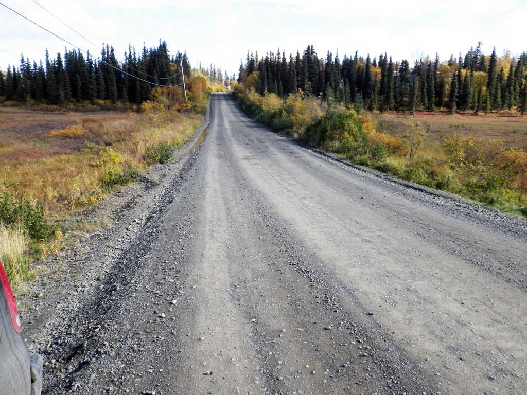
Road Name: Lupine Drive
Datum: NAD83
Quad Name / ITM: Dillingham A-7
AWC Stream #: 325-30-10100-2021
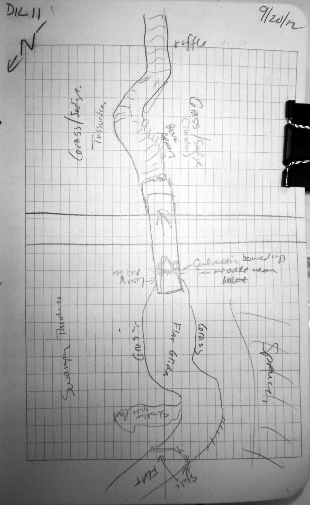
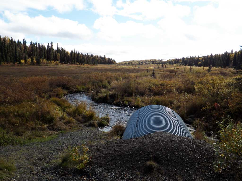
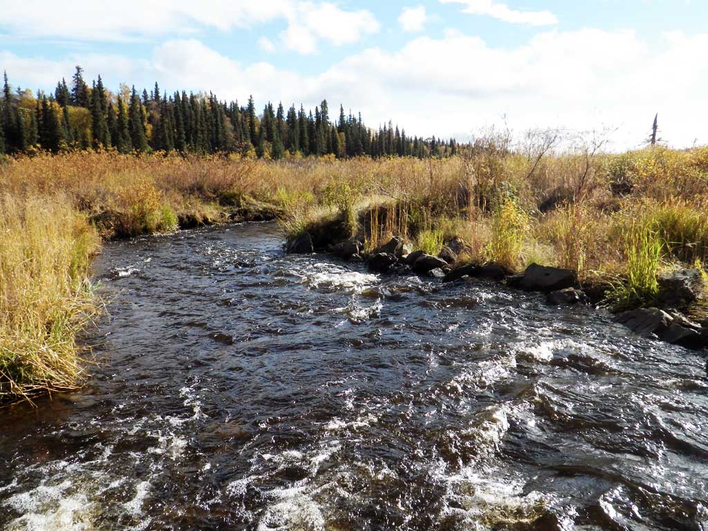
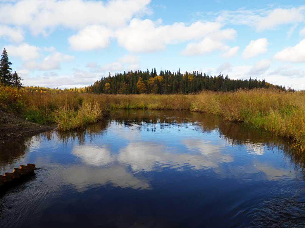
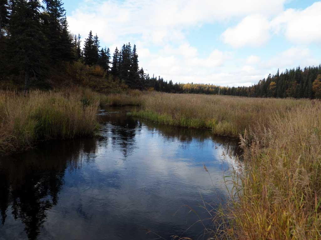
Stream Name: Seven Sisters Creek
Elevation:
Site Comments: Stream and Watershed name changed to local name on 11.24.21
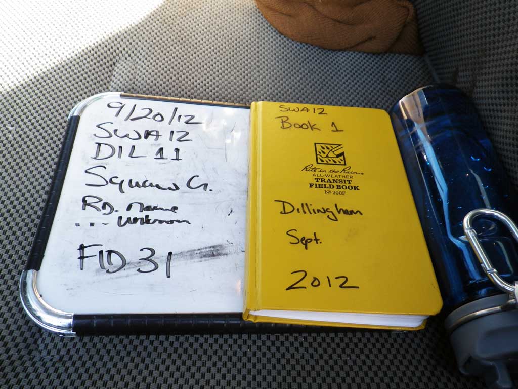
Survey SWA12-DIL11
Project Supervisor: Gillian O'Doherty, Alaska Department of Fish and Game
— Anchorage, AK
Observers: Gillian O'Doherty, Mark Eisenman
Overall Fish Passage Rating:
Tidal: No
Backwatered: No
Step Pools: No
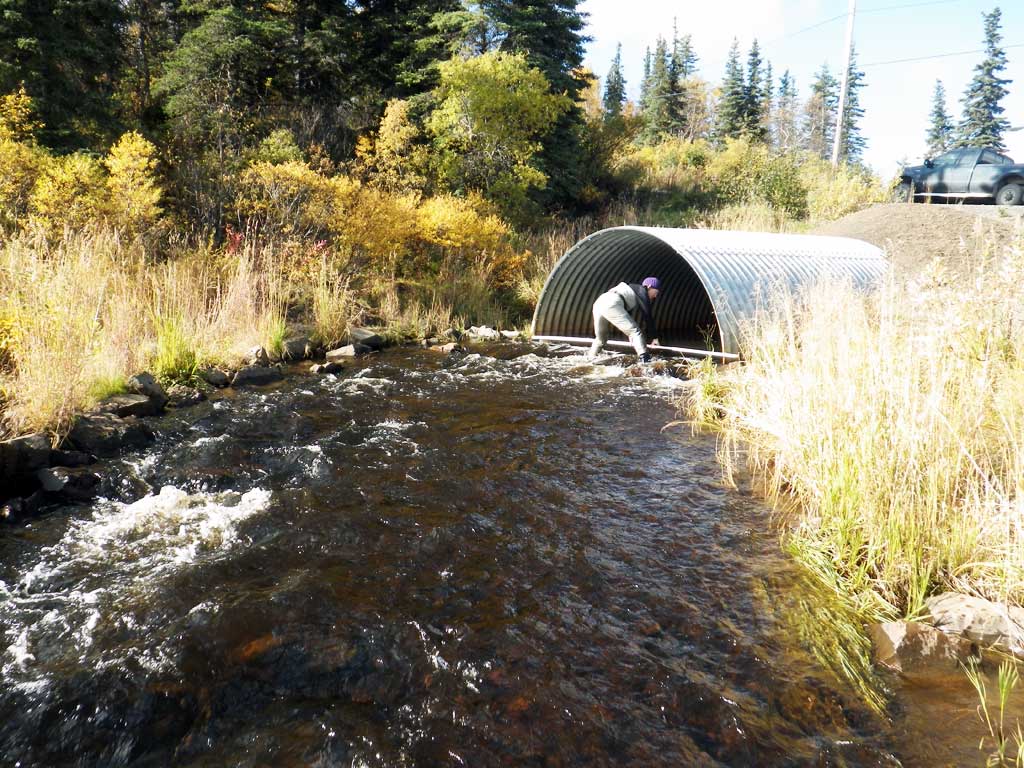
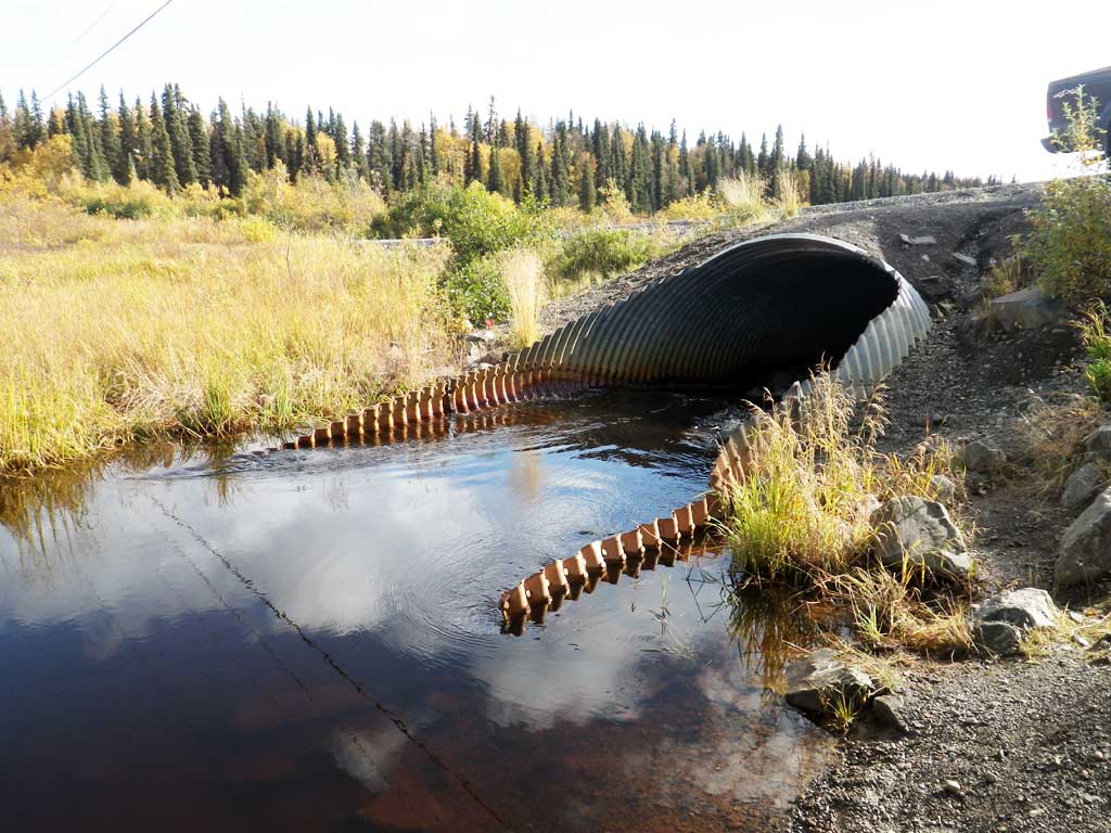
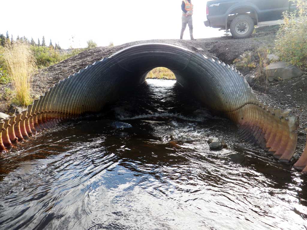
Construction Year: 1999
Site Observations:
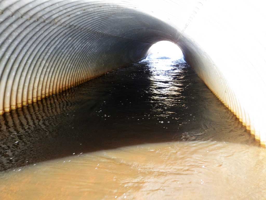
- Culvert gradient gray
- Inlet perch
- Mechanical damage or joints parting
- Improper bedding
- Damage associated with ice problems
- Compound gradient in pipe
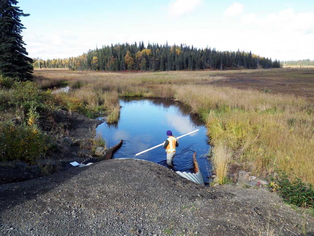
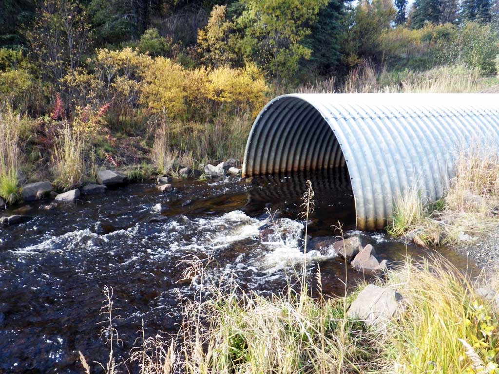
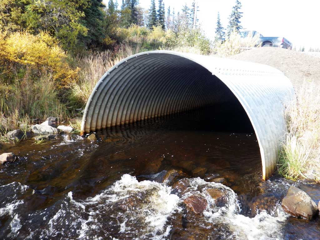
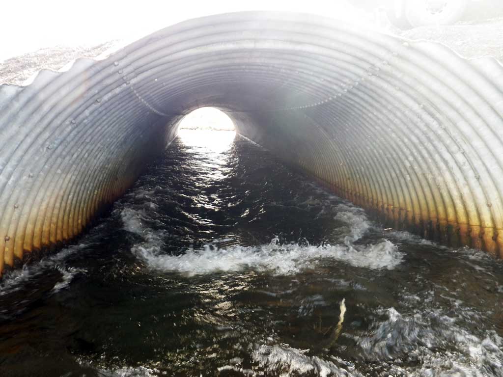
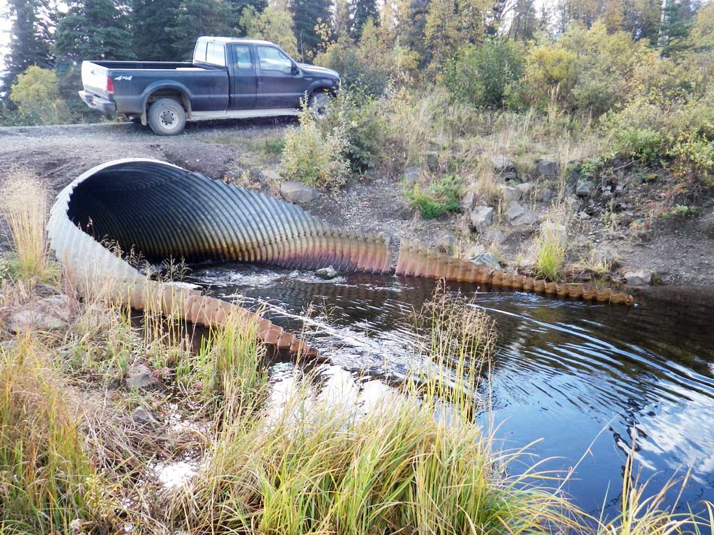
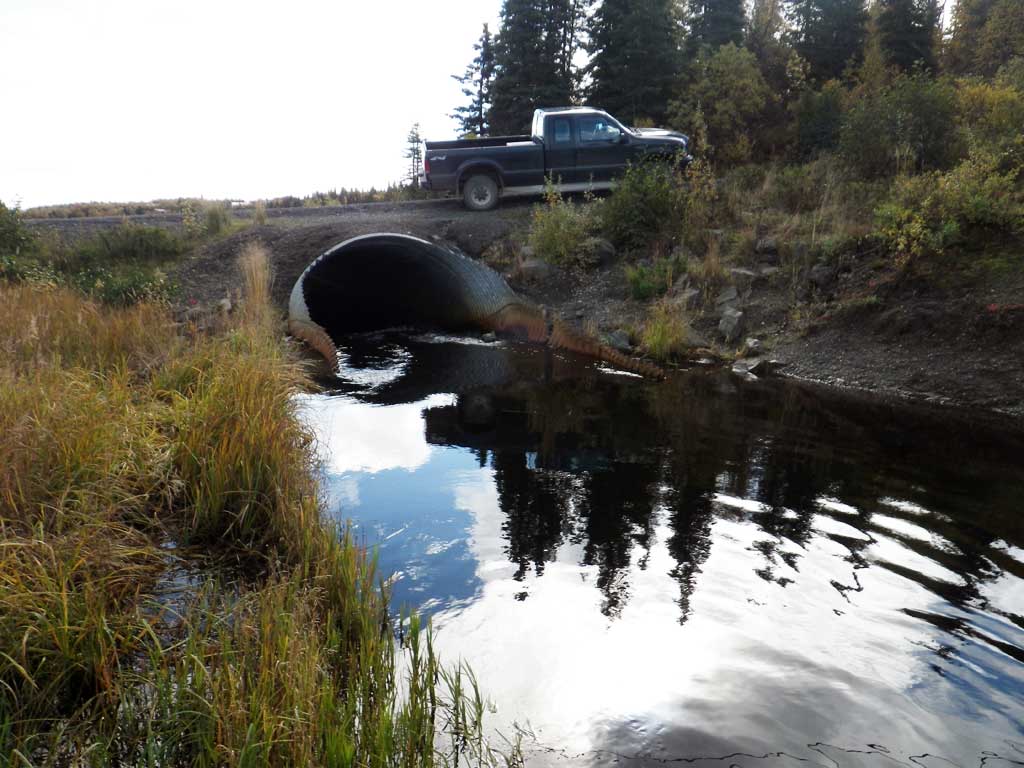
Comments: Substrate at outlet is riprap. Couldn't get good depth measurement. Large frost heave at inlet. Center is heaved up several feet, miter is above stream bed. Didn't measure rust line. Adult salmon present in pipe ( n = 2) and downstream (n = 1); probably chum. Hard to tell shape b/c of inlet, but think it is PA. Outlet channel lined with riprap.
Culvert Measurements
| ID: 1 | Structure Type: Pipe-arch (Structural steel plate) | Fish Passage Rating: | |||||||||||||||||||||||||||||||||||||||||
|
|
|
|||||||||||||||||||||||||||||||||||||||||
Comments: Top of miter length 80.7. Total length entered above. Substrate depth at outlet is minimum 2 feet. |
|||||||||||||||||||||||||||||||||||||||||||
Culvert Observations:
|
|||||||||||||||||||||||||||||||||||||||||||
Stream Measurements
|
|
| Stream Width Type | Distance From Crossing (ft) |
Stream Width (ft) |
|---|---|---|
| Downstream ordinary high water | 10.00 | |
| Downstream ordinary high water | 11.30 | |
| Downstream ordinary high water | 12.00 |
Elevations
| Locator ID | Culvert Number |
River Distance (ft)1 |
Distance From Crossing (ft)2 |
Relative Elevation (ft) |
|---|---|---|---|---|
| Road Elev | 107.29 | |||
| D/S Thalweg (middle of riffle) | 0.00 | 95.90 | ||
| D/S Water Surface Elev | 0.00 | 97.07 | ||
| D/S Water Surface Elev | 70.00 | 97.57 | ||
| D/S Thalweg (end of riprap) | 70.00 | 96.89 | ||
| D/S Tailcrest or 1st Thalweg | 94.00 | 97.01 | ||
| D/S Water Surface Elev | 94.00 | 98.33 | ||
| D/S Water Surface Elev | 100.00 | 98.57 | ||
| Outlet Culvert Top | 100.00 | 103.91 | ||
| Outlet Invert (substrate) | 100.00 | 97.13 | ||
| Inlet Culvert Top | 180.70 | 105.50 | ||
| U/S Thalweg (thalweg at miter) | 180.70 | 98.94 | ||
| U/S Water Surface Elev | 180.70 | 99.46 | ||
| U/S Thalweg (pipe below miter) | 180.70 | 99.73 | ||
| U/S Water Surface Elev | 180.70 | 99.86 | ||
| U/S Water Surface Elev | 191.70 | 100.34 | ||
| U/S Thalweg (middle of miter) | 191.70 | 98.83 | ||
| U/S Water Surface Elev | 201.70 | 100.40 | ||
| Inlet Culvert Invert (end of miter; on substrate.) | 201.70 | 98.32 | ||
| U/S Thalweg | 220.70 | 97.03 | ||
| U/S Water Surface Elev | 220.70 | 100.40 |
Notes:
- River distance is measured continuously throughout the survey reach along the thalweg of the stream.
- Measured from each end of the crossing along the thalweg of the stream.
Fish Sampling Efforts
| Gear Type: Visual Observation, Ground (A) | ||
| Comments: No traps set. Adult salmon (2) observed in pipe. Likely chum. | ||
| Gear Type: Visual Observation, Ground (B) | ||
| Comments: No traps. Adult salmon (1) observed downstream. Likely chum. | ||
Fish Observations
No fish observations occurred during this survey.
Photos
Questions or comments about this report can be directed to dfg.dsf.webmaster@alaska.gov