Fish Passage Site 30303072
Coordinates (dec. deg.): 59.04523°, -158.52838°
Legal Description: S013S055W18
Region: Southwest
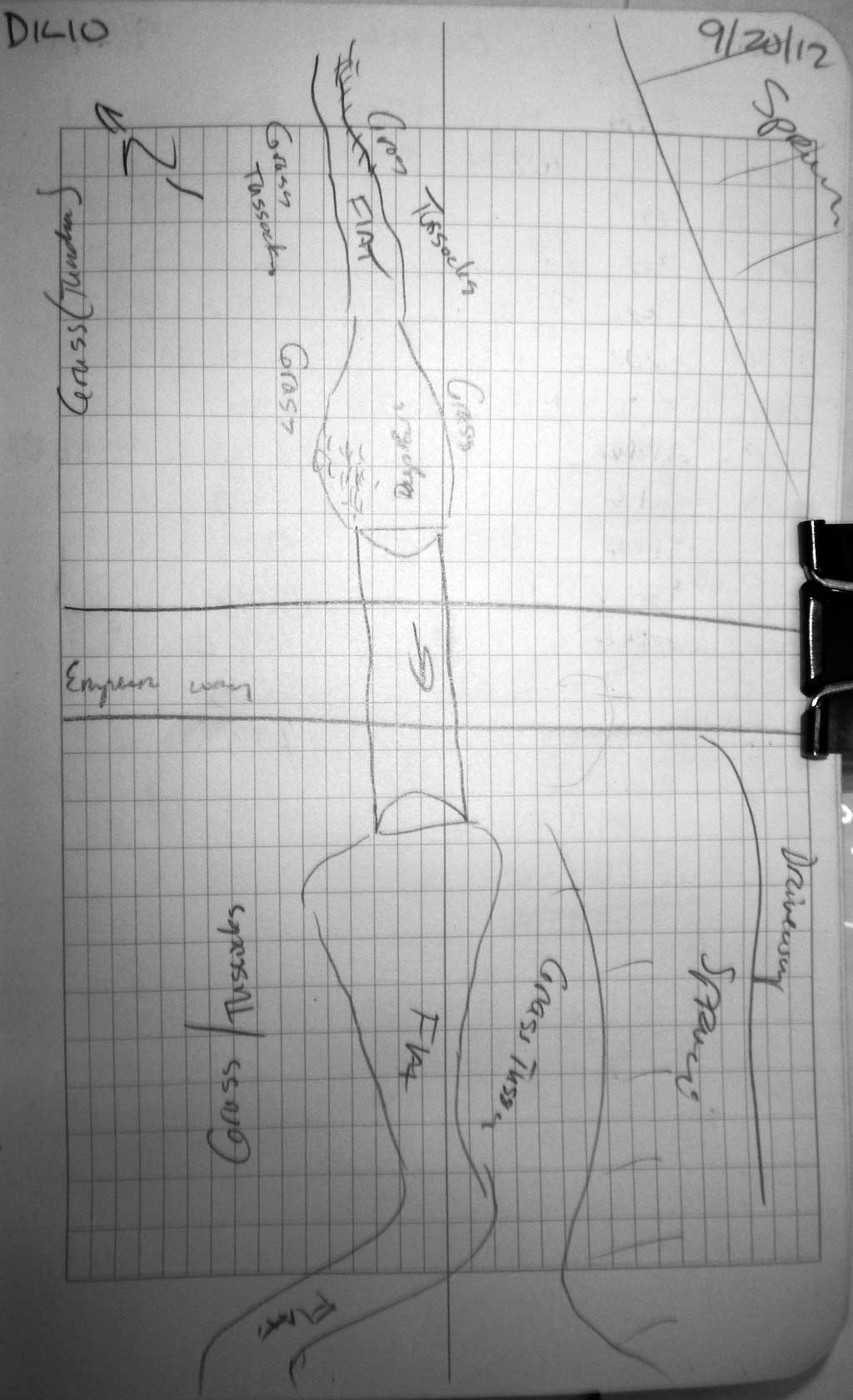
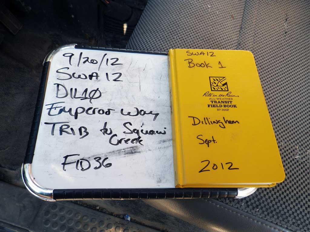
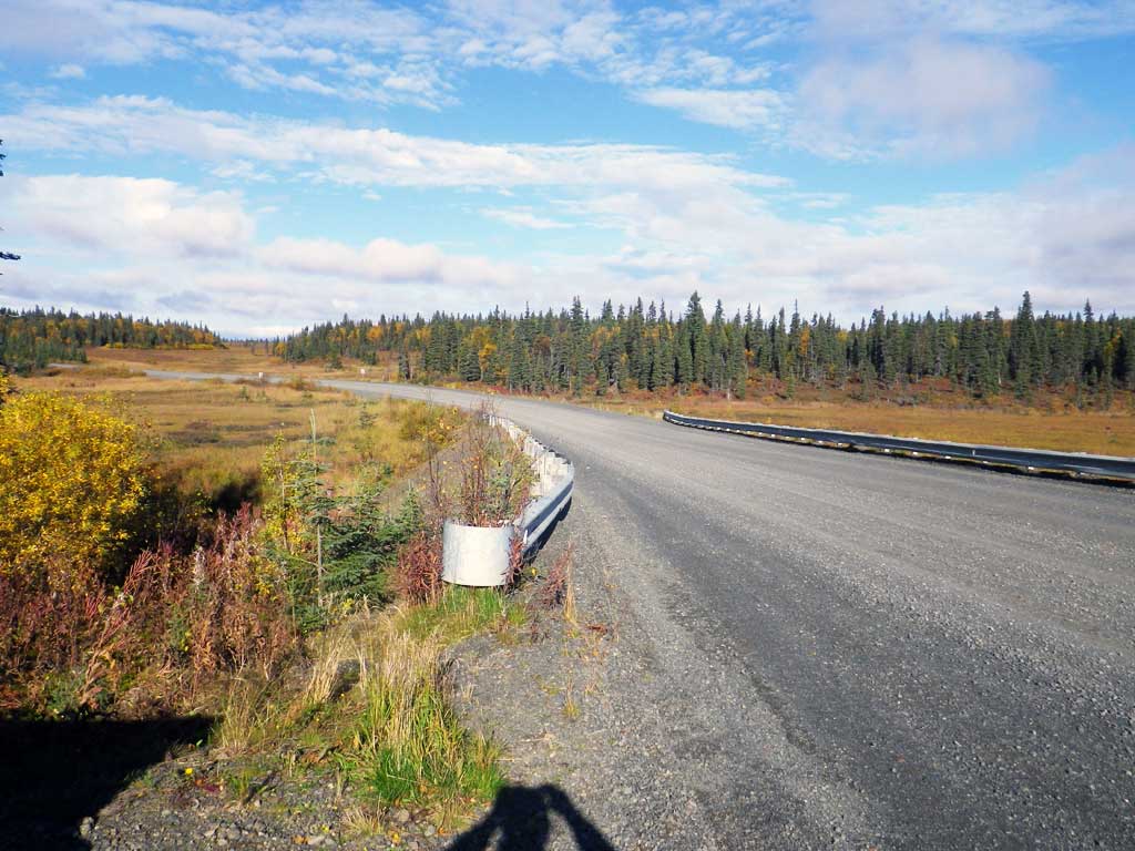
Road Name: Emperor Way
Datum: NAD83
Quad Name / ITM: Dillingham A-7
AWC Stream #:
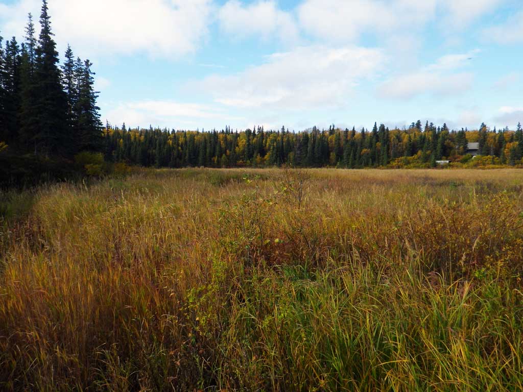
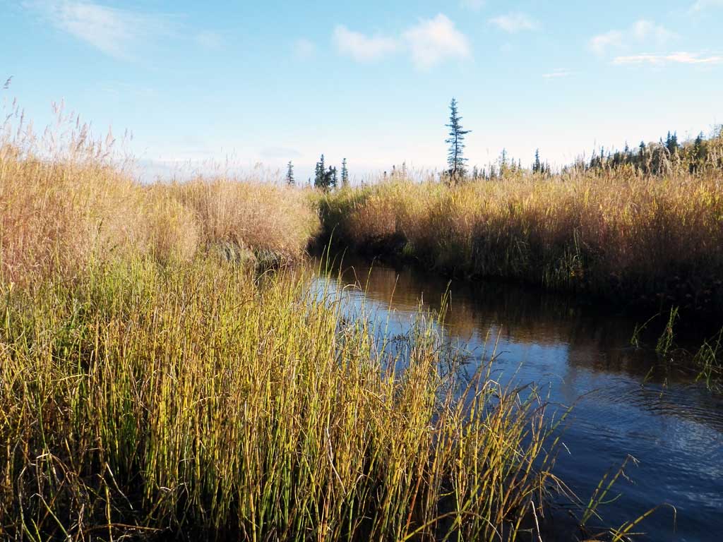
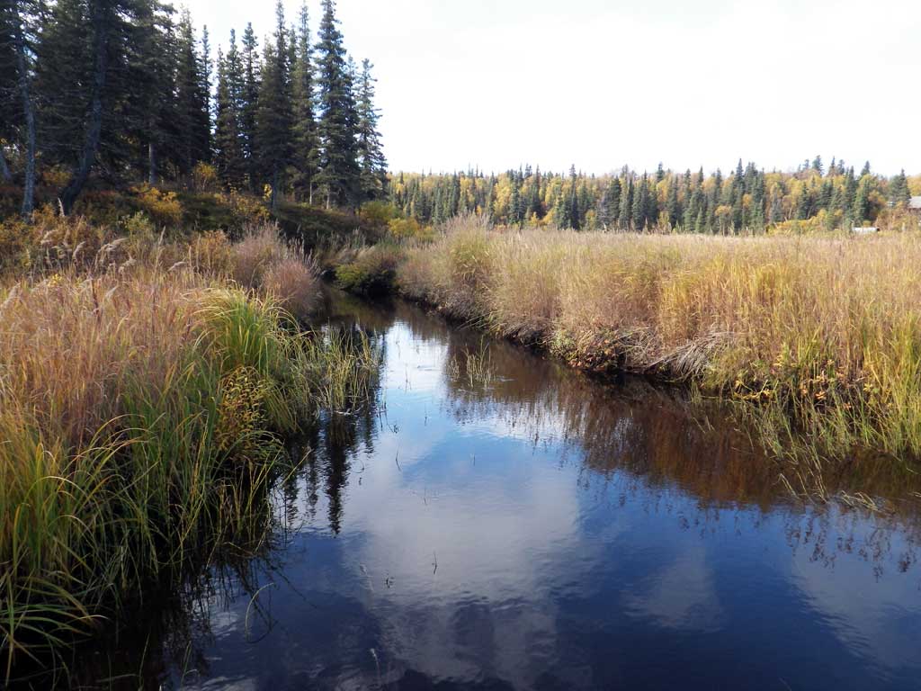
Stream Name: Seven Sisters Creek tributary
Elevation:
Site Comments: Stream and Watershed name changed to local name on 11.24.21
Survey SWA12-DIL10
Project Supervisor: Gillian O'Doherty, Alaska Department of Fish and Game
— Anchorage, AK
Observers: Gillian O'Doherty, Mark Eisenman
Overall Fish Passage Rating:
Tidal: No
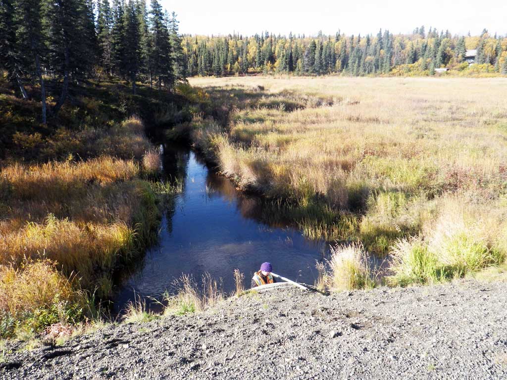
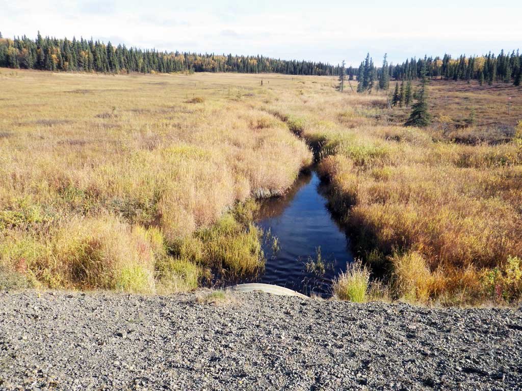
Backwatered: Yes
Step Pools: No
Construction Year: 1999
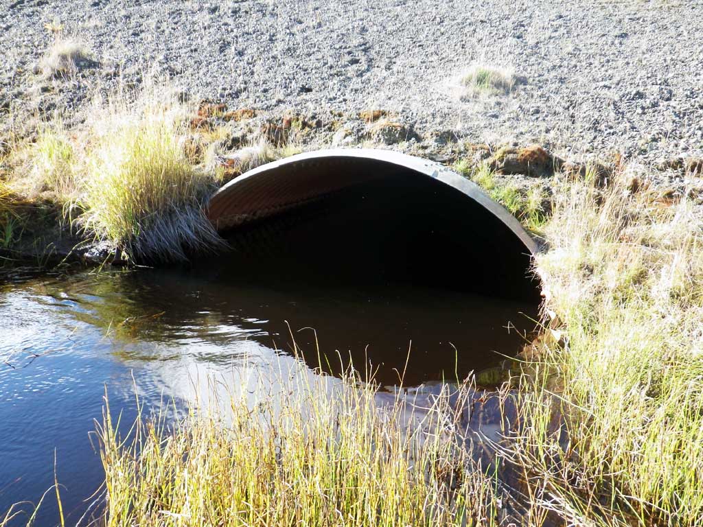
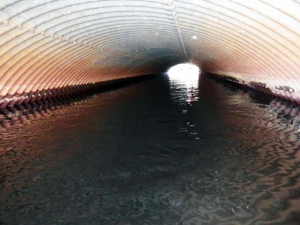
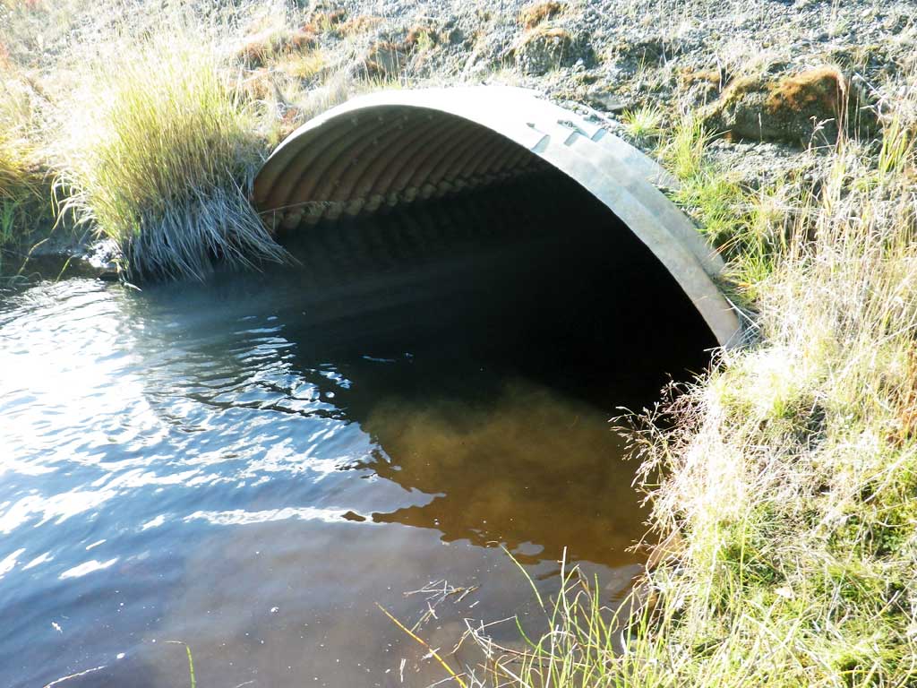
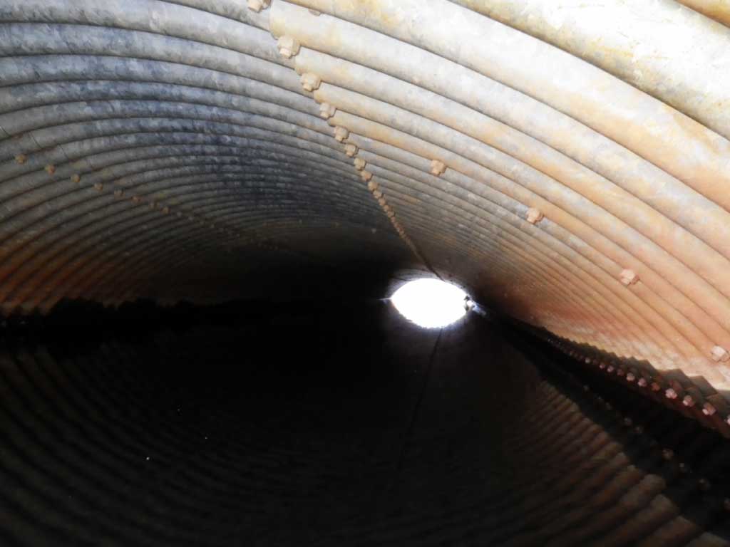
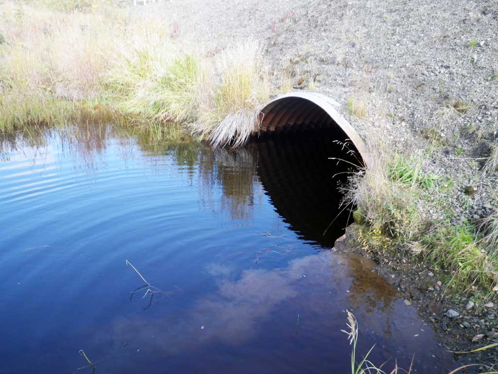
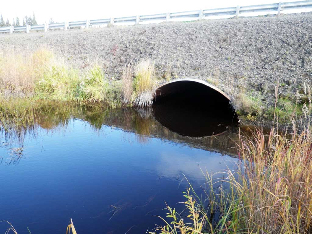
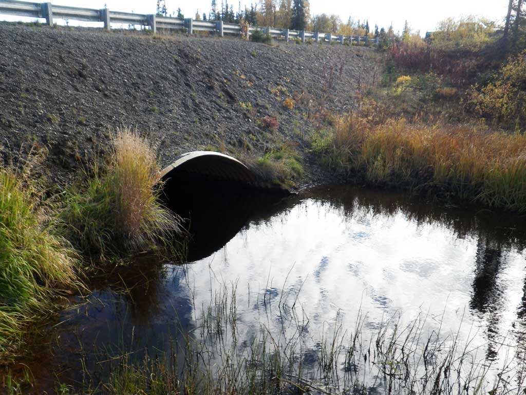
Comments: Pipe is stained, cannot measure rust line. Might be embedded, but too deep to measure all the way through. Very deep (>5 ft.) and narrow upstream. Flat and wider on downstream side of road. Slilght flow, not much through pipe.
Culvert Measurements
| ID: 1 | Structure Type: Pipe-arch (Structural steel plate) | Fish Passage Rating: | |||||||||||||||||||||||||||||||||||||||||
|
|
|
|||||||||||||||||||||||||||||||||||||||||
Comments: Substrate depth measurements are minimal. Top of miter length is 84.6 feet. |
|||||||||||||||||||||||||||||||||||||||||||
Stream Measurements
|
|
| Stream Width Type | Distance From Crossing (ft) |
Stream Width (ft) |
|---|---|---|
| Upstream ordinary high water | 89.0 | 4.00 |
| Upstream ordinary high water | 112.0 | 6.00 |
| Upstream ordinary high water | 150.0 | 9.00 |
Elevations
| Locator ID | Culvert Number |
River Distance (ft)1 |
Distance From Crossing (ft)2 |
Relative Elevation (ft) |
|---|---|---|---|---|
| Road Elev | 97.90 | |||
| D/S Water Surface Elev (appro 4.5 feet deep at this spot) | 0.00 | 87.40 | ||
| Outlet Culvert Top (top of miter) | 30.00 | 90.50 | ||
| Outlet Invert | 30.00 | 84.70 | ||
| D/S Water Surface Elev | 30.00 | 87.34 | ||
| Inlet Culvert Invert | 114.60 | 82.99 | ||
| U/S Water Surface Elev | 114.60 | 87.33 | ||
| Inlet Culvert Top (top of miter) | 114.60 | 90.66 | ||
| U/S Water Surface Elev (sg) | 154.60 | 87.31 | ||
| U/S Water Surface Elev (sg) | 273.60 | 87.41 |
Notes:
- River distance is measured continuously throughout the survey reach along the thalweg of the stream.
- Measured from each end of the crossing along the thalweg of the stream.
Fish Sampling Efforts
| Gear Type: Visual Observation, Ground (A) | ||
| Comments: No traps set, no fish observed. | ||
Fish Observations
No fish observations occurred during this survey.
Photos
Questions or comments about this report can be directed to dfg.dsf.webmaster@alaska.gov