Fish Passage Site 30303063
Coordinates (dec. deg.): 59.22559°, -158.67389°
Legal Description: S011S056W14
Region: Southwest
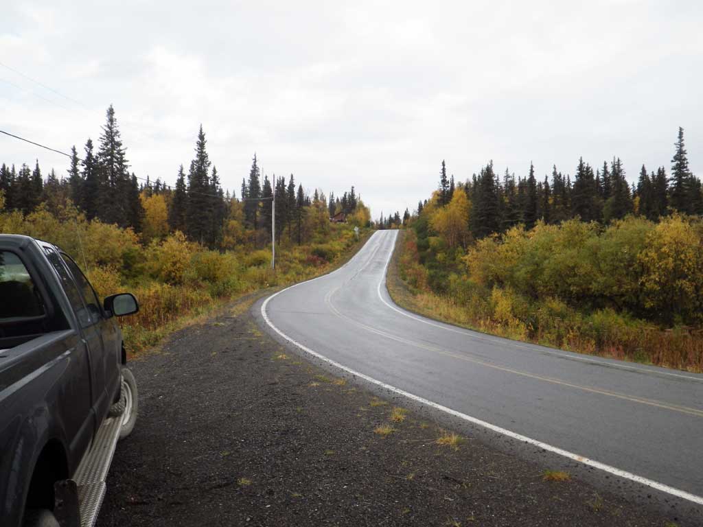
Road Name: Aleknagik Lake Road
Datum: NAD83
Quad Name / ITM: Dillingham A-8
AWC Stream #: 325-30-10100-2031-3051
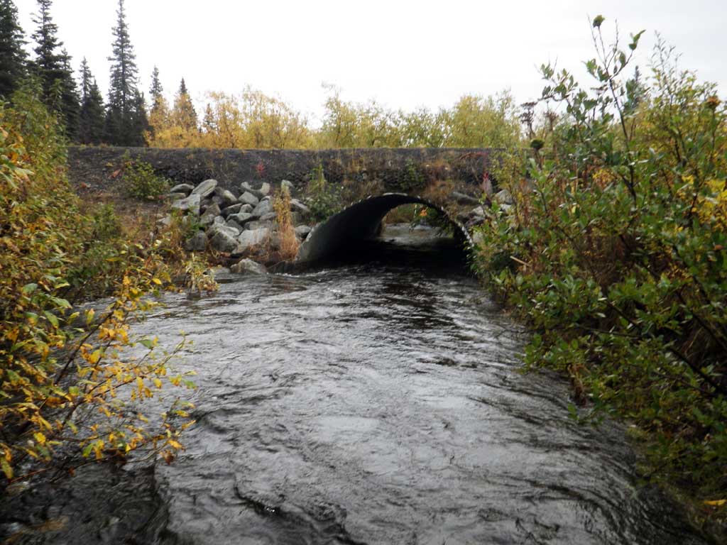
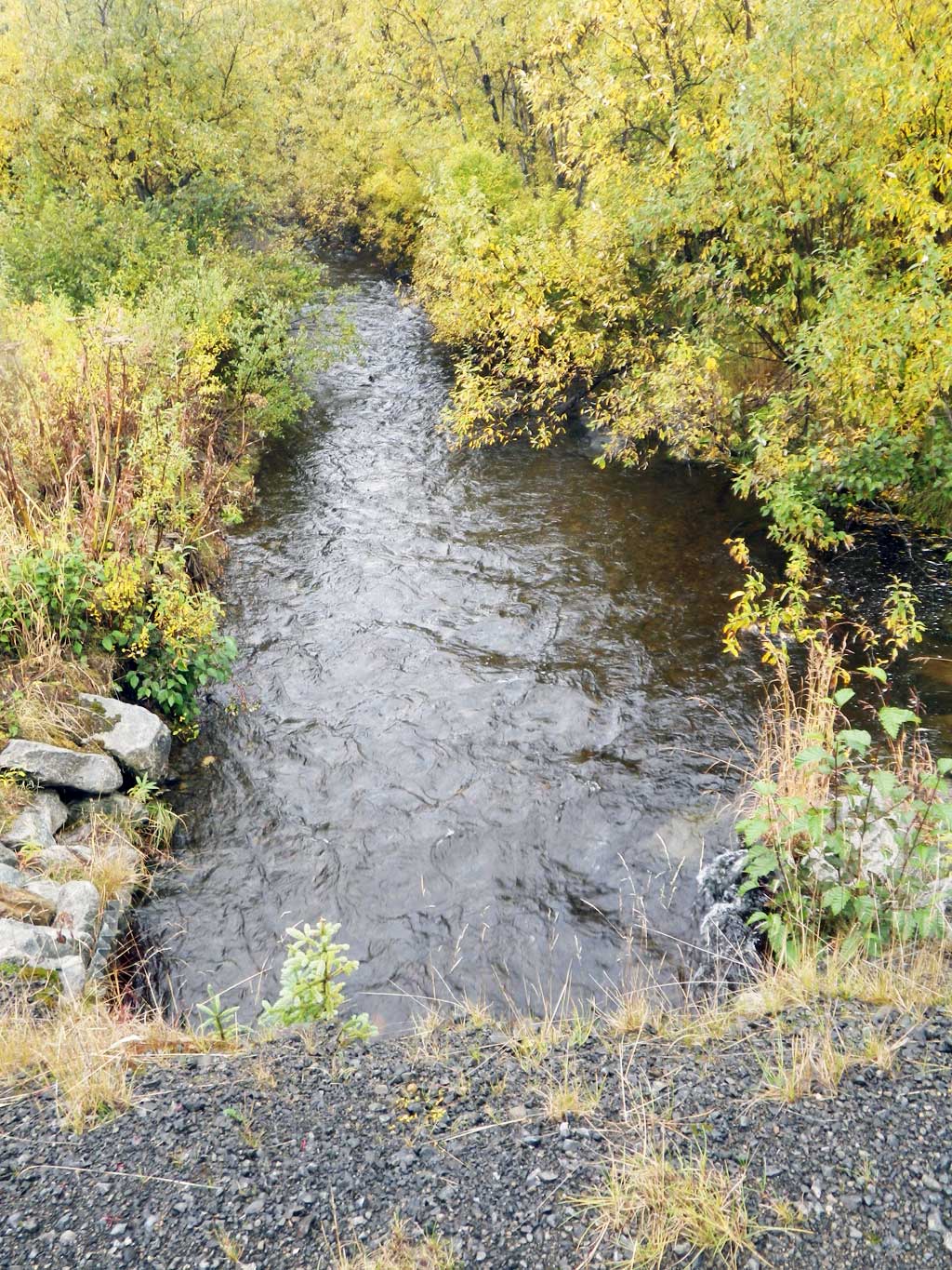
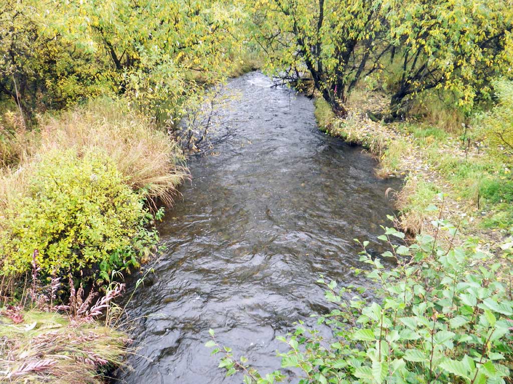
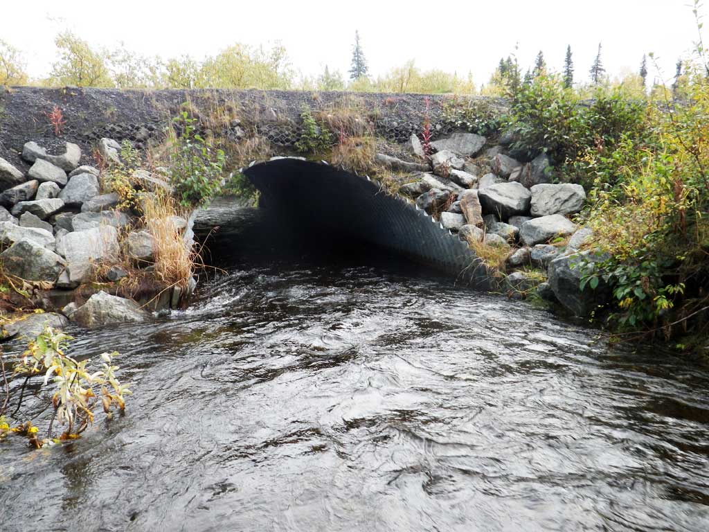
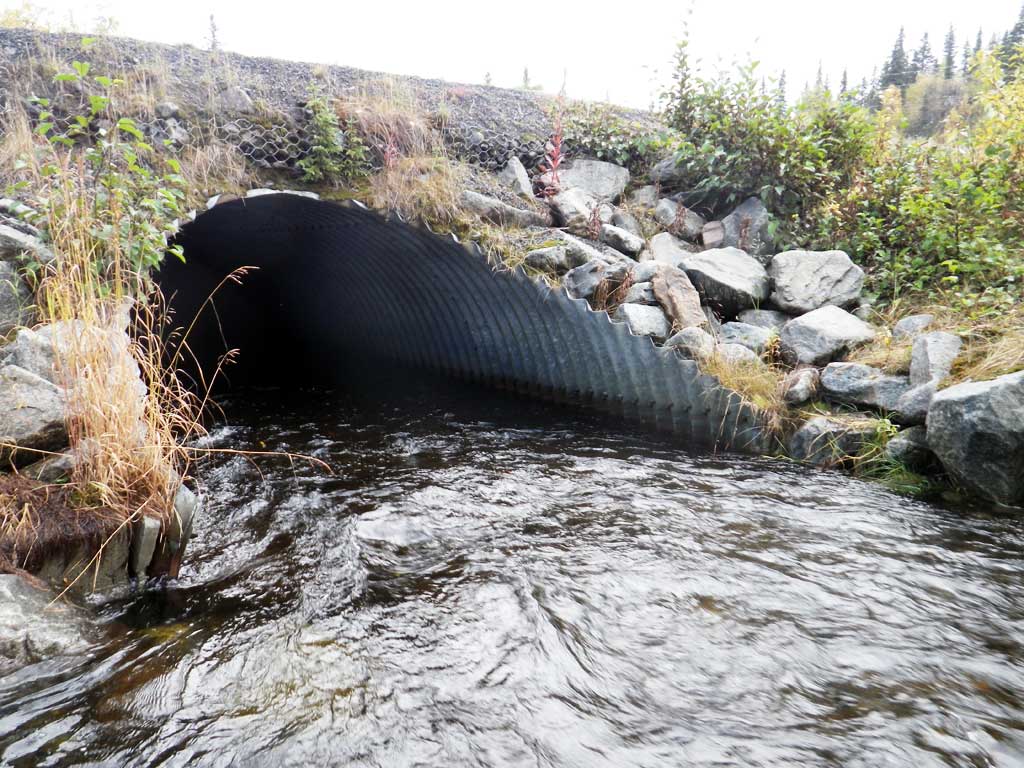
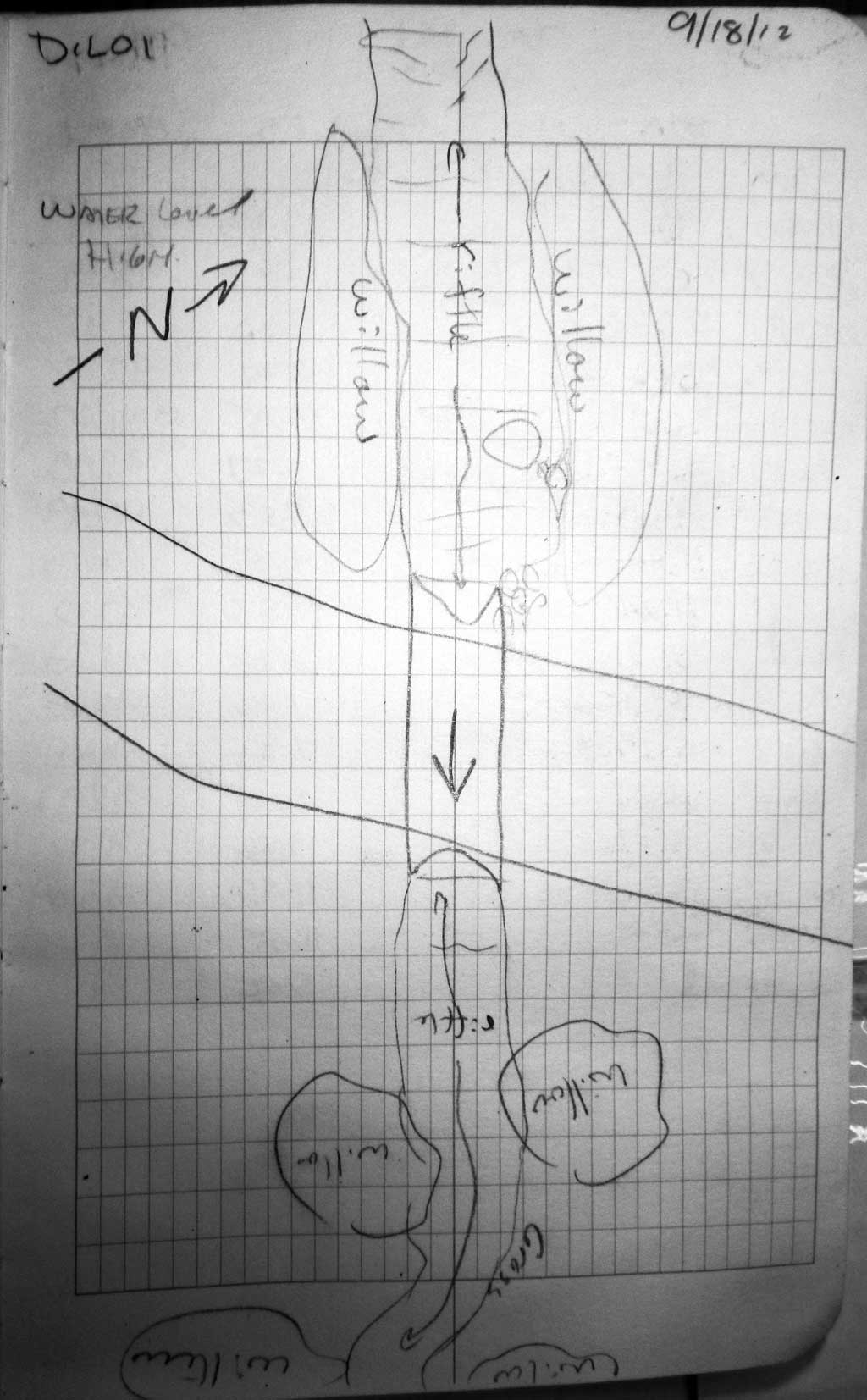
Stream Name: Silver Salmon Creek
Elevation:
Site Comments: None
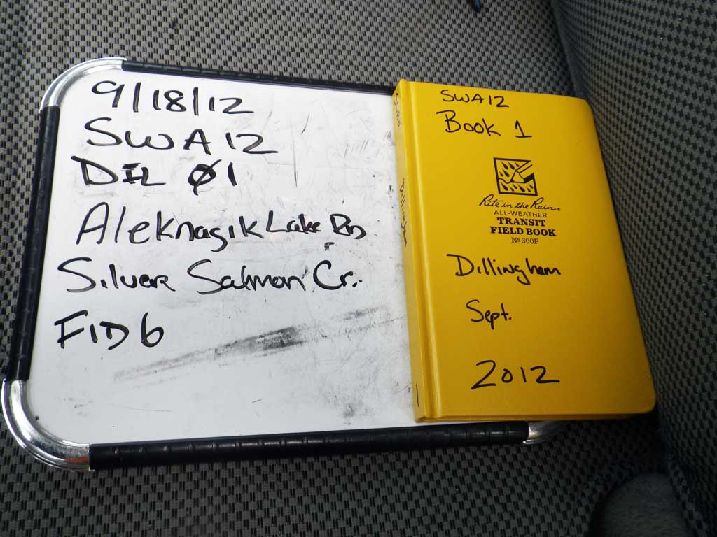
Survey SWA12-DIL01
Project Supervisor: Gillian O'Doherty, Alaska Department of Fish and Game
— Anchorage, AK
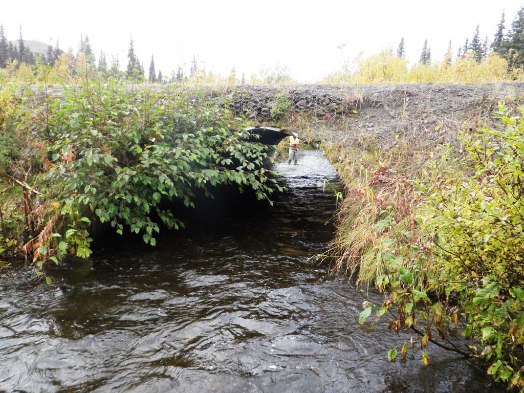
Observers: Gillian O'Doherty, Mark Eisenman
Overall Fish Passage Rating:
Tidal: No
Backwatered: No
Step Pools: No
Construction Year:
Site Observations:
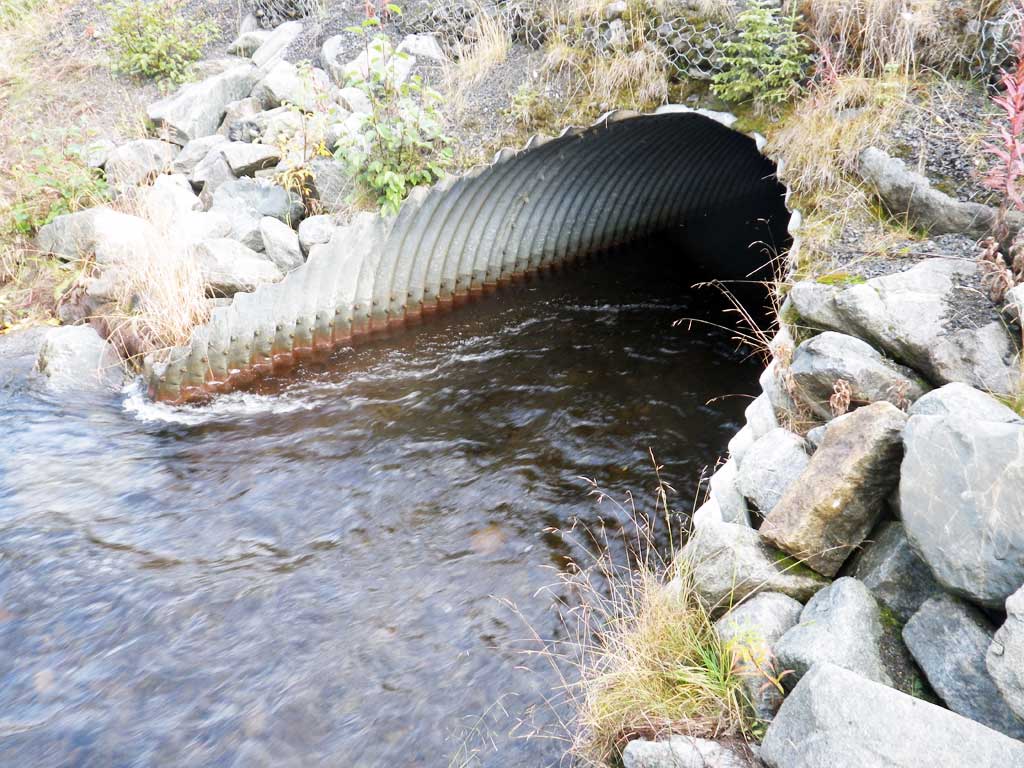
- Constriction ratio gray
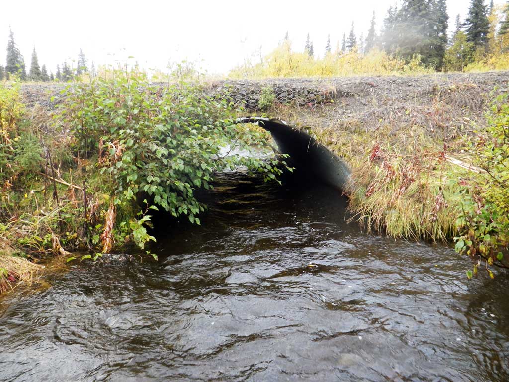
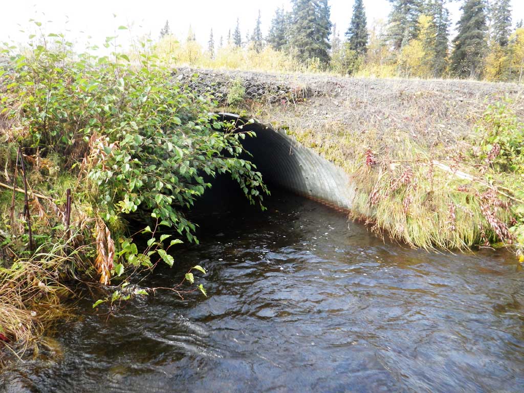
- Culvert is too short
- Road bank erosion
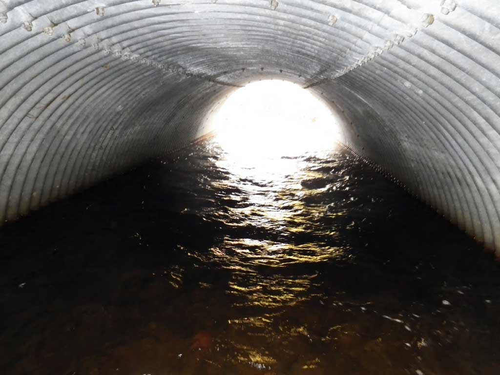
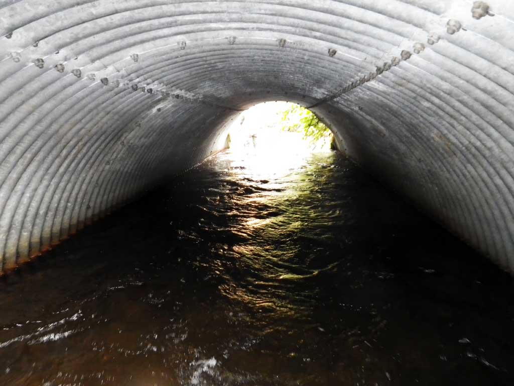
Comments: 1/4 mile from location. NHD is wrong. Velocity in pipe very high. Had to walk in 18"-deep water. Same amount of substrate through entire pipe.
Culvert Measurements
| ID: 1 | Structure Type: Pipe-arch (Structural steel plate) | Fish Passage Rating: | |||||||||||||||||||||||||||||||||||||||||
|
|
|
|||||||||||||||||||||||||||||||||||||||||
Comments: Top of miter length = 33.1. |
|||||||||||||||||||||||||||||||||||||||||||
Culvert Observations:
|
|||||||||||||||||||||||||||||||||||||||||||
Stream Measurements
|
|
| Stream Width Type | Distance From Crossing (ft) |
Stream Width (ft) |
|---|---|---|
| Upstream ordinary high water | 80.0 | 13.00 |
| Upstream ordinary high water | 100.0 | 16.00 |
| Upstream ordinary high water | 150.0 | 14.10 |
Elevations
| Locator ID | Culvert Number |
River Distance (ft)1 |
Distance From Crossing (ft)2 |
Relative Elevation (ft) |
|---|---|---|---|---|
| Road Elev | 100.78 | |||
| D/S Thalweg | 0.00 | 90.79 | ||
| D/S Water Surface Elev | 0.00 | 92.39 | ||
| D/S Thalweg | 20.00 | 91.42 | ||
| D/S Water Surface Elev | 20.00 | 92.82 | ||
| D/S Water Surface Elev | 31.50 | 92.75 | ||
| Outlet Invert (substrate) | 31.50 | 91.27 | ||
| Outlet Culvert Top | 40.00 | 97.49 | ||
| Inlet Culvert Top | 73.10 | 97.80 | ||
| U/S Water Surface Elev | 82.10 | 92.80 | ||
| Inlet Culvert Invert (substrate) | 82.10 | 91.24 | ||
| U/S Thalweg | 107.10 | 91.81 | ||
| U/S Water Surface Elev | 107.10 | 92.97 | ||
| U/S Water Surface Elev (sg) | 132.10 | 93.04 | ||
| U/S Thalweg | 132.10 | 91.46 | ||
| U/S Water Surface Elev (sg) | 211.10 | 93.97 |
Notes:
- River distance is measured continuously throughout the survey reach along the thalweg of the stream.
- Measured from each end of the crossing along the thalweg of the stream.
Fish Sampling Efforts
| Gear Type: Visual Observation, Ground (A) | ||
| Comments: No traps set, no fish observed. | ||
Fish Observations
No fish observations occurred during this survey.
Photos

Questions or comments about this report can be directed to dfg.dsf.webmaster@alaska.gov