Fish Passage Site 20601553
Coordinates (dec. deg.): 61.03941°, -151.47293°
Legal Description: S011N012W18
Region: South Central
Road Name:
Datum: NAD83
Quad Name / ITM: Tyonek A-4
AWC Stream #:
Stream Name: Unnamed
Elevation:
Site Comments: Site is ~50 ft DS of site 026 on abandoned roadway.
Survey TYCS1-TY027
Observers: Cecil Rich, Michael Anderson, Joe Buckwalter
Overall Fish Passage Rating:
Tidal: No
Backwatered: No
Step Pools:
Construction Year:
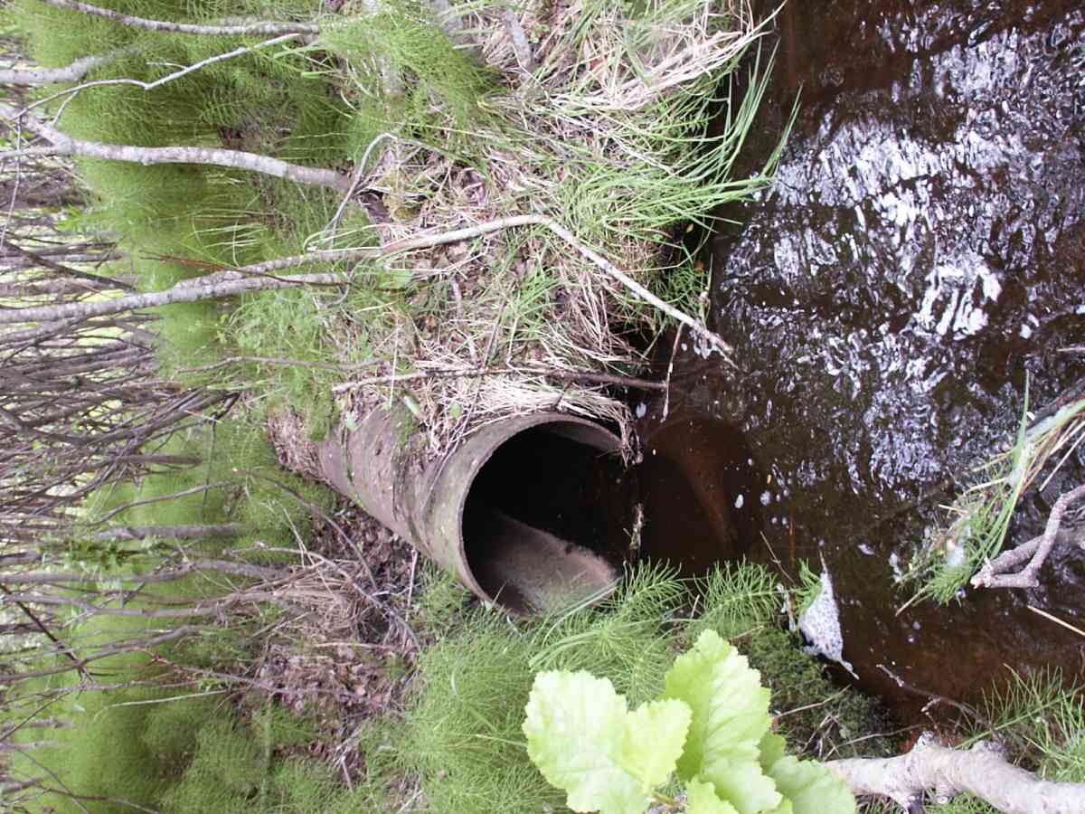
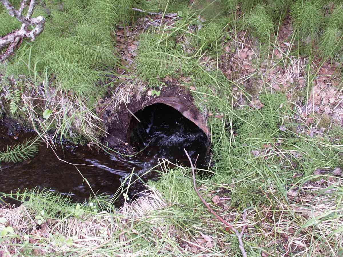
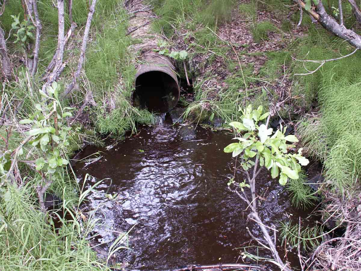
Comments: WGS84. 30.4 ft = gps accuracy. Site is ~50 ft DS of site 026 on abandoned roadway. Culvert B bearing = 162. Culvert A has no fill, = ~5% flow. DS distances (50,100-ft) measured from culvert A. Culvert B outlet is 10 ft US of A. B tailcrest = 5ft DS of B. Site scheuled to be removed by DNR.
Culvert Measurements
| ID: 1 | Structure Type: Circular pipe (Non-corrugated metal) | Fish Passage Rating: | |||||||||||||||||||||||||||||||||||||||||
|
|
|
|||||||||||||||||||||||||||||||||||||||||
Comments: Culvert A has no fill, = ~5% flow. |
|||||||||||||||||||||||||||||||||||||||||||
Culvert Observations:
|
|||||||||||||||||||||||||||||||||||||||||||
| ID: 2 | Structure Type: Circular pipe (Corrugated Metal) | Fish Passage Rating: | |||||||||||||||||||||||||||||||||||||||||
|
|
|
|||||||||||||||||||||||||||||||||||||||||
Comments: Culvert B bearing = 162. |
|||||||||||||||||||||||||||||||||||||||||||
Culvert Observations:
|
|||||||||||||||||||||||||||||||||||||||||||
Stream Measurements
|
|
| Stream Width Type | Distance From Crossing (ft) |
Stream Width (ft) |
|---|---|---|
| Downstream ordinary high water | 38.0 | 3.00 |
| Downstream ordinary high water | 75.0 | 4.00 |
| Upstream ordinary high water | 5.0 | 8.00 |
| Upstream ordinary high water | 14.3 | 7.80 |
Elevations
| Locator ID | Culvert Number |
River Distance (ft)1 |
Distance From Crossing (ft)2 |
Relative Elevation (ft) |
|---|---|---|---|---|
| D/S Thalweg | 75.0 | 91.84 | ||
| D/S Water Surface Elev | 75.0 | 92.17 | ||
| D/S OHW Elev | 75.0 | 92.87 | ||
| D/S Thalweg | 38.0 | 94.29 | ||
| D/S Water Surface Elev | 38.0 | 94.64 | ||
| D/S OHW Elev | 38.0 | 95.08 | ||
| D/S Thalweg (Culvert B = 0,2,5.80 (x,I,fs)) | 3.8 | 95.50 | ||
| Max Pool Depth | 1 | 3.8 | 95.50 | |
| Outlet Thalweg | 1 | 0.0 | 95.99 | |
| D/S Tailcrest or 1st Thalweg | 96.11 | |||
| OHW Left Bank (Culvert B = 3,2,4.72) | 5.0 | 96.35 | ||
| Outlet Invert | 1 | 0.0 | 96.48 | |
| Max Pool Depth | 2 | 0.0 | 96.61 | |
| Outlet Thalweg (max width OHW = 4.5 ft) | 2 | 0.0 | 96.61 | |
| OHW Left Bank (Culvert B =3,2,4.46) | 5.0 | 96.95 | ||
| Outlet Rustline Height (moss line) | 1 | 0.0 | 97.01 | |
| Inlet Thalweg | 2 | 0.0 | 97.06 | |
| U/S Thalweg | 1 | 1.0 | 97.42 | |
| Inlet Culvert Invert | 2 | 0.0 | 97.54 | |
| Inlet Thalweg | 1 | 0.0 | 97.56 | |
| Outlet Culvert Top (outlet crushed, 0.05 ft bl WEL) | 2 | 0.0 | 97.63 | |
| U/S Thalweg | 1 | 3.2 | 97.65 | |
| U/S Thalweg | 2 | 1.0 | 97.82 | |
| U/S Thalweg | 2 | 5.0 | 97.82 | |
| U/S Thalweg | 1 | 5.0 | 97.85 | |
| Inlet Culvert Invert | 1 | 0.0 | 98.01 | |
| U/S Thalweg | 14.3 | 98.04 | ||
| U/S Water Surface Elev | 2 | 5.0 | 98.06 | |
| U/S Water Surface Elev | 1 | 5.0 | 98.10 | |
| Inlet Rustline Height (moss line) | 2 | 0.0 | 98.12 | |
| Outlet Culvert Top | 1 | 0.0 | 98.17 | |
| U/S Water Surface Elev | 14.3 | 98.37 | ||
| U/S OHW elevation (OHW width @ 5=4.95) | 2 | 1.0 | 98.40 | |
| U/S OHW elevation | 1 | 1.0 | 98.47 | |
| U/S Headwater | 14.3 | 99.03 | ||
| Inlet Culvert Top | 2 | 0.0 | 99.07 | |
| Inlet Culvert Top | 1 | 0.0 | 99.62 | |
| Road Elev | 100.80 | |||
| Road Elev | 101.24 |
Notes:
- River distance is measured continuously throughout the survey reach along the thalweg of the stream.
- Measured from each end of the crossing along the thalweg of the stream.
Fish Sampling Efforts
| Gear Type: Minnow Trap, 1/4 in. Mesh (A) | Trap Duration(h): 2 | |
| Gear Type: Minnow Trap, 1/4 in. Mesh (B) | Trap Duration(h): 2 | |
Fish Observations
| Species: juvenile Dolly Varden | Life History: Resident | ||
| Total Fish Observed: 20 | Fish Measured: 10 | Fork Lengths (mm) Min: 52 Max: 156 Mean: 107 | |
| Collected/Observed by Gear Type: Downstream Minnow Trap, 1/4 in. Mesh (4) Upstream Minnow Trap, 1/4 in. Mesh (16) | |||
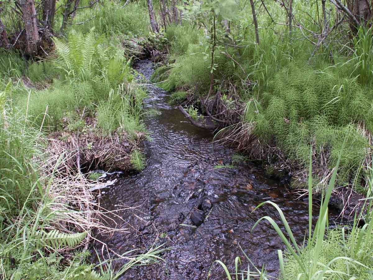
Photos
Questions or comments about this report can be directed to dfg.dsf.webmaster@alaska.gov