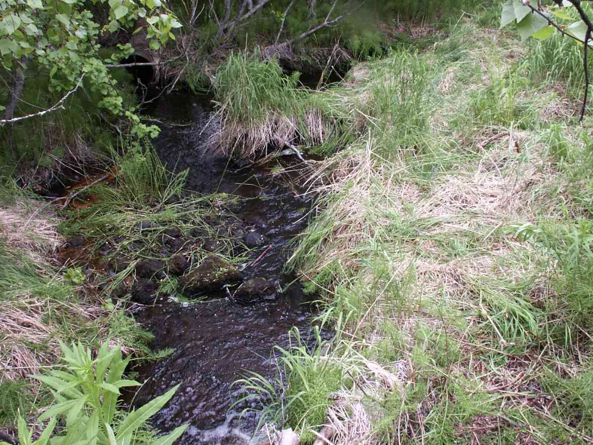
Fish Passage Site 20601552
Coordinates (dec. deg.): 61.03972°, -151.47273°
Legal Description: S011N012W18
Region: South Central
Road Name:
Datum: NAD83
Quad Name / ITM: Tyonek A-4
AWC Stream #:
Stream Name: Unnamed
Elevation:
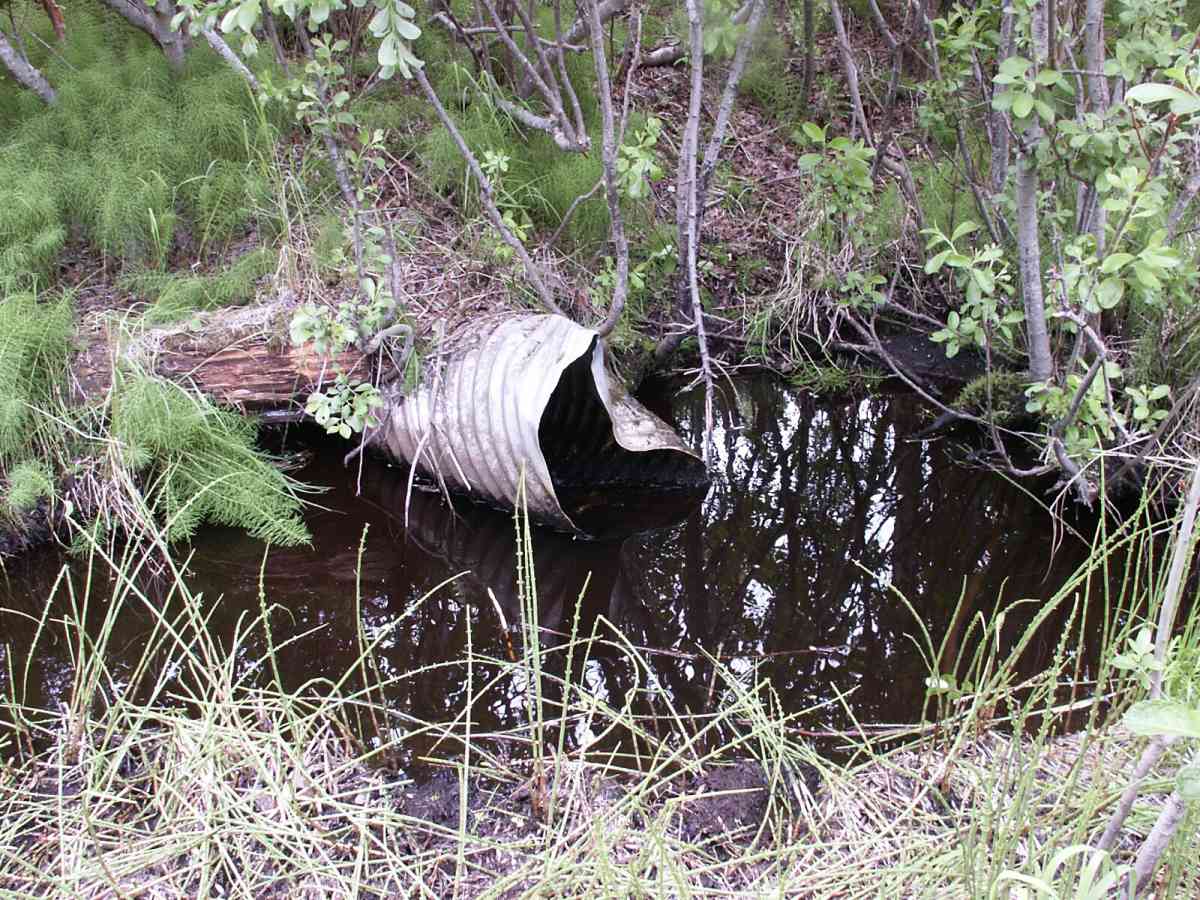
Site Comments: Site is 23.1 feet US of 027 inlet
Survey TYCS1-TY026
Observers: Cecil Rich, Michael Anderson, Joe Buckwalter
Overall Fish Passage Rating:
Tidal: No
Backwatered: No
Step Pools:
Construction Year:
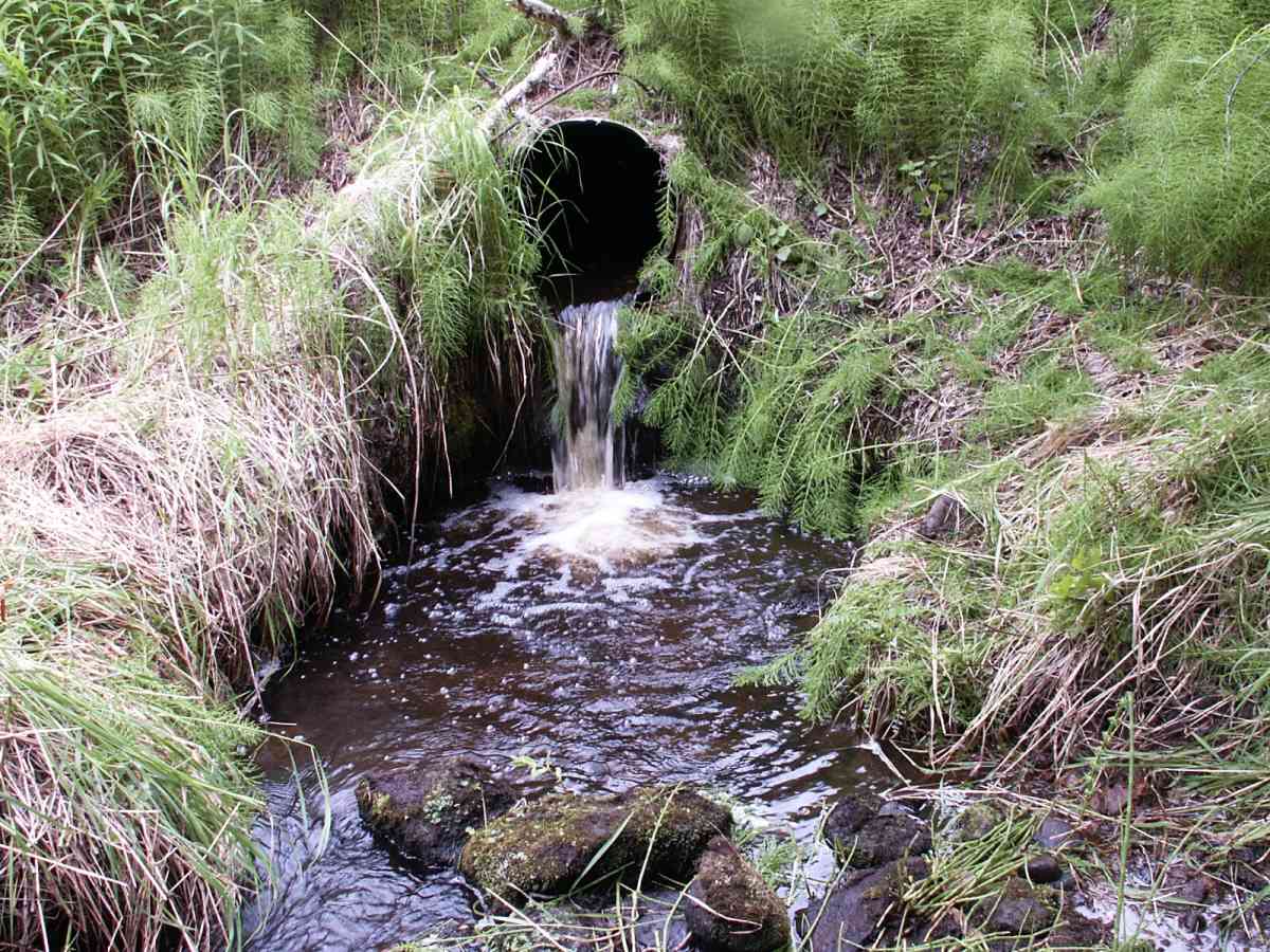
Comments: Datum = WGS84. GPS acccuracy 19.8. Site is 23.1 feet US of 027 inlet. Began with inst. 3 from site 027. Site scheduled to be removed by DNR.
Culvert Measurements
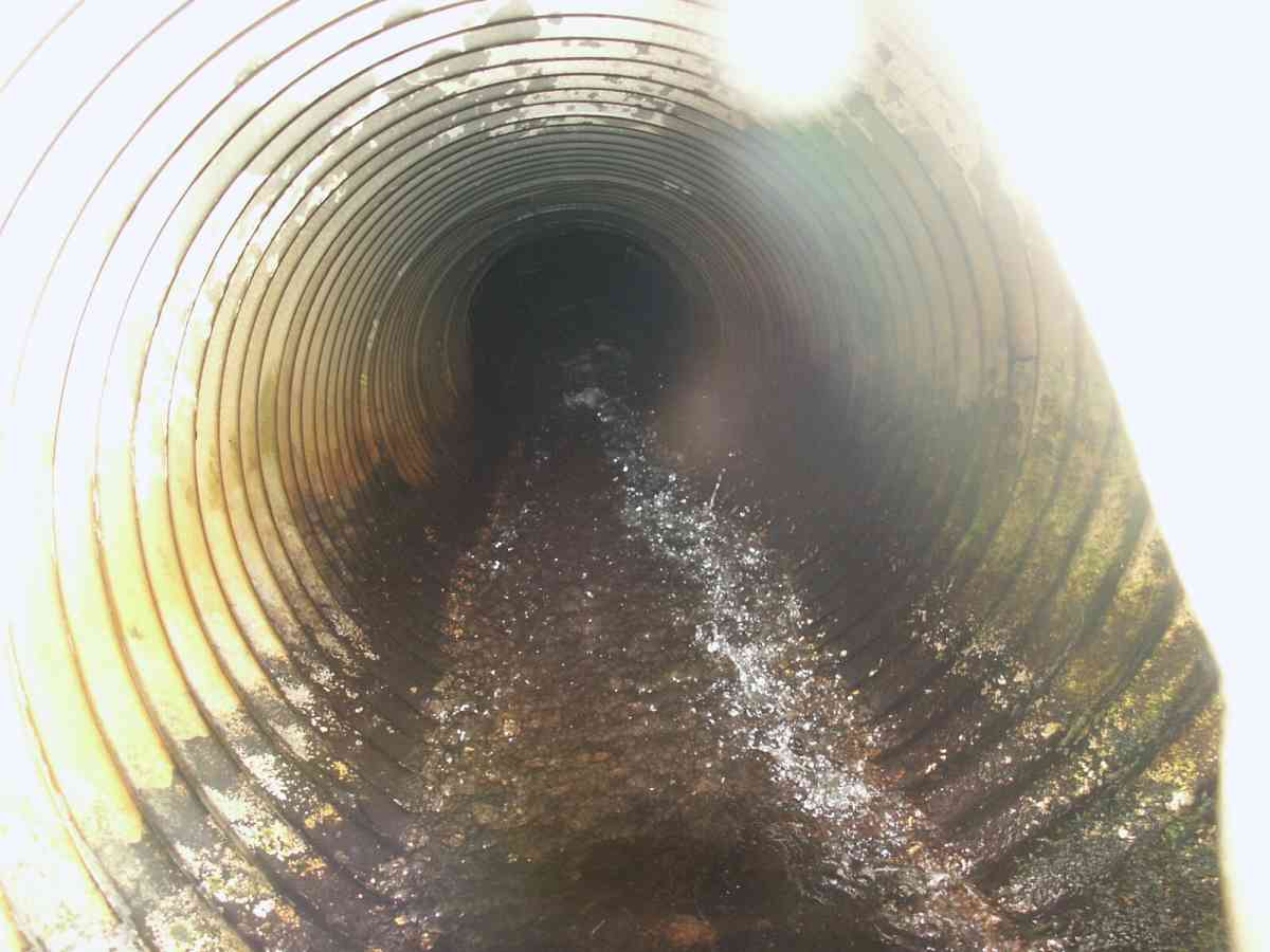
| ID: 1 | Structure Type: Circular pipe (Corrugated Metal) | Fish Passage Rating: | |||||||||||||||||||||||||||||||||||||||||
|
|
|
|||||||||||||||||||||||||||||||||||||||||
Culvert Observations:
|
|||||||||||||||||||||||||||||||||||||||||||
Stream Measurements
|
|
| Stream Width Type | Distance From Crossing (ft) |
Stream Width (ft) |
|---|---|---|
| Downstream ordinary high water | 10.0 | 7.80 |
| Upstream ordinary high water | 5.0 | 4.20 |
| Upstream ordinary high water | 141.5 | 6.70 |
| Upstream ordinary high water | 166.5 | 12.40 |
Elevations
| Locator ID | Culvert Number |
River Distance (ft)1 |
Distance From Crossing (ft)2 |
Relative Elevation (ft) |
|---|---|---|---|---|
| D/S Tailcrest or 1st Thalweg | 97.88 | |||
| D/S Thalweg | 0.00 | 10.2 | 98.04 | |
| D/S Water Surface Elev | 0.00 | 10.2 | 98.37 | |
| D/S OHW Elev | 0.00 | 10.2 | 99.03 | |
| OHW Left Bank | 6.90 | 3.3 | 98.46 | |
| OHW Left Bank | 6.90 | 3.3 | 98.88 | |
| D/S Thalweg | 7.20 | 3.0 | 96.78 | |
| Max Pool Depth | 1 | 7.20 | 3.0 | 96.78 |
| Outlet Thalweg | 1 | 10.20 | 0.0 | 97.51 |
| Outlet Invert | 1 | 10.20 | 0.0 | 100.10 |
| Outlet Rustline Height | 1 | 10.20 | 0.0 | 100.59 |
| Outlet Culvert Top | 1 | 10.20 | 0.0 | 102.10 |
| Road Elev | 40.70 | 109.02 | ||
| Road Elev | 40.70 | 109.46 | ||
| Inlet Culvert Top | 1 | 71.20 | 0.0 | 105.49 |
| Inlet Thalweg | 1 | 71.20 | 0.0 | 102.25 |
| Inlet Culvert Invert | 1 | 71.20 | 0.0 | 103.43 |
| Inlet Rustline Height (moss line) | 1 | 71.20 | 0.0 | 103.99 |
| U/S Thalweg | 1 | 72.20 | 1.0 | 102.21 |
| U/S OHW elevation | 1 | 72.20 | 1.0 | 104.27 |
| U/S Thalweg | 1 | 74.56 | 3.36 | 102.46 |
| U/S Thalweg | 1 | 76.20 | 5.0 | 102.56 |
| U/S Water Surface Elev | 1 | 76.20 | 5.0 | 103.78 |
| U/S Thalweg | 212.70 | 141.5 | 104.14 | |
| U/S Water Surface Elev | 212.70 | 141.5 | 104.43 | |
| U/S Headwater | 212.70 | 141.5 | 104.75 | |
| U/S Thalweg | 237.70 | 166.5 | 105.40 | |
| U/S Water Surface Elev | 237.70 | 166.5 | 105.72 | |
| U/S Headwater | 237.70 | 166.5 | 106.10 |
Notes:
- River distance is measured continuously throughout the survey reach along the thalweg of the stream.
- Measured from each end of the crossing along the thalweg of the stream.
Fish Sampling Efforts
| Gear Type: Minnow Trap, 1/4 in. Mesh (A) | Trap Duration(h): 2 | |
| Gear Type: Minnow Trap, 1/4 in. Mesh (B) | Trap Duration(h): 2 | |
Fish Observations
| Species: juvenile Dolly Varden | Life History: Resident | ||
| Total Fish Observed: 24 | Fish Measured: 12 | Fork Lengths (mm) Min: 87 Max: 171 Mean: 122 | |
| Collected/Observed by Gear Type: Downstream Minnow Trap, 1/4 in. Mesh (16) Upstream Minnow Trap, 1/4 in. Mesh (8) | |||
Photos
Questions or comments about this report can be directed to dfg.dsf.webmaster@alaska.gov