Fish Passage Site 20601546
Coordinates (dec. deg.): 61.10692°, -151.72321°
Legal Description: S012N014W26
Region: South Central
Road Name:
Datum: NAD83
Quad Name / ITM: Tyonek A-5
AWC Stream #:
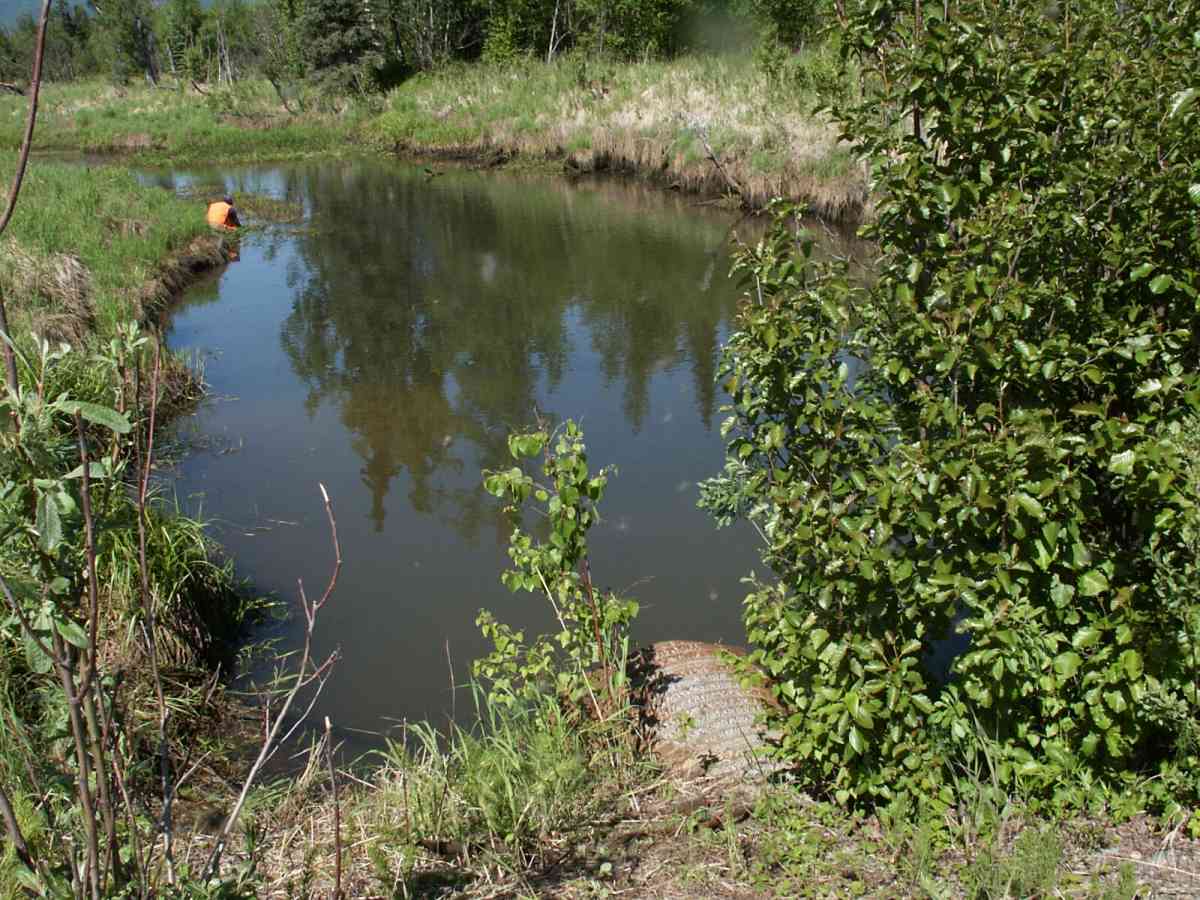
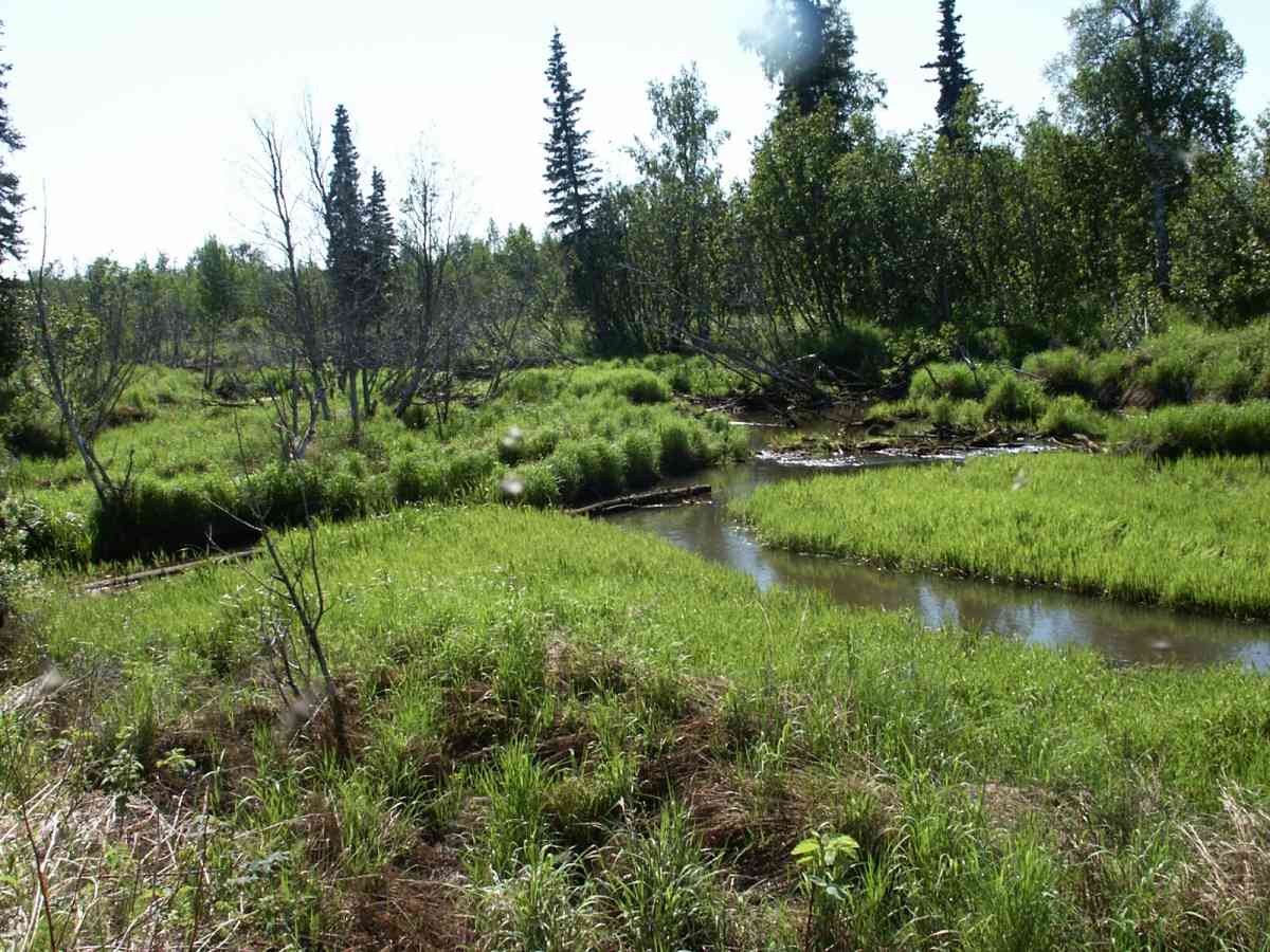
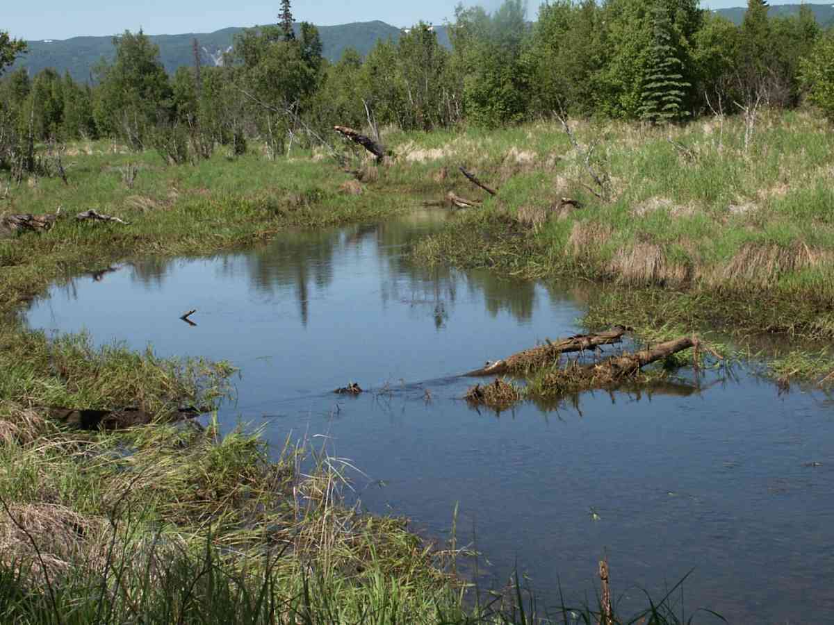
Stream Name: Chuitkilnachna Creek
Elevation:
Site Comments: None
Survey TYCS1-TY020
Observers: Cecil Rich, Michael Anderson, Joe Buckwalter
Overall Fish Passage Rating:
Tidal: No
Backwatered: No
Step Pools:
Construction Year:
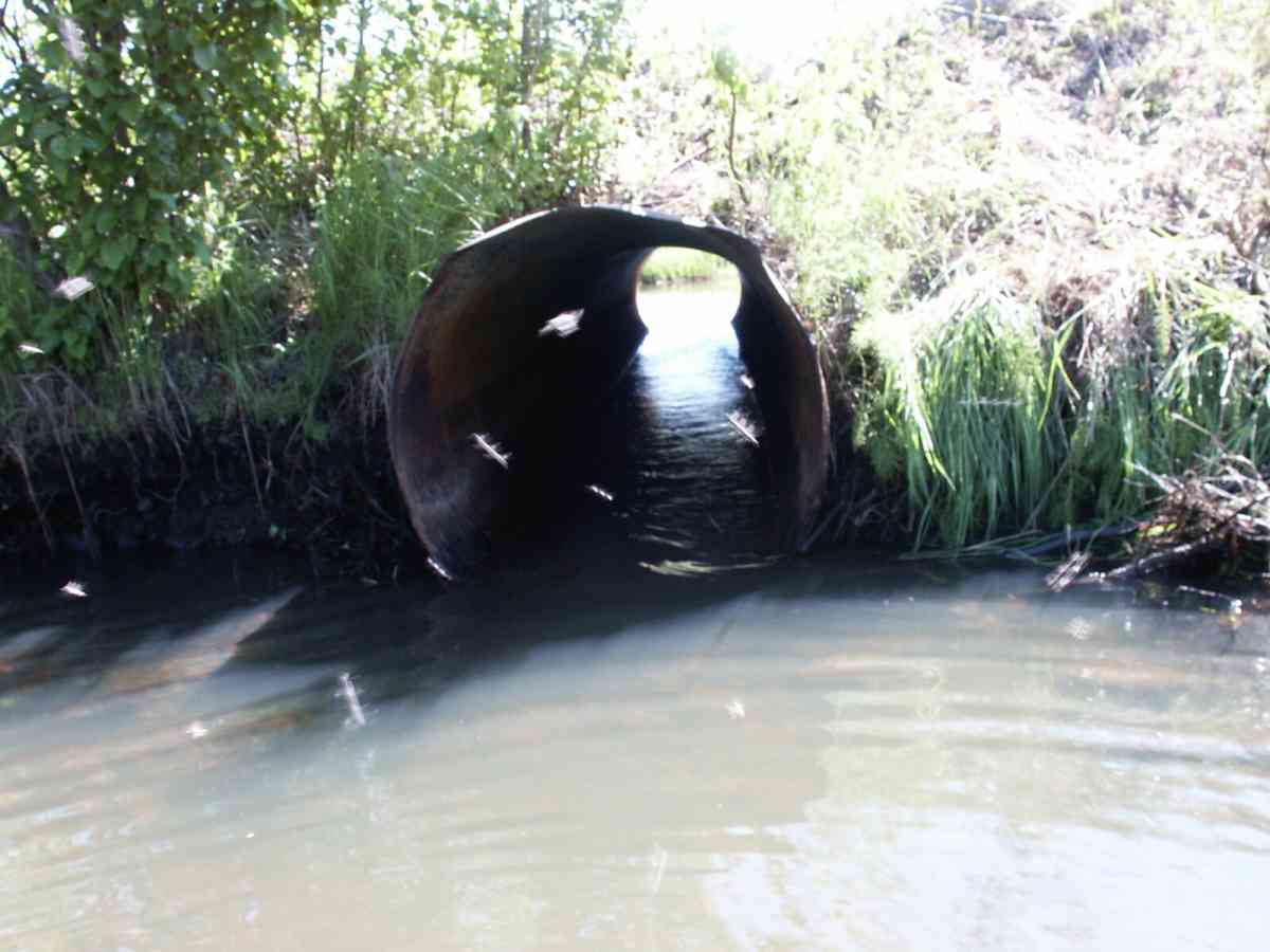
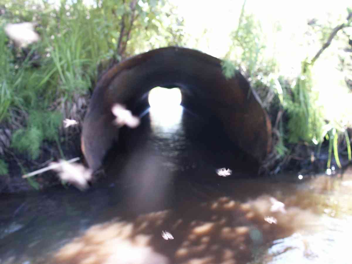
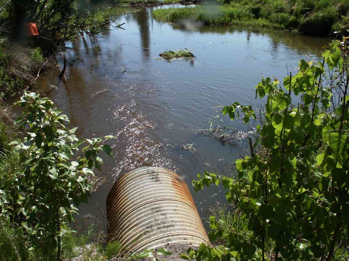
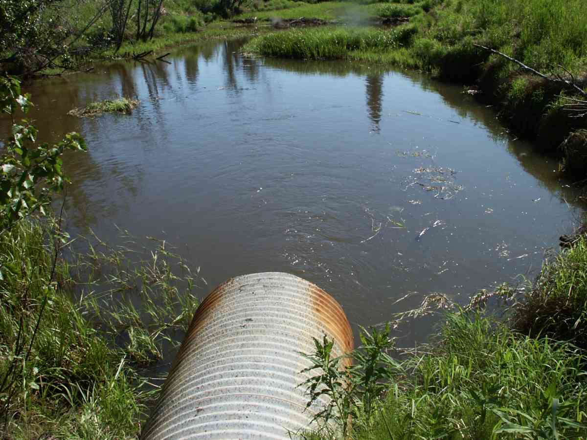
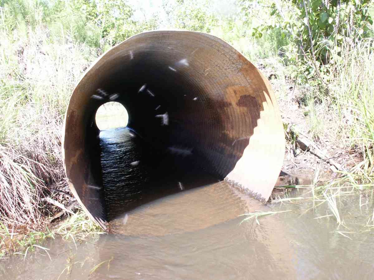
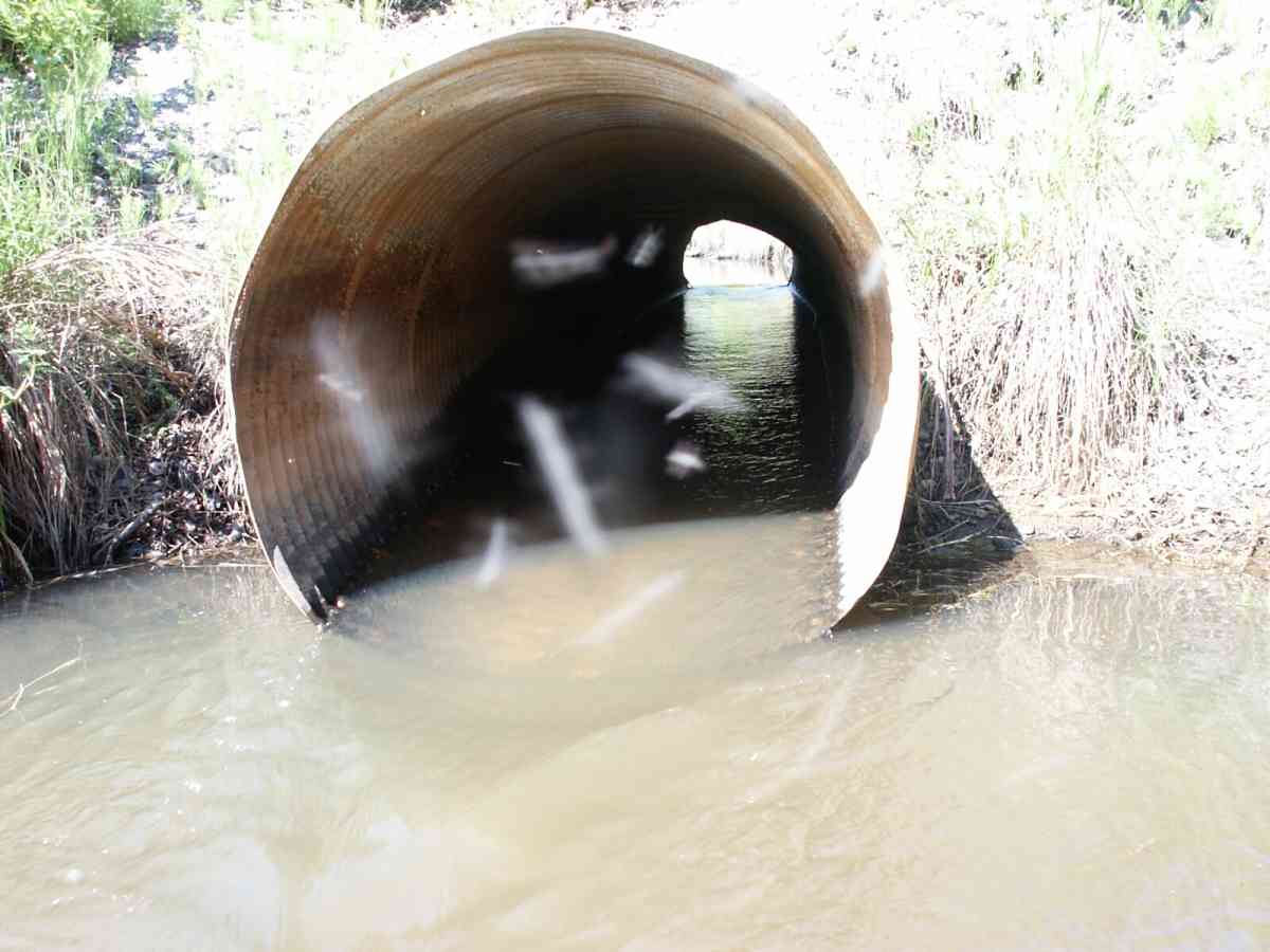
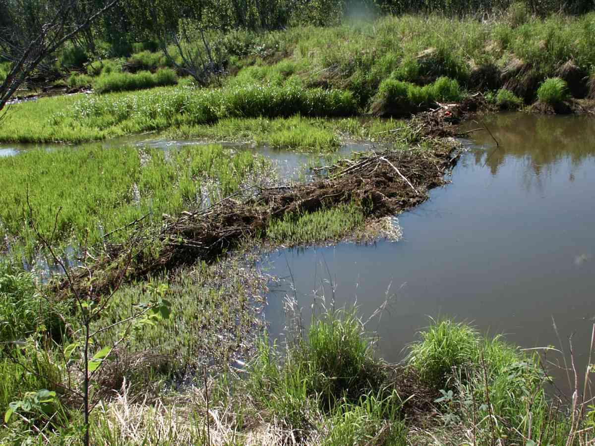
Comments: Datum = WGS84. GPS accuracy = 24.4 feet. Left culvert was completely plugged and right culvert partially plugged (by beavers). Both culverts were cleared approximately 2 hours prior to survey. Right culvert bearing = 164 degrees.
Culvert Measurements
| ID: 1 | Structure Type: Circular pipe (Corrugated Metal) | Fish Passage Rating: | |||||||||||||||||||||||||||||||||||||||||
|
|
|
|||||||||||||||||||||||||||||||||||||||||
Culvert Observations:
|
|||||||||||||||||||||||||||||||||||||||||||
| ID: 2 | Structure Type: Circular pipe (Corrugated Metal) | Fish Passage Rating: | |||||||||||||||||||||||||||||||||||||||||
|
|
|
|||||||||||||||||||||||||||||||||||||||||
Culvert Observations:
|
|||||||||||||||||||||||||||||||||||||||||||
Stream Measurements
|
|
| Stream Width Type | Distance From Crossing (ft) |
Stream Width (ft) |
|---|---|---|
| Downstream ordinary high water | 125.0 | 47.40 |
| Downstream ordinary high water | 224.0 | 48.00 |
| Downstream ordinary high water | 308.0 | 30.00 |
| Upstream ordinary high water | 5.0 | 42.50 |
| Upstream ordinary high water | 252.0 | 51.00 |
| Upstream ordinary high water | 394.0 | 32.50 |
Elevations
| Locator ID | Culvert Number |
River Distance (ft)1 |
Distance From Crossing (ft)2 |
Relative Elevation (ft) |
|---|---|---|---|---|
| D/S Tailcrest or 1st Thalweg | 88.88 | |||
| D/S OHW Elev | 0.00 | 308.0 | 87.90 | |
| D/S Thalweg | 0.00 | 308.0 | 87.08 | |
| D/S Water Surface Elev | 0.00 | 308.0 | 87.63 | |
| D/S Thalweg | 84.00 | 224.0 | 87.40 | |
| D/S Water Surface Elev | 84.00 | 224.0 | 87.90 | |
| D/S OHW Elev | 84.00 | 224.0 | 88.30 | |
| D/S Thalweg | 296.00 | 12.0 | 83.89 | |
| Max Pool Depth | 1 | 303.00 | 5.0 | 85.41 |
| Max Pool Depth | 2 | 303.00 | 5.0 | 85.75 |
| Outlet Invert | 1 | 308.00 | 0.0 | 87.67 |
| Outlet Thalweg | 1 | 308.00 | 0.0 | 87.20 |
| Outlet Thalweg | 2 | 308.00 | 0.0 | 87.29 |
| OHW Left Bank | 308.00 | 0.0 | 88.33 | |
| Outlet Invert | 2 | 308.00 | 0.0 | 87.75 |
| OHW Left Bank | 308.00 | 0.0 | 88.68 | |
| Outlet Rustline Height (lowest of 3) | 2 | 308.00 | 0.0 | 88.97 |
| Outlet Rustline Height (lowest of 3 rustlines) | 1 | 308.00 | 0.0 | 89.37 |
| Outlet Culvert Top | 2 | 308.00 | 0.0 | 91.79 |
| Outlet Culvert Top | 1 | 308.00 | 0.0 | 91.80 |
| Road Elev | 328.00 | 94.98 | ||
| Road Elev | 328.00 | 95.03 | ||
| Inlet Rustline Height | 2 | 348.00 | 0.0 | 89.23 |
| Inlet Culvert Top | 2 | 348.00 | 0.0 | 91.96 |
| Inlet Culvert Top | 1 | 348.00 | 0.0 | 91.46 |
| U/S OHW elevation | 2 | 348.00 | 0.0 | 88.93 |
| U/S Water Surface Elev | 1 | 348.00 | 0.0 | 88.68 |
| Inlet Thalweg | 2 | 348.00 | 0.0 | 87.78 |
| Inlet Culvert Invert | 2 | 348.00 | 0.0 | 87.86 |
| U/S Water Surface Elev | 2 | 348.00 | 0.0 | 88.67 |
| Inlet Culvert Invert | 1 | 348.00 | 0.0 | 87.31 |
| Inlet Thalweg | 1 | 348.00 | 0.0 | 87.36 |
| U/S Thalweg | 2 | 349.00 | 1.0 | 87.72 |
| U/S Thalweg | 1 | 349.00 | 1.0 | 87.40 |
| U/S OHW elevation | 1 | 349.00 | 1.0 | 89.02 |
| U/S Thalweg | 1 | 353.00 | 5.0 | 87.13 |
| U/S Thalweg | 2 | 353.00 | 5.0 | 86.88 |
| U/S Thalweg | 1 | 355.90 | 7.9 | 86.38 |
| U/S Thalweg | 2 | 356.00 | 8.0 | 86.46 |
| U/S Thalweg | 600.00 | 252.0 | 86.39 | |
| U/S Headwater | 600.00 | 252.0 | 89.06 | |
| U/S Water Surface Elev | 600.00 | 252.0 | 88.84 |
Notes:
- River distance is measured continuously throughout the survey reach along the thalweg of the stream.
- Measured from each end of the crossing along the thalweg of the stream.
Fish Sampling Efforts
| Gear Type: Minnow Trap, 1/4 in. Mesh (A) | Trap Duration(h): 3 | |
| Gear Type: Minnow Trap, 1/4 in. Mesh (B) | Trap Duration(h): 2.75 | |
Fish Observations
| Species: ninespine stickleback | Life History: Resident | ||
| Total Fish Observed: 2 | Fish Measured: 1 | Fork Lengths (mm) Min: 61 Max: 61 Mean: 61 | |
| Collected/Observed by Gear Type: Downstream Minnow Trap, 1/4 in. Mesh (2) | |||
| Species: threespine stickleback | Life History: Resident | ||
| Total Fish Observed: 6 | Fish Measured: 3 | Fork Lengths (mm) Min: 50 Max: 59 Mean: 55 | |
| Collected/Observed by Gear Type: Downstream Minnow Trap, 1/4 in. Mesh (6) | |||
| Species: juvenile coho salmon | Life History: Anadromous | ||
| Total Fish Observed: 16 | Fish Measured: 8 | Fork Lengths (mm) Min: 108 Max: 119 Mean: 113 | |
| Collected/Observed by Gear Type: Downstream Minnow Trap, 1/4 in. Mesh (8) Upstream Minnow Trap, 1/4 in. Mesh (8) | |||
| Species: sculpin-unspecified | Life History: Resident | ||
| Total Fish Observed: 4 | Fish Measured: 2 | Fork Lengths (mm) Min: 70 Max: 72 Mean: 71 | |
| Collected/Observed by Gear Type: Downstream Minnow Trap, 1/4 in. Mesh (4) | |||
Photos
Questions or comments about this report can be directed to dfg.dsf.webmaster@alaska.gov