Fish Passage Site 20601543
Coordinates (dec. deg.): 61.05783°, -151.40369°
Legal Description: S011N012W09
Region: South Central
Road Name: Tyonek Timber Road
Datum: NAD83
Quad Name / ITM: Tyonek A-4
AWC Stream #:
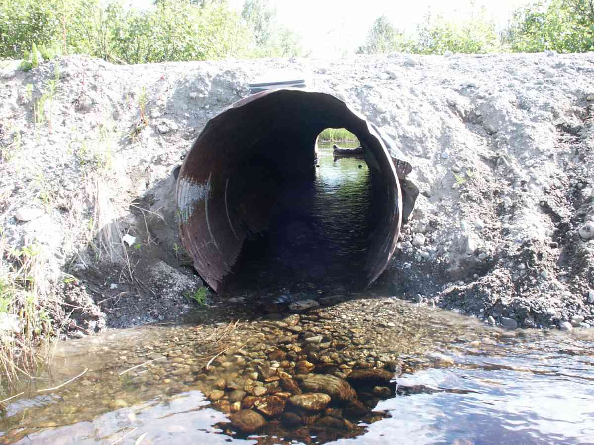
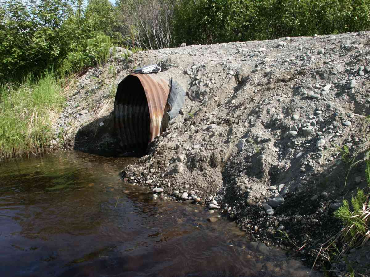
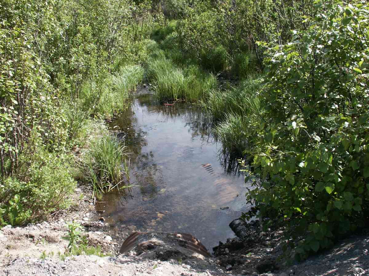
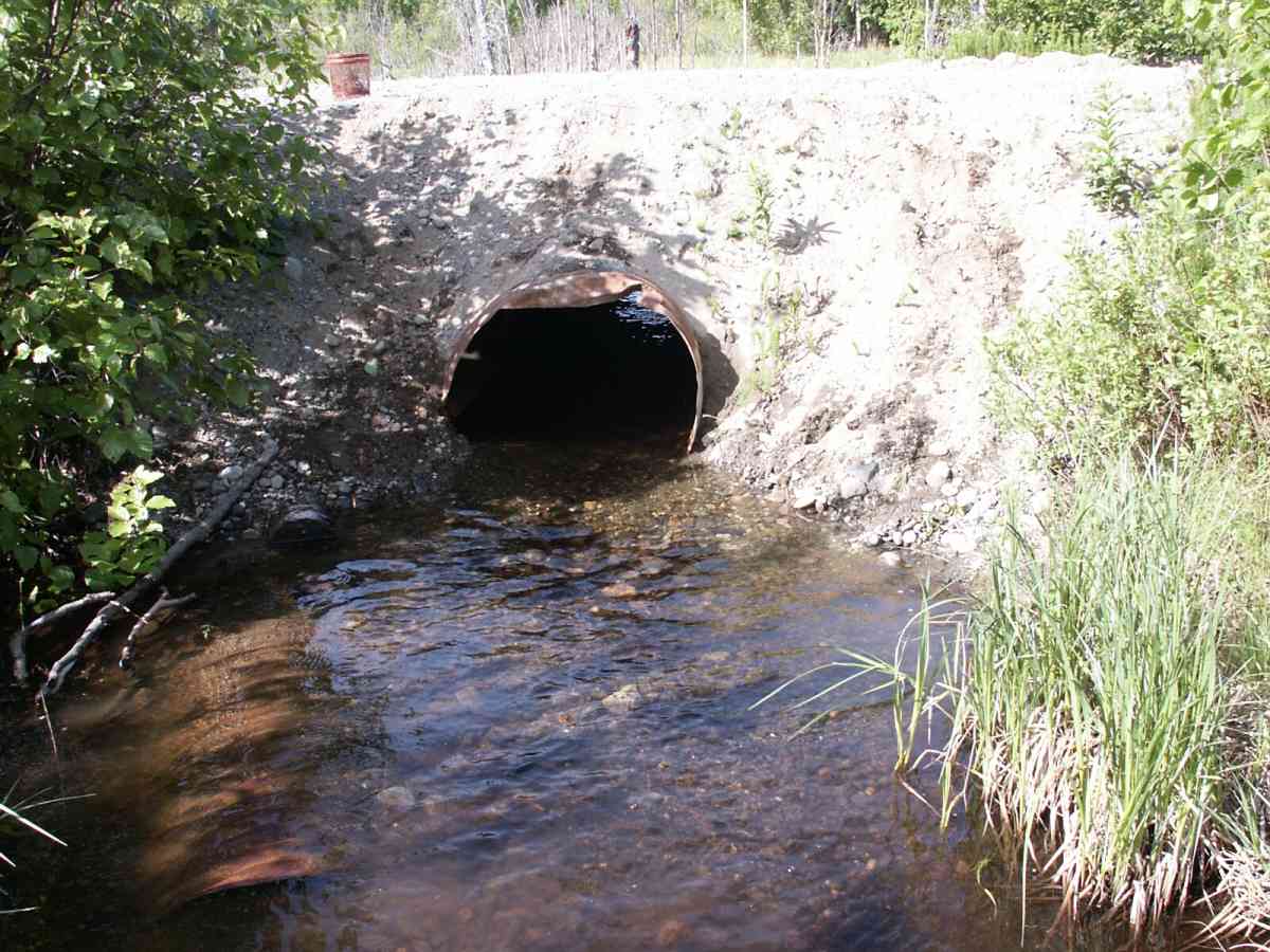
Stream Name: Bird Lake outlet
Elevation:
Site Comments: Bird Lake upstream of crossing.
arrow to the right of the survey date below to choose a different report for this site.
Survey TYCS1-TY017
Observers: Cecil Rich, Michael Anderson, Joe Buckwalter
Overall Fish Passage Rating:
Tidal: No
Backwatered: No
Step Pools:
Construction Year:
Comments: Datum = WGS84. gps accuracy = 25.2 feet. Bird Lake upstream of crossing.
Culvert Measurements
| ID: 1 | Structure Type: Circular pipe (Corrugated Metal) | Fish Passage Rating: | |||||||||||||||||||||||||||||||||||||||||
|
|
|
|||||||||||||||||||||||||||||||||||||||||
Culvert Observations:
|
|||||||||||||||||||||||||||||||||||||||||||
Stream Measurements
|
|
| Stream Width Type | Distance From Crossing (ft) |
Stream Width (ft) |
|---|---|---|
| Downstream ordinary high water | 0.7 | 6.00 |
| Downstream ordinary high water | 58.0 | 8.30 |
| Downstream ordinary high water | 110.0 | 3.00 |
Elevations
| Locator ID | Culvert Number |
River Distance (ft)1 |
Distance From Crossing (ft)2 |
Relative Elevation (ft) |
|---|---|---|---|---|
| D/S Tailcrest or 1st Thalweg | 91.75 | |||
| D/S Thalweg | 0.00 | 110.0 | 88.80 | |
| D/S Water Surface Elev | 0.00 | 110.0 | 89.07 | |
| D/S OHW Elev | 0.00 | 110.0 | 89.42 | |
| D/S Thalweg | 52.00 | 58.0 | 90.95 | |
| D/S Water Surface Elev | 52.00 | 58.0 | 91.22 | |
| D/S OHW Elev | 52.00 | 58.0 | 91.45 | |
| OHW Left Bank | 109.30 | 0.7 | 92.05 | |
| OHW Left Bank | 109.30 | 0.7 | 92.33 | |
| Outlet Culvert Top | 1 | 110.00 | 0.0 | 94.38 |
| Outlet Rustline Height | 1 | 110.00 | 0.0 | 92.18 |
| D/S Thalweg (=OPM1) | 110.00 | 0.0 | 91.49 | |
| Outlet Thalweg | 1 | 110.00 | 0.0 | 91.49 |
| Outlet Invert | 1 | 110.00 | 0.0 | 91.24 |
| Road Elev | 125.00 | 96.32 | ||
| Road Elev | 125.00 | 96.56 | ||
| Inlet Culvert Top | 1 | 140.00 | 0.0 | 95.32 |
| Inlet Culvert Invert | 1 | 140.00 | 0.0 | 91.77 |
| Inlet Thalweg | 1 | 140.00 | 0.0 | 91.93 |
| U/S Thalweg | 1 | 141.00 | 1.0 | 91.99 |
| U/S OHW elevation | 1 | 141.00 | 1.0 | 92.30 |
| U/S Water Surface Elev | 1 | 145.00 | 5.0 | 92.30 |
| U/S Thalweg | 1 | 145.00 | 5.0 | 91.07 |
| U/S Thalweg (wetland pond upstream-no chan.) | 1 | 146.10 | 6.1 | 90.95 |
Notes:
- River distance is measured continuously throughout the survey reach along the thalweg of the stream.
- Measured from each end of the crossing along the thalweg of the stream.
Fish Sampling Efforts
| Gear Type: Minnow Trap, 1/4 in. Mesh (B) | Trap Duration(h): 0 | |
| Gear Type: Visual Observation, Ground (C) | Trap Duration(h): 1 | |
Fish Observations
| Species: juvenile rainbow trout | Life History: Resident | ||
| Total Fish Observed: 2 | Fish Measured: 1 | Fork Lengths (mm) Min: 80 Max: 80 Mean: 80 | |
| Collected/Observed by Gear Type: Downstream Minnow Trap, 1/4 in. Mesh (2) | |||
| Species: sculpin-unspecified | Life History: Resident | ||
| Total Fish Observed: 1 | Fish Measured: | Fork Lengths (mm) Min: Max: Mean: | |
| Collected/Observed by Gear Type: Upstream Visual Observation, Ground (1) | |||
| Species: general fish observation, no species information | Life History: Not Recorded | ||
| Total Fish Observed: 4 | Fish Measured: | Fork Lengths (mm) Min: Max: Mean: | |
| Collected/Observed by Gear Type: Upstream Visual Observation, Ground (4) | |||
Photos
Questions or comments about this report can be directed to dfg.dsf.webmaster@alaska.gov