Fish Passage Site 20601542
Coordinates (dec. deg.): 61.07329°, -151.25336°
Legal Description: S011N011W05
Region: South Central
Road Name: Tyonek-Beluga Road
Datum: NAD83
Quad Name / ITM: Tyonek A-4
AWC Stream #:
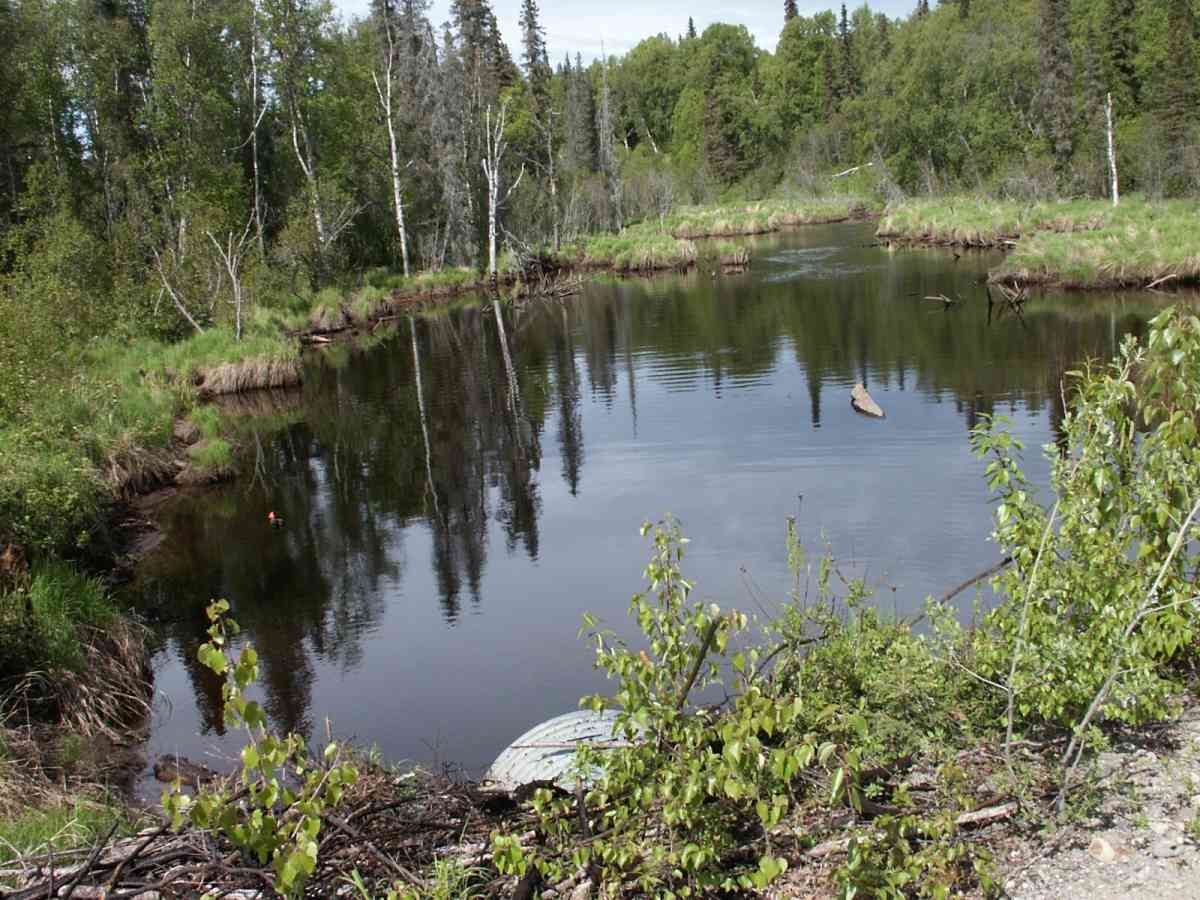
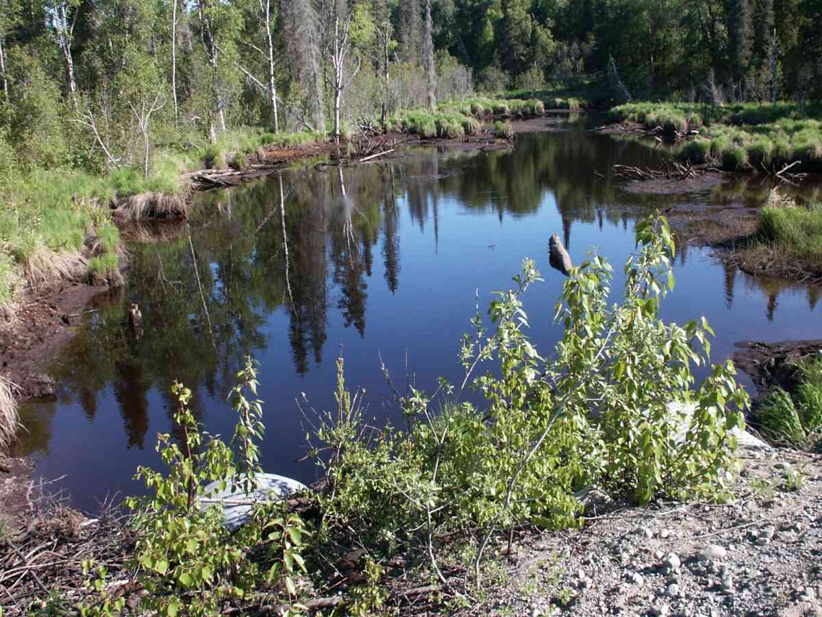
Stream Name: Tyonek Creek
Elevation:
Site Comments: None
Multiple surveys have been conducted at this site — click on the drop down
arrow to the right of the survey date below to choose a different report for this site.
arrow to the right of the survey date below to choose a different report for this site.
Survey TYCS1-TY016
Observers: Cecil Rich, Michael Anderson, Joe Buckwalter
Overall Fish Passage Rating:
Tidal: No
Backwatered: No
Step Pools:
Construction Year:
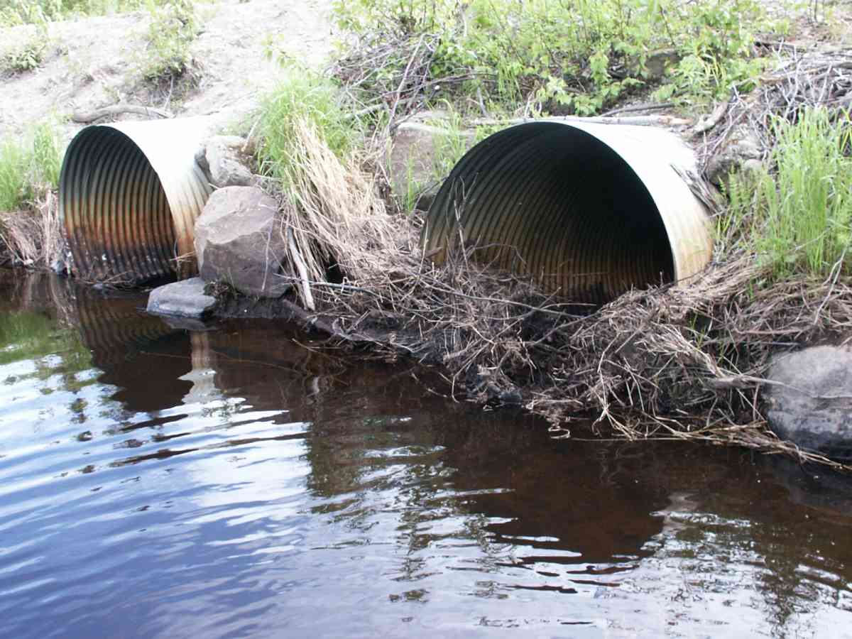
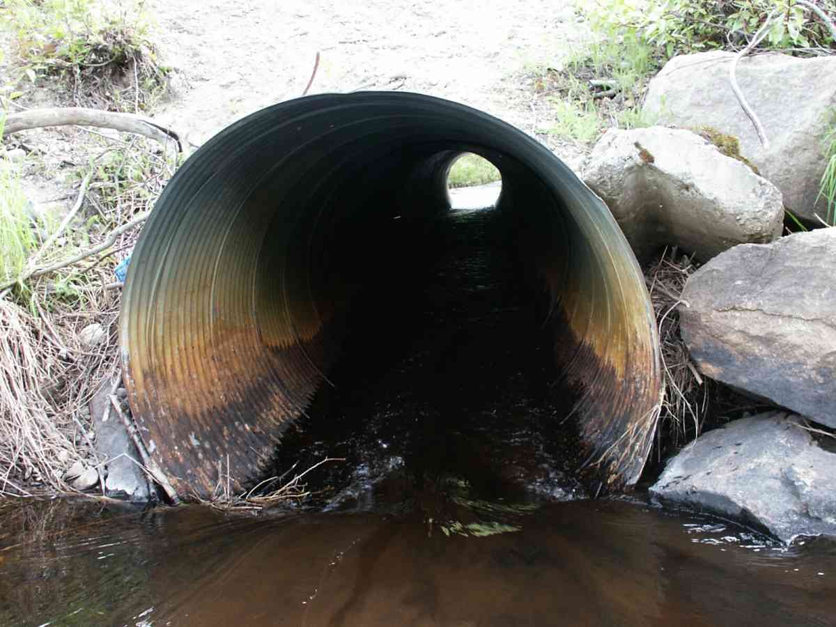
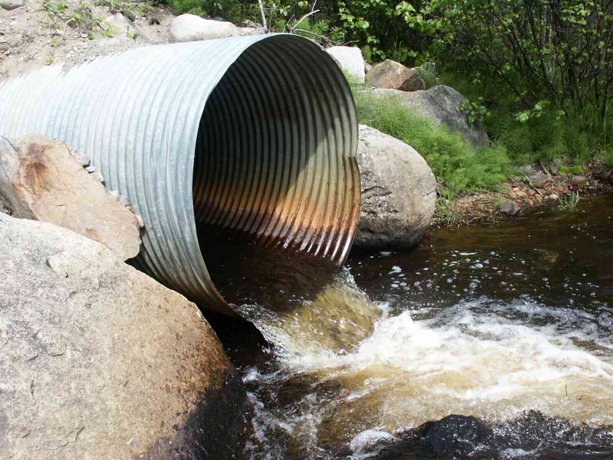
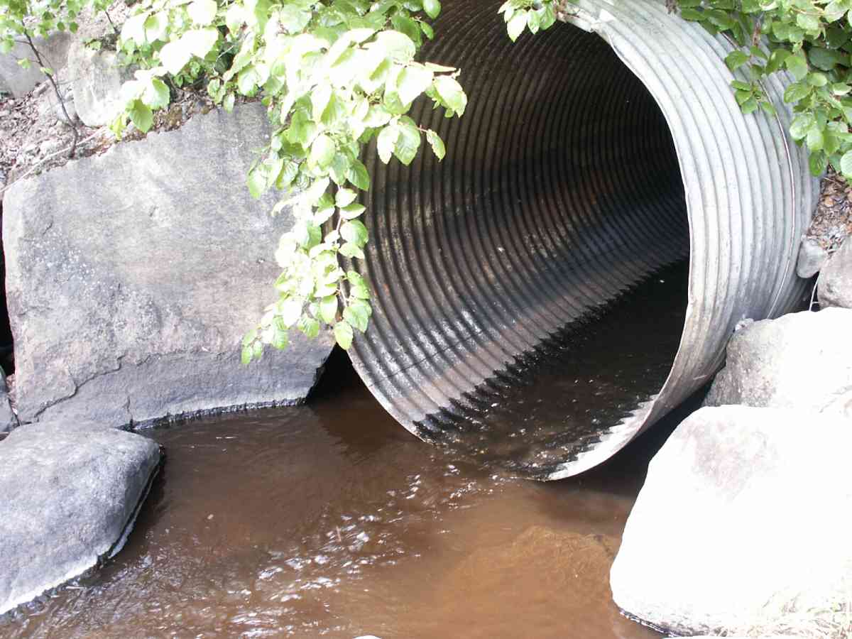
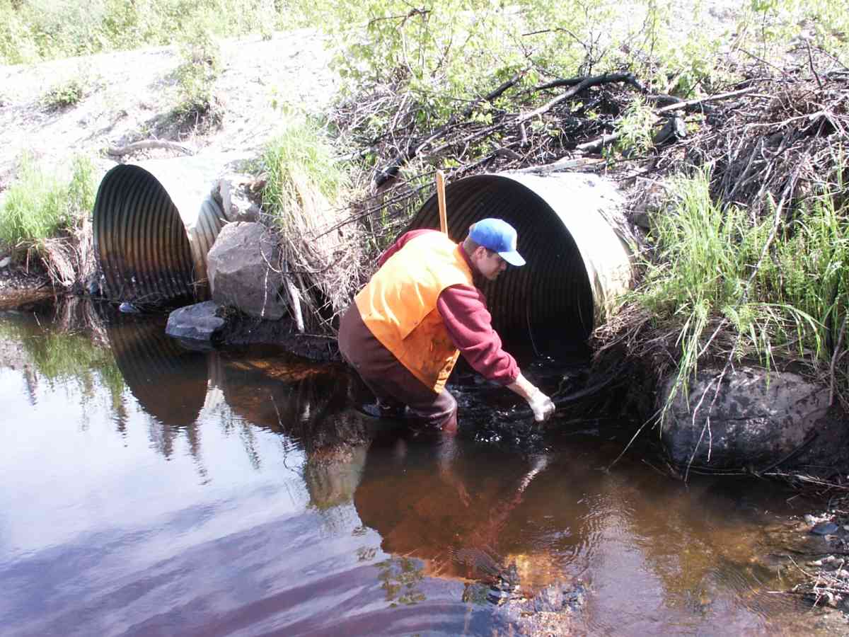
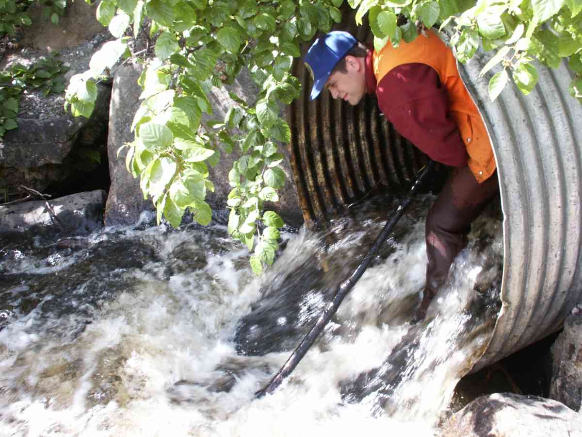
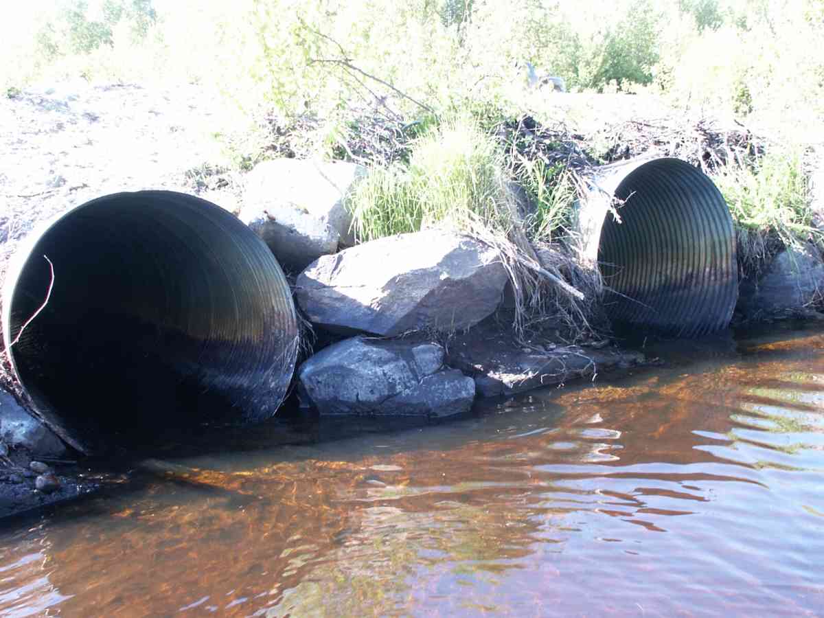
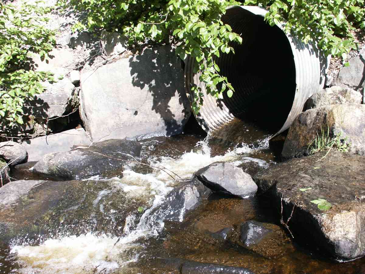
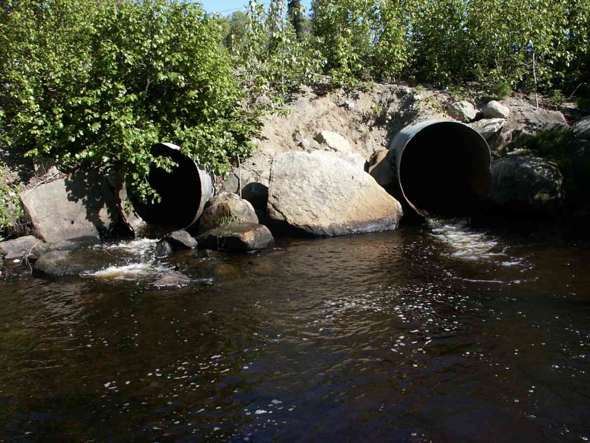
Comments: Datum = WGS84. 24.5-foot gps accuracy. Culvert B (right) bearing is 145 degrees.
Culvert Measurements
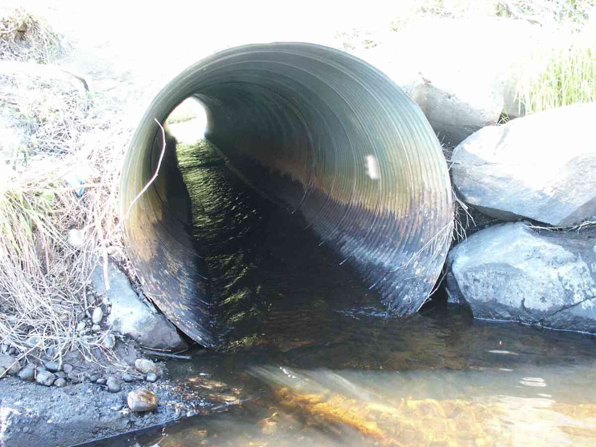
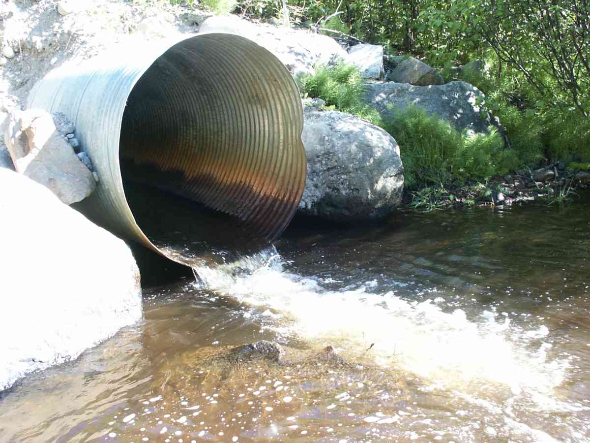
| ID: 1 | Structure Type: Circular pipe (Corrugated Metal) | Fish Passage Rating: | |||||||||||||||||||||||||||||||||||||||||
|
|
|
|||||||||||||||||||||||||||||||||||||||||
Culvert Observations:
|
|||||||||||||||||||||||||||||||||||||||||||
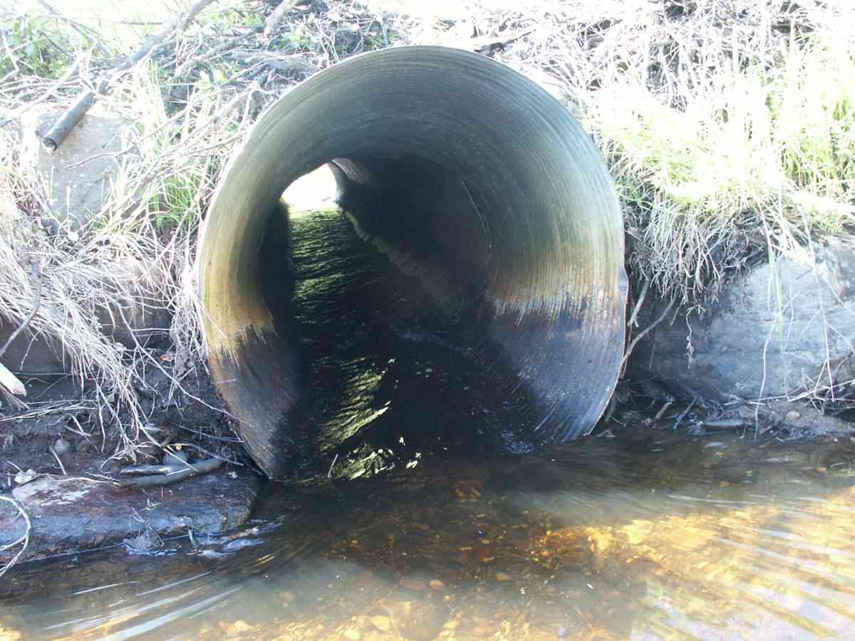
| ID: 2 | Structure Type: Circular pipe (Corrugated Metal) | Fish Passage Rating: | |||||||||||||||||||||||||||||||||||||||||
|
|
|
|||||||||||||||||||||||||||||||||||||||||
Culvert Observations:
|
|||||||||||||||||||||||||||||||||||||||||||
Stream Measurements
|
|
| Stream Width Type | Distance From Crossing (ft) |
Stream Width (ft) |
|---|---|---|
| Downstream ordinary high water | 35.5 | 15.14 |
| Downstream ordinary high water | 73.0 | 31.00 |
| Downstream ordinary high water | 187.0 | 16.00 |
| Upstream ordinary high water | 5.0 | 30.00 |
Elevations
| Locator ID | Culvert Number |
River Distance (ft)1 |
Distance From Crossing (ft)2 |
Relative Elevation (ft) |
|---|---|---|---|---|
| D/S Tailcrest or 1st Thalweg | 83.71 | |||
| D/S Thalweg | 0.00 | 187.0 | 82.11 | |
| D/S Water Surface Elev | 0.00 | 187.0 | 82.71 | |
| D/S OHW Elev | 0.00 | 187.0 | 83.07 | |
| D/S Water Surface Elev | 114.00 | 73.0 | 83.90 | |
| D/S OHW Elev | 114.00 | 73.0 | 84.32 | |
| D/S Thalweg | 114.00 | 73.0 | 83.44 | |
| D/S Thalweg | 177.00 | 10.0 | 81.14 | |
| Max Pool Depth (culvert b = 17.59) | 182.00 | 5.0 | 82.03 | |
| OHW Left Bank | 182.00 | 5.0 | 84.45 | |
| OHW Left Bank | 182.00 | 5.0 | 85.00 | |
| Outlet Rustline Height | 2 | 187.00 | 0.0 | 85.09 |
| Outlet Rustline Height | 1 | 187.00 | 0.0 | 85.35 |
| Outlet Invert | 1 | 187.00 | 0.0 | 84.50 |
| Outlet Thalweg | 2 | 187.00 | 0.0 | 83.30 |
| Outlet Thalweg | 1 | 187.00 | 0.0 | 82.97 |
| Outlet Invert (lower than a, due to plugging) | 2 | 187.00 | 0.0 | 84.32 |
| Outlet Culvert Top | 2 | 187.00 | 0.0 | 89.48 |
| Outlet Culvert Top | 1 | 187.00 | 0.0 | 89.68 |
| Road Elev | 222.00 | 95.92 | ||
| Road Elev | 222.00 | 95.96 | ||
| Inlet Culvert Top | 2 | 257.00 | 0.0 | 91.18 |
| Inlet Culvert Top | 1 | 257.00 | 0.0 | 91.29 |
| Inlet Culvert Invert | 1 | 257.00 | 0.0 | 86.23 |
| Inlet Rustline Height | 1 | 257.00 | 0.0 | 87.90 |
| Inlet Rustline Height | 2 | 257.00 | 0.0 | 87.94 |
| Inlet Thalweg | 2 | 257.00 | 0.0 | 85.89 |
| Inlet Culvert Invert | 2 | 257.00 | 0.0 | 85.96 |
| Inlet Thalweg | 1 | 257.00 | 0.0 | 85.98 |
| U/S Thalweg | 1 | 258.00 | 1.0 | 86.00 |
| U/S Thalweg | 2 | 258.00 | 1.0 | 85.83 |
| U/S OHW elevation (unplugging culvert) | 2 | 258.00 | 1.0 | 87.75 |
| U/S Thalweg | 1 | 262.00 | 5.0 | 85.60 |
| U/S Thalweg | 2 | 262.00 | 5.0 | 85.69 |
| U/S Water Surface Elev (we lowered the surface 0.37 by) | 2 | 262.00 | 5.0 | 86.85 |
| U/S Thalweg | 2 | 266.20 | 9.2 | 85.14 |
| U/S Thalweg | 1 | 268.20 | 11.2 | 85.50 |
Notes:
- River distance is measured continuously throughout the survey reach along the thalweg of the stream.
- Measured from each end of the crossing along the thalweg of the stream.
Fish Sampling Efforts
| Gear Type: Minnow Trap, 1/4 in. Mesh (A) | Trap Duration(h): 1.8 | |
| Gear Type: Minnow Trap, 1/4 in. Mesh (B) | Trap Duration(h): 0.33 | |
Fish Observations
| Species: juvenile/adult coho salmon | Life History: Anadromous | ||
| Total Fish Observed: 16 | Fish Measured: 8 | Fork Lengths (mm) Min: 79 Max: 140 Mean: 102 | |
| Collected/Observed by Gear Type: Downstream Minnow Trap, 1/4 in. Mesh (16) | |||
| Species: juvenile coho salmon | Life History: Anadromous | ||
| Total Fish Observed: 62 | Fish Measured: 18 | Fork Lengths (mm) Min: 74 Max: 140 Mean: 103 | |
| Collected/Observed by Gear Type: Downstream Minnow Trap, 1/4 in. Mesh (8) Upstream Minnow Trap, 1/4 in. Mesh (54) | |||
| Species: slimy sculpin | Life History: Unknown | ||
| Total Fish Observed: 1 | Fish Measured: | Fork Lengths (mm) Min: Max: Mean: | |
| Collected/Observed by Gear Type: Upstream Minnow Trap, 1/4 in. Mesh (1) | |||
Photos
Questions or comments about this report can be directed to dfg.dsf.webmaster@alaska.gov