Fish Passage Site 20601540
Coordinates (dec. deg.): 61.04521°, -151.18027°
Legal Description: S011N011W14
Region: South Central
Road Name: Tyonek Timber Road
Datum: NAD83
Quad Name / ITM: Tyonek A-4
AWC Stream #: 247-20-10040
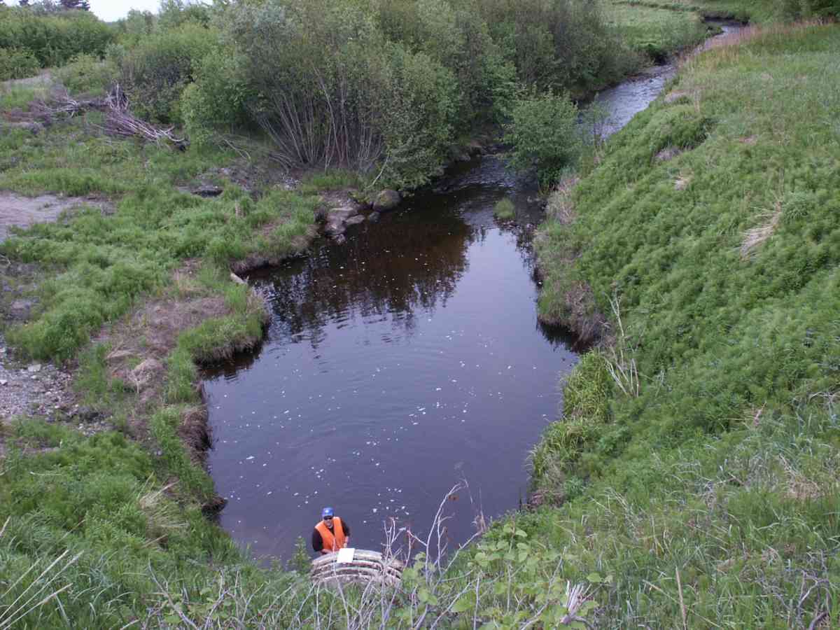
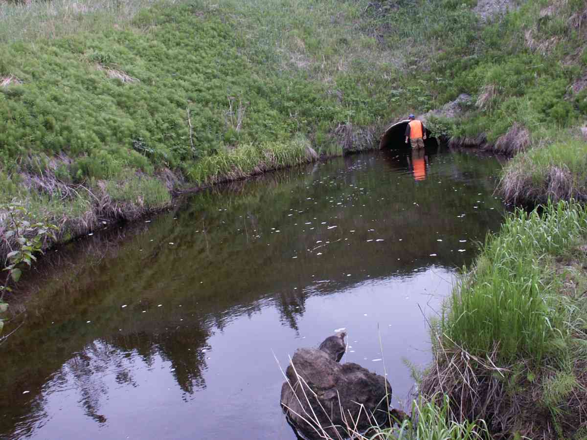
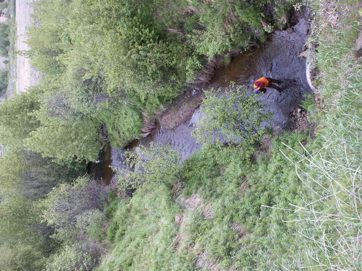
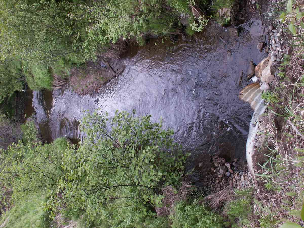
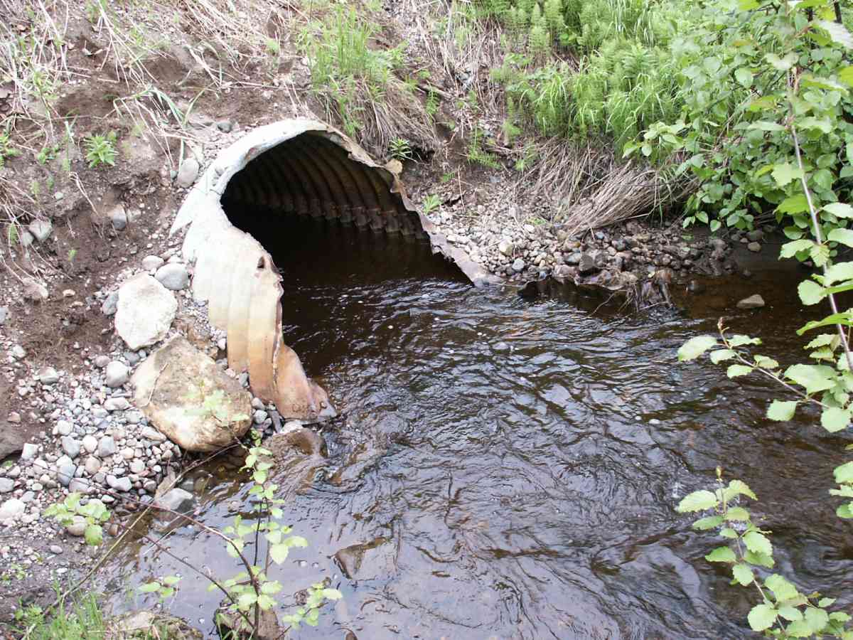
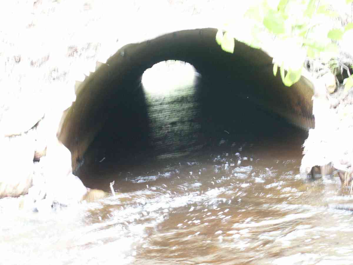
Stream Name: Tyonek Creek
Elevation:
Site Comments: None
Survey TYCS1-TY014
Observers: Cecil Rich, Michael Anderson, Joe Buckwalter
Overall Fish Passage Rating:
Tidal: No
Backwatered: No
Step Pools:
Construction Year:
Site Observations:
- Constriction ratio red
- Culvert gradient gray
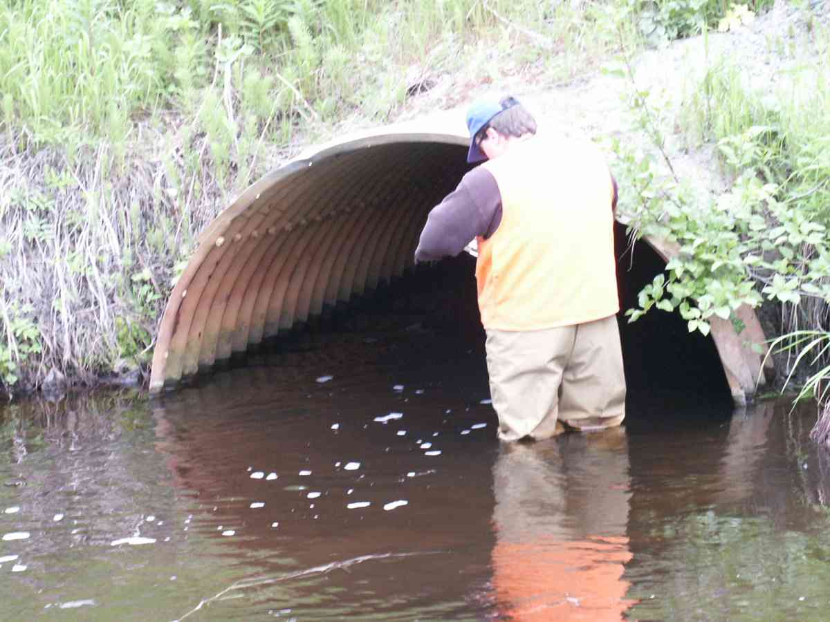
Comments: Datum = WGS84. accuracy 19.3 ft, Site visit in 2012 found the inlets had been bent up and are now creating a barrier to fish passage. 2016 site visit. Bent inlet had been cut off removing inlet perch. Site still constricted.
Culvert Measurements
| ID: 1 | Structure Type: Closed-bottom arch (Strutural Metal Plate) | Fish Passage Rating: | |||||||||||||||||||||||||||||||||||||||||
|
|
|
|||||||||||||||||||||||||||||||||||||||||
Culvert Observations:
|
|||||||||||||||||||||||||||||||||||||||||||
Stream Measurements
|
|
| Stream Width Type | Distance From Crossing (ft) |
Stream Width (ft) |
|---|---|---|
| Downstream ordinary high water | 120.0 | 19.30 |
| Downstream ordinary high water | 180.0 | 18.00 |
| Upstream ordinary high water | 5.0 | 17.60 |
| Upstream ordinary high water | 58.0 | 16.40 |
| Upstream ordinary high water | 84.0 | 16.50 |
Elevations
| Locator ID | Culvert Number |
River Distance (ft)1 |
Distance From Crossing (ft)2 |
Relative Elevation (ft) |
|---|---|---|---|---|
| D/S Tailcrest or 1st Thalweg | 92.97 | |||
| OHW Left Bank | 94.04 | |||
| D/S OHW Elev | 0.00 | 180.0 | 93.41 | |
| D/S Thalweg | 0.00 | 180.0 | 91.51 | |
| D/S Water Surface Elev | 0.00 | 180.0 | 92.43 | |
| D/S Thalweg | 60.00 | 120.0 | 92.76 | |
| D/S Water Surface Elev | 60.00 | 120.0 | 93.41 | |
| D/S OHW Elev | 60.00 | 120.0 | 93.94 | |
| D/S Thalweg | 158.00 | 22.0 | 89.97 | |
| Max Pool Depth | 175.00 | 5.0 | 91.58 | |
| OHW Left Bank | 175.00 | 5.0 | 94.74 | |
| Outlet Rustline Height (evidence of algal growth~5 in) | 1 | 180.00 | 0.0 | 94.52 |
| Outlet Culvert Top | 1 | 180.00 | 0.0 | 97.10 |
| Outlet Thalweg | 1 | 180.00 | 0.0 | 91.87 |
| Outlet Invert | 1 | 180.00 | 0.0 | 91.56 |
| Road Elev | 233.00 | 118.45 | ||
| Road Elev | 233.00 | 119.25 | ||
| Inlet Culvert Top | 1 | 286.00 | 0.0 | 97.89 |
| Inlet Rustline Height | 1 | 286.00 | 0.0 | 94.62 |
| Inlet Culvert Invert | 1 | 286.00 | 0.0 | 92.84 |
| Inlet Thalweg | 1 | 286.00 | 0.0 | 92.84 |
| U/S Thalweg | 1 | 286.00 | 0.0 | 92.96 |
| U/S OHW elevation | 1 | 287.00 | 1.0 | 94.42 |
| U/S Water Surface Elev | 1 | 291.00 | 5.0 | 94.13 |
| U/S Thalweg | 1 | 291.00 | 5.0 | 93.09 |
| U/S Thalweg | 1 | 298.20 | 12.2 | 93.18 |
| U/S Thalweg | 344.00 | 58.0 | 93.68 | |
| U/S Water Surface Elev | 344.00 | 58.0 | 94.64 | |
| U/S Headwater | 344.00 | 58.0 | 95.34 | |
| U/S Headwater | 370.00 | 84.0 | 95.84 | |
| U/S Water Surface Elev | 370.00 | 84.0 | 94.82 | |
| U/S Thalweg | 370.00 | 84.0 | 94.27 |
Notes:
- River distance is measured continuously throughout the survey reach along the thalweg of the stream.
- Measured from each end of the crossing along the thalweg of the stream.
Fish Sampling Efforts
| Gear Type: Minnow Trap, 1/4 in. Mesh (A) | Trap Duration(h): 2.0 | |
| Gear Type: Minnow Trap, 1/4 in. Mesh (B) | Trap Duration(h): 1 | |
Fish Observations
| Species: juvenile Dolly Varden | Life History: Unknown | ||
| Total Fish Observed: 2 | Fish Measured: 1 | Fork Lengths (mm) Min: 125 Max: 125 Mean: 125 | |
| Collected/Observed by Gear Type: Downstream Minnow Trap, 1/4 in. Mesh (2) | |||
| Species: juvenile coho salmon | Life History: Anadromous | ||
| Total Fish Observed: 104 | Fish Measured: 20 | Fork Lengths (mm) Min: 62 Max: 111 Mean: 88 | |
| Collected/Observed by Gear Type: Downstream Minnow Trap, 1/4 in. Mesh (75) Upstream Minnow Trap, 1/4 in. Mesh (29) | |||
Photos
Questions or comments about this report can be directed to dfg.dsf.webmaster@alaska.gov