Fish Passage Site 20601537
Coordinates (dec. deg.): 61.17976°, -151.20194°
Legal Description: S013N011W35
Region: South Central
Road Name: Logging Road
Datum: NAD83
Quad Name / ITM: Tyonek A-4
AWC Stream #:
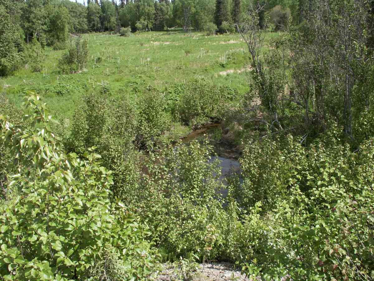
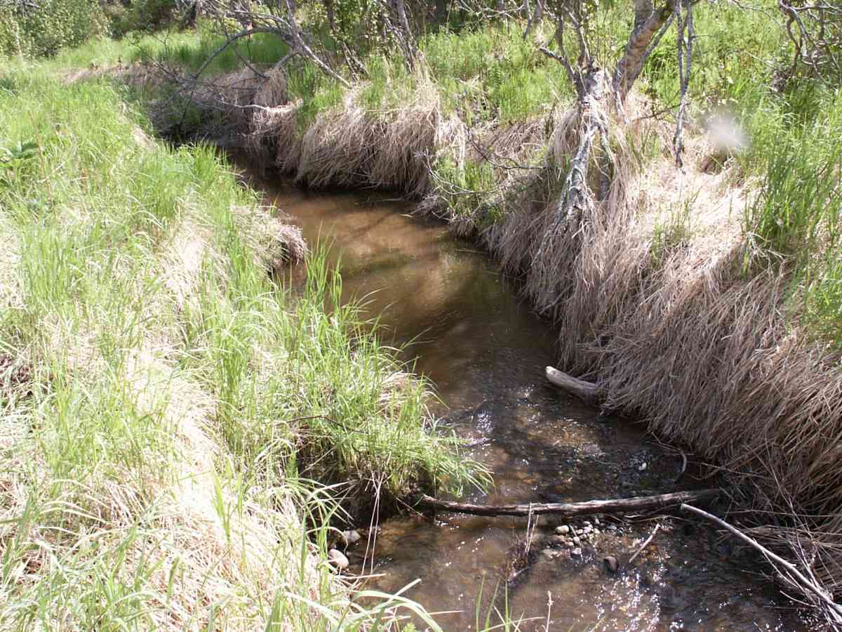
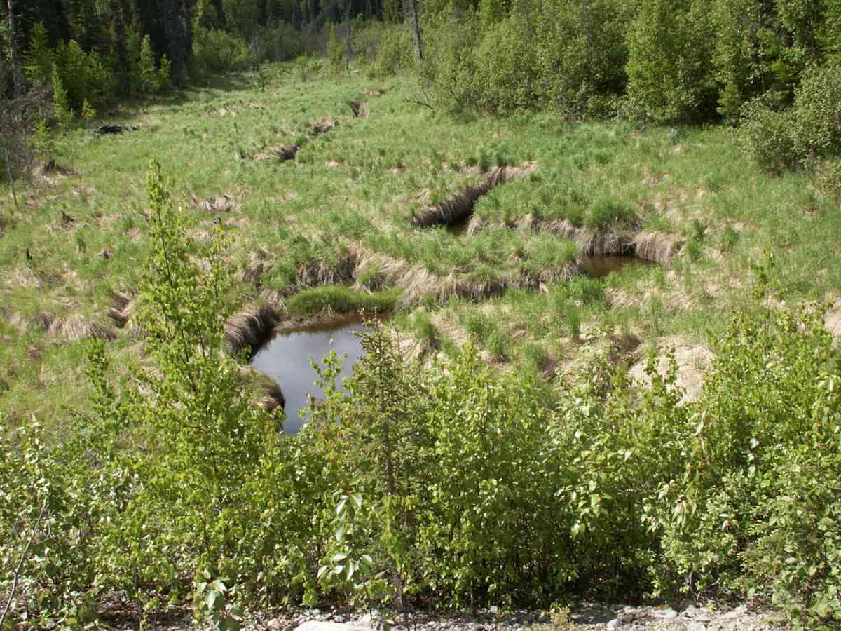
Stream Name: 3 Mile Creek
Elevation:
Site Comments: None
Multiple surveys have been conducted at this site — click on the drop down
arrow to the right of the survey date below to choose a different report for this site.
arrow to the right of the survey date below to choose a different report for this site.
Survey TYCS1-TY011
Observers: Cecil Rich, Michael Anderson, Joe Buckwalter
Overall Fish Passage Rating:
Tidal: No
Backwatered: No
Step Pools:
Construction Year:
Comments: Datum = WGS84. gps error-30.9 ft.
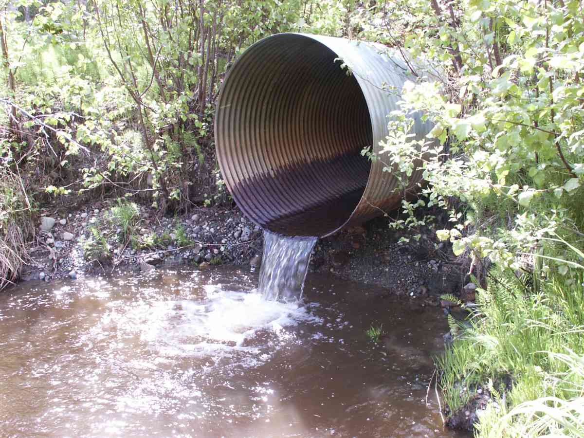
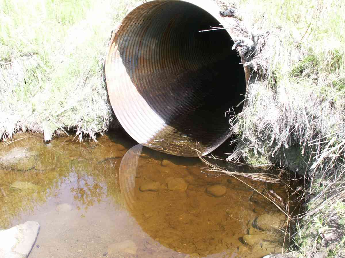
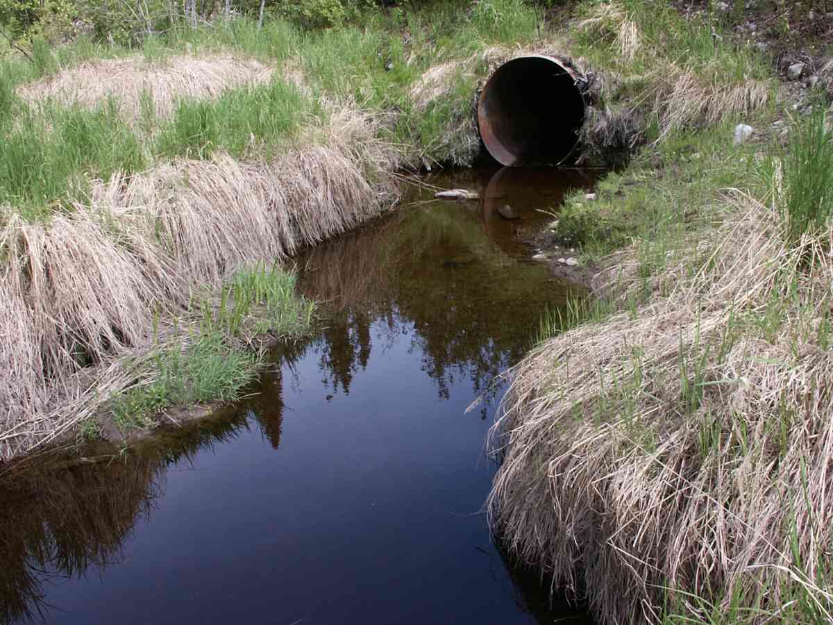
Culvert Measurements
| ID: 1 | Structure Type: Circular pipe (Corrugated Metal) | Fish Passage Rating: | |||||||||||||||||||||||||||||||||||||||||
|
|
|
|||||||||||||||||||||||||||||||||||||||||
Culvert Observations:
|
|||||||||||||||||||||||||||||||||||||||||||
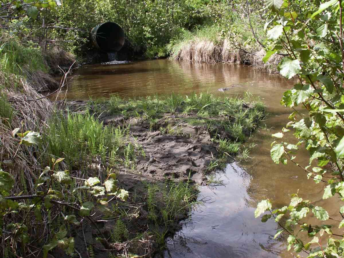
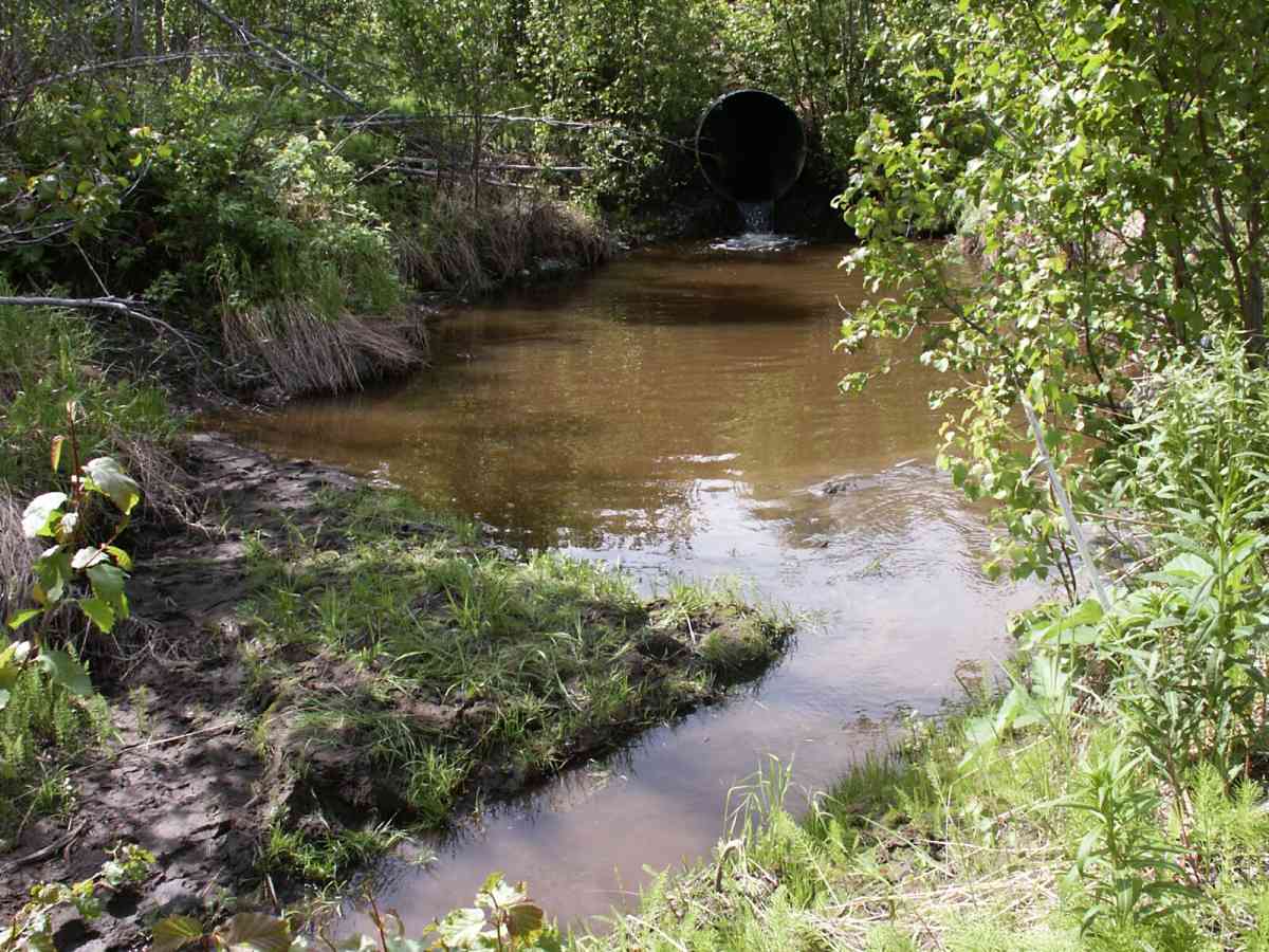
Stream Measurements
|
|
| Stream Width Type | Distance From Crossing (ft) |
Stream Width (ft) |
|---|---|---|
| Downstream ordinary high water | 108.0 | 7.30 |
| Downstream ordinary high water | 169.0 | 16.00 |
| Upstream ordinary high water | 5.0 | 15.60 |
| Upstream ordinary high water | 185.0 | 7.20 |
| Upstream ordinary high water | 243.0 | 9.50 |
Elevations
| Locator ID | Culvert Number |
River Distance (ft)1 |
Distance From Crossing (ft)2 |
Relative Elevation (ft) |
|---|---|---|---|---|
| D/S Tailcrest or 1st Thalweg | 85.53 | |||
| OHW Left Bank | 86.58 | |||
| D/S Thalweg | 0.00 | 169.88 | 85.48 | |
| D/S Water Surface Elev | 0.08 | 169.8 | 85.71 | |
| D/S OHW Elev | 0.08 | 169.8 | 87.92 | |
| D/S Thalweg | 61.88 | 108.0 | 85.80 | |
| D/S Water Surface Elev | 61.88 | 108.0 | 86.09 | |
| D/S OHW Elev | 61.88 | 108.0 | 86.98 | |
| D/S Thalweg | 158.18 | 11.7 | 82.81 | |
| Max Pool Depth | 164.88 | 5.0 | 83.58 | |
| OHW Left Bank | 164.88 | 5.0 | 87.68 | |
| Outlet Invert | 1 | 169.88 | 0.0 | 87.95 |
| Outlet Rustline Height | 1 | 169.88 | 0.0 | 89.00 |
| Outlet Thalweg | 1 | 169.88 | 0.0 | 85.25 |
| Road Elev | 220.38 | 112.27 | ||
| Road Elev | 220.38 | 112.35 | ||
| Inlet Rustline Height | 1 | 270.88 | 0.0 | 89.06 |
| Inlet Thalweg | 1 | 270.88 | 0.0 | 85.98 |
| Inlet Culvert Invert | 1 | 270.88 | 0.0 | 87.16 |
| U/S Thalweg | 1 | 271.88 | 1.0 | 85.97 |
| U/S Thalweg | 1 | 275.88 | 5.0 | 86.65 |
| U/S Thalweg | 1 | 280.68 | 9.8 | 86.37 |
| U/S Headwater | 455.88 | 185.0 | 88.19 | |
| U/S Thalweg | 455.88 | 185.0 | 86.16 | |
| U/S Water Surface Elev | 455.88 | 185.0 | 87.41 | |
| U/S Water Surface Elev | 513.88 | 243.0 | 87.47 | |
| U/S Thalweg | 513.88 | 243.0 | 86.25 | |
| U/S Headwater | 513.88 | 243.0 | 89.18 |
Notes:
- River distance is measured continuously throughout the survey reach along the thalweg of the stream.
- Measured from each end of the crossing along the thalweg of the stream.
Fish Sampling Efforts
| Gear Type: Minnow Trap, 1/4 in. Mesh (A) | Trap Duration(h): 2.75 | |
| Gear Type: Minnow Trap, 1/4 in. Mesh (B) | Trap Duration(h): 2.75 | |
Fish Observations
| Species: juvenile/adult sculpin-unspecified | Life History: Unknown | ||
| Total Fish Observed: 1 | Fish Measured: | Fork Lengths (mm) Min: Max: Mean: | |
| Collected/Observed by Gear Type: Downstream Minnow Trap, 1/4 in. Mesh (1) | |||
| Species: no fish collected or observed | Life History: Not Applicable | ||
| Total Fish Observed: 0 | Fish Measured: | Fork Lengths (mm) Min: Max: Mean: | |
| Collected/Observed by Gear Type: Upstream Minnow Trap, 1/4 in. Mesh (0) | |||
| Comments: findme | |||
Photos
Questions or comments about this report can be directed to dfg.dsf.webmaster@alaska.gov