Fish Passage Site 20601534
Coordinates (dec. deg.): 61.07681°, -151.31593°
Legal Description: S011N012W01
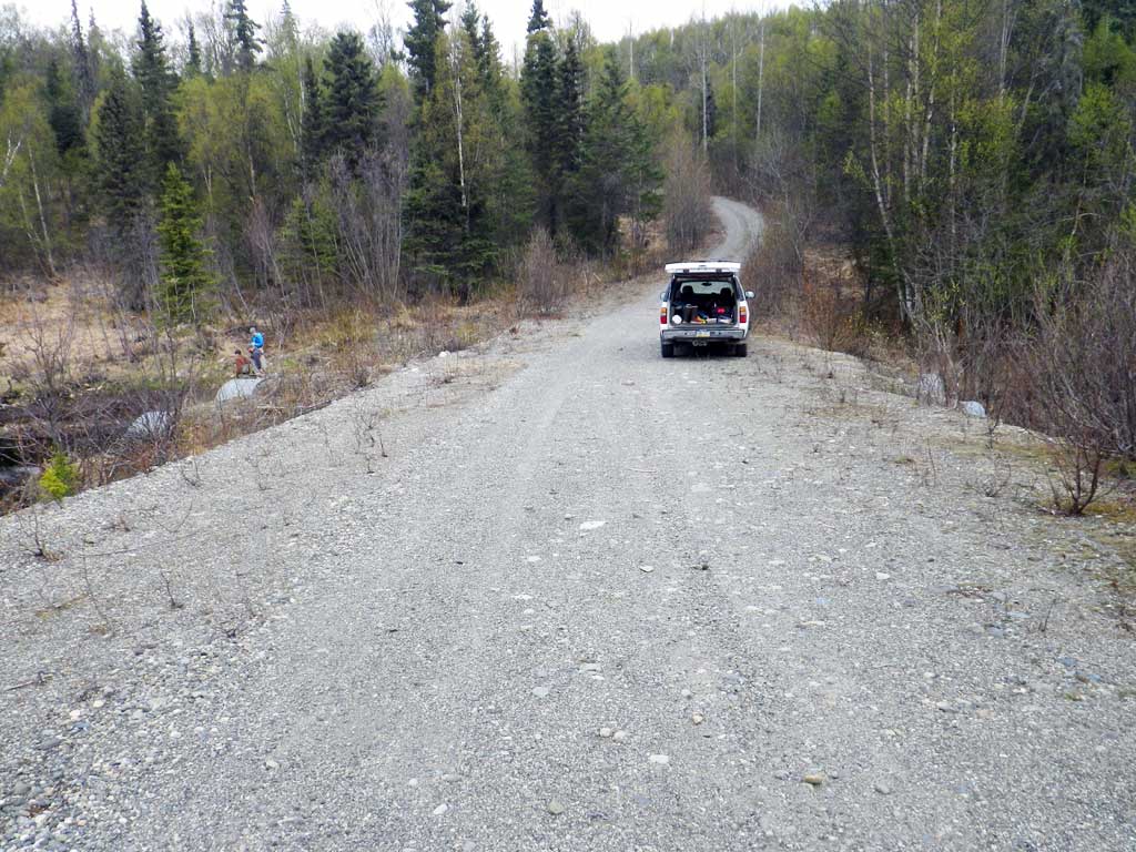
Region: South Central
Road Name:
Datum: NAD83
Quad Name / ITM: Tyonek A-4
AWC Stream #:
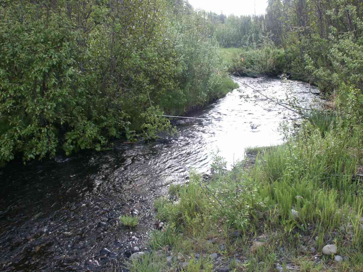
Stream Name: Tyonek Creek
Elevation:
Site Comments: None
Survey TYCS1-TY008
Observers: Cecil Rich, Michael Anderson, Joe Buckwalter
Overall Fish Passage Rating:
Tidal: No
Backwatered: No
Step Pools:
Construction Year:
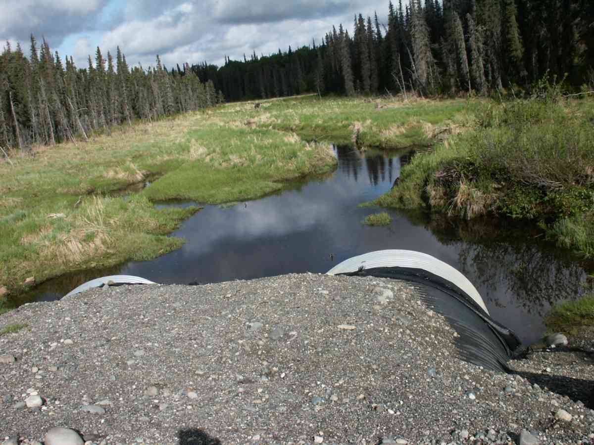
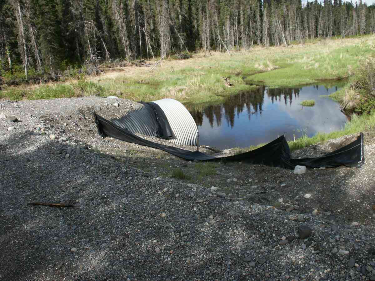
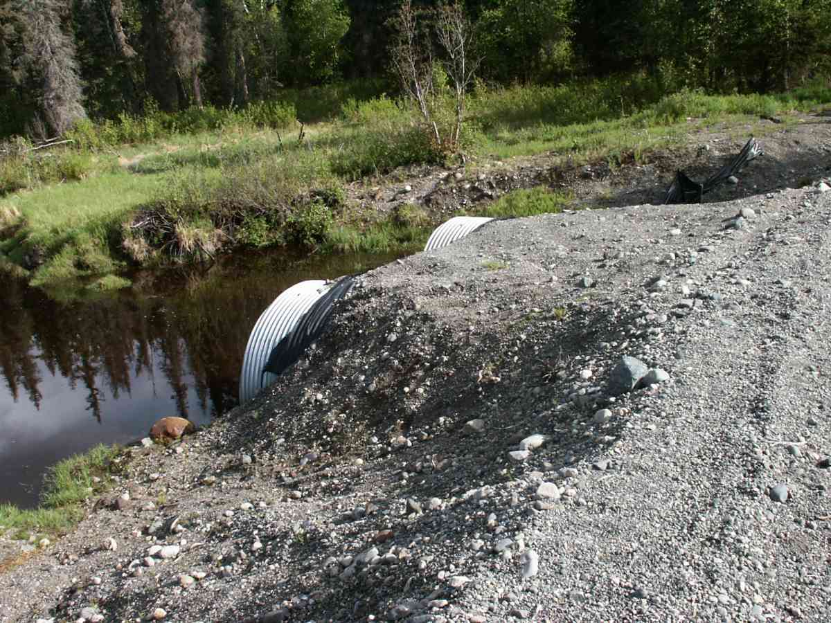
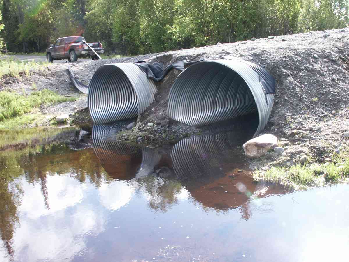
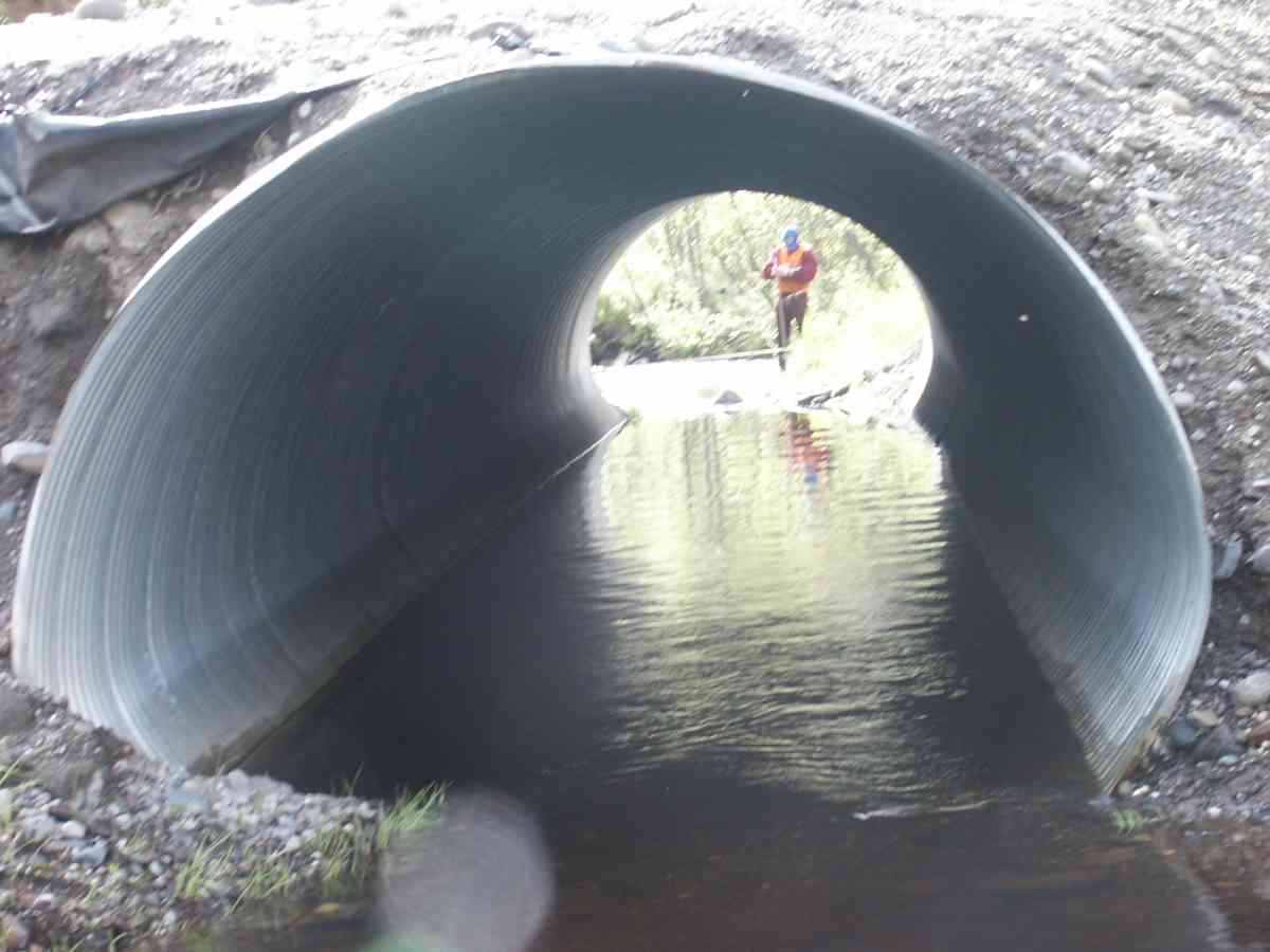
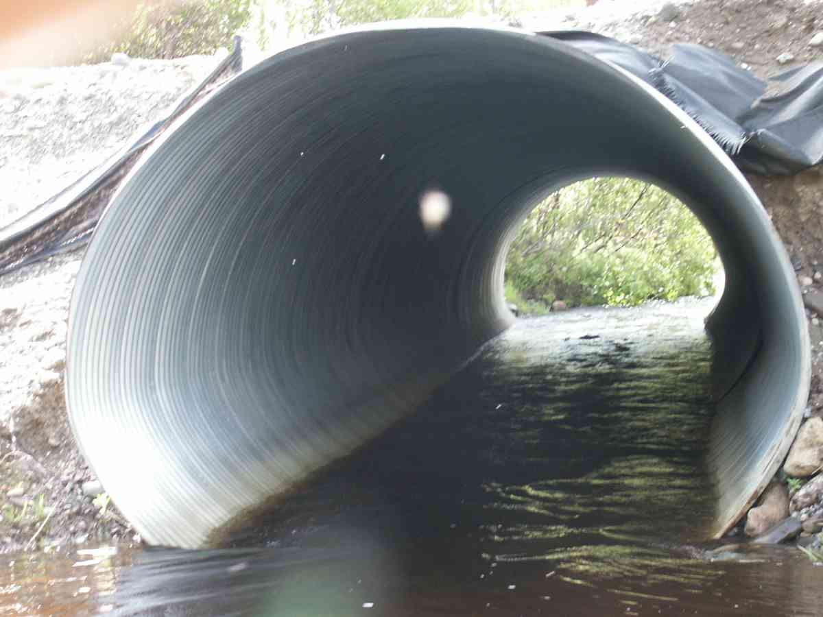
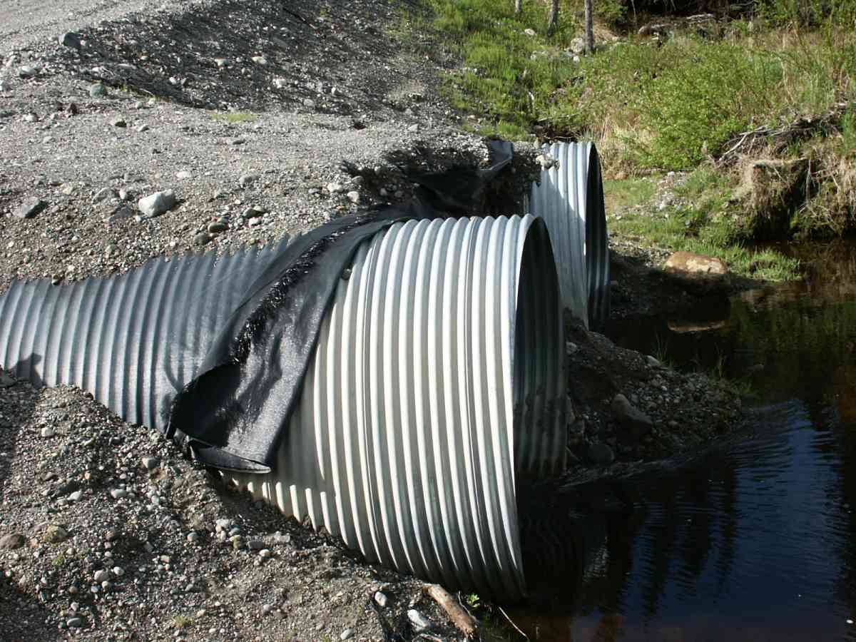
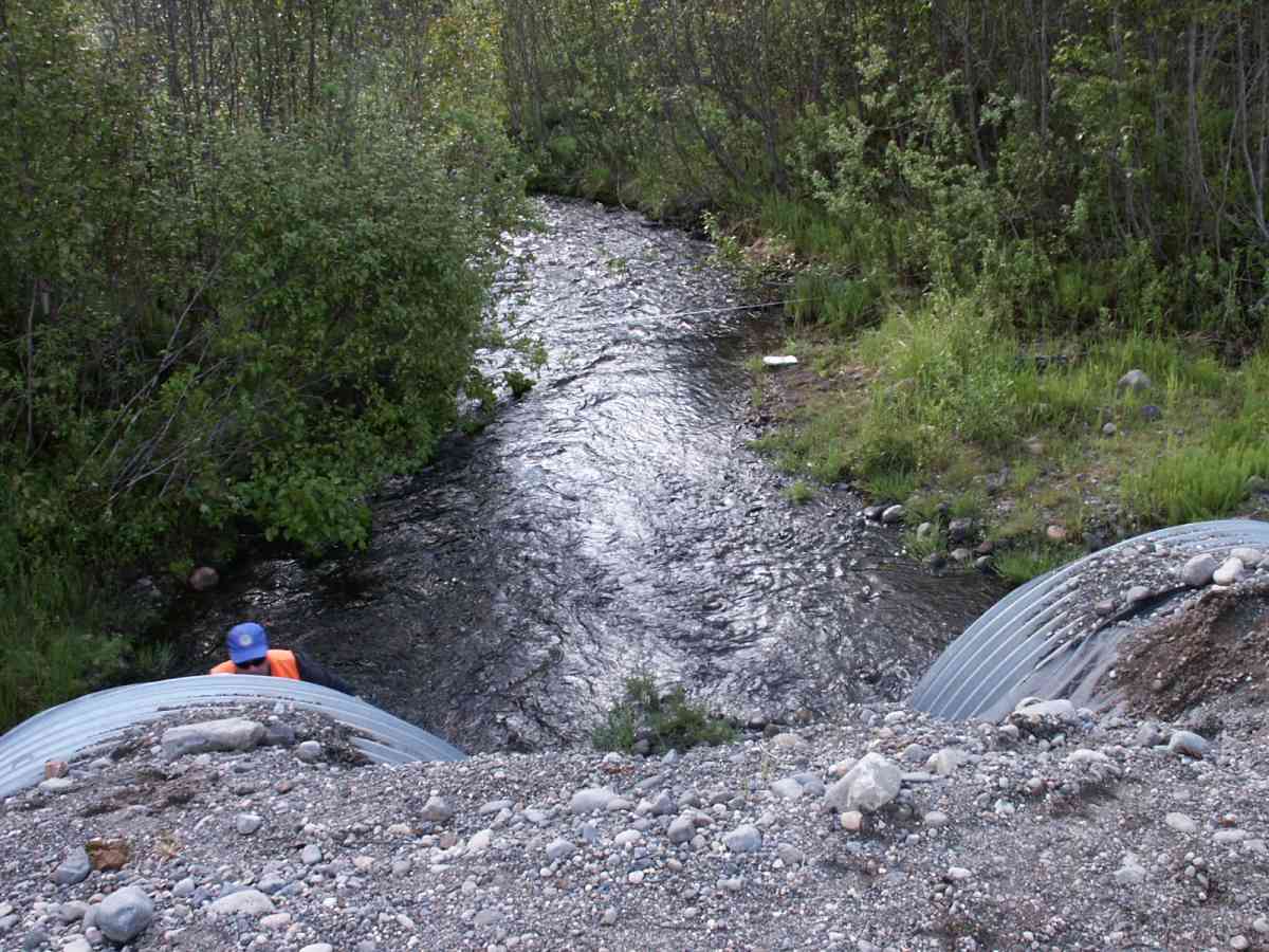
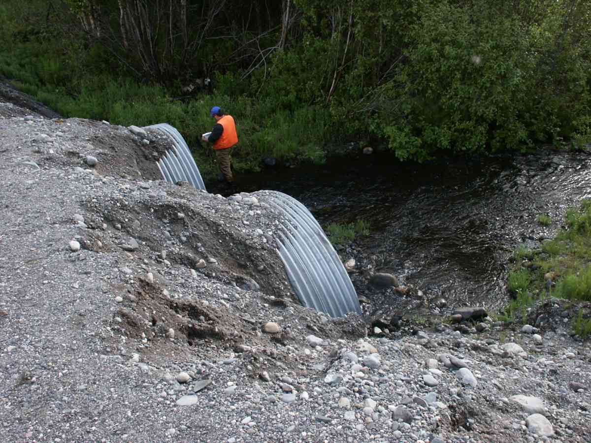
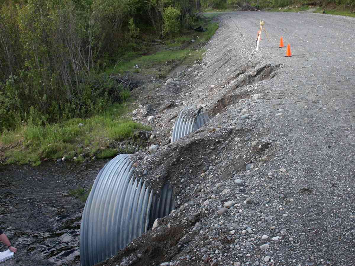
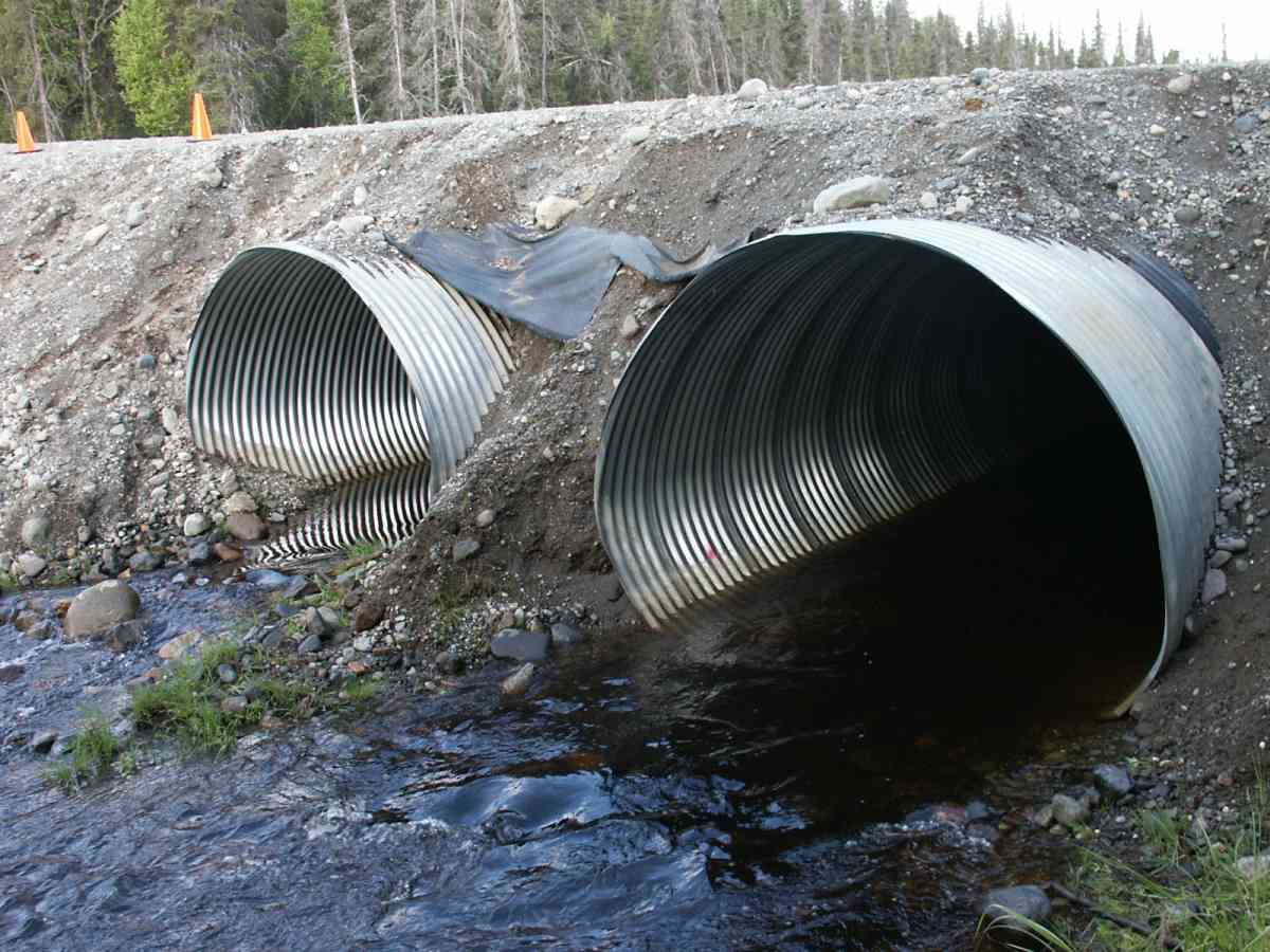
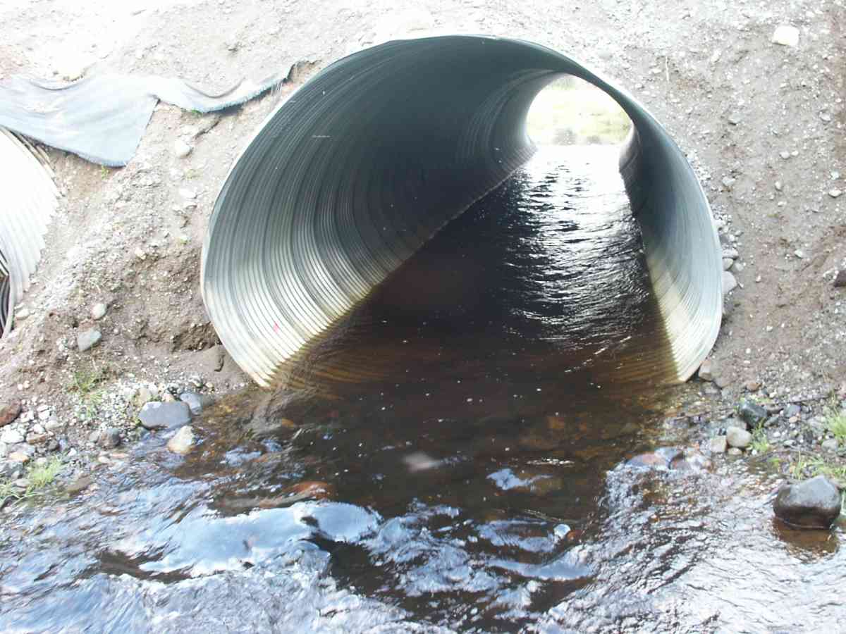
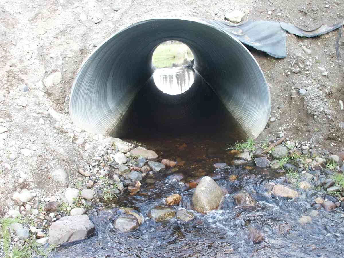
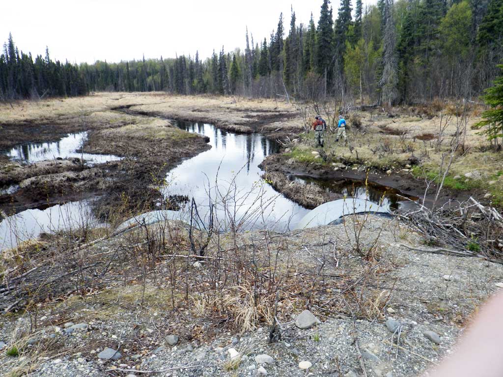
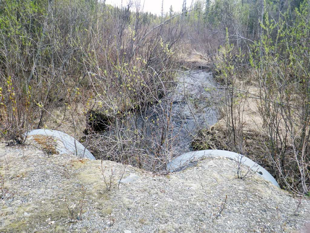
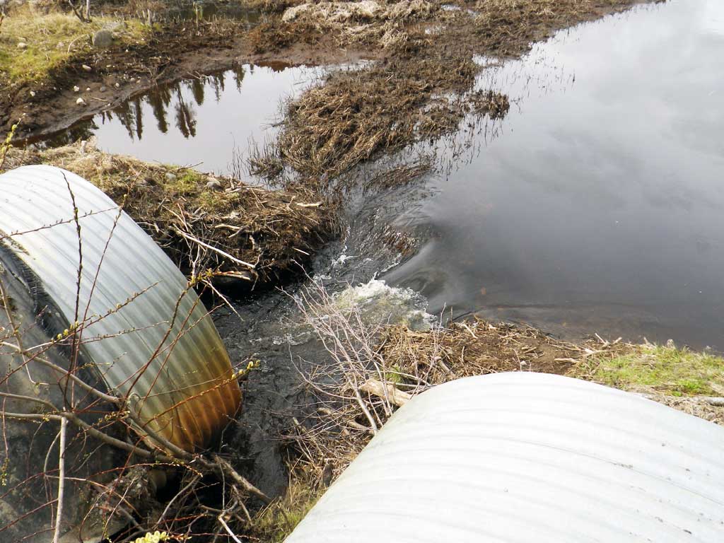
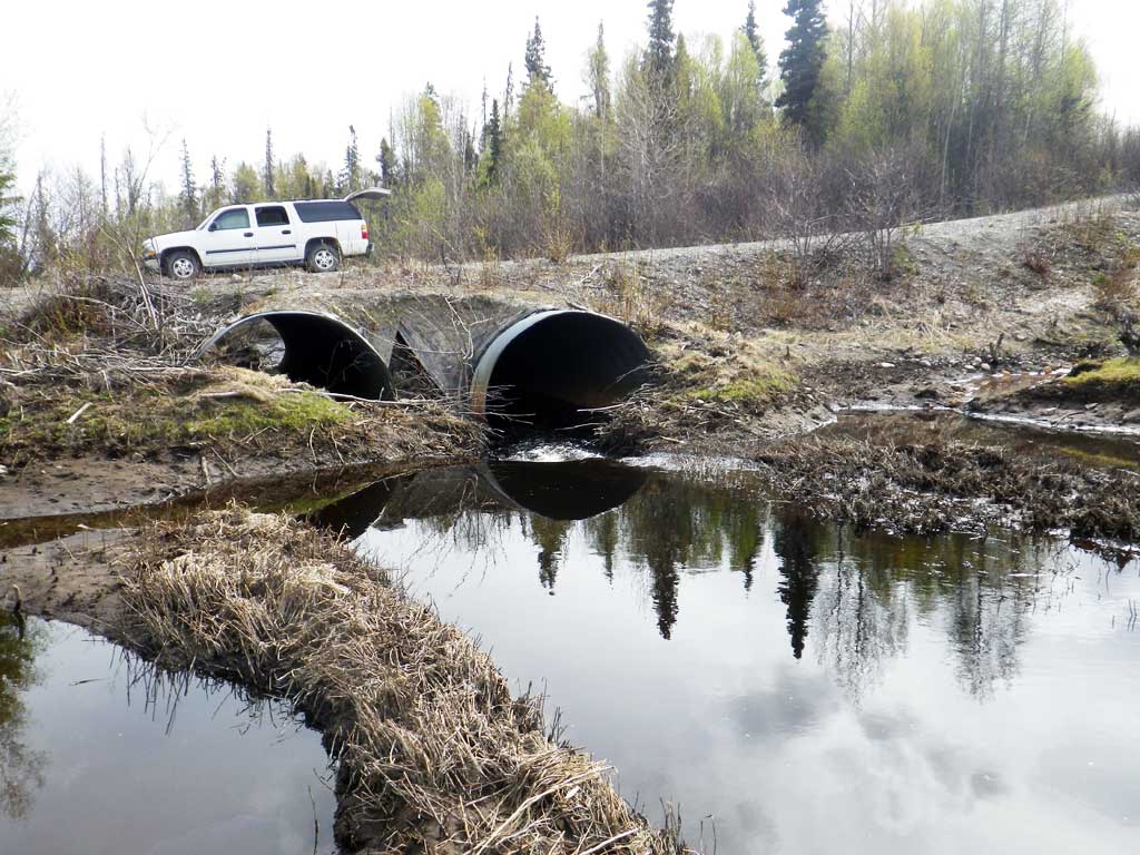
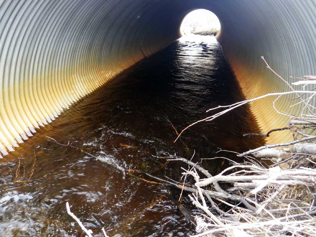
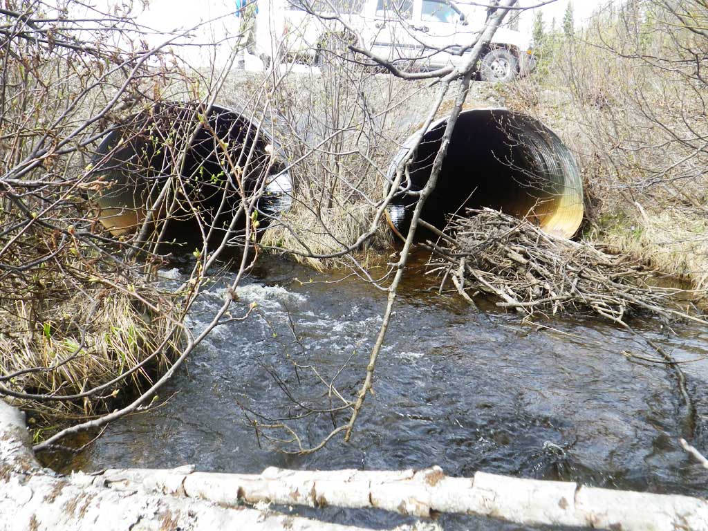
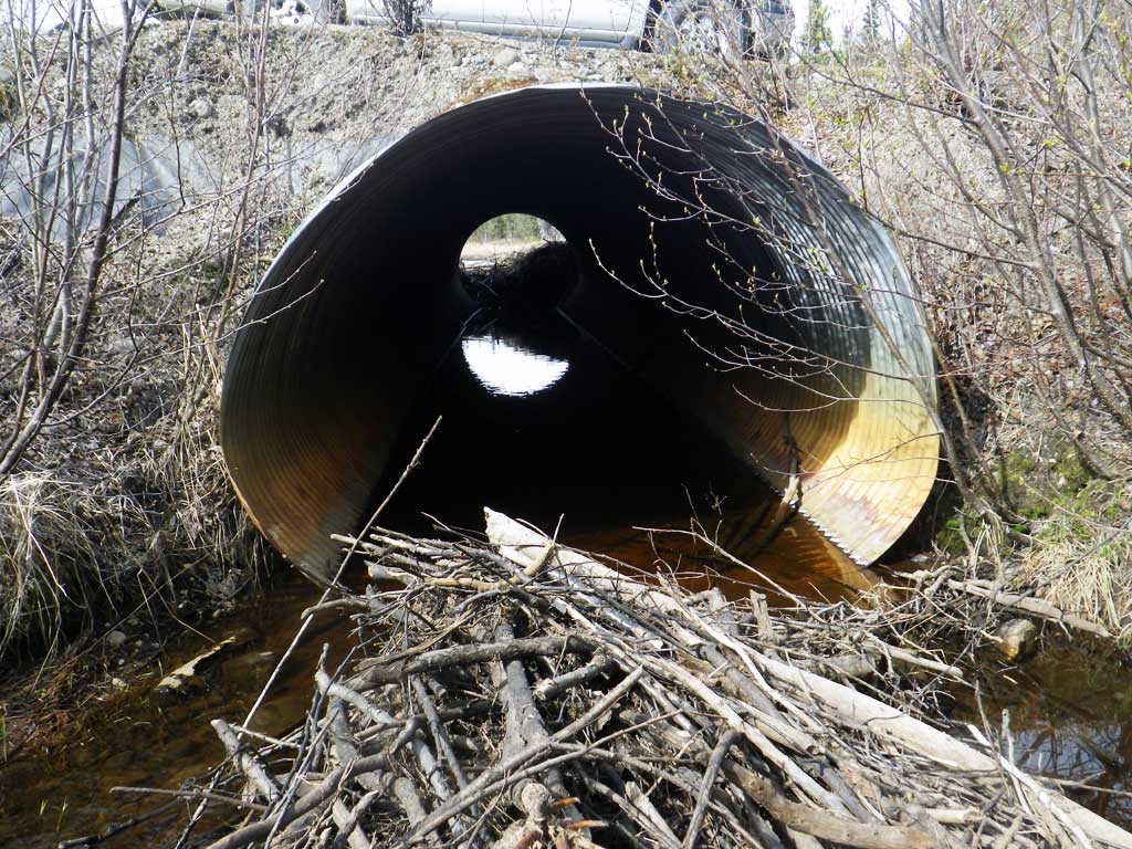
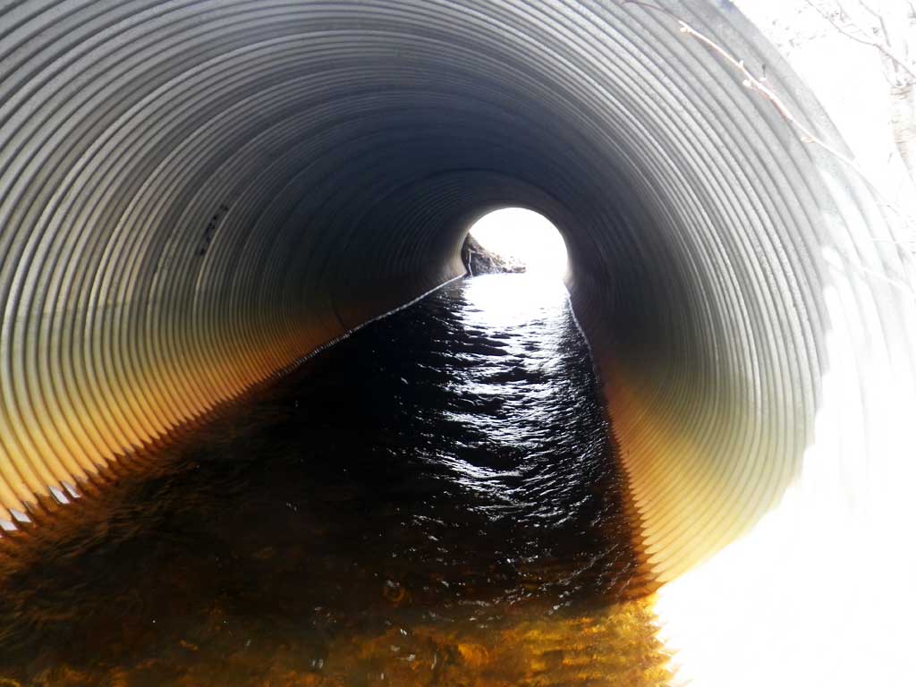
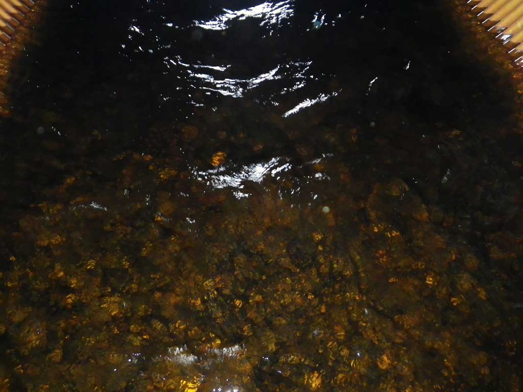
Comments: Datum = WGS84. Short culvert and steep fill yield fill sedimentation (fines) in streambed. Culverts had become plugged with beaver dam. At 2016 site visit C2 was taking all flow and potentially causing a juvenile barrier, but adults could likely still navigate it. C1 is 100% blocked.
Culvert Measurements
| ID: 1 | Structure Type: Circular pipe (Corrugated Metal) | Fish Passage Rating: | |||||||||||||||||||||||||||||||||||||||||
|
|
|
|||||||||||||||||||||||||||||||||||||||||
Culvert Observations:
|
|||||||||||||||||||||||||||||||||||||||||||
| ID: 2 | Structure Type: Circular pipe (Corrugated Metal) | Fish Passage Rating: | |||||||||||||||||||||||||||||||||||||||||
|
|
|
|||||||||||||||||||||||||||||||||||||||||
Culvert Observations:
|
|||||||||||||||||||||||||||||||||||||||||||
Stream Measurements
|
|
| Stream Width Type | Distance From Crossing (ft) |
Stream Width (ft) |
|---|---|---|
| Downstream ordinary high water | 5.7 | 24.60 |
| Downstream ordinary high water | 50.0 | 14.80 |
| Downstream ordinary high water | 97.0 | 16.00 |
| Upstream ordinary high water | 5.0 | 41.00 |
| Upstream ordinary high water | 97.5 | 15.70 |
| Upstream ordinary high water | 198.4 | 23.80 |
Elevations
| Locator ID | Culvert Number |
River Distance (ft)1 |
Distance From Crossing (ft)2 |
Relative Elevation (ft) |
|---|---|---|---|---|
| D/S Thalweg | 0.00 | 97.0 | 84.12 | |
| D/S Water Surface Elev | 0.00 | 97.0 | 84.67 | |
| D/S OHW Elev | 0.00 | 97.0 | 84.75 | |
| D/S Thalweg | 47.00 | 50.0 | 84.60 | |
| D/S Water Surface Elev | 47.00 | 50.0 | 85.17 | |
| D/S OHW Elev | 47.00 | 50.0 | 85.42 | |
| D/S Tailcrest or 1st Thalweg | 91.30 | 5.7 | 84.67 | |
| OHW Left Bank (culv b = 14.02) | 93.50 | 3.5 | 85.52 | |
| OHW Left Bank | 93.50 | 3.5 | 86.54 | |
| Max Pool Depth | 2 | 94.00 | 3.0 | 85.37 |
| D/S Thalweg (culv b = 14.63) | 94.00 | 3.0 | 84.62 | |
| Max Pool Depth | 1 | 94.00 | 3.0 | 84.62 |
| Outlet Invert | 1 | 97.00 | 0.0 | 84.46 |
| Outlet Thalweg | 1 | 97.00 | 0.0 | 84.50 |
| Outlet Invert | 2 | 97.00 | 0.0 | 84.75 |
| Outlet Thalweg | 2 | 97.00 | 0.0 | 85.37 |
| Outlet Rustline Height | 1 | 97.00 | 0.0 | 85.46 |
| Outlet Culvert Top | 1 | 97.00 | 0.0 | 91.54 |
| Outlet Rustline Height | 2 | 97.00 | 0.0 | 85.69 |
| Outlet Culvert Top | 2 | 97.00 | 0.0 | 91.87 |
| Road Elev | 127.00 | 94.12 | ||
| Road Elev | 127.00 | 94.12 | ||
| Inlet Culvert Top | 1 | 157.00 | 0.0 | 92.15 |
| Inlet Culvert Top | 2 | 157.00 | 0.0 | 91.83 |
| Inlet Thalweg | 2 | 157.00 | 0.0 | 85.58 |
| Inlet Rustline Height | 1 | 157.00 | 0.0 | 85.65 |
| Inlet Thalweg | 1 | 157.00 | 0.0 | 84.87 |
| Inlet Culvert Invert | 1 | 157.00 | 0.0 | 84.54 |
| U/S Thalweg | 2 | 158.00 | 1.0 | 85.50 |
| U/S Thalweg | 1 | 158.00 | 1.0 | 85.00 |
| U/S Thalweg | 2 | 162.00 | 5.0 | 84.85 |
| U/S OHW elevation | 1 | 162.00 | 5.0 | 86.56 |
| U/S Water Surface Elev | 1 | 162.00 | 5.0 | 86.04 |
| U/S Thalweg | 1 | 162.00 | 5.0 | 84.96 |
| U/S Thalweg | 2 | 174.80 | 17.8 | 84.83 |
| U/S Thalweg | 1 | 174.80 | 17.8 | 84.50 |
| U/S Thalweg | 254.50 | 97.5 | 84.06 | |
| U/S Water Surface Elev | 254.50 | 97.5 | 86.10 | |
| U/S Headwater | 254.50 | 97.5 | 86.25 | |
| U/S Water Surface Elev | 355.40 | 198.4 | 86.08 | |
| U/S Headwater | 355.40 | 198.4 | 86.81 | |
| U/S Thalweg | 355.40 | 198.4 | 84.77 |
Notes:
- River distance is measured continuously throughout the survey reach along the thalweg of the stream.
- Measured from each end of the crossing along the thalweg of the stream.
Fish Sampling Efforts
| Gear Type: Minnow Trap, 1/4 in. Mesh (A) | Trap Duration(h): 1 | |
| Gear Type: Minnow Trap, 1/4 in. Mesh (B) | Trap Duration(h): 1 | |
Fish Observations
| Species: juvenile Dolly Varden | Life History: Unknown | ||
| Total Fish Observed: 4 | Fish Measured: 2 | Fork Lengths (mm) Min: 125 Max: 168 Mean: 146 | |
| Collected/Observed by Gear Type: Downstream Minnow Trap, 1/4 in. Mesh (4) | |||
| Species: juvenile coho salmon | Life History: Anadromous | ||
| Total Fish Observed: 83 | Fish Measured: 20 | Fork Lengths (mm) Min: 69 Max: 134 Mean: 89 | |
| Collected/Observed by Gear Type: Downstream Minnow Trap, 1/4 in. Mesh (35) Upstream Minnow Trap, 1/4 in. Mesh (48) | |||
| Species: sculpin-unspecified | Life History: Resident | ||
| Total Fish Observed: 2 | Fish Measured: 1 | Fork Lengths (mm) Min: 89 Max: 89 Mean: 89 | |
| Collected/Observed by Gear Type: Downstream Minnow Trap, 1/4 in. Mesh (2) | |||
Photos


Questions or comments about this report can be directed to dfg.dsf.webmaster@alaska.gov