Fish Passage Site 20601532
Coordinates (dec. deg.): 61.11343°, -151.14975°
Legal Description: S012N011W24
Region: South Central
Road Name: Logging Road
Datum: NAD83
Quad Name / ITM: Tyonek A-4
AWC Stream #:
Stream Name: Chuitbuna Lake outlet
Elevation:
Site Comments: None
arrow to the right of the survey date below to choose a different report for this site.
Survey TYCS1-TY006
Observers: Cecil Rich, Michael Anderson, Joe Buckwalter
Overall Fish Passage Rating:
Tidal: No
Backwatered: No
Step Pools:
Construction Year:
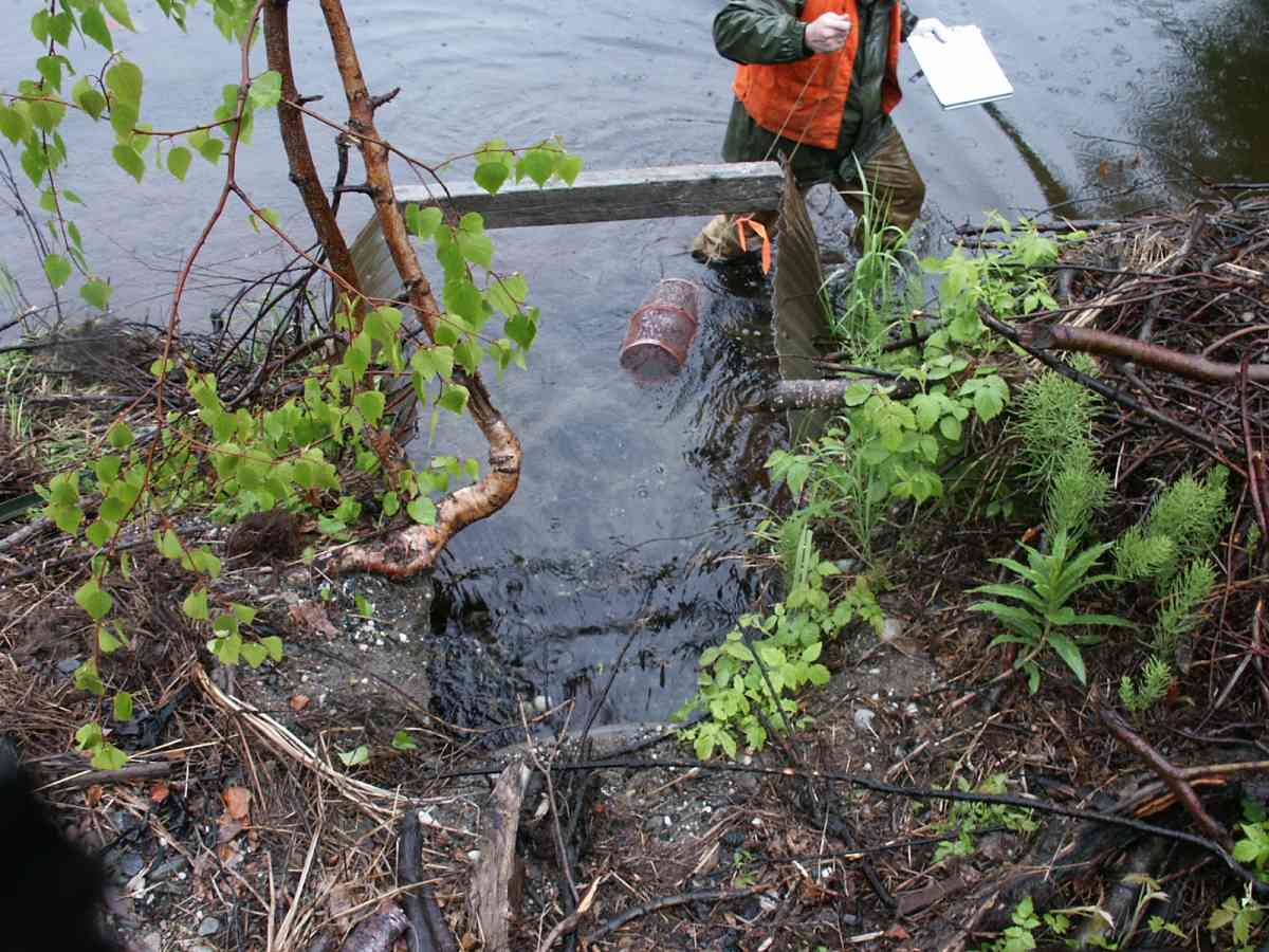
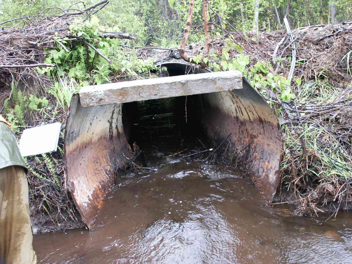
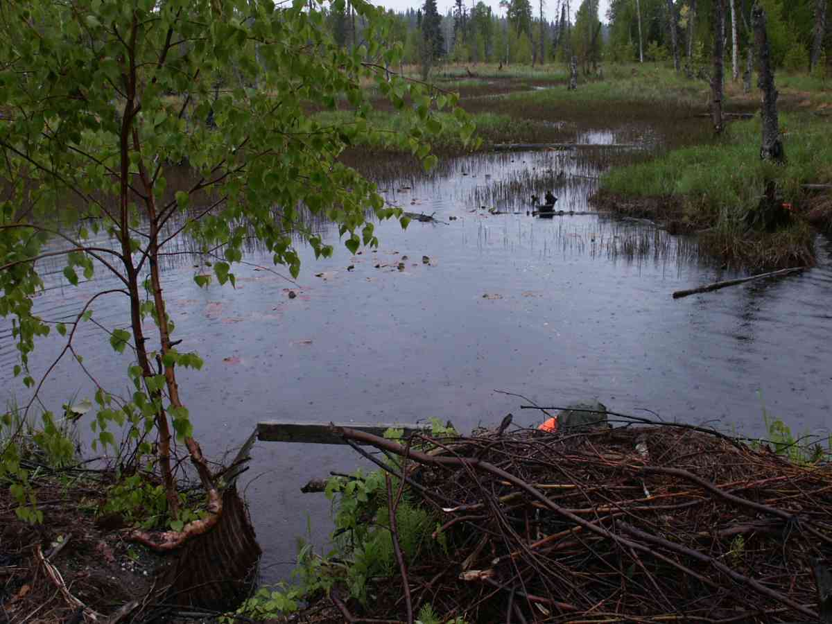
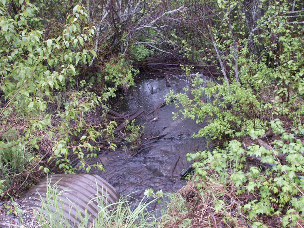
Comments: Datum = WGS84. gps accuracy = 28.0 ft. Palustrine wetland US of crossing - no channel. No outlet pool.
Culvert Measurements
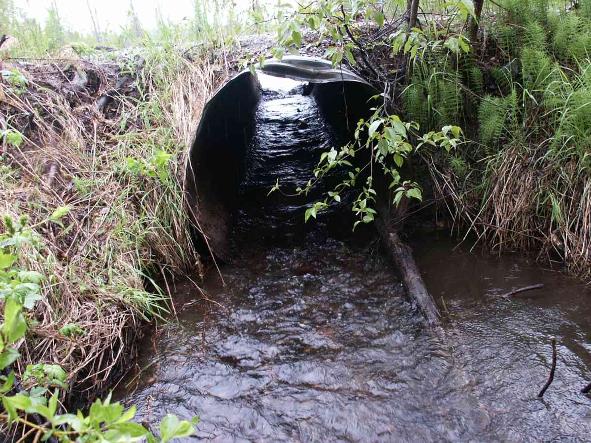
| ID: 1 | Structure Type: Circular pipe (Corrugated Metal) | Fish Passage Rating: | |||||||||||||||||||||||||||||||||||||||||
|
|
|
|||||||||||||||||||||||||||||||||||||||||
Stream Measurements
|
|
| Stream Width Type | Distance From Crossing (ft) |
Stream Width (ft) |
|---|---|---|
| Downstream ordinary high water | 59.0 | 10.20 |
| Downstream ordinary high water | 82.0 | 7.00 |
Elevations
| Locator ID | Culvert Number |
River Distance (ft)1 |
Distance From Crossing (ft)2 |
Relative Elevation (ft) |
|---|---|---|---|---|
| D/S Water Surface Elev | 0.00 | 82.0 | 91.25 | |
| D/S OHW Elev | 0.00 | 82.0 | 91.27 | |
| D/S Thalweg | 0.00 | 82.0 | 90.60 | |
| D/S Thalweg | 23.00 | 59.0 | 90.71 | |
| D/S Water Surface Elev | 23.00 | 59.0 | 91.27 | |
| D/S OHW Elev | 23.00 | 59.0 | 92.06 | |
| Outlet Rustline Height | 1 | 82.00 | 0.0 | 93.17 |
| Outlet Culvert Top | 1 | 82.00 | 0.0 | 95.52 |
| Outlet Invert | 1 | 82.00 | 0.0 | 91.40 |
| Outlet Thalweg | 1 | 82.00 | 0.0 | 91.69 |
| Road Elev | 99.00 | 96.00 | ||
| Road Elev | 99.00 | 96.25 | ||
| Inlet Rustline Height | 1 | 116.00 | 0.0 | 94.71 |
| Inlet Culvert Invert | 1 | 116.00 | 0.0 | 91.87 |
| Inlet Culvert Top | 1 | 116.00 | 0.0 | 95.96 |
| Inlet Thalweg | 1 | 116.00 | 0.0 | 92.35 |
| U/S Thalweg | 1 | 117.00 | 1.0 | 92.25 |
| U/S Water Surface Elev | 1 | 121.00 | 5.0 | 93.08 |
| U/S OHW elevation | 1 | 121.00 | 5.0 | 93.67 |
| U/S Thalweg | 1 | 121.00 | 5.0 | 91.56 |
Notes:
- River distance is measured continuously throughout the survey reach along the thalweg of the stream.
- Measured from each end of the crossing along the thalweg of the stream.
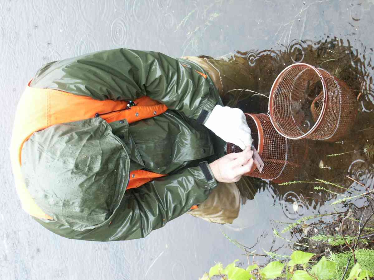
Fish Sampling Efforts
| Gear Type: Minnow Trap, 1/4 in. Mesh (A) | Trap Duration(h): 5 | |
| Gear Type: Minnow Trap, 1/4 in. Mesh (B) | Trap Duration(h): 6 | |
Fish Observations
| Species: juvenile Dolly Varden | Life History: Unknown | ||
| Total Fish Observed: 12 | Fish Measured: 5 | Fork Lengths (mm) Min: 74 Max: 108 Mean: 87 | |
| Collected/Observed by Gear Type: Upstream Minnow Trap, 1/4 in. Mesh (12) | |||
| Species: stickleback-unspecified | Life History: Resident | ||
| Total Fish Observed: 35 | Fish Measured: | Fork Lengths (mm) Min: Max: Mean: | |
| Collected/Observed by Gear Type: Downstream Minnow Trap, 1/4 in. Mesh (1) Upstream Minnow Trap, 1/4 in. Mesh (34) | |||
| Species: juvenile coho salmon | Life History: Anadromous | ||
| Total Fish Observed: 35 | Fish Measured: 14 | Fork Lengths (mm) Min: 65 Max: 132 Mean: 86 | |
| Collected/Observed by Gear Type: Downstream Minnow Trap, 1/4 in. Mesh (14) Upstream Minnow Trap, 1/4 in. Mesh (21) | |||
| Species: juvenile rainbow trout | Life History: Resident | ||
| Total Fish Observed: 61 | Fish Measured: 20 | Fork Lengths (mm) Min: 71 Max: 118 Mean: 103 | |
| Collected/Observed by Gear Type: Downstream Minnow Trap, 1/4 in. Mesh (31) Upstream Minnow Trap, 1/4 in. Mesh (30) | |||
Photos
Questions or comments about this report can be directed to dfg.dsf.webmaster@alaska.gov