Fish Passage Site 20601530
Coordinates (dec. deg.): 61.16178°, -151.05526°
Legal Description: S012N010W04
Region: South Central
Road Name: Beluga Highway
Datum: NAD83
Quad Name / ITM: Tyonek A-3
AWC Stream #:
Stream Name: Unnamed
Elevation:
Site Comments: .
Survey TYCS1-TY004
Observers: Cecil Rich, Michael Anderson, Joe Buckwalter
Overall Fish Passage Rating:
Tidal: No
Backwatered: No
Step Pools:
Construction Year:
Site Observations:
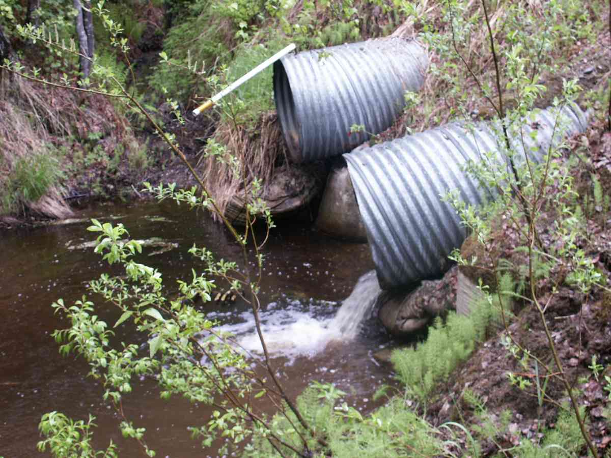
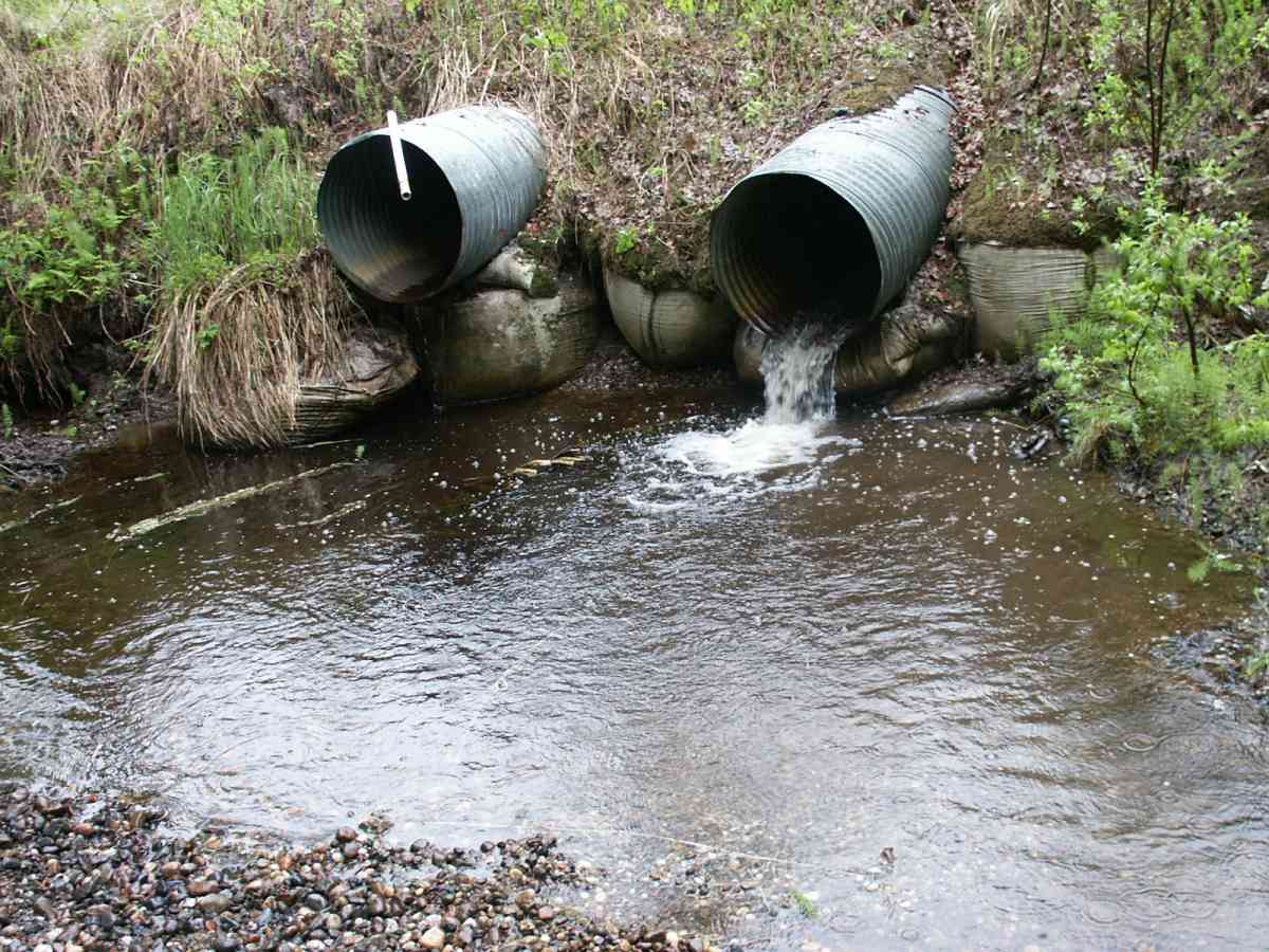
- Outfall height red
- Culvert gradient red
- Compound gradient in pipe
- Constriction ratio gray
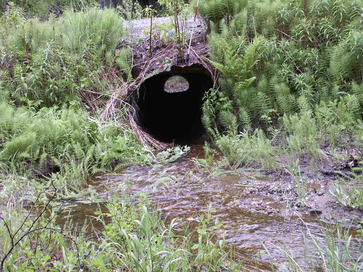
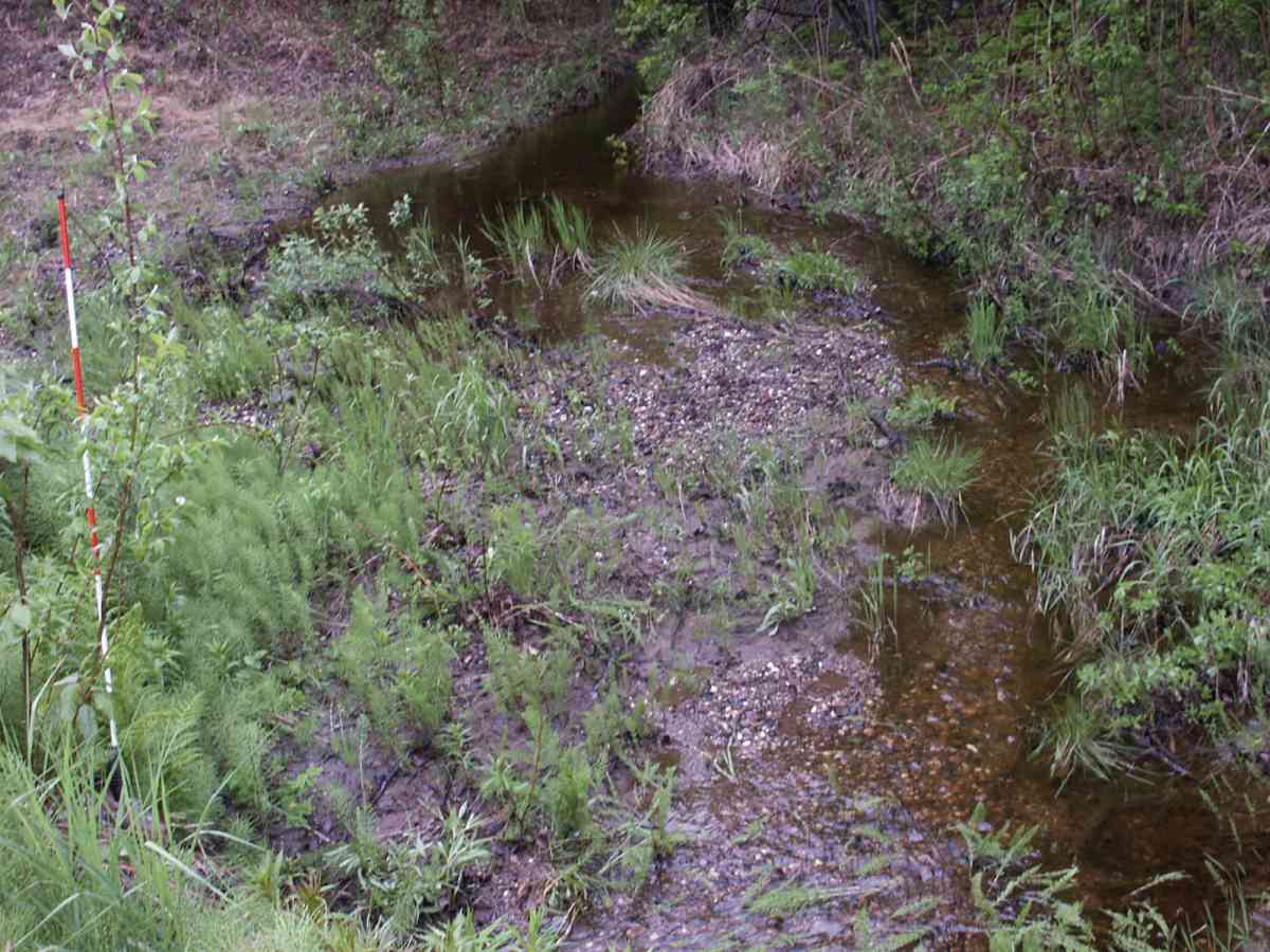
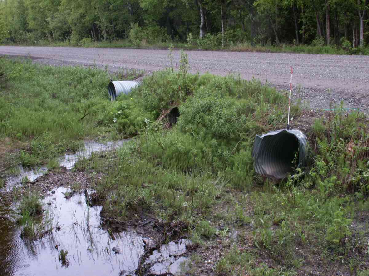
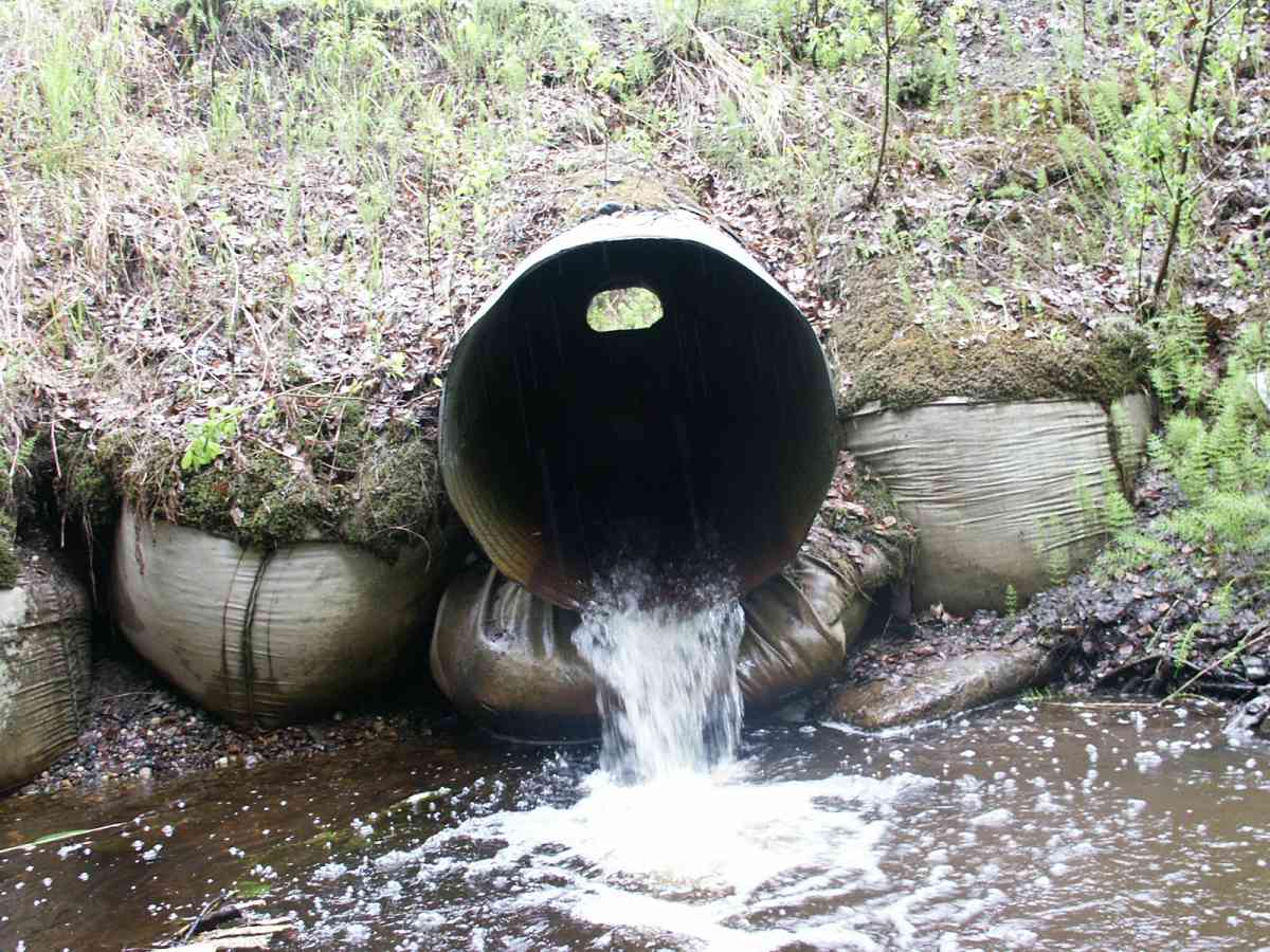
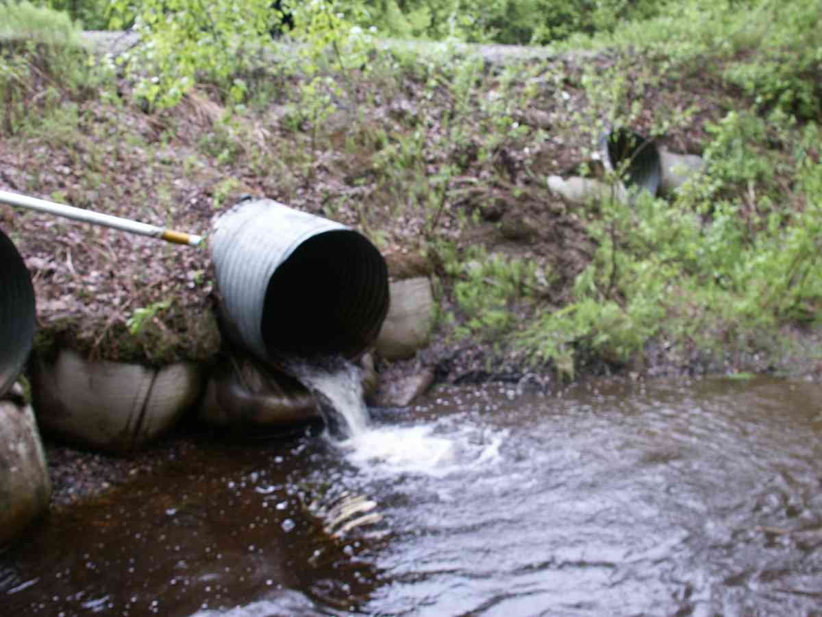
Comments: 2016 site visit. Set traps downstream for 26 hours did not catch any fish. Might be a barrier downstream. Culverts still very perched. Satillite imagery shows a decent stream course above site.
Culvert Measurements
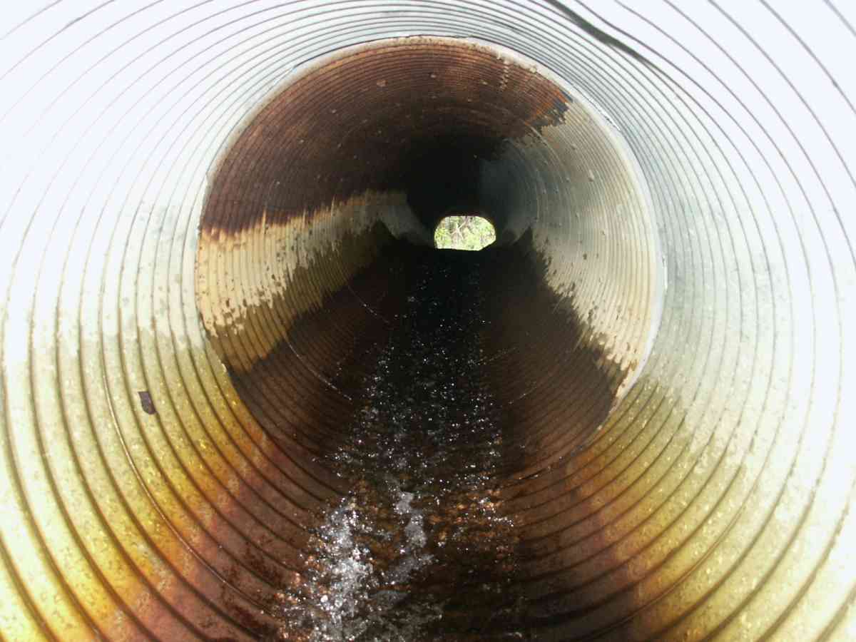
| ID: 1 | Structure Type: Circular pipe (Corrugated Metal) | Fish Passage Rating: | |||||||||||||||||||||||||||||||||||||||||
|
|
|
|||||||||||||||||||||||||||||||||||||||||
Culvert Observations:
|
|||||||||||||||||||||||||||||||||||||||||||
Stream Measurements
|
|
| Stream Width Type | Distance From Crossing (ft) |
Stream Width (ft) |
|---|---|---|
| Downstream ordinary high water | 12.2 | 5.70 |
| Downstream ordinary high water | 50.0 | 8.50 |
| Downstream ordinary high water | 77.3 | 8.00 |
| Upstream ordinary high water | 5.0 | 12.40 |
| Upstream ordinary high water | 50.0 | 5.00 |
| Upstream ordinary high water | 100.0 | 6.90 |
Elevations
| Locator ID | Culvert Number |
River Distance (ft)1 |
Distance From Crossing (ft)2 |
Relative Elevation (ft) |
|---|---|---|---|---|
| D/S Thalweg | 0.00 | 77.3 | 85.71 | |
| D/S Water Surface Elev | 0.00 | 77.3 | 85.85 | |
| D/S OHW Elev | 0.00 | 77.3 | 86.04 | |
| D/S Water Surface Elev | 27.30 | 50.0 | 86.12 | |
| D/S OHW Elev | 27.30 | 50.0 | 86.60 | |
| D/S Thalweg | 27.30 | 50.0 | 85.60 | |
| D/S Tailcrest or 1st Thalweg | 65.10 | 12.2 | 86.31 | |
| OHW Left Bank | 67.80 | 9.5 | 86.62 | |
| OHW Left Bank | 69.30 | 8.0 | 87.31 | |
| D/S Thalweg | 73.30 | 4.0 | 84.71 | |
| Max Pool Depth | 1 | 73.30 | 4.0 | 84.71 |
| Outlet Thalweg | 1 | 77.30 | 0.0 | 85.79 |
| Outlet Invert | 1 | 77.30 | 0.0 | 87.56 |
| Outlet Rustline Height | 1 | 77.30 | 0.0 | 88.17 |
| Outlet Culvert Top | 1 | 77.30 | 0.0 | 90.69 |
| Road Elev | 99.80 | 0.0 | 96.58 | |
| Road Elev | 99.80 | 0.0 | 96.69 | |
| Inlet Culvert Top | 1 | 122.30 | 0.0 | 95.25 |
| Inlet Thalweg | 1 | 122.30 | 0.0 | 92.25 |
| Inlet Culvert Invert | 1 | 122.30 | 0.0 | 92.37 |
| Inlet Rustline Height | 1 | 122.30 | 0.0 | 93.40 |
| U/S Thalweg | 1 | 123.30 | 1.0 | 92.19 |
| U/S Thalweg | 1 | 127.30 | 5.0 | 92.52 |
| U/S Water Surface Elev | 1 | 127.30 | 5.0 | 92.71 |
| U/S OHW elevation | 1 | 127.30 | 5.0 | 93.23 |
| U/S Thalweg | 1 | 128.80 | 6.5 | 92.46 |
| U/S Water Surface Elev | 172.30 | 50.0 | 93.17 | |
| U/S Headwater | 172.30 | 50.0 | 93.44 | |
| U/S Thalweg | 172.30 | 50.0 | 92.85 | |
| U/S Thalweg | 222.30 | 100.0 | 93.12 | |
| U/S Water Surface Elev | 222.30 | 100.0 | 93.52 | |
| U/S Headwater | 222.30 | 100.0 | 93.92 |
Notes:
- River distance is measured continuously throughout the survey reach along the thalweg of the stream.
- Measured from each end of the crossing along the thalweg of the stream.
Fish Sampling Efforts
| Gear Type: Minnow Trap, 1/4 in. Mesh (A) | Trap Duration(h): 1 | |
| Gear Type: Minnow Trap, 1/4 in. Mesh (B) | Trap Duration(h): 0 | |
Fish Observations
| Species: no fish collected or observed | Life History: Not Applicable | ||
| Total Fish Observed: 0 | Fish Measured: | Fork Lengths (mm) Min: Max: Mean: | |
| Collected/Observed by Gear Type: Downstream Minnow Trap, 1/4 in. Mesh (0) Upstream Minnow Trap, 1/4 in. Mesh (0) | |||
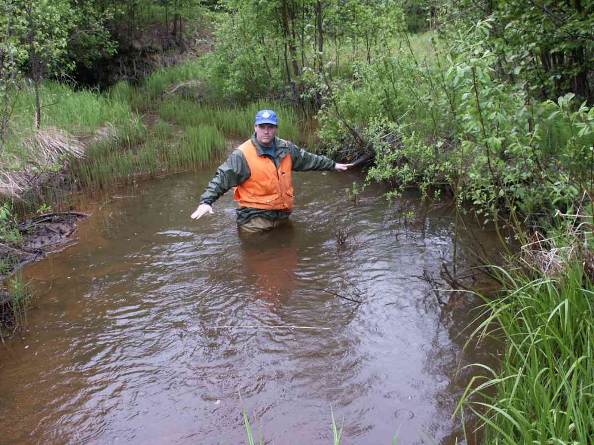
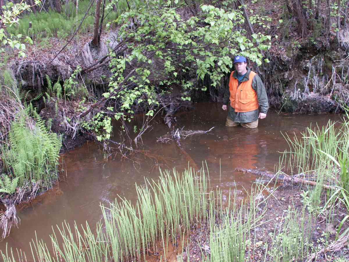
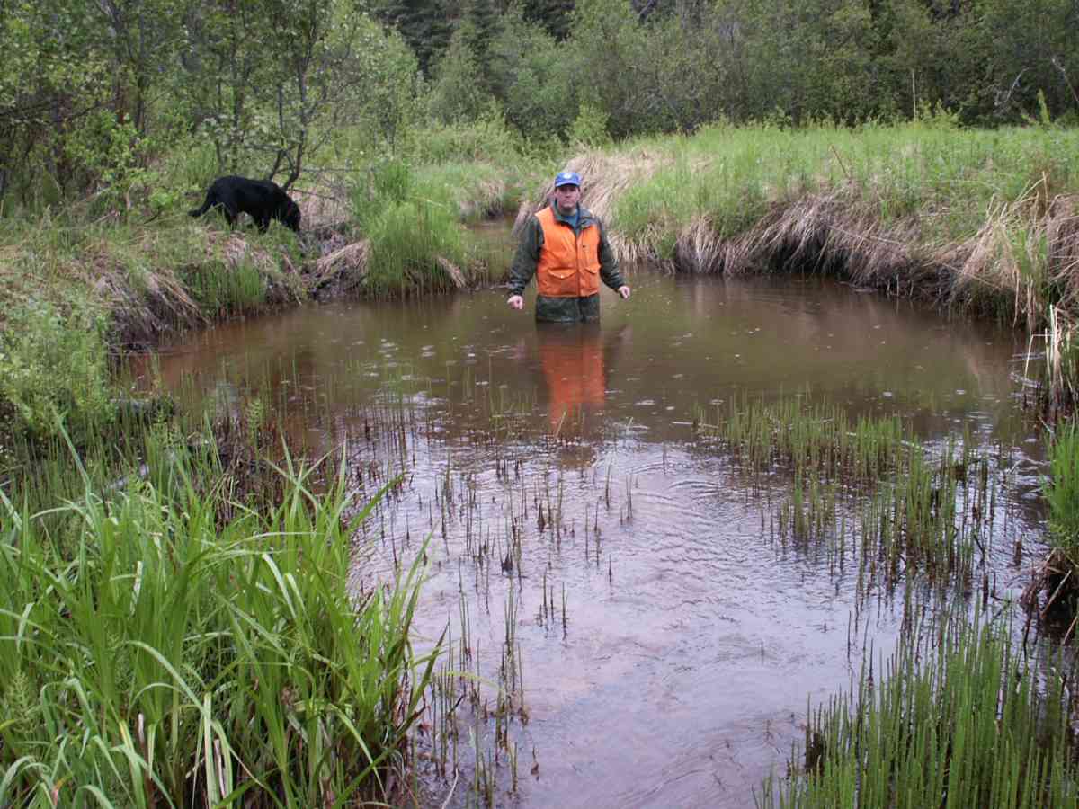
Photos
Questions or comments about this report can be directed to dfg.dsf.webmaster@alaska.gov