Fish Passage Site 20601527
Coordinates (dec. deg.): 61.06325°, -151.36644°
Legal Description: S011N012W11
Region: South Central
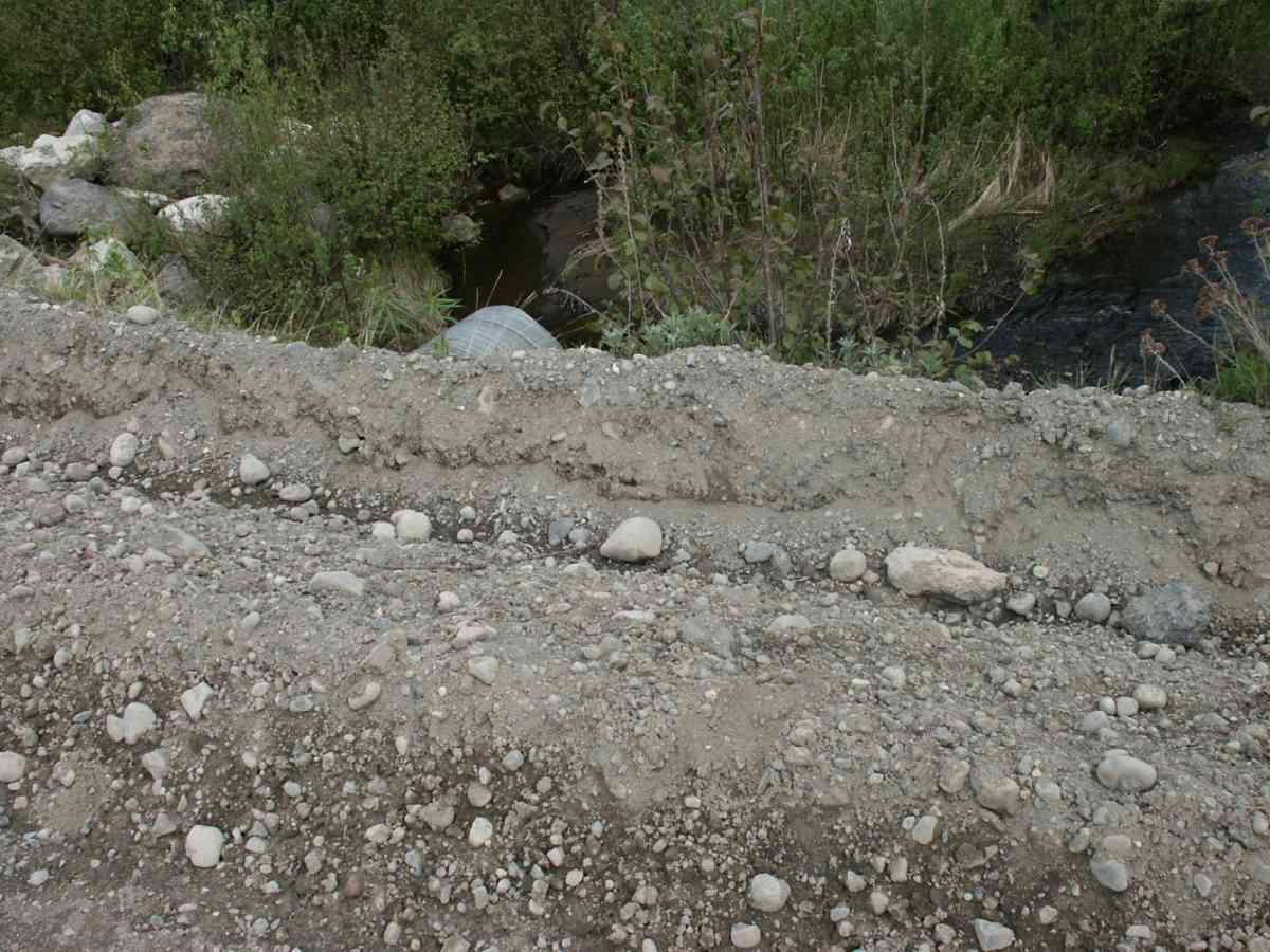
Road Name: Tyonek Timber Road
Datum: NAD83
Quad Name / ITM: Tyonek A-4
AWC Stream #:
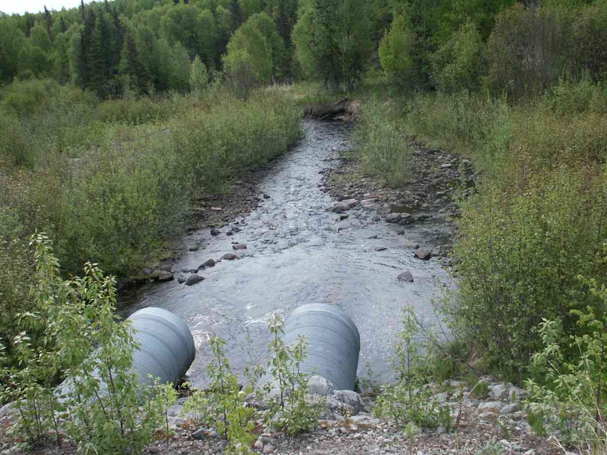
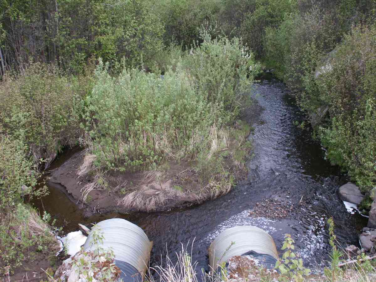
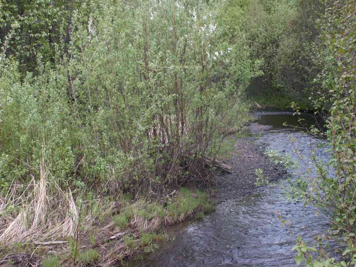
Stream Name: Old Tyonek Creek
Elevation:
Site Comments: AKA Roberts Creek
Multiple surveys have been conducted at this site — click on the drop down
arrow to the right of the survey date below to choose a different report for this site.
arrow to the right of the survey date below to choose a different report for this site.
Survey TYCS1-TY001
Observers: Cecil Rich, Michael Anderson, Joe Buckwalter
Overall Fish Passage Rating:
Tidal: No
Backwatered: No
Step Pools:
Construction Year:
Comments: Datum = WGS84. GPS Accuarcy 170 ft.
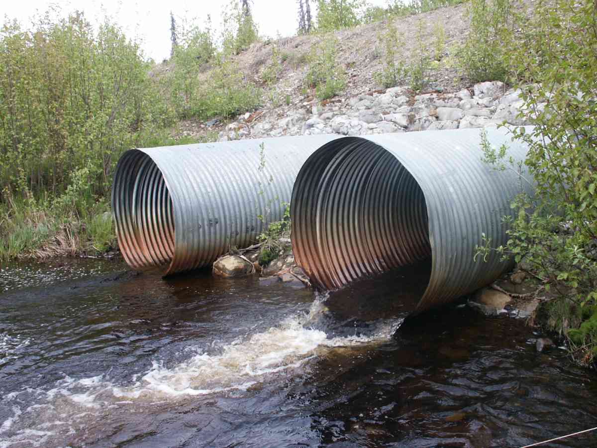
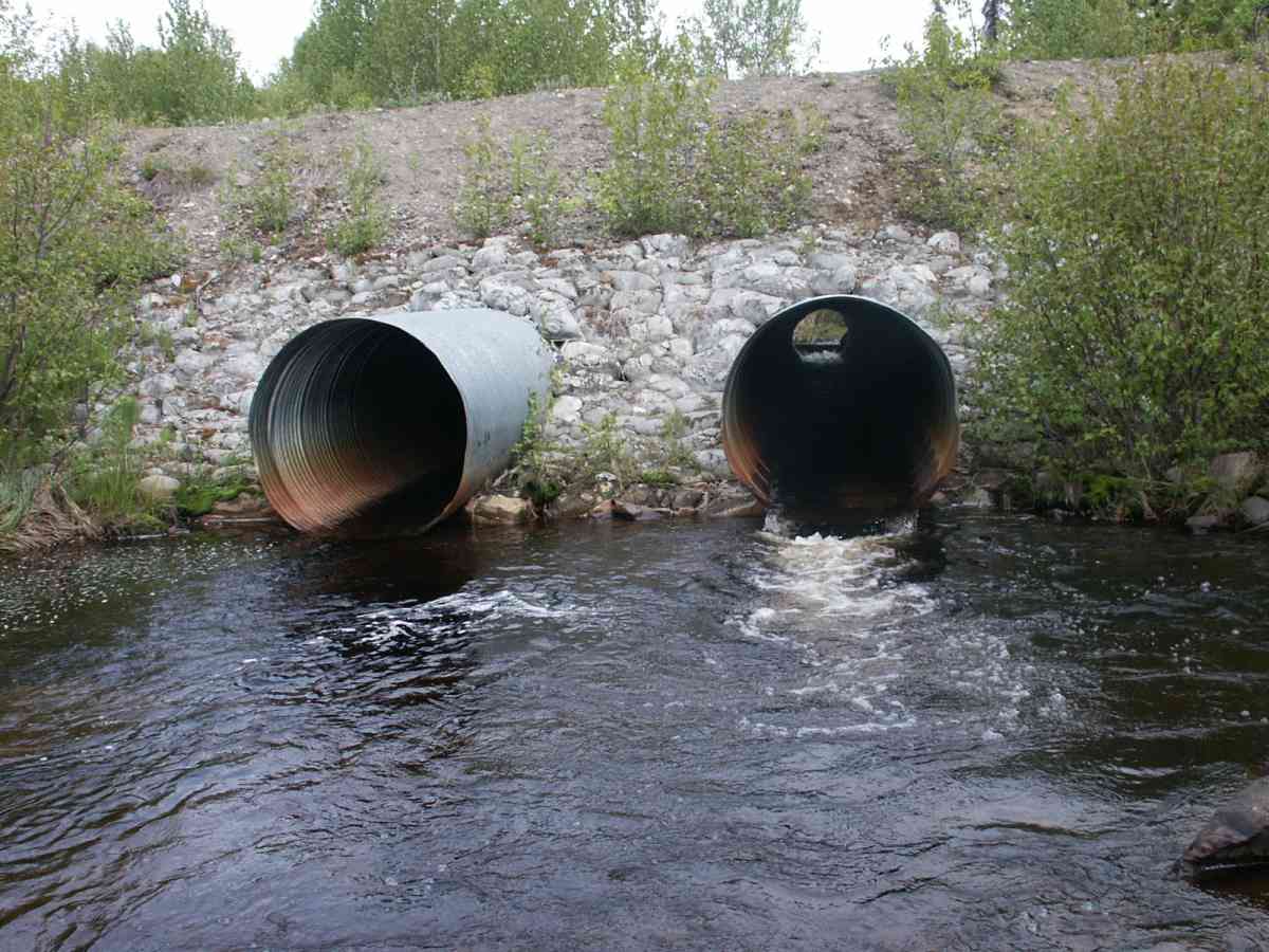
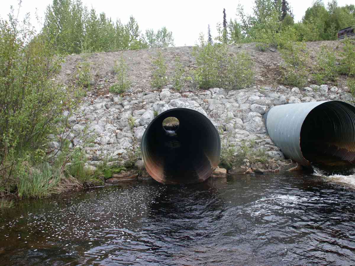
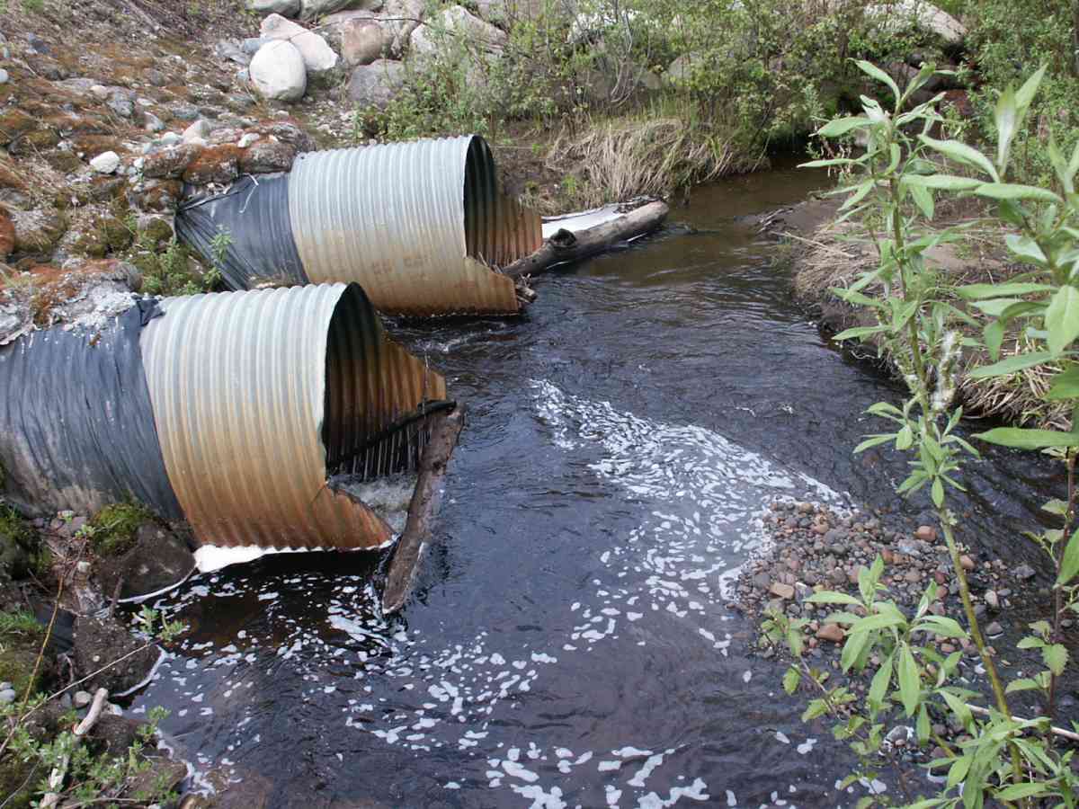
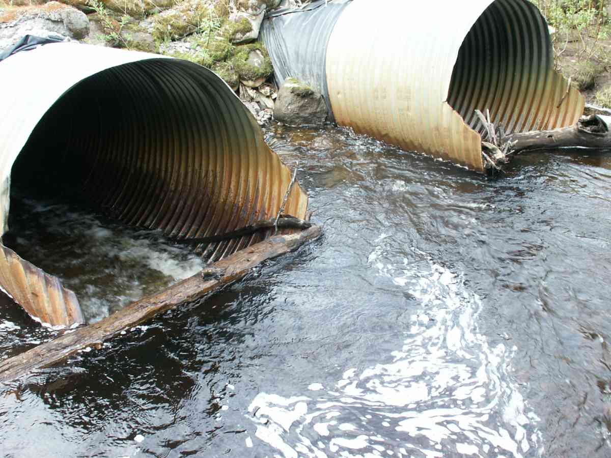
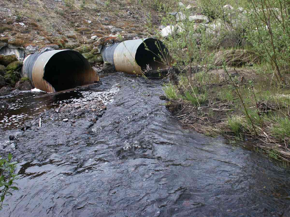
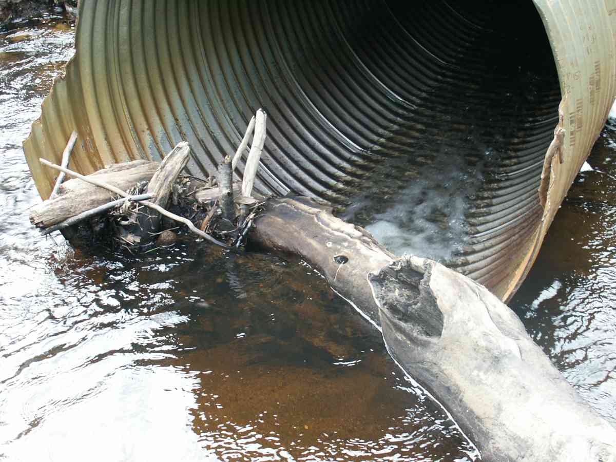
Culvert Measurements
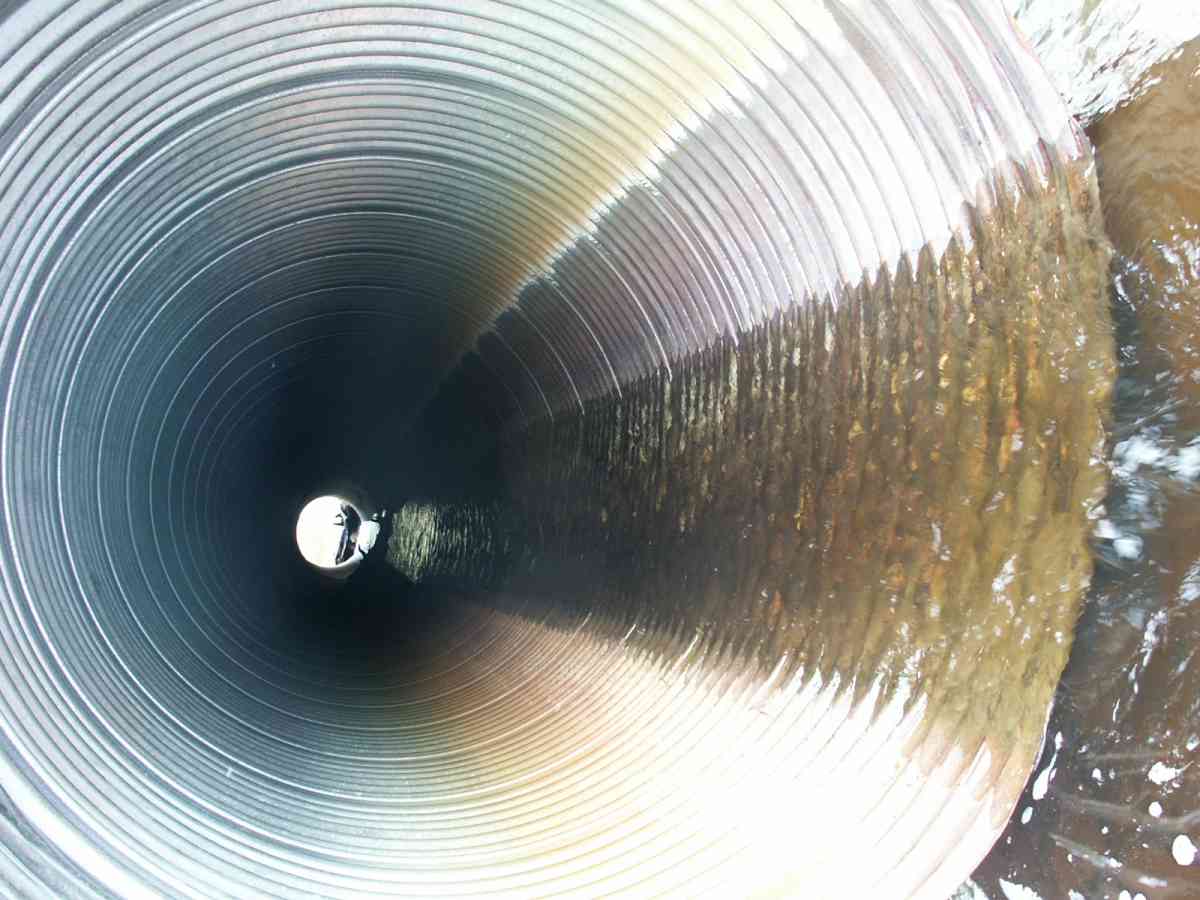
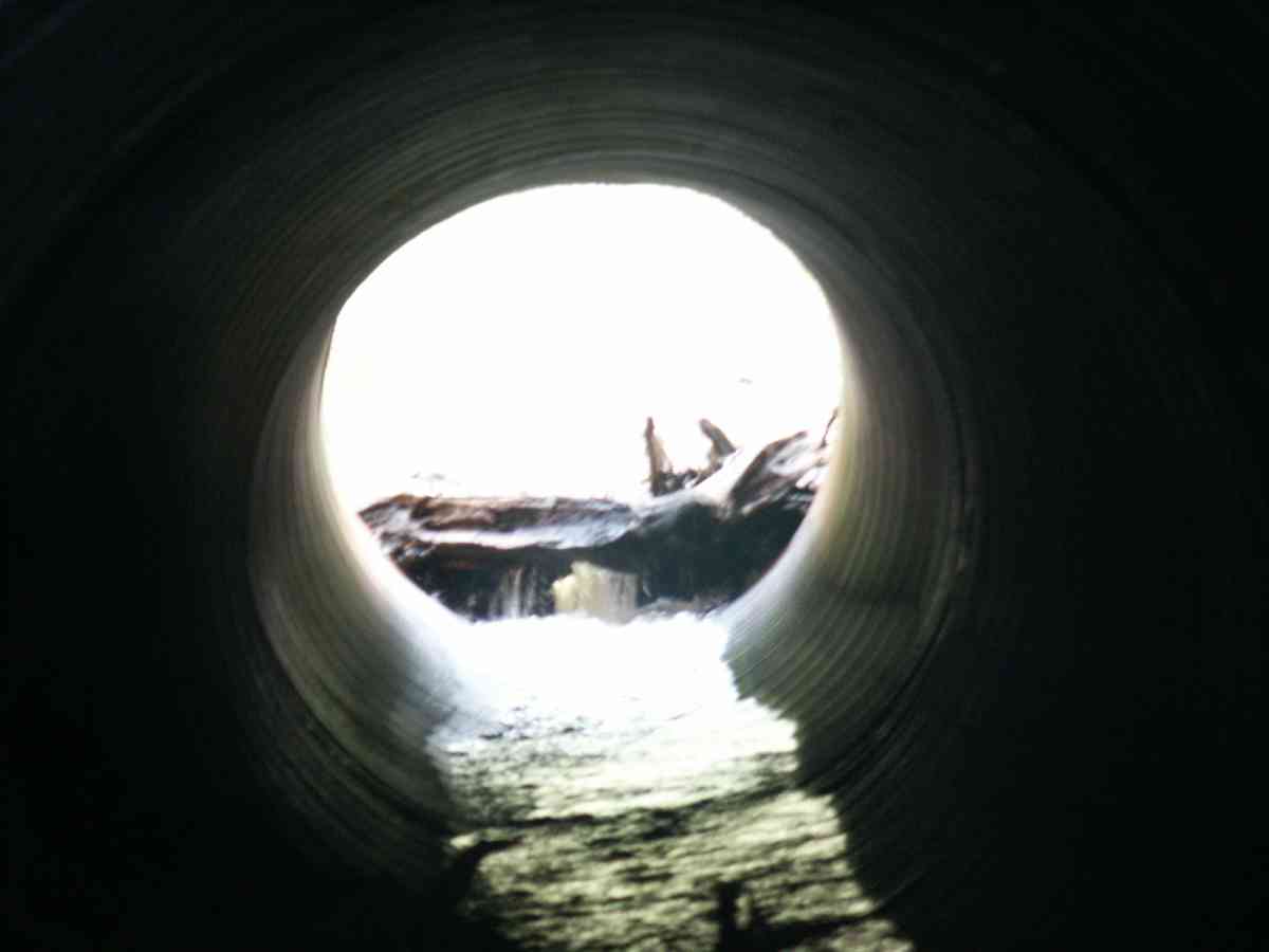
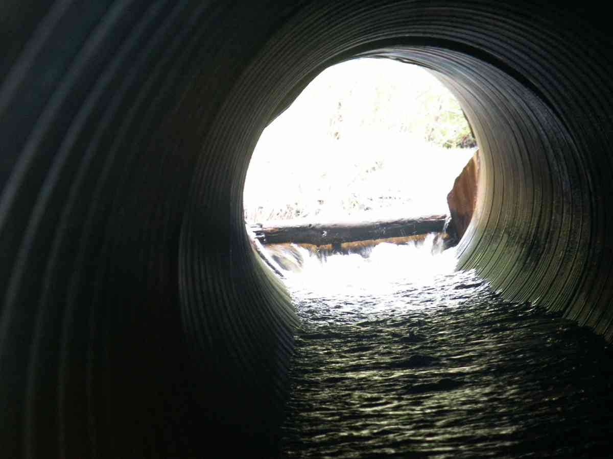
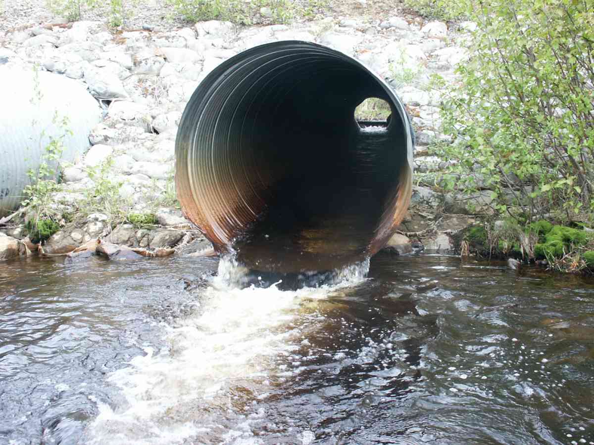
| ID: 1 | Structure Type: Circular pipe (Corrugated Metal) | Fish Passage Rating: | |||||||||||||||||||||||||||||||||||||||||
|
|
|
|||||||||||||||||||||||||||||||||||||||||
Culvert Observations:
|
|||||||||||||||||||||||||||||||||||||||||||
| ID: 2 | Structure Type: Circular pipe (Corrugated Metal) | Fish Passage Rating: | |||||||||||||||||||||||||||||||||||||||||
|
|
|
|||||||||||||||||||||||||||||||||||||||||
Culvert Observations:
|
|||||||||||||||||||||||||||||||||||||||||||
Stream Measurements
|
|
| Stream Width Type | Distance From Crossing (ft) |
Stream Width (ft) |
|---|---|---|
| Downstream ordinary high water | 27.0 | 36.70 |
| Downstream ordinary high water | 50.0 | 44.50 |
| Downstream ordinary high water | 100.0 | 34.00 |
| Upstream ordinary high water | 5.0 | 31.00 |
| Upstream ordinary high water | 15.0 | 18.00 |
| Upstream ordinary high water | 121.0 | 36.50 |
Elevations
| Locator ID | Culvert Number |
River Distance (ft)1 |
Distance From Crossing (ft)2 |
Relative Elevation (ft) |
|---|---|---|---|---|
| OHW Left Bank | 76.37 | |||
| D/S Thalweg | 0.00 | 100.0 | 76.92 | |
| D/S Water Surface Elev | 0.00 | 100.0 | 77.56 | |
| D/S OHW Elev | 0.00 | 100.0 | 78.44 | |
| D/S Thalweg | 50.00 | 50.0 | 77.75 | |
| D/S Water Surface Elev | 50.00 | 50.0 | 79.19 | |
| D/S OHW Elev | 50.00 | 50.0 | 79.75 | |
| D/S Tailcrest or 1st Thalweg | 73.00 | 27.0 | 78.62 | |
| OHW Left Bank | 92.00 | 8.0 | 75.67 | |
| D/S Thalweg | 93.00 | 7.0 | 72.25 | |
| Max Pool Depth | 1 | 95.00 | 5.0 | 72.67 |
| Max Pool Depth | 2 | 95.00 | 5.0 | 73.48 |
| Outlet Thalweg | 1 | 100.00 | 0.0 | 74.67 |
| Outlet Thalweg | 2 | 100.00 | 0.0 | 74.75 |
| Outlet Invert | 2 | 100.00 | 0.0 | 75.34 |
| Outlet Invert | 1 | 100.00 | 0.0 | 75.48 |
| Outlet Rustline Height | 2 | 100.00 | 0.0 | 76.46 |
| Outlet Rustline Height | 1 | 100.00 | 0.0 | 76.83 |
| Outlet Culvert Top | 2 | 100.00 | 0.0 | 84.14 |
| Outlet Culvert Top | 1 | 100.00 | 0.0 | 84.25 |
| Road Elev | 143.00 | 94.54 | ||
| Road Elev | 143.00 | 0.0 | 94.73 | |
| Inlet Culvert Top | 1 | 186.00 | 0.0 | 85.19 |
| Inlet Culvert Top | 2 | 186.00 | 0.0 | 85.50 |
| Inlet Rustline Height | 2 | 186.00 | 0.0 | 81.37 |
| Inlet Rustline Height | 1 | 186.00 | 0.0 | 81.40 |
| Inlet Culvert Invert | 1 | 186.00 | 0.0 | 80.27 |
| Inlet Thalweg | 1 | 186.00 | 0.0 | 80.27 |
| Inlet Culvert Invert | 2 | 186.00 | 0.0 | 80.56 |
| Inlet Thalweg | 2 | 186.00 | 0.0 | 80.56 |
| U/S Thalweg | 2 | 187.00 | 1.0 | 80.56 |
| U/S Thalweg | 1 | 187.00 | 1.0 | 80.35 |
| U/S Thalweg | 1 | 191.00 | 5.0 | 80.73 |
| U/S Thalweg | 2 | 191.00 | 5.0 | 80.96 |
| U/S Water Surface Elev | 2 | 191.00 | 5.0 | 81.15 |
| U/S Water Surface Elev | 1 | 191.00 | 5.0 | 81.27 |
| U/S OHW elevation | 2 | 191.00 | 5.0 | 82.08 |
| U/S OHW elevation | 1 | 191.00 | 5.0 | 82.31 |
| U/S Thalweg | 2 | 196.00 | 10.0 | 80.42 |
| U/S Thalweg | 1 | 196.00 | 10.0 | 80.46 |
| U/S Water Surface Elev | 236.00 | 50.0 | 82.21 | |
| U/S Thalweg | 236.00 | 50.0 | 81.67 | |
| U/S Headwater | 236.00 | 50.0 | 82.77 | |
| U/S Water Surface Elev | 307.00 | 121.0 | 83.35 | |
| U/S Headwater | 307.00 | 121.0 | 84.60 | |
| U/S Thalweg | 307.00 | 121.0 | 82.69 |
Notes:
- River distance is measured continuously throughout the survey reach along the thalweg of the stream.
- Measured from each end of the crossing along the thalweg of the stream.
Fish Sampling Efforts
| Gear Type: Minnow Trap, 1/4 in. Mesh (A) | Trap Duration(h): 3 | |
| Gear Type: Minnow Trap, 1/4 in. Mesh (B) | Trap Duration(h): 2 | |
Fish Observations
| Species: juvenile coho salmon | Life History: Anadromous | ||
| Total Fish Observed: 36 | Fish Measured: 12 | Fork Lengths (mm) Min: 64 Max: 122 Mean: 83 | |
| Collected/Observed by Gear Type: Downstream Minnow Trap, 1/4 in. Mesh (32) Upstream Minnow Trap, 1/4 in. Mesh (4) | |||
Photos
Questions or comments about this report can be directed to dfg.dsf.webmaster@alaska.gov