Fish Passage Site 20501437
Coordinates (dec. deg.): 61.56901°, -149.75970°
Legal Description: S017N003W14
Region: South Central
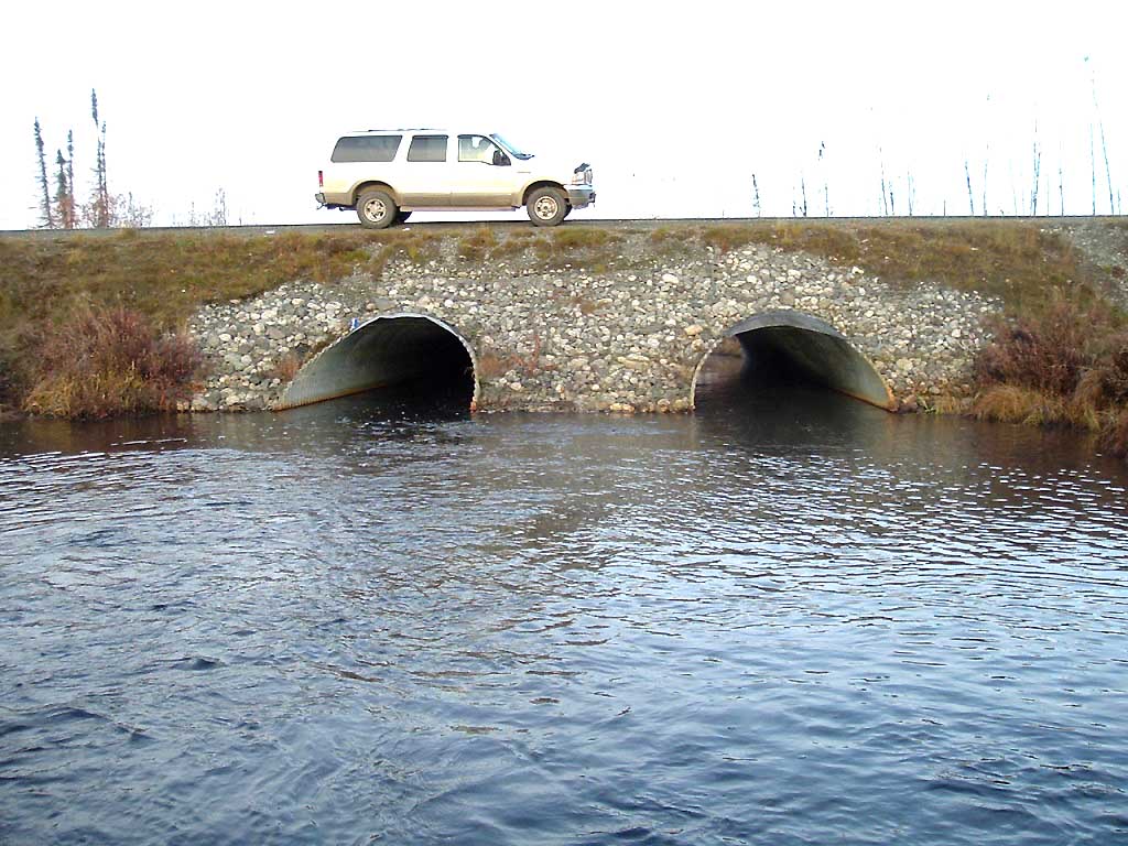
Road Name: Kenlar Road
Datum: NAD83
Quad Name / ITM: Anchorage C-8
AWC Stream #: 247-50-10330-2050-3050
Stream Name: Little Meadow Creek
Elevation:
Site Comments: SUSITNA RIVER WATERSHED
arrow to the right of the survey date below to choose a different report for this site.
Survey MSB04-ML065
Observers: Gary Greenberg, I S
Overall Fish Passage Rating:
Tidal: No
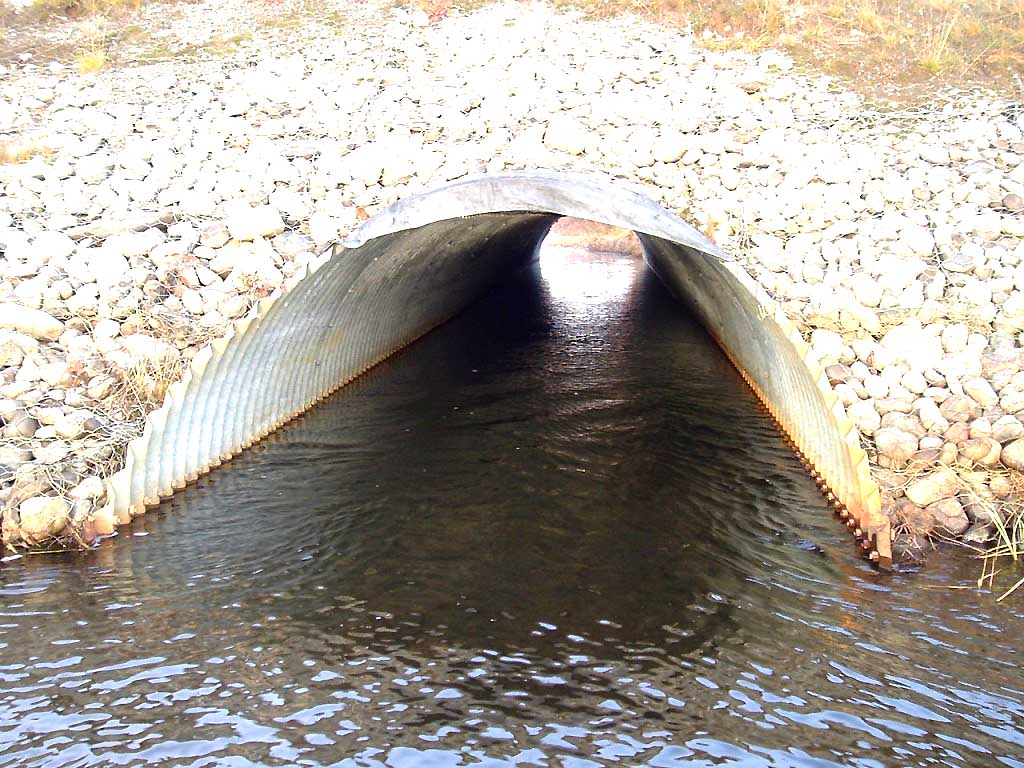
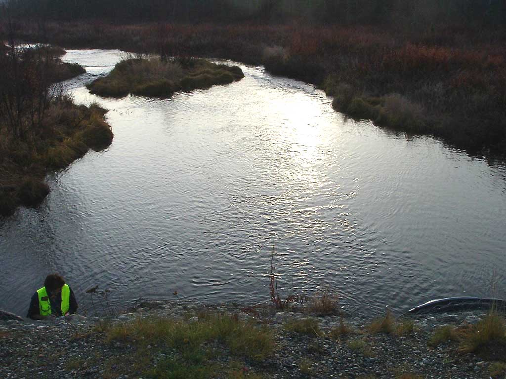
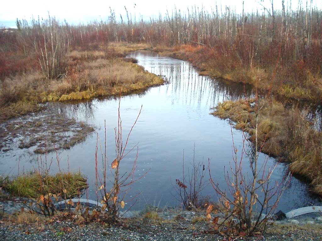
Backwatered: Yes
Step Pools:
Construction Year:
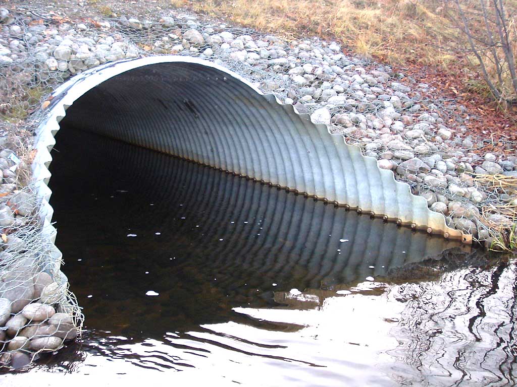
Comments: BANK FULL NOT TAKEN DUE TO MARSH, COHO FRY ON BOTH SIDES OF CULVERT
Culvert Measurements
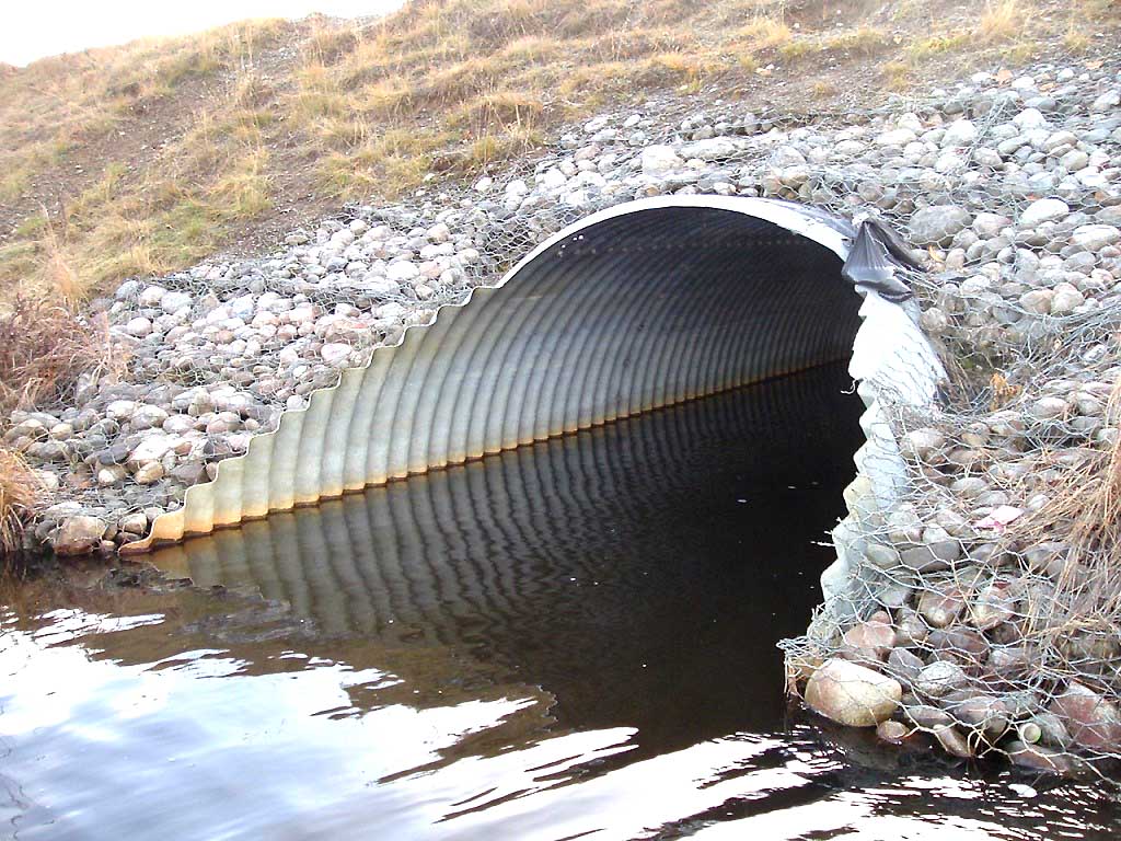
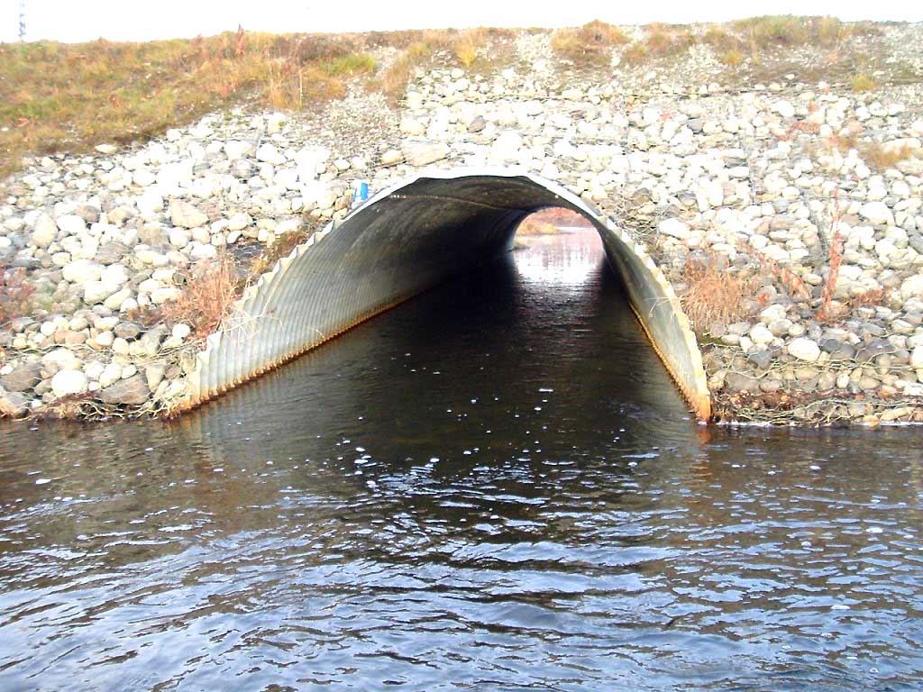
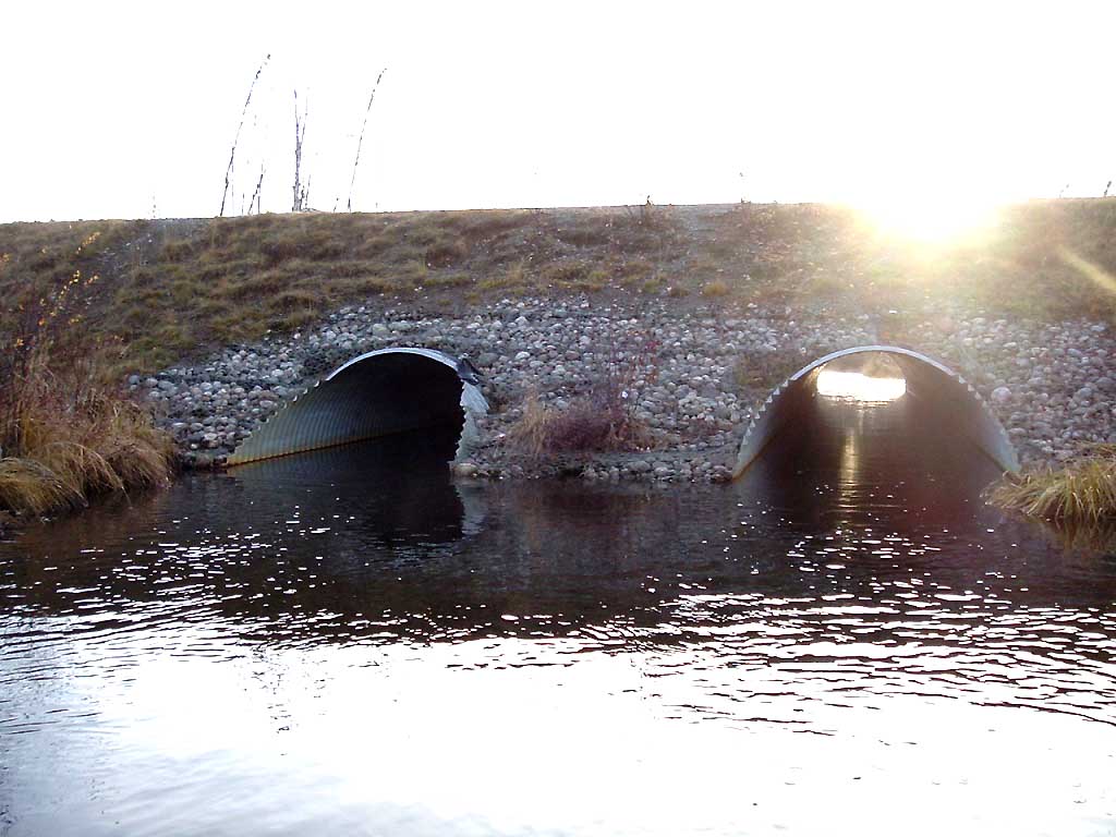
| ID: 1 | Structure Type: Closed-bottom arch (Strutural Metal Plate) | Fish Passage Rating: | |||||||||||||||||||||||||||||||||||||||||
|
|
|
|||||||||||||||||||||||||||||||||||||||||
| ID: 2 | Structure Type: Closed-bottom arch (Strutural Metal Plate) | Fish Passage Rating: | |||||||||||||||||||||||||||||||||||||||||
|
|
|
|||||||||||||||||||||||||||||||||||||||||
Stream Measurements
|
|
| Stream Width Type | Distance From Crossing (ft) |
Stream Width (ft) |
|---|---|---|
| Upstream bed width | 75.0 | 32.80 |
| Upstream bed width | 100.0 | 28.30 |
| Upstream bed width | 125.0 | 19.20 |
| Upstream bed width | 150.0 | 22.50 |
| Upstream ordinary high water | 75.0 | 41.60 |
| Upstream ordinary high water | 100.0 | 32.50 |
| Upstream ordinary high water | 125.0 | 28.40 |
| Upstream ordinary high water | 150.0 | 27.90 |
Elevations
| Locator ID | Culvert Number |
River Distance (ft)1 |
Distance From Crossing (ft)2 |
Relative Elevation (ft) |
|---|---|---|---|---|
| OHW Left Bank | 95.46 | |||
| OHW Left Bank | 95.50 | |||
| D/S Tailcrest or 1st Thalweg | 0.00 | 28.9 | 94.41 | |
| Max Pool Depth | 28.90 | 0.0 | 93.47 | |
| D/S Thalweg | 28.90 | 0.0 | 93.47 | |
| Outlet Invert | 2 | 28.90 | 0.0 | 93.48 |
| Outlet Invert | 1 | 28.90 | 0.0 | 93.60 |
| Road Elev | 67.90 | 107.33 | ||
| Inlet Culvert Invert | 1 | 106.90 | 0.0 | 93.92 |
| Inlet Culvert Invert | 2 | 106.90 | 0.0 | 94.03 |
| U/S Thalweg | 1 | 124.50 | 17.6 | 93.72 |
| U/S Thalweg | 2 | 124.50 | 17.6 | 94.49 |
| U/S Water Surface Elev | 1 | 201.90 | 95.0 | 95.19 |
| U/S Water Surface Elev | 2 | 201.90 | 95.0 | 95.19 |
Notes:
- River distance is measured continuously throughout the survey reach along the thalweg of the stream.
- Measured from each end of the crossing along the thalweg of the stream.
Fish Sampling Efforts
| Gear Type: Visual Observation, Ground (A) | ||
| Comments: Coho fry observed on both sides of culvert. | ||
Fish Observations
No fish observations occurred during this survey.
Photos
Questions or comments about this report can be directed to dfg.dsf.webmaster@alaska.gov